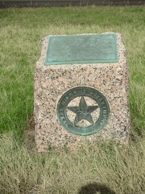
By Randal B. Gilbert, December 5, 2015
Smith County, Texas Marker
RANKED BY RELEVANCE
| On State Highway 64 at Dixie Drive (County Road 1143), on the right when traveling west on State Highway 64. |
| On North Broadway Avenue north of East Erwin Street, on the right when traveling north. |
| Near City Cemetery Road west of South Pacific Street. |
| Near North Broadway Avenue south of West Bow Street, on the left when traveling north. |
| On Hubbard Drive west of Chad Drive, on the left when traveling east. |
| On South Chilton Avenue at West Rusk Street, on the right when traveling south on South Chilton Avenue. |
| On South Main Street at Jacksonville Drive (Business U.S. 79), on the right when traveling south on South Main Street. |
| On State Highway 155 0.3 miles south of County Route 313E, on the right when traveling north. |
| On North Broadway Avenue at West Erwin Street, on the right when traveling south on North Broadway Avenue. |
| On Montgomery Drive east of Jacksonville Drive (Business U.S. 79). |
| On East Erwin Street east of North Spring Avenue, on the left when traveling east. |
| Near Interstate 20 at milepost 538, on the right when traveling west. |
| On Farm to Market Road 513 at County Road 1624, on the left when traveling north on Road 513. Reported missing. |
| On South Saunders Avenue at East Earle Street, on the right when traveling south on South Saunders Avenue. |
| On South College Avenue south of West Erwin Street, on the right when traveling south. |
| On East Ferguson Street west of North Spring Avenue, on the right when traveling west. |
| On Farm to Market Road 90 at Gordon Lane, on the right when traveling east on Route 90. |
| On South Buffalo Street (State Highway 198) south of East Dallas Street (State Highway 64), on the left when traveling south. |
| On Farm to Market Road 607 at County Road 4334, on the right when traveling north on Highway 607. |
| Near Farm to Market Road 346 0.1 miles south of County Route 1353, on the left when traveling south. |
| Near West Ferguson Street west of North Broadway Avenue, on the right when traveling west. |
| On Pine Springs Road (County Route 334) 0.2 miles south of Fielder Road (County Route 330), on the right when traveling south. |
| On Rose Park Drive 0.1 miles south of West Front Street (Texas Highway 31), on the left when traveling south. |
| Near West Line Street at North Ellis Avenue. |
| On North Bois d'Arc Avenue north of West Wilson Street, on the left when traveling north. |
| Near 4th Street, on the left when traveling north. |
| On Harris Creek Church Road (County Road 336) 0.2 miles south of County Road 41, on the right when traveling south. |
| On County Road 3418 0.2 miles south of Bypass County Road 4240, on the right when traveling south. |
| On Interstate 30 Frontage Road 0.2 miles west of Division Street, on the right when traveling west. |
| On U.S. 271 near Loop State Highway 323, on the right when traveling north. |
| Near Meadors Cemetery Road (County Road 2121) 0.3 miles east of Monarch Road (County Road 2214). |
| On South Bois d'Arc Avenue at West Erwin Street, on the right when traveling south on South Bois d'Arc Avenue. |
| On County Road 481 at County Road 478, on the left when traveling north on County Road 481. |
| On Farm to Market Road 16E 0.2 miles west of County Road 369, on the left when traveling west. |
| On Farm to Market Road 857 at County Road 1707, on the right when traveling west on Road 857. |
| Near West Ferguson Street east of North College Avenue. |
| Near Red Road 1.5 miles north of U.S. 70. |
| On Main St (Farm to Market Road 95) at Gingerbread Lane, on the left when traveling north on Main St. |
| On Erwin Street 0.1 miles east of S. Fannin Avenue, on the right when traveling east. |
| On Moorman Road at Hillcrest Street, on the left when traveling west on Moorman Road. |
| On County Highway 157 0.4 miles east of Farm to Market Road 1689, on the left when traveling east. |
| On Farm to Market Road 809 6.4 miles south of Interstate 40, on the left when traveling south. |
| On Farm to Market Road 1616 at County Road 3714, on the left when traveling north on Road 1616. |
| Near Old Dallas-Shreveport Road (County Road 452) 0.3 miles west of Old Mineola Highway (County Road 431), on the right when traveling west. |
| On West Erwin Street east of North College Avenue, on the left when traveling east. |
| On Clover St. (Tennessee Route 96), on the left when traveling east. |
| On West Martin Luther King Junior Boulevard at Ramey Avenue, on the left when traveling west on West Martin Luther King Junior Boulevard. |
| On Harris Creek Church Road (County Road 336) 0.2 miles south of County Road 41, on the right when traveling south. |
| On South Polk Street at Southwest 16th Avenue, on the left when traveling north on South Polk Street. |
Thin black lines indicate changes in relevance. Between each pair of lines entries are ordered geographically but all have the same relevance.* Inflectional forms of words are their plurals, singulars, and possessives as well as gramatical tenses and similar variations.
Nov. 13, 2026
