By Brian Scott, September 13, 2015
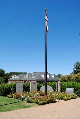
Washington, Wilkes County, Georgia Monument
Second From the Right
RANKED BY RELEVANCE
| On East Court Street at North Spring Street on East Court Street. |
| On East Court Street at East Square, on the left when traveling east on East Court Street. |
| On S Oliver St. (Georgia Route 77). |
| On Monroe Street (Georgia Route 208) 0.1 miles west of Taylor Street, on the right when traveling west. |
| Near Depot Street at Lagrange Street, on the left when traveling south. |
| On East Court Street at East Square, on the right when traveling west on East Court Street. |
| On East Court Street at East Square, on the right when traveling west on East Court Street. |
| On North Main Street at East Elford Street, on the right when traveling north on North Main Street. |
| On Spring Street (Georgia Route 47) at West Liberty Street when traveling north on Spring Street. |
| On East Court Street at East Square, on the right when traveling west on East Court Street. |
| Near Memorial Drive west of North East Street, on the left when traveling west. |
| On Mallorysville Road (County Route 106) at Dunkhill Road (County Route 105), on the right when traveling west on Mallorysville Road. |
| Near Jeddo Road (County Highway 297) 0.2 miles north of Farm to Market Road 713. |
| Near Capitol Avenue Southwest near Capitol Square Southwest, on the right when traveling north. |
| On East Robert Toombs Avenue (Business U.S. 78) at East Square, on the right when traveling west on East Robert Toombs Avenue. |
| On South Oliver Street (State Highway 77), on the left when traveling south. |
| On Settlement Road 0.3 miles west of War Hill Road, on the right when traveling west. |
| On Andrew Drive (County Route 41) 0.1 miles Spring Street ( Route 47), on the right when traveling west. |
| On State Highway 28 at Old Charleston Road (Local Road 38), on the left when traveling south on State Highway 28. |
| On South Berrong Street at River Street, on the right when traveling east on South Berrong Street. |
| On West Robert Toombs Avenue (Business U.S. 78) 0 miles west of North Mercer Street ( Route 44), on the left when traveling west. |
| On Calhoun Falls Highway (Georgia Route 72) at Bobby Brown State Park Road, on the right when traveling east on Calhoun Falls Highway. |
| On Elijah Clark State Park (Drive) 1 mile north of U.S. 378, on the right when traveling north. |
| On War Hill Road 0.2 miles south of Settlement Road, on the right when traveling west. |
| On West Robert Toombs Avenue (Business U.S. 78) just east of South Allison Street, on the right when traveling east. |
| On North Main Street (State Highway 121) at West Wheeler Circle, on the left when traveling north on North Main Street. |
| On East Robert Toombs Avenue (Business U.S. 78) west of Jefferson Street, on the right when traveling east. |
| On Main Street (U.S. 78) at Gilmer Street, on the right when traveling east on Main Street. |
| Near War Hill Road 1.5 miles south of Tyrone Road. |
| On West Court Street at North Spring Street / West Square, on the left when traveling west on West Court Street. |
| On Beaverdam Road (County Route 64) at Columbus Granade (County Route 65), on the left when traveling west on Beaverdam Road. |
| On East Robert Toombs Avenue (U.S. 72) just east of Spring Street, on the right when traveling east. |
| Near Capitol Avenue Southwest south of M.L.K. Junior Drive Southeast, on the left when traveling north. |
Thin black lines indicate changes in relevance. Between each pair of lines entries are ordered geographically but all have the same relevance.* Inflectional forms of words are their plurals, singulars, and possessives as well as gramatical tenses and similar variations.
Nov. 12, 2026
