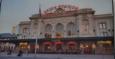
"Without railroads, Denver would be too dead to bury."
Thomas Durant, Vice President
Union Pacific Railroad, 1867
A survivor of fire and floods, Union Station is at the head of our railroad history. Landlocked, Denver needed . . . — — Map (db m118570) HM
”This is our history – from the Transcontinental Railroad to the Hoover Dam, to the dredging of our ports and building of our most historic bridges – our American ancestors prioritized growth and investment in our nation’s . . . — — Map (db m118589) HM
Windsor Farm Dairy Building
1918
A building with a milky past, the Windsor Farm Dairy was built in 1918 for $30.000. A leading Denver architectural firm, Fisher & Fisher, designed this red brick structure with terra cotta . . . — — Map (db m97358) HM
In 1915, this was the Colorado National Bank’s slogan.
Designed by W.E. and A.A. Fischer, the buildings bronze vault and door weighs 73,000 lbs with supports walls three-and-a-half inches thick. Inside the vaults, the doors alone weigh 62,000 . . . — — Map (db m135451) HM
At the very heart of Denver’s rough beginnings, Fifteenth Street actually followed the old military trails from Santa Fe, Fort Union and trading posts north and south of Denver. It was here that General Larimer expropriated the one “cabin” claim . . . — — Map (db m118601) HM
On December 10, 1975, 17th Street celebrated its 25th year as a concrete street. Anniversary invitations were engraved in old English and former Governor John Love led the champagne toast.
In 1950, amid great City Council debate, 17th Street . . . — — Map (db m135544) HM
The masonry labor for this memorial is donated by Stephan Dach in loving memory of his father Alfred who perished in the early years of World War II in a Nazi Concentration Camp. May this be a reminder of him and all those others who have . . . — — Map (db m46101) HM
"Stand up you man-eatin' son of a
bitch, stand up. They wuz seven
Demmy-crats in Hinsdale County, and
you et five of 'em. I sentence you to
be hanged by the neck until you are
dead, dead, dead."
Attributed to Judge Gerry . . . — — Map (db m255447) HM
The legend says that Denver's early settlers, who made their camp on the banks of Cherry Creek, laughed at the Arapaho, a local Indian tribe, for making their camp inconveniently far from the water's edge.
The Arapaho warned the settlers of . . . — — Map (db m135440) HM
In 1893, Katherine Lee Bates,
a vacationing school teacher,
wrote America the Beautiful as a
poem about the view from the
14,110 foot Pikes Peak summit. — — Map (db m255446) HM
Before the founding of the City of Denver, the tribe that camped in the area called themselves “Inuna-ina" meaning, “Our people.”
This tribe was also known as “Arapaho,” the word for “trader” or “buyer” in Pawnee. Denver’s founders honored . . . — — Map (db m135442) HM
The significance of 1514 Blake St. lies in its connection to the remarkable life of black pioneer Barney Ford. Ford was born a slave on January 22, 1822 in Stafford, Virginia, but escaped to Chicago, where he worked with the underground railroad . . . — — Map (db m118597) HM
For more than a century, Denver's warehouse district has centered on Wynkoop. Stimulated by the arrival of the railroads in 1870 and the subsequent need for distribution services, an impressive array of three-to-five story warehouses, flat roofed . . . — — Map (db m97395) HM
Baur's Building,
constructed in 1881.
Placed on National and State
Registers of Historic Places - 2006.
Home of Baur's
Restaurant & Confectionery
for eighty years.
City and County of Denver Landmark No. 316 - 2006. . . . — — Map (db m254940) HM
"A dog fight on Champa Street is of more interest to Denverites than a war in Europe."
Frederick Bonfils
(1860-1933)
Founder of The Denver Post
and prominent philanthropist — — Map (db m135447) HM
The downtown skyline was transformed in the late 1970s and early 1980s as the Denver economy boomed based on the price of oil. As oil prices fell below $10/barrel in 1986, Denver’s economy contracted.
In 1986, the Denver economy entered its . . . — — Map (db m135486) HM
Famous Hole in the Wall Gang
outlaw Butch Cassidy robbed his
first bank in the box canyon town of
Telluride, Colorado on June 24, 1889.
Cassidy and three others made off
with $20,000 from the San Miguel
Valley Bank and were
never . . . — — Map (db m255445) HM
Constructed in 1896 for $75,000, the Morey Mercantile Building was the first notable warehouse to be built after the 1893 silver crash. Designed by Gove & Walsh, the structure included a spice grinding mill, roasting plant, extract laboratory and . . . — — Map (db m97396) HM
In the 1860’s, when gold from Colorado’s grubstakes began flowing into Denver at a mad pace, the costly and risky problem of shipping it to banks back East was neatly solved by Clark, Gruber and Co. In a building near this site, the banking firm . . . — — Map (db m51712) HM
Josephine Roche, daughter of a wealthy coal mine operator, ran for governor in 1934. She advocated a progressive sales tax that fell heavily on the rich.
Although she lost the election, she became Assistant Secretary of Treasury, the second . . . — — Map (db m135101) HM
Colorado Territory - Organized
February 28, 1861
Colorado Admitted as a State
August 1, 1876
Census of Territory in 1861 - 23,331
War Governors
William Gilpin
Richard Ed Whitsitt Adjutant General
1861-1862
John . . . — — Map (db m4745) HM WM
Colorado
State Capitol
is part of the
Denver Civic Center
National Historic
Landmark.
The Denver Civic Center is an outstanding
representation of the widespread impact of
the City Beautiful movement on American cities
and . . . — — Map (db m256027) HM
Memorial Stone commemorating the 100th Anniversary of the laying of the cornerstone of the Colorado State Capitol. The time capsule beneath this stone contains messages and memorabilia from the people of Colorado in 1990 to its people in 2090. . . . — — Map (db m46059) HM
Dedicated by the people of Colorado in gratitude and respect for the men and women who have proudly served and sacrificed in our nation’s armed forces. — — Map (db m46079) HM
The First National Bank of Denver made its first home here in 1866, with a building constructed for a cost of $45,000. The bank stayed at this location for 10 years, enlarging rooms, installing fancy gas lights, and in 1875, adding a third floor . . . — — Map (db m27508) HM
The D&F Tower at the corner of 16th and Arapahoe Streets is all that remains of the Daniels & Fisher department store that stood on this block.
After its construction in 1911, the D&F Tower was for many years the tallest building in Denver. . . . — — Map (db m135103) HM
Denver Auditorium Theatre has been placed on the National Register of Historic Places by the United States Department of the Interior. — — Map (db m253366) HM
The area known today as Lower Downtown, is the Location of the original town of Denver. Gold seekers from Lawrence, Kansas staked the first claim in September of 1858, under the name St. Charles Town Association, but they left only one man to . . . — — Map (db m27493) HM
Originally built as the stables for the Denver City Railway Company in 1883, this building was the birthplace of Denver's Public Transportation system. Horse drawn trolleys, soon replaced by one of America's most extensive cable car networks, . . . — — Map (db m97394) HM
November 18, 1997
While waiting for a bus on 17th Street, Oumar Dia was shot and killed because of the color of his skin. Jeannie Van Velkinburgh who came to his assistance was shot and paralyzed.
In response to the murder, thousands of . . . — — Map (db m135508) HM
This property has been placed on the National Register of Historic Places by the United States Department of the Interior.
City and County of Denver Landmark No. 216 – 1994.
Landmark Preservation Commission. — — Map (db m255506) HM
The Silver Panic of 1893 brought 17th Street to her knees. Eventually she recovered; gold was the reason she survived. Golden riches arrived from the mines of Cripple Creek filling Denver's coffers.
This Golden Era is symbolized by the gold . . . — — Map (db m135105) HM
Charles Henry Dow, the first editor of the Wall Street Journal, created the stock market index with Edward D. Jones in 1897.
Dow, who had worked as a bookkeeper for a Leadville mining operation, was the first Vice-President of the . . . — — Map (db m135528) HM
Constructed in 1890-92, the Equitable Building is on the National Register of Historic Places. It has long been home to many of Denver’s most prestigious law firms and financial institutions, and is generally regarded as the last great building . . . — — Map (db m135472) HM
This building is named for Edward W. Wynkoop (1836-1891) to honor his peacemaking efforts, though unsuccessful, to resolve the Indian-white conflict which resulted tragically in the Sand Creek Massacre in 1864.
Exaggerated reports of . . . — — Map (db m97294) HM
The First United Presbyterian
Church (originally the Capital
Avenue Presbyterian Church)
was built on this site in 1883 and
demolished in 1965. It sat nearly
800 people and cost $39,145 to
build, including four lots and the
furniture. The . . . — — Map (db m256028) HM
The four corners of 17th and Champa Streets are occupied by the Boston Building (1890), the Colorado National Bank (1915), the Railway Exchange (Title) Building (1937), and the Ideal Cement (Colorado Federal) Building (1907). All were built of . . . — — Map (db m4659) HM
Maurice Rose was one of the highest ranking
and most distinguished Jewish soldiers in U.S. history.
Prior to joining the Army, he was raised in Denver,
attended religious school, Denver public
elementary schools, and East High School.
He . . . — — Map (db m257742) HM WM
Given to the State of Colorado by
the Boettcher Foundation - 1960.
The former residence of three families
prominent in Colorado history:
Walter S. Cheesman, John Evans,
Claude K. Boettcher.
National Register of Historic Places - . . . — — Map (db m255212) HM
City and County of Denver Landmark No. 95 - 1976.
Landmark Preservation Commission.
This property has been placed on the National Register of Historic Places by the United States Department of the Interior. — — Map (db m255214) HM
The five-pointed intersection at 17th and Broadway is the result of shifts in Denver’s street grid.
The grid shift created the triangular-shaped block upon which the Brown Palace Hotel is located. Here, the original grid which runs parallel . . . — — Map (db m135518) HM
On August 26, 1964 five thousand screaming fans waited outside the Brown Palace Hotel for hours hoping to catch a glimpse of their idols, the Beatles.
Well-rehearsed in evading mobs, the “Fab Four” sneaked into the hotel through a service . . . — — Map (db m167285) HM
The pattern of ownership of 1545 Wazee Street symbolizes the development of Denver's rail age boom as an industrial and supply city requiring large scale warehousing. Its first owner and occupant, Henry Lee, was an agriculturist, pioneer gardener . . . — — Map (db m27242) HM
“We have to organize. The best way to make the system work for us is cooperation.”
-- Bernie Valdez (1912-1997)
Co-founder of Latin American Education Foundation and the Latin American Research and Service Agency, and Head of the Colorado . . . — — Map (db m135515) HM
Valedictorian of the first class, Denver high School, 1877. Graduated from United States Military Academy 1884 with record of 2070.4 out of possible 2075. War with Spain, Colonel 1st Colorado infantry U.S.V. His regiment led the advance in capture . . . — — Map (db m46108) HM
General William H. Larimer, Jr., founder of Denver City which was established on November 22, 1858, named the city after the Governor of the Kansas Territory and the principal street after himself. Some of Denver’s first cabins were located at the . . . — — Map (db m51710) HM
In the 1880s and 1890s Denver was the nation's headquarters for "con" men, a dubious honor that it maintained into the early years of the 20th century.
The most famous con man was "Soapy" Smith who sold $5.00 bars of soap from 17th Street, . . . — — Map (db m52186) HM
Dedicated to you, a free citizen in a free land.
This reproduction of the Liberty Bell was presented to the people of Colorado
by direction of
the honorable John W. Snyder,
Secretary of the Treasury,
as the inspirational symbol of . . . — — Map (db m257734) HM
General Orders, No. 11, Headquarters Grand Army of the Republic, Washington D.C. May 5, 1868.
I. The 30th day of May, 1869, is designated for the purpose of strewing with flowers or otherwise decorating the graves of comrades who died in defense of . . . — — Map (db m46107) HM
Lynching in America.
Racial terror lynchings between 1877 and 1950 claimed the lives of thousands of Black people and terrorized millions more who were denied equal protection under the law. After the Civil War, white resistance to equal . . . — — Map (db m236319) HM
This bridge symbolizes the revitalization of lower downtown Denver in the late twentieth century and represents one of the many contributions made to our community by Emanuel "Manny" Salzman. After moving to LoDo in 1980, Manny and his wife, Joanne, . . . — — Map (db m97412) HM
Seventeenth Street is home to
many of Denver’s parades.
Annual parades include:
St. Patrick’s Day Parade
Memorial Day Parade
Veteran’s Day Parade
Parade of Lights
National Western Stock Show Parade
Special . . . — — Map (db m135525) HM
The first man to rob the Denver Mint was “Small Bad Jim” – James Clark. The gold bars were so heavy that he began dropping them only one mile away in what is now Cheesman Park. Six days later, the desperado was captured 25 miles south of Colorado . . . — — Map (db m100808) HM
Before the coming of the rails, stagecoaches were a major form of passenger transportation to and from Denver.
In 1878, Helen Hunt Jackson wrote, The public coaches are here, as everywhere, uncomfortable, overloaded, intolerable. I know of no . . . — — Map (db m135476) HM
The Brown Family Moves to Denver
In 1886 Margaret Tobin married charming mine engineer J.J.
Brown in Leadville, Colorado after moving from Hannibal,
Missouri. The Browns were soon parents to two children,
son Lawrence "Larry" and . . . — — Map (db m257724) HM
Until 1911, Denver was the largest city in the nation where women could vote. Western states, including Colorado, were among the first to give women the right to vote.
In 1920, the 19th Amendment to the U.S. Constitution guaranteed full . . . — — Map (db m135444) HM
Clark, Gruber and Company printed gold notes as well as producing $2.50, $5 and $20 gold pieces.
After private mints were outlawed in 1864, the federal government took over the job as the Denver Mint.
Clark, Gruber and Co. evolved to . . . — — Map (db m135483) HM
The Skyline Urban Renewal Project consisted of twenty blocks between Curtis Street and Larimar Street that were demolished in the late 1960s to “remove blight” and make way for the new and modern. There is a noticeable difference in scale between . . . — — Map (db m135445) HM
The Oxford Hotel, built in 1891, is Denver's Oldest Hotel. Bankrolled by Brewer Adolph Zang and his partners Philip Feldhauser and William Mygatt, the hotel was designed by Denver's greatest 19th century architect, Frank E. Edbrooke. Through the . . . — — Map (db m6674) HM
Unlike San Francisco, which the Spanish founded as a mission, and Salt Lake City, which the Mormons started as a communal religious utopia, Denver originated as a place to make money.
From the beginning, the town aspired to be the supply hub: . . . — — Map (db m135357) HM
Down 17th Street, Longs Peak is visible over the roof of Union Station. Together, they symbolize two bases of Denver's economy. Since its founding in 1858, Denver has taken advantage of its location for freight and passenger transportation. . . . — — Map (db m135104) HM
The Oscar Wallpaper investigates not only the collision of the natural world with the domestic but also the weight of time and history in addition the intersection of the local and global. The installation reframes and reconsiders . . . — — Map (db m233740) HM
“Your ruffle shirts, standing collars and all kinds of fine clothing had better be left in your wardrobe at home. Discard all cotton or linen clothing; adapt yourself at once to woolen and leather; provide yourself with woolen underclothes. . . . — — Map (db m135351) HM
The controversy surrounding this Civil War Monument has become a symbol of Coloradans' struggle to understand and take responsibility for our past. On November 29, 1864, Colorado's First and Third Cavalry, commanded by Colonel John Chivington, . . . — — Map (db m6755) HM
By 1886, Denver’s transportation system was becoming more sophisticated with the use of an electric streetcar system.
However, by 1887 its use declined and this mode of transport was ultimately abandoned. The electricity was inadequate and . . . — — Map (db m135480) HM
At this location on April 23, 1865, assassins shot and killed 1st Colorado Cavalary Officer Capt. Silas S. Soule. During the infamous Sand Creek Massacre of November 29, 1864, Soule had disobeyed orders by refusing to fire on Chief Black Kettle's . . . — — Map (db m67133) HM
Charles Boettcher (1852-1948) was a German immigrant who played several key roles in the state’s economic development. He introduced the sugar beet industry to Colorado and established the Great Western Sugar Company.
While building sugar . . . — — Map (db m135478) HM
On the original site of the Washington Hotel and Studebaker Buggy and Carriage House, this building was constructed in 1906 as a four-story warehouse for the Spratlen-Anderson Mercantile Co. Frank Edbrooke designed the original structure, as well as . . . — — Map (db m97415) HM
The St. Elmo Hotel, constructed in 1896, joined a pantheon of grand and small hotels clustered in lower downtown to serve railroad travelers. In 1870, the first Denver Pacific locomotive pulled into Denver, and prosperity followed close on its . . . — — Map (db m97391) HM
The sweet smell of success pervaded the Sugar Building from 1906, when it was constructed by the Great Western Sugar Company. During the 1920's, GW became the largest producer of sugar beets in the country. The original building was four stories . . . — — Map (db m22304) HM
The first traffic signal with a pedestrian "walk" component was installed here by Henry Barnes in 1952. The resultant diagonal crossing pattern was reminiscent of a square dance colloquially known as "the Barnes Dance."
Barnes stated, "The . . . — — Map (db m135470) HM
The evolution of mass transit in Denver began in 1871 and by the mid-1880s the system (eventually called the Denver City Railway) boasted 45 coaches and a sixteen-mile network of rails. In 1886, the Denver Tramway Company inaugurated the nation's . . . — — Map (db m135546) HM
Mr. Barney Ford (1822-1902) was a former slave who dared to venture forth in the new frontier of Colorado. He eventually settled in Denver becoming a political activist, prominent businessman and sometimes millionaire. — — Map (db m135510) HM
Denver's municipal facts book of 1909 states "Denver is known in every civilized country as the 'City of Lights.'" Electric light bulbs were considered a miraculous new invention and Denver took full advantage of the ease and elegance these . . . — — Map (db m118598) HM
This site has been home to:
1880 • The Washington Hotel
1896 • Studebaker Buggy & Carriage Works
1902 • The Spratlen-Anderson Wholesale Grocery Company
1923 • Davis Brothers Drug Company
1957 • Lande Manufacturing
1990 • Edbrooke . . . — — Map (db m97417) HM
An ancestor to the beginnings of the National Western Stock Show, the Elephant Corral was home to prairie oxen and mountain mules, horses, and cows, but not a single elephant. In fact, the name is said to relate to a metaphor for the Gold Rush . . . — — Map (db m199427) HM
The Molly Brown House has been designated a Registered National Historic Building under the provisions of the Historic Site Act of 1935. This site possesses exceptional value in commemorating or illustrating the history of the State of Colorado. . . . — — Map (db m47192) HM
Overnight, paper empires collapsed. Prominent businessman Claude Boettcher borrowed $2 million in life insurance and plunged into the market to recoup his losses. Fifty-six of Colorado’s 174 state and national banks closed their doors. — — Map (db m135490) HM
Was founded on this site at a meeting in the Unity Church on January 11, 1876. In 1893 Colorado became the second state in the Union to grant women the right to vote. — — Map (db m135106) HM
Orphaned at age seven, Henry C. Brown worked on a farm in Ohio where he learned carpentry. In 1860, Brown moved to Denver and set up shop. He went on to become one of Denver’s most important early developers. He donated land for the State Capitol, . . . — — Map (db m135541) HM
Long’s Peak, visible at the end of 17th Street, is 14,255 feet in elevation.
The National Forest Service lists 54 peaks over 14,000 feet in elevation within the state of Colorado. Mt. Elbert at 14,433 feet it the highest peak in the Rocky . . . — — Map (db m135531) HM
This property has been placed on the National Register of Historic Places by the United States Department of the Interior.
University
Building
910
Sixteenth Street — — Map (db m255415) HM
Home of Margaret Brown, ‘Titanic’ survivor & national advocate for Suffrage & Labor Rights. Proposed as candidate for U.S. Senate 1914. — — Map (db m177950) HM
17th Street earned this title long ago based on its status as the business and financial center of the Rocky Mountain Region. Many consider 17th Street the “right address” for business success.
Denver’s major banking institutions, brokerage . . . — — Map (db m135513) HM
Denver grew from its humble beginnings along the banks of Cherry Creek in the 1860’s, to a well-organized and prosperous city by the turn of the century. The “rail-age” of Denver’s history brought tremendous growth and turned thoughts from mining . . . — — Map (db m237351) HM
Welton Street connects Downtown to Five Points, the historical commercial center of the African-American community.
The name of the neighborhood comes from the five-pointed intersection where 26th Avenue, 27th Street and Washington Street . . . — — Map (db m135527) HM
Denver's first settlement was along the confluence of the South Platte River and Cherry Creek. Arapahoe Indians named Cherry Creek for the wild chokecherries they harvested here in the fall. They respected the stream's power and warned the first . . . — — Map (db m96283) HM
Rodolfo Corky Gonzales born in Denver June 18, 1928, son of a migrant worker, helped organize and lead the Chicano civil and human rights movement of the 1960s and '70s. He advocated equality, justice and self-determination for the Chicano/Mexicano . . . — — Map (db m135326) HM
1043 entries matched your criteria. Entries 101 through 200 are listed above. ⊲ Previous 100 — Next 100 ⊳