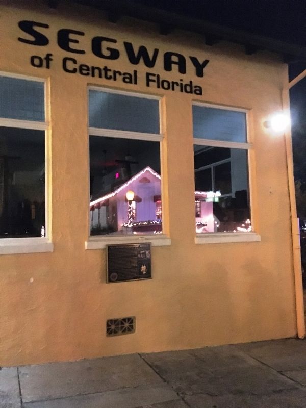
The area received its first post office in 1880. Ross C. Tremarin was appointed as the first postmaster and named the lakeside outpost “Royellou” after his three children, Roy, Ella and Louis. Two years later, the town’s official name . . . — — Map (db m145363) HM
The Mount Dora Lawn Bowling Club was envisioned in 1925 by Willard Bryant and Fred Thompson, two winter visitors from Hartford, Connecticut. They approached Charles Edgerton, owner of the historic Lakeside Inn and member of the City’s Park . . . — — Map (db m145383) HM
In reverent memory of
the men of Mount Dora
who gave their lives in
The World War
Erected by
Mount Dora Post
American Legion
July 4, 1931 — — Map (db m143759) WM
After a fire destroyed the community’s Town Hall in 1922, Mount Dora was in need of an auditorium for public assemblies. Despite the hard economic times, construction of the Mount Dora Community Building began in 1929 with funds raised by the . . . — — Map (db m145589) HM
Attorney Virgil Darnell Hawkins
1906-1988
Florida and Okahumpka’s
Civil Rights Pioneer
May his personal sacrifices
which desegregated
Florida's universities
and provided legal assistance
to those in need,
inspire future . . . — — Map (db m81480) HM
Julius Rosenwald was the chairman of Sears Roebuck and Co. in 1908. As a Jewish American, he believed the most serious problem of the United Stats was the plight of Black Americans. Rosenwald was a close friend of Booker T. Washington. . . . — — Map (db m185785) HM
On October 29, 1966, Jim Kern, founder of the Florida Trail Association, and like-minded hiking enthusiasts began building the Florida Trail at the entrance to Clearwater Lake Recreation Area in the Ocala National Forest. The first 26-mile section, . . . — — Map (db m101445) HM
Charles and Henrietta Call were the grandparents of Walt Disney. The Call and Disney family moved to Florida in 1884 from Kansas. The families settled on land about a mile north of Paisley. Charles and Henrietta's daughter, Flora married Elias . . . — — Map (db m290977) HM
This structure was built by the Civilian Conservation Corps (CCC) in 1938. It originally served as a home for the State Game Officer for the Ocala National Forest. It has been used by the Forest Service as an office and laboratory. The interior of . . . — — Map (db m167892) HM
The first settlers in Florida were Paleo-Indians who arrived about 14,000 years ago. These hunters and gatherers built their settlements near springs. At least a dozen campsites have been documented along the Wekiva River and Rock Springs Run.
. . . — — Map (db m265284) HM
The single room schoolhouse sat close to Ethel Road and the railway line. It also served as the church where services were held every other Sunday. The earliest mention of the school is in a deed granting half an acre of land to the School Board of . . . — — Map (db m265302) HM
The first settlers were the Moore family: William, Charlotte, and their three sons, who came from Georgia in the late 1860s. They had 360 acres of land, but life was hard, and their three sons, who came from Georgia in the late 1860s. They had 360 . . . — — Map (db m265255) HM
Settlers would often fashion their own furniture from wood and as families grew, cabins would be extended or replaced with a bigger structure. Cooking was done outside, as indoor cast-iron stoves were too expensive for most families to afford. . . . — — Map (db m265386) HM
Most cabins had one bed for the parents and two youngest children, while the rest of the family often slept on a rug on the floor. Mattresses and pillows were stuffed with grass and Spanish moss.
The mother would have a 'good' dress for church . . . — — Map (db m265345) HM
The early settler's diet consisted largely of pork, beef, fish, game, grits, sweet potatoes, butter, a little milk, and syrup. Flour could be bought at the local store, but ground, dried acorns were added to make it go further. Sweet potatoes would . . . — — Map (db m265352) HM
William S. Delk was the largest plantation owner in the area and grew cotton, rice, sugar cane and corn around Rock Springs. His first home, a log cabin, burned down when he tried to smoke out fleas with fire. The next house was built on the . . . — — Map (db m265278) HM
In 1880, Frazier, Delk and James Madison were appointed Orange County Special Road Commissioners. They were tasked with building a public road from Orlando to Rock Springs, and another from Rock Springs to Hawkinsville, a cypress timber settlement . . . — — Map (db m265401) HM
Anthony Frazier was born in Georgia in the mid-1820's and spent most of his early life as a slave on the Delk Plantation at Rock Springs. After being freed by Delk, Frazier and Robards made their way to South Carolina and enlisted in the Union Army, . . . — — Map (db m265315) HM WM
The railway transformed Ethel and other communities in the area. Before, travel was a slow and tedious experience. There were no paved roads; instead, narrow, sandy, pot-holed tracks caused ox-drawn carts to get stuck or lose a wheel. With the new . . . — — Map (db m265305) HM
While hiking at Rock Springs in 2008, Tony Moore, a retired land surveyor and park volunteer, noticed something in the corner of a field of waist-high grass. Imagine his surprise when he discovered a tombstone with the same last name as his. He . . . — — Map (db m265310) HM
Establishing Ethel
The first settler at Rock Springs was William S. Delk, descended from English colonists who landed at Jamestown in 1623. Aged 38, he purchased 3,000 acres of land in 1854 and built a home close to the springs at what is . . . — — Map (db m265292) HM WM
Built in 1923, this church on North Joanna Avenue has served Tavares as a
sanctuary for over a century. Early Methodist services in Tavares were
held in St. Clair-Abrams Hall, built in 1882 by Major Alexander St. Clair-Abrams,
the city founder. . . . — — Map (db m304175) HM
In July 1949, Walter Irvin, Samuel Shepherd, Charles Greenlee and Ernest Thomas — known collectively as the "Groveland Four" — were accused of crimes in Lake County. Eyewitness accounts, records, and subsequent investigations revealed that these men . . . — — Map (db m145768) HM
During the Second Seminole War (1835-1842), troops under the command of Brig. Gen. Abraham Eustis left Volusia County headed toward the Withlacoochee River as part of a military action in response to the December 28, 1835 massacre of Major Francis . . . — — Map (db m56224) HM
Public education has always been an important part of Apopka's history. In 1879, Orange County held its first institute for teacher education in Apopka. In the early 1880s, the school in Apopka lacked a permanent building and was forced to hold . . . — — Map (db m244558) HM
For those who died a hero's death
Who felt the flag upon their chest
Who kept the bonds of the free unfurled
Who fought for peace throughout the world
This olive branch is gratefully lain
To show your death was not in vain.
- . . . — — Map (db m212341) WM
Piedmont, named in the late 1890s, was comprised of a wide area around Blue lake, one and one-half miles east of Apopka City. It was a close-knit community populated in the 1870s almost entirely by Swedish immigrants. Among the earliest settlers . . . — — Map (db m72441) HM
To the memory of Dr. Howard Atwood Kelly of Baltimore, Maryland, one of the founders of Johns Hopkins Hospital and medical school. He was a great surgeon, teacher and medical authority, and above all, a Christian gentleman.
Dr. Kelly, in 1927 . . . — — Map (db m66834) HM
Rock Springs is the source of the Rock Springs Run, a swift running stream with an average flow of 26,000 gallons per minute and a constant temperature of 68 degrees. The spring flows from limestone containing fossils that date back 17 million . . . — — Map (db m94341) HM
This little church began as a simple rectangular board and batten structure built in 1886 by the First Congregational Church on Main Street in Apopka. Services were held in the church for ten years until the Great Freeze of 1895 forced the . . . — — Map (db m104871) HM
The history of people and the environment intertwine at Lake Apopka. Lake Apopka has a long history as a farming community. Beginning in the 1940s, about 20,000 acres of wetlands along the north shore of Lake Apopka were drained and diked to . . . — — Map (db m165348) HM
Restoring Lake Apopka The Lake Apopka Restoration Act of 1985 and the Florida Surface Water Improvement and Management (SWIM) Act of 1987 paved the way for restoration work to begin. Activities have included: • Purchase of more than . . . — — Map (db m165349) HM
In the 1870s, the early settlers of northwest Orange County looked to area waterways as commercial highways. Lake Apopka, the head of the Ocklawaha chain of lakes, offered access to the St. Johns River near Palatka and a way for citrus and vegetable . . . — — Map (db m72409) HM
Masonic Lodge No. 36 of the Grand Jurisdiction of Florida was established in 1856 and is still serving under a warrant issued that year. This building was erected here in 1859; the upper story has been continually used for lodge meetings. The . . . — — Map (db m72418) HM
This property has been placed on the
National Register of Historic Places
by the United States Department of the Interior
Circa 1886 — — Map (db m279278) HM
Named for their wooden stave planks, Norway's iconic stave churches were constructed using many of the same techniques used to build Norwegian ships. To help protect the medieval structures against the harsh winters, master craftsmen designed the . . . — — Map (db m220022) HM
The Pine Castle Homestead
Will Wallace Harney built a large English-style home he called Pine Castle on his homestead along the western shore of Lake Conway in 1873. The house was constructed from the pine trees which grew on his land. Two . . . — — Map (db m251907) HM
On June 19, 1943 a routine training flight took the lives of seven WWII airmen who crashed here in what is now Tosohatchee Wildlife Management Area.
Their flight departed from Sanford Naval Air Station, once filled with metal hangars containing . . . — — Map (db m212134) HM
The cracker name for a group of trees is head. Bees filled the hollows of the live oak trees with honey. The area where the ranch house was located was noted for its numerous honey trees, resulting in the house being named, The Beehead Ranch House. . . . — — Map (db m208468) HM
The blockhouses served as lookouts, headquarters of General Thomas S Jesup, and protection of the troops in the event of an Indian attack. Two blockhouses were constructed on opposite corners of the stockade twenty (20) feet square with four (4) . . . — — Map (db m208578) WM
The blockhouses served as lookouts, headquarters of General Thomas S. Jesup and protection of the troops in the event of an Indian attack. Two blockhouses were constructed on opposite corners of the stockade, twenty feet square with four feet . . . — — Map (db m208610) HM
Ephriam Legrand Brown built this house in 1900. Mr. Brown was born in Americus, Georgia in 1859 and came to Florida at the age of sixteen. He worked as a surveyor. In 1882 he married Julia Roberts of the Roberts Plantation on Lake Mills. He . . . — — Map (db m108107) HM
Every farmer had a patch of sugarcane that provided syrup and brown sugar. The patch was cultivated in low areas, getting sweet in late October. It was cut and hauled by wagon to the mill where it was stripped and topped.
To grind sugarcane, a . . . — — Map (db m208446) HM
To grind cane, a mule was hitched to the long shaft that turned the rollers as the mule walked around. The cane was fed through the rollers and the juice from the pressed stalks was collected in a barrel. Virtually every farmer had a patch of . . . — — Map (db m208447) HM
As European immigrants and settlers came to America, many came with chickens in tow. Some were raised on farms and in towns sharing living space with the farmer in their house or outbuildings, free to roam the fields foraging for food and even . . . — — Map (db m208483) HM
The post office was an important meeting place for
the community of Christmas. This is the eighth structure to house the post office. The first post offices were in people's homes and then as part of a general store. This is the first building that . . . — — Map (db m208598) HM
Cotton was grown by American Indians in the early 1500's, documented from sightings by the Coronado expedition 1540-1542. The Spaniards raised a cotton crop in Florida in 1556.
Pioneers had to make all the thread they required for their . . . — — Map (db m208586) HM
This 19 foot canoe was found in the area of Tampa Bay in 1980. It was believed to have been a seafaring canoe of 50 to 100 years in age at that time. It is unlikely of Seminole or Miccosukee construction, but may be from the islands, Central America . . . — — Map (db m208530) HM
Almost every family in the late 1800s and early 1900s had a garden. It was their main source of food. The climate of Florida allowed them to have a spring and fall garden. Food was grown year round with plants being replaced when their productive . . . — — Map (db m208540) HM
Sugarcane is a crop that can be grown throughout Florida. In most areas of the state it is grown only as a hobby crop for syrup production or as a source of "chewing cane".
In south Florida, along the shores of Lake Okeechobee, sugarcane is . . . — — Map (db m208448) HM
As white settlers moved into Florida in the 1820's and 1830's, there were growing demands that the Seminole Indians be removed to a reservation west of the Mississippi. Efforts to convince the Seminoles to move failed, and in 1835 the conflict known . . . — — Map (db m54086) HM
This pavilion was built by the Works Progress Administration (WPA), during the depression era of the 1930s. It has been renovated and preserved at the request of the local Christmas community for its service and for the memorable times it . . . — — Map (db m208077) HM
The Union School was established in 1906. Originally a large, one-room school, it was named “Union" School because it united several small, family operated schools in the Fort Christmas area into a central location.
In the 1920s the school was . . . — — Map (db m208399) HM
Dixie Partin (1893-1977) was the youngest son of Hugh Gilmore Partin, Jr and Margaret Hull. He married Emma Gill (1900-1987) and had three daughters, Louise, Marcile and Naomi. He purchased land near his father's homestead (Sun Flower Trail) where . . . — — Map (db m208451) HM
The powder magazine was used for storing ammunition and was below ground level for safety. Should the powder explode the energy from the blast would be sent mostly upward into the air, not outward destroying the Fort and causing injury to the . . . — — Map (db m208603) HM
George Washington Simmons and Ann McDougald Simmons were married at Silver Springs in 1856. They soon moved to the Orlando area where they lived near Curry’s Ford for a number of years. Then in 1873 they settled at Taylor Creek near Fort Christmas . . . — — Map (db m108044) HM
Thomas Jefferson Woods, born in 1896, was the son of Francis Jackson Woods and Emma Matilda Savage. In 1927 he and his wife, Katie, were living in a palmetto-thatched lean-to, struggling to complete the house in time for the birth of their first . . . — — Map (db m208479) HM
The storehouse was used for storing army rations and supplies. Food staples consisted of salt pork, dried beef, corn, beans, rice and coffee, plus such condiments as salt, brown sugar, vinegar and molasses. Equipment and supplies for an army, such . . . — — Map (db m208607) WM
During the Second Seminole War General Eustis, U.S. Army, under the command of General Thomas S. Jesup, moved a column south from Fort Mellon (Sanford, Florida) on the 17th of December 1837. The column consisted of the 3rd Regiment of Artillery, 4 . . . — — Map (db m208532) HM
This is an example of a tree that has been prepared for turpentining. You will notice trees with this type of distinctive scaring all around the park. To prepare a tree for turpentining part of the bark on the tree trunk was first removed. Next, a . . . — — Map (db m214832) HM
The Union School was established in 1906. Originally a large, one-room school, it was named “Union" School because it united several small, family operated schools in the Fort Christmas area into a central location.
In the 1920s the school was . . . — — Map (db m208396) HM
Built by Jim Wheeler in the early 1900s, this small house began as a barn. It was converted to a home shortly after its completion. Early rural homes did not have glass windows. Board shutters were opened to allow entry of light and air circulation. . . . — — Map (db m208452) HM
Thomas Jefferson Woods, born in 1896, was the son of Francis Jackson Woods and Emma Matilda Savage. In 1927 he and his wife, Katie, were living in a palmetto-thatched lean-to, struggling to complete the house in time for the birth of their first . . . — — Map (db m208469) HM
John Burl (Bud) Yates III, born in 1875, and Polly Canada, born in 1874, lived on the John Burl Yates’ homestead, located on Taylor Creek when they first were married. They converted an old shed into living quarters and prepared meals on a 'cook . . . — — Map (db m108093) HM
Barber / Mizell Feud
Moses Barber moved his family from Georgia to northern Florida in 1833 and settled near the present Macclenny. They developed one of the largest cattle empires in the state but, during the Civil War (1861-1865), their . . . — — Map (db m251300) HM
Citrus Industry and Red Hill Groves
Cattle ranches and turpentine stills filled the Conway landscape in the late nineteenth century, but it was the citrus industry that would predominate in most of the twentieth century. For miles, neat . . . — — Map (db m210835) HM
Conway First Baptist Church
The Conway First Baptist Church was organized in 1910 and first housed in a clubhouse on Arnold Avenue and Anderson Road. In February 1911, the clubhouse and lot were sold or exchanged for five acres of land . . . — — Map (db m101052) HM
Conway United Methodist Church
The Conway Methodist Church was first organized in 1874 as the Prospect Methodist Episcopal Church South. Services were held monthly in a log cabin and led by a circuit rider. The building also served as the . . . — — Map (db m93389) HM
St. Mary's Missionary Baptist Church
St. Mary's Missionary Baptist Church was built on land donated by Mary Walker in 1915. It was a small frame building with a steeple to the side of the main entrance The small African American community . . . — — Map (db m101051) HM
The English Colony
A group of Englishmen known locally as the English Colony immigrated to Conway in the 1880s. They came as a result of a land and citrus industry promotion by the state and railroad corporations that promised an annual . . . — — Map (db m101054) HM
Celebrating the life of William Billy, Sr.
William Billy, Sr., was a loyal and dedicated school crossing guard for our community and children for over 18 years. During this time he crossed to safety thousands of our children at the . . . — — Map (db m311006) HM
Club Eaton opened in 1946 during the times of segregation. The club was the first “Big-Time" nightclub for African Americans with entertainment by notable, successful African American entertainers, these entertainers included Duke Ellington, BB . . . — — Map (db m196480) HM
Many of the homesites in early Eatonville included a citrus grove. One of the largest was Dash's Citrus Grove. Bounded by Kennedy Boulevard, West, Clark, and Calhoun Streets, it occupied an entire square block The grove was part of the homestead of . . . — — Map (db m221683) HM
Eatonville Fire Dept
Organized Oct. 13, 1955
C.H.Crooms Mayor
M. Robinson Chief
H. T. Baker Asst. Chief
N. Vereeniging Sec.
A.Franklin Chap.
A. G. Green Lt
J. W. Baldwin Reporter
O.H. Majors
C. Boyer
J. Graham . . . — — Map (db m196602) HM
The Eatonville Gateway, mounted on 30-foot brick pedestals, arches over the west side of Kennedy Boulevard. The Gateway greets visitors to the town with a large, decorative clock and archway signage that speaks to the town’s rich history: "The town . . . — — Map (db m196458) HM
The first police station was built circa 1912 under Mayor John Hurston. Several buildings were built and continuously renovated. A holding section (jail) was housed within the police station until circa 1971.
The current police station is . . . — — Map (db m196530) HM
Town hall was originally located in Joe Clark’s store. As the town grew, town hall was relocated within various other buildings including the original police station.The first building to be constructed and specifically dedicated for usage as a town . . . — — Map (db m196424) HM
This water tower serves as a beacon to let all know that Eatonville, Florida was the first municipality within the United States to be incorporated by families of newly freed slaves.
Incorporated on August 18, 1887, "This is the Town that . . . — — Map (db m196618) HM
“The Nation’s Oldest Black Incorporated Municipality” established 1887
The community of Eatonville was established by and for African Americans whose dream it was to govern themselves.Between 1880 and 1930, hundreds of such communities were . . . — — Map (db m196791) HM
The Robert L. Hungerford Normal and Industrial School was founded in 1889 as the first school for African Americans in Central Florida. Modeled after, Tuskegee Institute, a school started by Booker T. Washington in Tuskegee, Alabama, the mission of . . . — — Map (db m196810) HM
Joe Clark’s store with "The Lying Porch” was located on Old Apopka Road (now Kennedy Boulevard). The store sold groceries and general merchandise. It also served as the town’s post office and town hall. This was a gathering place for town residents . . . — — Map (db m196442) HM
Kennedy Boulevard, originally known as Old Apopka Road, has always been the Town of Eatonville's "main street." It has functioned since at least 1846 as the primary traffic artery connecting Maitland and Winter Park in the northwest section of . . . — — Map (db m196729) HM
The concrete-block building that presently sits on the corner of Kennedy Boulevard and College Street was once the location of one of the "second-wave" business establishments within the Town. Beginning in the late 1930's, some businesses were . . . — — Map (db m196857) HM
Friends of Libraries USA
Library Landmarks Register
Matilda Mosley Home
Eatonville
site of the home of the childhood best friend of
Zora Neal Hurston
who, throughout her writings, celebrates the rich culture of Eatonville as . . . — — Map (db m196869) HM
Founded in 1882, Macedonia Missionary Baptist Church is the second oldest congregation in Eatonville. When the church began; its members assembled on alternate Sundays in the same structure used by the St. Lawrence African Methodist Episcopal . . . — — Map (db m196786) HM
Taylor Street is the eastern boundary of Eatonville and is the site of Jim and Matilda Clark Moseley's home. Matilda, or "Miss Tillie," as she was affectionately called, was the niece of Joseph Clark, Eatonville's founder and first mayor. Early . . . — — Map (db m52686) HM
The school was patterned after Tuskegee Institute, which was founded by Booker T. Washington the noted educator and scientist, (sic) George Washington Carver was a featured lecturer at Robert Hungerford Normal and Industrial School. — — Map (db m196587) HM
The history of the current St. Lawrence African Methodist Episcopal (A.M.E.) Church is represented by the present church structure as well as by the home located on Kennedy Boulevard, opposite the church sanctuary. Founded in 1881, the St. . . . — — Map (db m196780) HM
The St. Lawrence African Methodist Church was Founded in 1881. St. Lawrence Church is older than the historic town itself, and it is one of the oldest African American Church’s in the Central Florida area. It was named in honor of Lewis Lawrence . . . — — Map (db m196645) HM
Across from this site (on People Street) once stood the eight-room, "one story and a jump" house in which the Hurston family lived. The Rev. John Hurston was the Town's third mayor and the second pastor of the Macedonia Missionary Baptist Church. . . . — — Map (db m196783) HM
The first church in historic Eatonville was St. Lawrence African Methodist Episcopal (AME) Church. This church shared sanctuary usage with Macedonia Missionary Baptist Church
with alternating worship times. The church building later housed . . . — — Map (db m196728) HM
Eatonville is strategically located between two lakes, Lake Sybelia at the northeastern edge of the original Eatonville Town site and Lake Belle in the southeastern corner. The pathways between these two natural lakes were an early means of moving . . . — — Map (db m221703) HM
Somerset County, PA • New York, NY • Washington, DC Through blurred eyes we find the strength and courage to soar beyond the moment. We look to the future knowing we can never forget the past. God Bless America
[Supplemental Plaque] . . . — — Map (db m237975) WM
For Those Returned. Thank you God. For Those Who Died, Glory Forever God. For Those Still Missing, Please God. The United States and the citizens of Florida gratefully acknowledge all former Prisoners of War for their heroic sacrifices . . . — — Map (db m237981) WM
On July 4, 1971 Mrs. Glendon W. Perking and Mrs. Ralph T. Browning wives of American Prisoners of War in Viet Nam, lighted a torch freedom which burned until all Americans held as P.O.W.'s by the North Vietnamese and the Viet Cong were released. . . . — — Map (db m238025) HM WM
This site was home to Dr. Henry Nehrling (1853-1929), an internationally renowned horticulturalist, naturalist, botanist, ornithologist, and writer known as the "patron saint of Florida gardens." Here, and at his later Naples gardens, between 1886 . . . — — Map (db m226365) HM
Died on their return from outer space STS-107 February 1, 2003 List up your eyes and look to the heavens The pioneers of human achievement will live in our hearts forever May they rest in peace
[Captions:]
(Front . . . — — Map (db m237983) HM
718 entries matched your criteria. Entries 101 through 200 are listed above. ⊲ Previous 100 — Next 100 ⊳