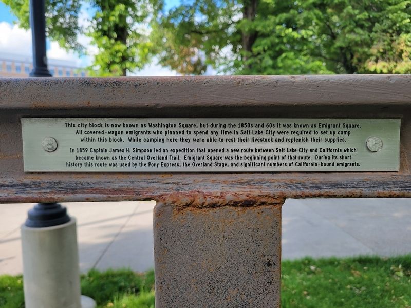
"The city presents a handsome appearance. About 9 o'clock the whole train arrived and is camped in Emigration Square in a dusty place, full of horses and wagons from the states. A large number of old acquaintances came into our camp to . . . — — Map (db m273865) HM
"Started out again across the desert, drove 6 miles, found water for our horses then drove on up the mountains for 9 miles of an upward grade. Reached the summit, then drove down into the Deep Creek Canyon."
- Abbey Fulkerth June 26, 1863 . . . — — Map (db m249753) HM
"Seven miles brought us where the road forked - the left hand one leading up a ravine towards the mountain. We took it..."
Madison Berryman Moorman, July 27, 1850 — — Map (db m301554) HM
"This morning it is raining it seams so plesent to see it rain as we have not seen it rane since we came in the valey before we now noon near a salt spring [Horseshoe Springs] we then went on to elbow spring [Hope Wells] fresh water it is very good . . . — — Map (db m301553) HM
"We struck the stage road in 5 miles. Good water here. Drove on to the summit of Point Lookout. Here we nooned and drove 1 miles farther to water and camped" Albert Jefferson Young, August 9, 1862 — — Map (db m249524) HM
"We were off at seven A. M. and marching 16 ½ miles camped at Pleasant (or Simpson's) Spring, where there is a mail station, getting into camp about one o'clock. We are now on the eastern rim of the Great American Desert."
William Lee (member of . . . — — Map (db m249633) HM
"The roads were gravelly round the end of some high rocks. Barren mountains (Silver Island)." -- Robert Chalmers, July 27, 1850 — — Map (db m105241) HM
“...a considerable Portion of the land between the Spanish Fork and F.P. [Fort Peteetneet] is low and marshy and Bad to cross especially with heaby loade waggons...some of the waggons required 9 yokes of oxen to get them through the sloughs 0 this . . . — — Map (db m272747) HM
The depression on either side of North Shore Road here marks a historically important route that has been used by many people. The way was established thousands of years ago by the region's tribes as part of a vast trail network. The Walla Walla . . . — — Map (db m311359) HM
The Oregon Trail crosses LaPrele Creek about one mile downstream from Natural Bridge. Before the modern road was built into the gorge, Natural Bridge was difficult to access, and it was only rarely visited by emigrants of the covered wagon era. From . . . — — Map (db m71495) HM
Caleb and Nancy Magill with their six children were part of a wagon train traveling fro Brown County, Kansas, to Dallas, Oregon, in 1864. After leaving Fort Laramie their three-year-old daughter Ada was taken sick with dysentery. At Deer Creek . . . — — Map (db m92079) HM
Nineteen-year-old Alvah Unthank was one of a group of young men who left Newport, Wayne County, Indiana, for the goldfields of California in 1850. On June 23 the wagon train passed Register Cliff, south of Guernsey. There Alvah inscribed his name: . . . — — Map (db m177934) HM
Mary Elizabeth Homsley was born near Lexington, Kentucky, July 20, 1824. She move with her parents, Jacob and Sarah Oden, to Truxton, Missouri, where she was married to Benjamin Franklin Homsley in 1841. In April 1852, accompanied by Mary's . . . — — Map (db m98361) HM
The grave of F.R. Fulkerson was noted by forty-niner J.G. Bruff on July 26, 1849, as he traveled through what he termed "Pass of the Rattle-Snake Mountain to the left of Devil's Gate." The survival of the large granite boulder used as the Fulkerson . . . — — Map (db m66997) HM
In 1852 an estimated 50,000 pioneers passed Independence Rock on their way west. Among this number was the family of 21-year-old Ezra Meeker, recently of Eddyville, Iowa, but natives of Indiana. Meeker, his wife Eliza, and their infant son, arrived . . . — — Map (db m95546) HM
Canyons and the southward curve of the North Platte west of here forced emigrant wagon trains to cross to the north side of the river somewhere between present Glenrock and Casper. This region was known generally as the Upper Platte Crossing. Until . . . — — Map (db m92052) HM
In April 1862 the Thomas Paul family left Fremont, Iowa, for Washington Territory. Mrs. Elizabeth Mortimore Paul, who was pregnant, had a difficult time on the journey west, and here on July 27, 1862, age 32, she died giving birth to a daughter. . . . — — Map (db m179898) HM
This maker consists of three plaques, each dealing with the Lander Cut-off.
“The Best Mountain Road in the West”
In 1857, Congress funded construction of the Fort Kearney-South Pass-Honey Lakes Wagon Road (Lander . . . — — Map (db m80540) HM
In July 1844 the California bound Stevens-Townsend-Murphy wagon train, guided by Isaac Hitchcock and 81-year old Caleb Greenwood, passed this point and continued nine and one half miles southwest from here, to a place destined to become prominent . . . — — Map (db m67036) HM
Too young and naïve
to think they could fail
Too full of visions
for the end of the trail
They stored their silk dresses
and donned calico
To join in the cry
of Westward Ho
Their diaries tell
of the endless hours
The . . . — — Map (db m55832) HM
"The next day we followed up Butte Creek for six
miles and pitched our tents. We lost a fine horse here."
- Andrew Soule, Sep 29, 1854 — — Map (db m151595) HM
Travel along the Oregon and California trails increased in the 1840s with the cry of “Westward Ho.” When the 1848 discovery of gold was made at Sutter’s Mill in California, the desire to reach the gold fields ahead of others intensified . . . — — Map (db m131310) HM
Between 1843 and 1869 over 300,000 emigrants fulfilled Americas's Manifest Destiny by voluntarily relocating to Oregon and California. Their nearly 2,000 mile journey along game trails long used by the early Native Americans would become known as . . . — — Map (db m119239) HM
Pioneers traveling west on the Oregon Trail discovered this spring that Plains Indians had frequented for centuries. It provided an oasis for man and beast alike in the "Great American Desert."
In 1867, Union Pacific railroad workers named . . . — — Map (db m258618) HM
Traveling northwest from Ash Hollow, the emigrants encountered three natural features of the North Platte Valley which became well-known milestones. First was Court House Rock, rising abruptly from the plains as the vanguard of the bluffs farther . . . — — Map (db m61968) HM
(left panel:)
Tour Our National Byways
Click on the Tour Our National Byways photograph to enlarge it and view the local byway routes. (center panel:)
The springs of Soda Springs - indeed a . . . — — Map (db m106214) HM
Here was the terminus of the Oregon-California Trail used by the French-Canadian trappers employed by the Hudson’s Bay Company from about 1832 to 1845. Michel La Framboise, among others, met fur trappers here annually where they camped with their . . . — — Map (db m15957) HM
This road began in St. Joseph, MO and joined the Independence Road just west of Marysville, KS. These two roads formed the Oregon - California Trail. Emigrants pioneered this branch in 1844 and used it until about 1865. — — Map (db m253385) HM
Captain Stephens brought the first wagons
over the snow covered Sierra Nevada
Truckee Pass with no casualties in the
Stephens-Murphy-Townsend party of 1844,
arriving at Sutter's Fort with 11 wagons
and 51 people plus 2 infants born on the
way. . . . — — Map (db m24125) HM
The Bidwell-Bartleson Party
In 1841, John Bidwell and John Bartleson became the first Americans emigrants to undertake a wagon crossing from Missouri to California.
Although Oregon was the primary destination of early westward-bound . . . — — Map (db m140278) HM
Historic Frontier Trails cut through the territory now known as Merriam. Hundreds of thousands of people emigrated [sic – immigrated] to the western frontiers along the Oregon and California Trails. The Santa Fe, Oregon and California Trails . . . — — Map (db m46856) HM
From the late 1830s and into the 1860s, thousands of traders, emigrants, and gold prospectors passed this way. After crossing the Big Blue River, covered wagons struggled up this hill due to the mud left behind from torrential spring downpours. Over . . . — — Map (db m199357) HM
Sometimes muddy, often dusty, the shared track of the Santa Fe, Oregon, and California trails once passed this way. Teamsters created this route, urging heavy freight wagons to and from New Mexico. In the 1840s-50s, pioneer families traveled this . . . — — Map (db m251721) HM
"Coming to the point of the ridge [Timpie Point]... I saw an expanse of water extending far to the North and East...The Salt Lake a joyful sight was spread before us. ...I had traveled so much in the vicinity of the Salt Lake that it had become . . . — — Map (db m254732) HM
The original Spring Ranche, located two miles south of here on the north side of the Little Blue River, was founded about 1863. James Bainter, the first permanent settler, operated a store and inn for travelers along the Oregon-California Trail. . . . — — Map (db m287728) HM
Native Americans traveled and camped in the Soda Springs area for centuries before emigrants traveled the Oregon Trail.
Sheep Rock (Soda Point) marked the junction of the main route of the Oregon-California Trail and the Hudspeth Cutoff and was . . . — — Map (db m106850) HM
The Oregon-California Trail passed by the mission and trail ruts are still visible to the southeast of the building. Both tribes benefitted from the increased traffic by building a toll bridge. But with the travelers came small pox and cholera, . . . — — Map (db m47926) HM
Apprx. 6 1/2 miles south on East River Road. A campsite on the Oregon - California Trail named by the Reed Donner party of 1846. Burial site of
Sarah Keyes of that party. Also used as early as 1820 by fur trappers and missionaries. — — Map (db m253384) HM
East of this marker is where the Military Road and the Oregon/California trail crossed the Vermillion River. The crossing was named for Louis Vieux, who was of Native American and French descent. He established a toll bridge there in the 1850s . . . — — Map (db m246356) HM
Jim Bridger first came west in 1822, working in the fur trade until that industry declined. He traveled throughout the west, becoming an expert on the Indians and the land. After working as a trader, he established the Bridger Trail through the . . . — — Map (db m86164) HM
John C. Fremont reported using the Canyon Creek crossing in 1843 and Lansford Hastings's 1845 Emigrant's Guide to Oregon and California listed the site as an important Oregon Trail crossing and campsite. Emigrant diaries report frequent use of . . . — — Map (db m125784) HM
Between Lawrence and Topeka, the Kansas turnpike passes near the route of the old Oregon-California Trail, traveled in the 1800s by explorers, missionaries, soldiers, emigrants in search of land, and forty-niners in search of gold. Fifteen miles . . . — — Map (db m103242) HM
Here US-56 lies directly on the route of the Oregon-California and Santa Fe trails. Nearby, the trails branched. On a rough sign pointing northwest were the words, "Road to Oregon." Another marker directed travelers southwest along the road to Santa . . . — — Map (db m21669) HM
You are traveling in the path of countless men, women, and children who passed this very home in the 1860s! When you turned into the parking lot, you pulled off the Westport Route of the Santa Fe, Oregon, and California Trails. And now, you're . . . — — Map (db m34470) HM
Begun in 1858, the Hollenberg Ranch, four miles north and one mile east of here, served as a stop on the Oregon-California Trail until the late 1860s. Gerat and Sophia Hollenberg, German emigrants, sold food and other supplies, lodging, and draft . . . — — Map (db m228348) HM
Jim Bridger (1804-1881) was one of the greatest American mountain men and frontier explorers. He was an eighteen-year-old member of William Ashley's first expedition in 1822 to the upper reaches of the Missouri River.
In 1843, he built a . . . — — Map (db m199426) HM
Courthouse and Jail Rocks are two of the most famous landmarks of western migration. Nearby passed the Oregon-California Trail, the Mormon Trail, the Pony Express Trail, and the Sidney-Deadwood Trail. The rocks were vanguards of unforgettable scenic . . . — — Map (db m79391) HM
Hollenberg Station and Transportation
By the time Hollenberg Station was begun in 1857 or 1858, Gerat Hollenberg
already had years of experience in operating at road ranch on the Oregon-California Trail. A native of Germany, he had been drawn . . . — — Map (db m253085) HM
When Kansas territory was opened for white settlement on May 30, 1854, a bitter contest developed over the slavery question. Established the following December, Topeka, 25 miles ahead, favored the Free-State cause even though the territorial . . . — — Map (db m55359) HM
The trail which followed the south side of the Platte River was the main route to Oregon and California. Fur traders going to the Rocky Mountains took the first wagons over the trail in 1830. Oregon-bound missionaries followed in the mid-1830s, and . . . — — Map (db m53268) HM
The boundaries of the future Thayer County were first defined in 1856, and the county was named Jefferson. In 1867 Jones County to the east was attached. The legislature in 1871 divided the single large county into two, naming the western county . . . — — Map (db m79885) HM
Rock quarries, visible from several points near this location, were used beginning in 1849 to supply stone and lime for construction projects at Fort Laramie, about 15 miles east. Workers in the quarries were protected by soldiers stationed in . . . — — Map (db m85753) HM
Broken dreams and hope, carried 2000 miles through scorching deserts and over loft mountains. At last...the sight of the promise land. Those of you who visit this grave carry a torch of love and hope (which this young girl lost), and pass it on, to . . . — — Map (db m100573) HM
This is an east-west travel corridor of the earliest emigrant trails that continued even after the arrival of railroads and highways. Early explorers, such as John Fremont, Jedediah Smith, Osborne Russell, and missionary Narcissi Whitman were among . . . — — Map (db m106846) HM
Franklin is Idaho's oldest town. Settled in 1860 by Mormon pioneers who traveled to the vicinity of the confluence of Worm Creek and Muddy River, by year's end, 61 Latter-day Saints (LDS) families were there. The LDS laid out a fort-style . . . — — Map (db m105566) HM
In 1849, Frank Marshall obtained permission from the U.S. government to establish a trading post and ferry before Kansas opened for settlement. Thousands of wagons lined up to cross the Blue River on the Oregon-California Trail as settlers headed . . . — — Map (db m227616) HM
The Donner family and their hired teamsters left Springfield, Illinois in April, 1846. At Independence, Missouri, their wagons joined hundreds of others traveling west on the Oregon-California Trail.
The New Captain Takes a Shortcut . . . — — Map (db m129925) HM
A few miles to the northwest, the Oregon-California trail crossed the Vermillion Creek heading toward the Pacific from the "jumping off" towns on the Missouri River.
The crossing was named for Louis Vieux, a Potawatomi leader of French and . . . — — Map (db m119123) HM
Past travel and settlement across the rugged lands of the Bear Lake Valley were strongly influenced by the valley's hydrologic features. The shifting rivers, sloughs, and marshes presented natural barriers and were prone to flooding. This often . . . — — Map (db m140215) HM
The region comprising Bear Lake County has alway been an important juncture for overland travel. From the 1800s onward, migrants on the Oregon and California trails traversed the area, relying on knowledge garnered by Native Americans, early . . . — — Map (db m140213) HM
The Lander Trail, part of the Congressionally designated California National Historic Trail, was a shortcut of the main emigrant trails to California and Oregon, as well as to the new gold fields in Montana and Idaho. Emigrants started their . . . — — Map (db m96954) HM
Established in 1827, Fort Leavenworth is the oldest army post in continuous operation west of the Missouri River. Serving as the army's chief base of operations on the Central Plains, the fort furnished troops and supplies for military operations . . . — — Map (db m63183) HM
Renowned city of the Pony Express, St. Joseph was first settled as a trading post for the American Fur Company by Joseph Robidoux, 1826. Later he acquired the site and laid out a town in 1843.
St. Joseph became an outfitting point for . . . — — Map (db m4989) HM
Hollenberg's Land- Gerat Hollenberg acquired 160 acres of land in 1857 or 1858. He bought it with a land warrant given by the United States government to a veteran of the War of 1812.
1. Hollenberg Station - The building also was known as . . . — — Map (db m253083) HM
Transportation is the movement of people or goods from one location to another. Long before the Europeans first came to this area in the 1500s, the native peoples were engaged in transportation. On foot they followed trails that had been cut by . . . — — Map (db m253088) HM
This monument, erected by the Brotherhood of the American Mountain Men, is "dedicated to all Mountain Men known and unknown for their essential part in the opening of the American West." It consists of two busts and six plaques honoring four . . . — — Map (db m91017) HM
(This marker has two panels. From the left panel:)
Key Map
Traveling across this bridge, the fourth Red Bridge near this location since 1859, you may notice art panels attached to each of the large pillars that rise at both . . . — — Map (db m210568) HM
(The Oregon Trail kiosk houses thirteen panels which deal with Native Americans, the Fur Trade, the Oregon Question, Oregon Fever, and trials of the Oregon Trail.)
Pathway to the "Garden of the World"
Excitement filled the . . . — — Map (db m107234) HM
(Twelve panels dealing with Oregon Trail related topics are found at this kiosk)
Pathway to the "Garden of the World"
Excitement filled the air May 22, 1843 as nearly one thousand Americans left Missouri toward new . . . — — Map (db m112193) HM
170 entries matched your criteria. Entries 101 through 170 are listed above. ⊲ Previous 100
Thin black lines indicate changes in relevance. Between each pair of lines entries are ordered geographically but all have the same relevance.
* Inflectional forms of words are their plurals, singulars, and possessives as well as gramatical tenses and similar variations.