2195 entries match your criteria. Entries 201 through 300 are listed.⊲ Previous 100 — Next 100 ⊳
Pennsylvania Historical and Museum Commission Historical Markers
The official history agency of the Commonwealth of Pennsylvania administers a program of historical markers to capture the stories of people, places, events, and innovations that have affected the lives of Pennsylvanians over the centuries.
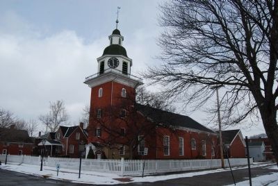
Constructed, 1828-1831, with bricks made by the Society members, this is the second building erected for worship. It is believed designed by Frederick Rapp. The spiritual life of the Society centered here. — — Map (db m40236) HM
Maintained by the
Pennsylvania Historical
and Museum Commission
as a State memorial to the
Harmony Society
Organized February 15, 1805
Dissolved December 15, 1905
These buildings erected 1824-1831, . . . — — Map (db m40721) HM
Gen. Anthony Wayne's army camped here Nov. 1792 to April 1793, preparing for the campaign which led to the Battle of Fallen Timbers with the Northwest Indians. — — Map (db m56581) HM
One of the large Indian towns on the upper Ohio was located nearby in 1727-58. Important conferences were held here between the British, French, and Indians in the struggle for the Ohio country. — — Map (db m40240) HM
A short distance southeast of this spot, along the banks of the river, was situated the village of Logstown one of the largest Indian settlements on the upper Ohio. It was the scene of many important conferences between the French, the British and . . . — — Map (db m56580) HM
The first United States military post north of the Ohio. Located on River Road, in the area between Bank, Insurance, and Market Streets. Built in 1778 and scene of Treaty of Fort McIntosh in 1785; also a survey base. Abandoned in 1791. — — Map (db m40235) HM
Present Beaver perpetuates the name of a Delaware chief and of his village near here. Its location along the Ohio-Beaver River trails gave it importance in the fur trade. — — Map (db m40238) HM
Home of the noted state and national political leader is near here. He rose, between 1856-1887, from local and state offices to United States Senator. A Republican Party leader from 1887 until his death in 1904. — — Map (db m40241) HM
During 64 years, "Ing-Rich" became one of the leading producers of porcelain enamel products in the United States. Noted for durability, the company's output included outdoor advertising signs and "porcel panels" for building exteriors; it also made . . . — — Map (db m40237) HM
Home of Grace Greenwood (Sara J. Clarke Lippincott, 1823-1904), pioneer woman correspondent, poetess, and authoress. While living here during the mid-19th Century, she wrote many of her popular juvenile stories. — — Map (db m134) HM
A log structure, built prior to 1761, stood on this site. Known, also, as the Commandants House; later as “Rising Sun Inn.” Occupied by British officers until close of French and Indian War. Destroyed by fire, Dec. 14, 1885. — — Map (db m14004) HM
Built in 1815. East room housed the first bank in Bedford, known as the Allegheny Bank of Pennsylvania, from 1815 to 1832. Original vault can still be seen. Since 1924, used as public library and community center. — — Map (db m13986) HM
Formed on March 9, 1771 from Cumberland County, it first embraced most of western Pennsylvania. Named for its county seat (formerly Raystown) incorporated 1795. In 1758, Fort Bedford was erected here, and Forbes Road - to become a major highway . . . — — Map (db m13990) HM
Settled about 1750, known then as Raystown. Site of an early trade post and Fort Bedford, 1758. Base for Forbes, Bouquet expeditions. In 1794 Washington here reviewed forces in Whiskey Rebellion. — — Map (db m52662) HM
Built about 1771. It was the headquarters of George Washington in October, 1794, when he came to Bedford to review troops assembled here to quell Whiskey Rebellion in western part of the State. — — Map (db m14015) HM
Site of lots on which John Fraser and his wife established an inn and trading post in 1758. Fraser had been a guide and interpreter for Colonel Washington. The inn provided meals for army officers at Fort Raystown (Bedford). — — Map (db m166918) HM
This house, built
in 1816 by the Hon.
James Russell, first
burgess of Bedford,
is considered a fine
example of Georgian
style of the Post-
Colonial period. — — Map (db m145062) HM
Medicinal values of these springs discovered about 1796. It soon became a leading resort visited by numerous notables. James Buchanan used the Springs as his summer White House while President. — — Map (db m202853) HM
Settled about 1750, known then as Raystown. Site of an early trading post and Fort Bedford, 1758. Base for Forbes, Bouquet expeditions. In 1794 Washington here reviewed forces in Whiskey Rebellion. — — Map (db m13995) HM
Settled about 1750, known then as Raystown. Site of an early trade post and Fort Bedford, 1758. Base for Forbes, Bouquet expeditions. In 1794 Washington here reviewed forces in Whiskey Rebellion. — — Map (db m82781) HM
This is one of the original service plazas for the nation's first long-distance superhighway. On October 1, 1940, the Turnpike opened, stretching 160 miles from Irwin to Carlisle. The Turnpike Commission had been created in 1937; construction . . . — — Map (db m8188) HM
This is one of the original service plazas for the nation's first long-distance superhighway. On October 1, 1940, the Turnpike opened, stretching 160 miles from Irwin to Carlisle. The Turnpike Commission had been created in 1937; construction . . . — — Map (db m8816) HM
In 1936 seventy-five percent of Pennsylvania farms had no electric service. During the next five years, with Federal support, 14 consumer-owned cooperatives were formed in this State. Bedford Rural Electric Cooperative, which serves members in . . . — — Map (db m52665) HM
The increased number of automobiles during the Lincoln Highway era (1912-1940) led to the development of programmatic architecture. Proprietors took daring approaches to appeal to the new motoring public.
All across the country, oversized . . . — — Map (db m13998) HM
Near this site on July 30, 1758, Cols. Bouquet and Washington discussed proposed routes by which Gen. Forbes’ army would attack French Ft. Duquesne. Bouquet preferred the route due west from Bedford, while Washington advocated Braddock’s 1755 road . . . — — Map (db m84287) HM
Founded 1681 by William Penn as a Quaker Commonwealth. Birthplace of The Declaration of Independence and The Constitution of the United States — — Map (db m91128) HM
This inn at the junction of the Forbes and Burd Roads was operated, 1779-1815, by Jean Bonnet and his heirs. In mid-1794, during the Whiskey Rebellion, embattled farmers met here and raised a liberty pole to protest the federal excise tax on . . . — — Map (db m60115) HM
This intersection marks the point where Forbes Road
of 1758 diverged from the path cut by Col. Burd in
1755. The Forbes Road led through the wilderness
west toward Ligonier from this point. — — Map (db m59734) HM
The Forks
The Road cut by Colonel James Burd
in 1755 and the Forbes Road diverge here,
Forbes Road leading southwestward to Shawnee
Cabins Encampment 4 1/2 miles from Fort Bedford. — — Map (db m166740) HM
At the Juniata Crossings, half a mile north of here, General Forbes erected a small stockade in 1758 to protect the communications of his army moving west to attack Fort Duquesne. — — Map (db m52663) HM
Entrenchments still visible by the roadsides were prepared in June, 1863, by militia under Col. J.C. Higgins against threatened Confederate attack toward the railroad at Altoona. The march of troops toward Gettysburg on June 30-July 1 ended the . . . — — Map (db m54182) HM
In 1936 seventy-five percent of Pennsylvania farms had no electric service. Over the next five years, in response to their needs, 14 consumer-owned cooperatives were formed in this State. Serving users in Bedford, Fulton and Huntingdon counties, New . . . — — Map (db m91087) HM
Before and during the Civil War, Benjamin Walker, Abner Walker, Sr. and George Harbaugh worked closely with African American Underground Railroad conductors John Fiddler, Elisa Rouse and Joseph Crawley. Hundreds of fugitive slaves were led from the . . . — — Map (db m91088) HM
Capt. William Phillips and 11 men of his militia company were captured near this point by Indians, July 16, 1780. Ten men were killed here and were buried later by a search party. Capt. Phillips and son Elijah, taken prisoner, were freed by British . . . — — Map (db m91084) WM
Near here was located Shawnee Cabins camp. Used by Gen. Forbes army in the campaign of 1758 against the French at Fort Duquesne in present Pittsburgh. — — Map (db m8288) HM
A village site nearby on the Raystown Path. Named for a group of Shawnee Indians who halted here on their retreat from the Potomac to the lower Allegheny valley in the early 18th century. — — Map (db m8290) HM
One of the nation's earliest cooperative
extension offices was established in 1910
in Schellsburg, Bedford County, with A.B.
Ross as county agent. The innovative
program sought to educate farmers about
agricultural science to increase . . . — — Map (db m176111) HM
On land granted by John Schell for the purpose of erecting a union church, construction of this primitive log church building was begun in 1806 by the Reformed and Lutheran Congregations of this area. — — Map (db m121037) HM
Graves of ten of Capt. Phillips' militia killed by Indians, July 16, 1780. Administered by the Pennsylvania Historical and Museum Commission. — — Map (db m91085) WM
Re-named Bally for Father Augustin Bally. The third Roman Catholic mission and first Catholic school in the State were established here in 1743 by Father Theodore Schneider — — Map (db m84570) HM
Organized 1729, this is one of the early Lutheran churches founded by Rev. John Caspar Stoever, Jr., who started the parish records in 1730. A log church, erected before 1749, was replaced by the present stone building in 1809. Since 1853, Lutheran . . . — — Map (db m84515) HM
Built 1756; garrisoned during the French and Indian War by troops under Capt. Christian Busse. Pennsylvania's major frontier defense east of Ft. Augusta (Sunbury). The site is 3/4 mile to the northwest. — — Map (db m29547) HM
"Pilgrim's Rest" was the name given to this spring on the Tulpehocken Path by Count Zinzendorf, the Moravian missionary, on his journey to the Indian towns of Shamokin and Wyoming in 1742. — — Map (db m29551) HM
Fort Henry, built 1756 to guard Lebanon Valley from Delaware and Shawnee raids, stood 3/4 mile northwest of here on the Tulpehocken Path. The trail came over the mt. near where present road cutting is seen. Round Head overlooks it from east. — — Map (db m29542) HM
An Indian path connecting the Iroquois capital at Shamokin, now Sunbury, with the Tulpehocken Valley, ran northwest through here. It was used by ambassadors to "Brother Onas," i.e., Wm. Penn and his successors. — — Map (db m85726) HM
Famous pioneer and wilderness scout, who lived in this area his first 16 years. Born 3 miles northwest on site of Daniel Boone Homestead, State historical shrine. — — Map (db m25167) HM
Greatest American pioneer and wilderness scout. Born Nov. 2, 1734. Spent the first 16 years of his life on the Boone Homestead a few miles north. Now a State historical shrine dedicated to American youth. — — Map (db m23776) HM
Greatest American pioneer and wilderness scout. Born Nov. 2, 1734. Spent the first 16 years of his life on the Boone Homestead a few miles north. Now a State historical shrine dedicated to American youth. — — Map (db m163362) HM
Hopewell Forge, 1744, and Furnace, 1770, were seven miles south. The furnace and the remains of an iron making community of the era are administered by the National Park Service, with recreation areas. — — Map (db m23784) HM
Established here in 1893 by C.A. Mory and Associates, it was among the largest casket manufacturers in the world and earliest traded on the N.Y. and Phila. stock exchanges. The company secured numerous patents for innovative improvements and designs . . . — — Map (db m84547) HM
Aviation pioneer Spaatz was a 1914 graduate of West Point and a pilot in France in World War I. He rose to the rank of brigadier general in 1940 and general in 1945. During World War II he commanded the US 8th Air Force and the US Strategic Air . . . — — Map (db m84545) HM
The evolution of the business located here mirrors America's changing transportation scene. In the factory begun by Mr. Sweinhart in 1872, horse-drawn carriages, farm and delivery vehicles, and sleighs were built. After 1914, bus and truck bodies, . . . — — Map (db m84546) HM
A disastrous fire destroyed the theater that stood at Philadelphia Ave. & Washington St. On Jan. 13 1908. It claimed 170 Victims, many buried here, due to overcrowding, poorly designed and unmarked exits, and inadequate fire escapes. The tragedy . . . — — Map (db m49338) HM
Established on Iron Stone Creek, one half mile to the east, by James Lewis, Anthony Morris, Thomas Potts, and Thomas Rutter. Called after Colebrookdale Furnace in England, it is considered the first blast furnace to be erected in Pennsylvania, c. . . . — — Map (db m84544) HM
Pioneer ironmaster and opponent of slavery who died 1730. Built Pennsylvania's first ironworks nearby, 1716. In ensuing decade he erected Pine Forge and built this mansion; in 19th century it was an Underground Railroad stop. Academy was founded . . . — — Map (db m84540) HM
Polish pioneer, Indian trader, settled along Schuylkill River in this area, 1712. He served the Provincial government as a messenger-interpreter during negotiations with Indian tribes in 1728. He was buried, 1736, in graveyard of St. Gabriel's . . . — — Map (db m25273) HM
Established 1725 as Oley; name changed to Exeter, 1742. Present stone meeting house built 1759 near site of two previous log structures. Buried here are members of the Boone, Ellis, Hughes, Lee, and Lincoln families. Meetings discontinued 1899; . . . — — Map (db m84536) HM
First European settlers in present Berks County on land granted by William Penn, 1704-5. The home of Mounce and Ingeborg Jones, built 1716 and the oldest house in the county, stands at the opposite end of the river bridge. — — Map (db m84538) HM
Established in 1909 by Harry C. Urich, the firm designed and fabricated custom auto bodies for the finest domestic and foreign automobile manufacturers, notably Cadillac, Duesenberg, Packard, Mercedes-Benz, ALCO, SGV, and Rolls-Royce. It was . . . — — Map (db m191838) HM
The first organized Amish Mennonite congregation in America. Established by 1740. Disbanded following Indian attack, September 29, 1757, in which a Provincial soldier and three members of the Jacob Hochstetler family were killed near this point. — — Map (db m174965) HM
Established by Thomas Maybury in 1745 on the west bank of the Perkiomen Creek for the purpose of manufacturing iron. Maybury is credited with producing here in 1767 the first cast-iron cooking-stove in North America. — — Map (db m84571) HM
Born in Reading, this self-taught artist won international recognition for his paintings of barnyard and woodland creatures, still lifes, and landscapes. He was the creator of the famed Bon Ami chick. Ben Austrian had studios in Paris and Florida . . . — — Map (db m85725) HM
Founded in 1934 by Rosalie Edge, it is the world's first refuge for birds of prey. It had been a popular shooting site because of its location on a major hawk migration corridor and a 1929 bounty placed on northern goshawks. Through the work of its . . . — — Map (db m140170) HM
Revolutionary soldier, Congressman, Governor 1820-1823, lived in the Hiester Mansion. Now a part of the Berks County Welfare Farm. — — Map (db m84514) HM
President Lincoln’s great-great grand-father Mordecai purchased Andrew Robeson’s land and built the stone house that stands about 1¼ miles south of here in 1733. Mordecai Lincoln served as Justice of the Peace of Philadelphia County from 1733 to . . . — — Map (db m84505) HM
Built 1745 by Dr. George de Benneville, preacher in this area 1743-55, and founder of Universalism in America. He died in Philadelphia in 1793. The house is 2.25 miles away on a side road. — — Map (db m84526) HM
Built in 1767 by John de Turk, son of Isaac de Turk, a Huguenot who settled here in 1712 and was one of a number of French Protestants who were pioneers in this part of Berks County. — — Map (db m179602) HM
This home, built 1801 by Henry Fisher, is a fine example of late Georgian architecture. Brought from the British Isles, this style is reflected in old homes of eastern and southern Pennsylvania. — — Map (db m84527) HM
A building erected about 1748 by Moravians, for use as a church and school, stands on the side road, about 1.5 miles away. Here they conducted a boarding school, 1745-51; and built a later schoolhouse, since demolished, in 1776. — — Map (db m84525) HM
Berks County's oldest Black church building. Erected 1837 by free African Americans; became an Underground Railroad station for escaped slaves seeking freedom. Rebuilt 1867; remodeled 1889. Congregation, dating from 1822, moved to Windsor Street in . . . — — Map (db m25205) HM
A hewn-log building, erected on this site about 1750; operated until 1760 by Conrad Weiser, distinguished pioneer settler, treaty maker, Indian agent and interpreter, and first Berks County lay judge. — — Map (db m25270) HM
On this site was the house occupied by Dr. Jonathan Potts; Deputy Director General, 1777-1780, of Northern and Middle Departments of the Continental Army. — — Map (db m25247) HM
Site of the home of Dr. Bodo Otto, Military Surgeon in Continental Army, 1775-82. Served as Surgeon-in-Chief at Valley Forge, 1777-78; Physician and Surgeon of the Continental Hospitals. Died, 1787. — — Map (db m25225) HM
Named in honor of Charles E. Duryea, inventor and builder of first successful hill-climbing gasoline automobile in U.S. Duryea Drive, extending from City Park to the Pagoda, is the course used by Duryea for testing his cars, 1900-1907. — — Map (db m25168) HM
Site of Federal Inn, erected about 1754. George Washington, with military escort, was a guest here, October, 1794, when on his way to muster an armed force to suppress the Whiskey Rebellion. — — Map (db m25206) HM
Pastor of the Trinity Lutheran Church from 1803 to 1829; Member of Congress, 1829-38; first U.S. Minister to Austria; Candidate for governor of Pennsylvania at the time of death in 1844. His home was on this site. — — Map (db m25222) HM
After Burgoyne's surrender, 1777, German mercenaries, mostly Hessian, were held prisoners at various places until end of war. Those brought to Reading, 1781, were encamped until 1783 in huts on the hillside a quarter-mile to the north. — — Map (db m84504) HM
Site of house occupied by Joseph Hiester from about 1792 until his death, 1832; a Lt. Col. in Continental Army; Delegate to Provincial Convention in 1776; Member of Congress for 14 years; Governor of Pennsylvania, 1820-23. — — Map (db m25211) HM
Born here March 21, 1857. A graduate of West Point, 1879. He held commands in the Philippines, 1899-1901 and 1915-17, and rose to the rank of Lt. Gen in 1918. On Oct. 16, 1918, he succeeded Gen. Pershing as head of the American First Army in . . . — — Map (db m25214) HM
Labor leader and advocate for child labor reform, pensions, and the state's first workers’ compensation act. Self-educated, Maurer was elected president of the Pennsylvania Federation of Labor from 1912-1928. He served as state legislator from . . . — — Map (db m84490) HM
Laid out 1748 by direction of Thomas Penn. Seat of Berks County since 1752. Incorporated borough, 1783. Soon became, and has remained, center of the Pennsylvania-Dutch area. An old and progressive industrial community. — — Map (db m161067) HM
Regarded best example of skew bridge in U.S. Designed by Richard Osborn for the P & R Railroad in 1857. Each course of the arch of 40 feet is laid in ellipsoidal curve, each stone properly curved. There is no keystone. — — Map (db m84503) HM
Founder of the family-owned department store chain. An immigrant from Russia, 1911, he came to Reading as a peddler. His first store began here after WWI and gradually expanded. New stores opened starting in 1962. In 1969 he died; thirty years . . . — — Map (db m71370) HM
With men enlisted from Berks County, Nagel's Company was a part of the first battalion in the colonies authorized by Congress, in June 1775. After gathering at Reading the following month, this company and other companies of the battalion marched . . . — — Map (db m71371) HM
A major 20th century American poet, Stevens was awarded the Pulitzer Prize for his “Collected Poems” in 1955. Works such as "Bantams in Pinewoods," "Harmonium," and "The Auroras of Autumn" combined poetic language with serious . . . — — Map (db m84501) HM
Eminent jurist; Member State Supreme Court, 1857-1868; Associate Justice of the Supreme Court of U.S., 1870-80; Member Electoral Commission, 1877. His law office and home stood on this site. Died, 1895. — — Map (db m71372) HM
This canal was operated from 1828-1884. It connected the Schuylkill at Reading with the Susquehanna at Middletown. Remains of tow path can be seen .3 mile southeast of here, along the Tulpehocken Creek. — — Map (db m84506) HM
Founded 1794 as Reading Furnace by ironmaster George Ege. In 1845 Henry P. Robeson expanded the furnace, spurring establishment in 1855 of the town of Robesonia. Although the furnace itself ceased operation and was razed in 1927, the Georgian-style . . . — — Map (db m157244) HM
Two-time Pulitzer Prize winner and one of
America's most noted authors, Updike lived
here until age thirteen. He was inspired
by his mother, an amateur writer, and his
childhood surroundings, which he included
in many works over his 50-year . . . — — Map (db m242030) HM
Member of the Continental Congress, a Revolutionary soldier, first Pennsylvania governor, 1790-99, lived at his estate Angelica from 1774 to 1794. The Berks County Farm and Home now occupies the site. — — Map (db m84488) HM
In use, 1828-1884. It connected the Schuylkill at Reading with the Susquehanna at Middletown. About a mile east, at tip of Fritts Island, are remains of easternmost lock. It passed boats traveling to and from Philadelphia by way of Schuylkill . . . — — Map (db m84489) HM
Erected 1749; once owned by Baron Stiegel. Operated by ironmaster George Ege, 1774-1824. Hessians were employed in Revolutionary days to cut a rock channel for water supply. Site is to the north of Womelsdorf. — — Map (db m84522) HM
Pioneer, Indian interpreter, treaty maker, 1732-1760. The Indians called him the "Holder of the Heavens." He lived, died, and is buried on this property, now a State Park devoted to his memory. — — Map (db m38777) HM
An Indian path from Shamokin (Sunbury) came over the mts. by way of Klingerstown and Pine Grove to Weiser's place in the Tulpehocken Valley. Chiefs of the Six Nations, carrying "words of wampum" to Brother Onas (Penn) at Philadelphia, traveled this . . . — — Map (db m38797) HM
Governor of Pennsylvania, 1823-1829. Born, 1775, in the old parsonage behind Christ Lutheran Church. During his terms, the State inaugurated its extensive program of internal improvements. He died at Lancaster in 1852. — — Map (db m38771) HM
2195 entries matched your criteria. Entries 201 through 300 are listed above. ⊲ Previous 100 — Next 100 ⊳