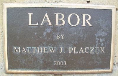
On Riverfront Drive, on the right when traveling north.
This monument, titled Labor, is a salute to the dedication and hard work of all those who built the grand city of Omaha. It is a tribute to the men and women who worked for and continue to forge a better life for themselves, their families . . . — — Map (db m83300) HM
On Farnam Street west of 17th Street, on the left when traveling west.
Lynching in America
After the Civil War, an ideology of white supremacy persisted as many Americans still believed in racial hierarchy. Violent resistance to Black equality ushered in an era of racial terrorism where more than 6,500 Black . . . — — Map (db m264855) HM
On Riverfront Drive, on the right when traveling north.
The 2011 Missouri River Flood was triggered by record snowfall in the Rocky Mountains of Montana and Wyoming and near record spring rainfall in the upper Missouri River Basin. High water levels threatened communities of all sizes along the river . . . — — Map (db m83302) HM
On Riverfront Drive, on the right when traveling north.
On this day, three men attempted to reach safety by crossing floodwaters on a skiff through a break in a temporary berm. The current, which was flowing at volumes never seen since, pushed them into the main channel. Thaddeus Wren was rescued but . . . — — Map (db m261616) HM
On Farnam Street at South 17th Street, on the left when traveling west on Farnam Street.
To commemorate the sturdy pioneers who in 1854 crossed the Missouri River to establish the Town of Omaha, more than 500 committee members and several thousand of the city's quarter-million citizens one hundred years later conducted a twelve-month . . . — — Map (db m88602) HM
On Riverfront Drive, on the right when traveling south.
As pioneers settled in small towns and villages across Nebraska, the shout of “Fire” summoned fear and panic in every person who heard it. If they were lucky, bucket brigades could save part of a burning building and its surrounding . . . — — Map (db m58037) HM
On Jackson Street at South 12th Street, on the right when traveling east on Jackson Street.
In 1854, Omaha's first building was erected at this 12th & Jackson corner.
Crafted of logs by the ferry company, it was the home of William P. Snowden which he operated
as Omaha's first hotel called the St. Nicholas. In the same building, a . . . — — Map (db m245129) HM
The joint efforts of many individuals and groups – among them military men and scientists, a president and an enslaved man, French-speaking boatmen and American Indians, women and men – determined the fate of the Corps of Discovery. Today, more . . . — — Map (db m57978) HM
The Midwest Regional Office, located in Omaha since 1937, assists NPS sites across the heartland of the United States. Inside this building, more than 200 people – from architects to wildland fire managers – work to sustain the . . . — — Map (db m57970) HM
On 10th Street near Cuming Street, on the right when traveling south.
You are standing at the site of the original Union Pacific Omaha Shops.
From this point a railroad was begun that would fulfill a national destiny.
Even before Union Pacific was an American icon, it was an American dream. It was a . . . — — Map (db m58038) HM
On 14th Street at Jackson Street, on the left when traveling south on 14th Street.
Increasing business led the Skinner Manufacturing Company to build this six-story brick building in 1914. Designed by architect Harry Lawrie, it was doubled in size with the addition of 66 feet to the east a year later. The new building was . . . — — Map (db m83293) HM
On Jackson Street at 12th Street, on the right when traveling east on Jackson Street.
On approximately this site was erected in 1854 the first home in Omaha
It was occupied by Mr. and Mrs. William P. Snowden
This marker placed by Seymour Camp 16, Woodmen of the World October 13, 1946 — — Map (db m264852) HM
On Jones Street west of 13th Street, on the right when traveling west.
has been placed on the
National Register of
Historic Places
by the
United States
Department of the Interior
Renovated 1992
Alley-Poyner Architect
Lund-Ross Constructors — — Map (db m83241) HM
On Cuming Street at 13th Street, on the right when traveling east on Cuming Street.
Presented by
College World Series of Omaha, Inc.
to the City of Omaha
June 7, 1999
In Celebration of 50 Years of NCAA
Division I Baseball Championship Games
in Omaha
John Lajba, Sculptor
Moved from its Original Location . . . — — Map (db m57999) HM
Near Douglas Street 0.1 miles east of South 8th Street, on the right when traveling east.
In 1898, following the financial panic of 1893 and the droughts of 1894-95, a world-class
exposition was held in Omaha under the guidance of Gurdon W. Wattles and other civic leaders.
The Trans-Mississippi and International Exposition emulated . . . — — Map (db m33044) HM
On Riverfront Drive, on the left when traveling south.
This Union Walk is a reminder to all of our citizens, as well as a salute to the unionized men and women from all walks of life, who invested their energy, the sweat of their brow, and sometimes even their lives to forge a better life for . . . — — Map (db m63498) HM
On Farnam Street at 11th Street, on the right when traveling west on Farnam Street.
These two arches are from the former United States
National Bank Building that once stood at the corner of 12th and Farnam Streets. The bank, constructed in 1887, was a fine example of late Richardsonian Romanesque architecture and the stone in . . . — — Map (db m229019) HM
On Douglas Street near 14th Street, on the right when traveling east. Reported missing.
From 1867 to 1869 the first photography studio of William Henry Jackson, renowned photographer, artist, and explorer of the Old West, stood on the northwest corner of this block. His autobiography, Time Exposure, reports that in 1869 Omaha . . . — — Map (db m35193) HM
On Dodge Street (U.S. 6) at 19th Street, on the left when traveling west on Dodge Street.
This plaque commemorates
the First Holy Sacrifice
of the Mass celebrated in
Omaha Nebraska - May 14, 1855
by
Father William Emonds
Erected May 1959 — — Map (db m35184) HM
On Capitol Avenue near 18th Street, on the right when traveling west.
In loving memory of The Right Reverend
Robert Harper Clarkson
(1826 - 1884)
Bishop of Nebraska and Dakota Territories
First Episcopal Bishop of the State of Nebraska
Founder of Trinity Cathedral
Founder and Sponsor of Nebraska's . . . — — Map (db m35188) HM
On Underwood Avenue west of 50th Street, on the right when traveling east.
In the sky over 50th and Underwood, a Japanese balloon bomb exploded on April 18, 1945. The incendiary device flared brightly in the night, but caused no damage.
The Japanese military hoped the device would create an incident, which if . . . — — Map (db m265977) HM
On Florence Boulevard at Pinkney Street, on the right when traveling north on Florence Boulevard.
William F. “Buffalo Bill” Cody held the first official performance of his Wild West show just half a mile northeast of here on May 19, 1883. Eight thousand people attended the premiere at the Omaha Driving Park near Eighteenth and . . . — — Map (db m33040) HM
On Florence Boulevard at Pinkney Street, on the left when traveling north on Florence Boulevard.
At this site in 1898, Omaha hosted the Trans-Mississippi and International Exposition. Following the model of other “world's fairs,” the exposition highlighted the “Progress of the West,” drawing over 2.5 million admissions. . . . — — Map (db m33018) HM
On 24th Street north of Blondo Street, on the right when traveling north.
On June 24, 1969, 14-year-old Vivian Strong was shot and killed by James Loder, a white police officer, while leaving a party in the Logan Fontenelle public housing complex. Vivian was one of many teenagers at a dance party in a vacant housing unit . . . — — Map (db m265408) HM
On Old Lincoln Highway, on the left when traveling west.
This three-mile brick segment of roadway was once the route of the Lincoln Highway. The Lincoln Highway Association was founded by private interests in 1913 to develop a paved, toll-free, transcontinental highway from New York City to San . . . — — Map (db m274411) HM
On 32nd Avenue near Hickory Street, on the left when traveling south.
Land for Hanscom Park was donated in 1872 by Andrew J. Hanscom and James Megeath. Improvements including flower beds, lakes, cascades and fountains greatly changed the site’s rugged character. In time, the park was referred to as “one of . . . — — Map (db m57998) HM
On 30th Street, on the right when traveling north.
Florence was born after the 1854 Kansas-Nebraska Act opened lands west of the Missouri River to speculators and settlers. Built on the grounds of Winter Quarters, founder James C. Mitchell named the new town after his granddaughter, Florence . . . — — Map (db m90576) HM
On North 30th Street, on the right when traveling south.
Forced to leave their homes along the Mississippi, the Mormons began arriving in the Missouri River Valley in June of 1846. By September, nearly 4,000 refugees had begun to settle in for the winter - laying out blocks and streets, building cabins . . . — — Map (db m90578) HM
On Dick Collins Road at Bridge Street, on the right when traveling west on Dick Collins Road.
Here on the banks of the Missouri River was an important outfitting site for early members of The Church of Jesus Christ of Latter-day Saints. In 1847 at an area just north of this location was the Nebraska dugway of the Upper Mormon Ferry. There . . . — — Map (db m261494) HM
On 30th Street, on the right when traveling north.
Florence was a small town with a big history. The Oto, Missouri, and Omaha Indians lived and hunted here. Frenchmen, Canadians and Spaniards traded along the Missouri River. Lewis and Clark's Corps of Discovery made their first contact with Indians . . . — — Map (db m90529) HM
On 30th Street at Willit Street, on the left when traveling north on 30th Street. Reported missing.
This Bridge is on the Mormon Pioneer Trail from Nauvoo, Illinois, to the Rocky Mountains. Driven from their homes by mobs, many of the dispossessed Mormon people crossed the Mississippi River on the ice in February, 1846. From these refugees five . . . — — Map (db m90469) HM
On John J. Pershing Drive at Dick Collins Road, on the left when traveling north on John J. Pershing Drive.
This bridge is on the Mormon Pioneer Trail from Nauvoo, Illinois, to the Rocky Mountains. Driven from their homes by mobs, many of the dispossessed Mormon people crossed the Mississippi River on the ice in February, 1846. From these refugees . . . — — Map (db m261266) HM
On 30th Street at Willit Street, on the left when traveling north on 30th Street.
The Bank of Florence was chartered by the Nebraska Territorial legislature on January 18, 1856. It was located in this substantial building, constructed during the same year. Sheet steel one quarter inch thick, shipped by river steamboat from . . . — — Map (db m90468) HM
On McKinley Street at 30th Street, on the left when traveling east on McKinley Street. Reported missing.
On this lot stands the old mill build during the westward migration of the Mormons. Purchased by Jacob Weber in 1860. Now owned by his descendants. — — Map (db m90461) HM
On McKinley Street at 30th Street, on the left when traveling east on McKinley Street.
The Florence Mill, one of the earliest in Nebraska, was constructed by the Mormons at Winter Quarters during the winter of 1846-1847. Supplying both flour and lumber, the water-powered mill enabled the Mormons to cope more readily with the adverse . . . — — Map (db m90460) HM
On North 30th Street, on the right when traveling south.
The Mormon Pioneer Trail
Fleeing heated religious and political hostility and persecution, many members of The Church of Jesus Christ of Latter-day Saints (widely known as Mormons) abruptly fled their homes in Nauvoo, Illinois in February . . . — — Map (db m90577) HM
On McKinley Street at 30th Street, on the left when traveling east on McKinley Street.
From the late 1840s through the 1860s, an exodus of more than 70,000 Mormons passed by here on their way to their "New Zion" in Utah. Starting from Nauvoo, Illinois in February 1846, the first group of at least 13,000 Mormons crossed into Iowa to . . . — — Map (db m90464) HM
On 30th Street at Mormon Street, on the left when traveling north on 30th Street.
Here in 1846 an oppressed people fleeing from a vengeful mob found a haven in the wilderness. Winter Quarters, established under the direction of the Mormon leader Brigham Young, sheltered more than 3,000 people during the winter of 1846-1847. . . . — — Map (db m90527) HM
On Wooworth Avenue at 32nd Street, on the right when traveling west on Wooworth Avenue.
38th President
of the United States
“My fellow Americans, our long national nightmare is over. Our Constitution works. Our Great Republic is a government of laws and not of men.
Here, the People rule…”
President Ford’s Inaugural Address . . . — — Map (db m58089) HM
Hanscom Park, Omaha’s oldest remaining park, was designed by landscape architect H.W.S. Cleveland in 1889. Early improvements were described in the 1898 Park Commissioner’s Report: “Two lakes, a cascade, extensive flower beds, two and . . . — — Map (db m57979) HM
On Woolworth Avenue near 32nd Street, on the left when traveling east.
Nebraska, originally part of the Louisiana Purchase in 1803, became a territory of the United States Government in 1854 when Congress passed the Kansas-Nebraska Act. The Nebraska Territory included parts of Montana, North Dakota, South Dakota, . . . — — Map (db m58063) HM
On Woolworth Avenue near 32nd Street, on the left when traveling east.
The settlement of Omaha began in 1854 with the opening of the Nebraska Territory. The following year Omaha was selected as the Nebraska Territorial capital. Omaha was incorporated as a city in 1857. The capital was moved from Omaha to Lincoln in . . . — — Map (db m58060) HM
On Burt Street west of 36th Street, on the right when traveling east.
In October, 1881, Mother Margaret Dunne and three religious of the Sacred Heart opened a boarding school for girls at a temporary location on Ninth and Howard in Omaha. On September 1, 1882, Bishop James O'Connor sold Park Place, a 12-acre site . . . — — Map (db m265446) HM
On Florence Boulevard north of Cass Street, on the right when traveling south.
Archaeological evidence shows periodic Native American residence in this general area for some 12,000 years. From the mid-1600s to the early 1700s the Omaha, Ponca, Oto, and Ioway migrated from the Upper Midwest and Great Lakes to today's western . . . — — Map (db m265304) HM
On 24th Street, on the right when traveling south.
This University is named for Edward and John A. Creighton--Ohio farm boys who gained immortality in the West. They helped to link our coasts by telegraph during the Civil War. They pioneered as cattlemen on the Laramie Plains, as merchants in the . . . — — Map (db m265307) HM
On 40th Street at Davenport Street, on the right when traveling north on 40th Street.
The Joslyns purchased the Sutphen farm in 1893 and began landscaping the five-acre site. Omaha architect John McDonald designed the mansion to resemble a Scottish manor. Named Lynhurst and known locally as "Joslyn Castle," the thirty-four-room house . . . — — Map (db m266224) HM
On 42nd Street south of Dewey Avenue, on the left when traveling north.
In 1902 the Omaha Medical College, a private medical school, affiliated with the University of Nebraska to form the University of Nebraska College of Medicine. At first, classes were split between Lincoln and Omaha. After much debate, in 1909 the . . . — — Map (db m264446) HM
On Lincoln Boulevard west of 30th Street, on the right when traveling west.
This boulder erected 1912 by
Omaha Chapter Daughters of the
American Revolution to mark
the California Trail 1849
later called the Military Road — — Map (db m265479) HM
Alfred Sorenson, the doyen of Omaha newspapermen, was a picturesque figure familiar around Omaha. His varied career led him to seek the offices of U.S. Senator twice and Congressman once. He was unsuccessful all three times, but remarked that he . . . — — Map (db m58237) HM
Andrew was born on July 25, 1830, in Oakland County, Michigan, one of seven children, and was reared on a farm. His father, William, had served in the Continental Army during the American Revolution. Andrew attended the University of Michigan, and . . . — — Map (db m58201) HM
On Metro Tech College Road (West Road) at Metro Tech College Road (North Road), on the left when traveling north on Metro Tech College Road (West Road).
On April 27, 1875, General George A. Crook assumed command of the Department of the Platte, which then included Iowa, Nebraska, Wyoming, Utah, and part of Montana and Idaho. When the headquarters was shifted from downtown Omaha to Fort Omaha (Omaha . . . — — Map (db m223451) HM
On Fort Avenue at North 30th Street (U.S. 75), on the right when traveling west on Fort Avenue.
A military post was first established here in 1868 and named Sherman Barracks after the famous Civil War general, William Tecumseh Sherman. The post's name was soon changed to Omaha Barracks and, in 1878, to Fort Omaha. In 1879, General George . . . — — Map (db m33057) HM
Until after World War I, no other method equaled a soldier’s ability to send intelligence information directly to the ground by telephone from an observation balloon.
Fort Omaha entered America’s balloon and aviation history in April 1909 when . . . — — Map (db m58151) HM
On East Road at South Road, on the right when traveling north on East Road.
Originally a filtration plant constructed in 1912, this building was remodeled and enlarged to become the Post Exchange Building in 1923. All incoming or outgoing calls, whether emergency or routine, would pass through the Post switchboard housed . . . — — Map (db m58118) HM
To maintain discipline among a large garrison, Fort Omaha commanders strictly followed the military code of the frontier era. Facing occasional problems with drunkenness, insubordination, fighting and desertion, officers were quick to punish . . . — — Map (db m58122) HM
Constructed in 1906, this double barracks building housed noncommissioned officers of the U.S. Army Signal Corps, which had reactivated Fort Omaha in 1905. During World War I, this building served as South Post Headquarters for the Army’s first . . . — — Map (db m58106) HM
Maintaining the health and well-being of soldiers at Fort Omaha was accomplished only after overcoming serious obstacles.
One such obstacle was the shortage of potable water. By 1869 only two of the Fort’s wells were considered safe for . . . — — Map (db m58090) HM
During World War I, citizen participation in relief and aid societies was exceptional across America. Omaha’s Red Cross chapter led all cities in the country in per capita membership.
In addition to the Red Cross providing a canteen at Fort . . . — — Map (db m58149) HM
On West Road at Middle Road, on the left when traveling north on West Road.
Built in 1906, Fort Omaha’s “Officers Row” typifies the architecture appropriate for officers’ residences on an army post in the early 20th century. Large and impressively formal, the houses lack elaborate exterior decoration . . . — — Map (db m58156) HM
In 1880, nearly a dozen years after Fort Omaha was established, indoor hot and cold water bathing facilities were installed – three shower rooms for enlisted men and one for officers. By the end of the 19th century a new attitude towards the . . . — — Map (db m58120) HM
Even after the 1869 completion of the transcontinental railroad, the Army relied on mules and wagons to outfit its isolated posts. The Department of the Platte, headquartered at Fort Omaha, paid over $700,000 to acquire and transport troops and . . . — — Map (db m58107) HM
Upon the recommendation of Lt. General William T. Sherman, in 1866 the Adjutant General’s office created the Department of the Platte which included present-day Iowa, Nebraska, Wyoming, Utah, Montana and a portion of southeastern Idaho. As . . . — — Map (db m58154) HM
Founded in 1858 by Byron Reed, early Omaha real estate developer and financier, Prospect Hill is the final resting place for over 15,000 citizens. While burial permit #1 was issued for Territorial Legislator Alonzo Salisbury on October 4, 1858, . . . — — Map (db m53108) HM
On Middle Street, on the left when traveling west.
As a result of a major confrontation from 1866-1868 between the U.S. Army and the Lakota (Sioux), the U.S. government signed a treaty agreeing that the Army would abandon several posts along the Bozeman Trail. By this time, the Union Pacific had . . . — — Map (db m58157) HM
Born in Virginia in 1824, James Megeath was the eldest of 10 children. By age 20, he had become a cattle and sheep trader. Struck by gold fever, he went to Calaveras County, California, in 1851, operating a general merchantise store for three . . . — — Map (db m58234) HM
Born in 1829 in Onondaga County, New York, Mr. Woolworth graduated with high honors from Hamilton College in 1849, and took up the study of law. After two years practicing in Syracuse, New York, he determined to go west and locate in the new . . . — — Map (db m58345) HM
Johan Ahmanson was born on April 7, 1827, in Smaland, Sweden. At age six he was taken to live with a farmer, for whom he worked until age eighteen. He became a master bookbinder and emigrated to Denmark in 1849. There he was recruited by the . . . — — Map (db m58207) HM
John Wesley Nichols was born January 28, 1839, in Crawford County, Pennsylvania, to Samuel and Katharine Maxwell Nichols. Little is known of his early years. In 1860 he married Sarah Elizabeth Dearborn, also born in Crawford County.
Nichols . . . — — Map (db m58277) HM
Born in Germany, Joseph Francis Bauman came to Omaha in the early 1860s. Like many others, he may have been escaping the wars that plagued Central Europe at that time. In 1863, with his partner John Green, he purchased a brewery from a Mr. McCombe . . . — — Map (db m58338) HM
Near Evans Street 0.1 miles west of North 33rd Street, on the left when traveling west.
El-Hajj Malik El-Shabazz was born Malcolm Little at University Hospital in Omaha, Nebraska, May 19, 1925. He was the son of Earl and Louise Little, 3448 Pinkney Street. Reverend Little helped organize the Universal Negro Improvement Association. . . . — — Map (db m33050) HM
On 45th Street 0.1 miles north of Binney Street, on the right when traveling north.
The Nebraska School for the Deaf was established by the legislature in 1867. It opened April 1, 1869, on Twenty-Second Street between St. Mary and Leavenworth, overseen by Principal William DeCoursey French, a deaf man, and Rev. Henry W. Kuhns. . . . — — Map (db m265477) HM
After nine years of inactivity, Fort Omaha reopened in 1905 as a school for noncommissioned Signal Corps officers. A structure to house the army’s only dirigible (balloon airship) was completed in 1908, and the first dirigible flew in April 1909. . . . — — Map (db m58150) HM
On the Alley between 2nd and 1st Roads, on the left when traveling north.
This small, tin-roofed building hardly suggests its central role in the mission of the officers and troops once stationed at Fort Omaha. Constructed in 1883-84, the ordnance magazine was the chief storage place for weapons and ammunition.
It was . . . — — Map (db m58117) HM
In August 1905, the Fort Omaha post was reestablished with a new mission. The War Department designated Fort Omaha as a place of instruction for the technical duties in connection with the Signal Corps of the Army. With this change, the War . . . — — Map (db m58158) HM
Throughout the frontier era, the Quartermaster’s Department oversaw post construction, supply procurement and transportation. It worked closely with the Subsistence Department which purchased and assigned rations. To both agencies, Fort Omaha . . . — — Map (db m58131) HM
This beautiful monument to the soldiers of the Spanish-American War was erected in 1900 by the Lee Forby Encampment #1 of the Spanish-American War Veterans.
Captain Lee Forby, born January 3, 1871, was wounded at the Battle of San Francisco del . . . — — Map (db m58332) HM WM
William Brown is credited as Omaha's founder (although not its first settler). He operated a Missouri River ferry from Council Bluffs and was a principal in the company that first developed the Omaha townsite.
Mr. Brown came west as a young man . . . — — Map (db m58275) HM
On 26th Avenue north of Farnam Street, on the right when traveling south.
In 1858 the Allegheny Synod of Pennsylvania sent Rev. Henry Kuhns as the first Lutheran missionary to Nebraska Territory. On December 5, Kuhns and fourteen charter members organized Emanuel's Evangelical Lutheran Church in Omaha. In 1862 the . . . — — Map (db m265402) HM
On Dodge Street (U.S. 6) 0.1 miles west of North 20th Street, on the right when traveling west.
This site on Capitol Hill was for a decade the location of Nebraska's second territorial capitol. The building was erected here in 1857 and 1858 and served until the seat of government was removed to Lincoln in 1868.
Acting-Governor Cuming . . . — — Map (db m178538) HM
On Dodge Street (U.S. 6) 0.1 miles west of North 20th Street. Reported missing.
The first session of Omaha High School, now Central High School, was held on November 10, 1859, in Nebraska's territorial capitol on Ninth Street between Douglas and Farnam. Following the removal of the territorial government from Omaha, Nebraska's . . . — — Map (db m33252) HM
On Harney Street east of South 24th Street, on the right when traveling west.
Jews have been part of Nebraska’s social, economic and political life since the mid 1800’s.
It was not until 1871 that the small Jewish community in Omaha grew large enough to organize and formally found Congregation of Israel.
On Sept. . . . — — Map (db m40743) HM
Near Bancroft Street 0.2 miles east of Bancroft Plaza.
When President Thomas Jefferson needed a leader for a scientific expedition to western North America, he wanted someone with knowledge of plants. Meriwether Lewis was Jefferson's choice.
Lewis had been raised in a world of plants. In Virginia . . . — — Map (db m264721) HM
Near Bancroft Street 0.2 miles east of Bancroft Plaza.
The search for a transcontinental railroad route began in 1853, but regional partisanship between North and South prevented Congress from acting. In 1862, after secession of the southern states, President Abraham Lincoln signed the Pacific Railroad . . . — — Map (db m264782) HM
Near Bancroft Street 0.2 miles east of Bancroft Plaza.
At the top of this hill stand two of the largest locomotives ever built. The "Big Boy" steam locomotive and "Centennial" diesel locomotive were brought here to honor one of Union Pacific's greatest leaders, John Cooper Kenefick, who served as the . . . — — Map (db m264780) HM
Near Bancroft Street 0.2 miles east of Bancroft Plaza.
First marker:
Cheap Farms! Free Homes!! On the line of the Union Pacific Railroad.
The Great Trans-Continental Route from Omaha to the Pacific Ocean.
A Land Grant Direct from the Government of 12,000,000 . . . — — Map (db m264802) HM
Near Bancroft Street 0.2 miles east of Bancroft Plaza.
At the top of this hill stand two of the largest locomotives ever built. The "Big Boy" steam locomotive and "Centennial" diesel locomotive were brought here to honor one of Union Pacific's greatest leaders, John C. Kenefick. Kenefick served as the . . . — — Map (db m264779) HM
Near Bancroft Street 0.2 miles east of Bancroft Plaza.
Locomotive 4023, built in November of 1944, was one of 25 famous "Big Boy" type articulated locomotives. They were designed in Omaha by Union Pacific's mechanical officer Otto Jabelmann and his engineering team to support the nation's entry into . . . — — Map (db m264787) HM
Near Bancroft Street 0.2 miles east of Bancroft Plaza.
Locomotive 6900 was one of 47 "DDA-40X" locomotives built by the Electro-Motive Division of General Motors exclusively for Union Pacific and according to Union Pacific specifications. These "Centennial" locomotives were built in 1969 when Union . . . — — Map (db m264785) HM
Near Bancroft Street 0.2 miles east of Bancroft Plaza.
National Historic Civil Engineering Landmark
American Society of Civil Engineers 1852
Union Pacific Railroad
The First Transcontinental Railroad
Completed May 10, 1869
ASCE July 13, 2019 — — Map (db m264801) HM
On 67th Street 0.1 miles north of Pine Street, on the right when traveling south.
Ak-Sar-Ben Field, whose hangars were located on the southeastern corner of these grounds, was used extensively during the early development of U.S. Postal Air Mail Service. Ray Benedict landed here with the first air mail from Chicago on May 15, . . . — — Map (db m265442) HM
Bohemian patriot and journalist who sincerely labored for the elevation and liberty of his countrymen.
To live in hearts we leave behind, is not to die. — — Map (db m83239) HM
On Center Street at 67th Street, on the right on Center Street.
Buried here at Ak-Sar-Ben is Omaha, one of the immortals of the American turf. His sire Gallant Fox was the 1930 winner of the Triple Crown, and Omaha succeeded him to this title in 1935. To win the Triple Crown a three-year-old must win the . . . — — Map (db m66486) HM
Early in the 20th century, the meat packing industry was born. The work force was made up mostly of immigrants from many foreign lands. Unschooled and with limited use of English, they were accustomed to hard work, long days, and low pay. They . . . — — Map (db m265936) HM
1467 entries matched your criteria. Entries 401 through 500 are listed above. ⊲ Previous 100 — Next 100 ⊳