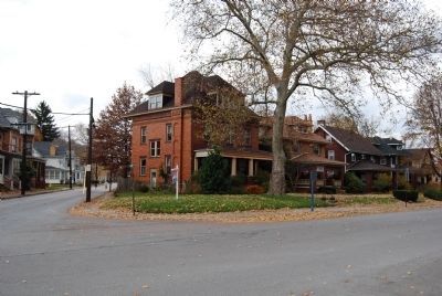
Beaver County Agriculture Society formed January 26, 1853. Site of annual fairs until 1899. Located between Leopard Lane, Otter Lane, Sharon Road and Fair Avenues. First board of managers: John Carothers, Thomas Thorniley, Thomas McKinley, Daniel . . . — — Map (db m49426) HM
The congregation was served by supply ministers from 1784 until the coming of George M. Scott on Sept 14, 1799 he served Mill Creek Church for 40 years and rests in this burial ground — — Map (db m122306) HM
Beaver County has a storied past beginning with the Native Americans who first roamed
the land through its heyday as an industrial powerhouse and beyond. Historically our
people and industries have helped build America and win her wars. Past and . . . — — Map (db m231799) HM
March 5, 1793 The first Free Masons Lodge existed in the county when the Grand Lodge
of Pennsylvania granted Warrant #58 to a number of officers and men camping at Legion Ville.
April 21, 1794 - Service Theological Seminary (Eudolpha Hall) . . . — — Map (db m177045) HM
1772 - Mary Dungan became one of the first medical practitioners in the county when she arrived here with her husband Levi and family. Although she was not formally trained, Mary had studied medicine with Dr. Benjamin Rush and brought her . . . — — Map (db m177036) HM
Prior to 1800 Beaver County did not exist as we know it today and was, at various times, part of several other much older counties.
On March 12, 1800, Beaver County was officially formed from parts of Allegheny and Washington Counties. The Borough . . . — — Map (db m176917) HM
Erected by the Beaver Valley Knights of Columbus in commemoration of the first public religious ceremony in Beaver County.
This holy and historic event was performed by Reverend Joseph Peter Bonnecamps S.J. on the morning of August 9, 1749 in the . . . — — Map (db m245955) HM
Dedicated to the Two Hundredth Anniversary of the United States of America and sponsored by the Utah American Revolution Bicentennial Commission and Beaver Daughters of Utah Pioneers
Determined to preserve this historic courthouse, the Beaver . . . — — Map (db m274182) HM
In Honor Of
All Veterans Who Served
In The Korean War Era
In Memory Of Those Veterans
From Beaver County
Who Made The Supreme Sacrifice
1950 - 1953
David Albanese •
Melvin F. Anderson •
Joseph M. Barna •
Homer Bruington • . . . — — Map (db m204292) WM
In sacred memory of
those who served in
Vietnam
and those who remain
missing in action.
From the people of
Beaver County, Pennsylvania.
In memory of the men and women
who served in the Vietnam War
and later died as a result . . . — — Map (db m204294) WM
November 1778 - Fort McIntosh was erected at the present site of Beaver becoming the first
United States military post on the "Indian side” (northern side) of the Ohio River.
September - 30, 1785 -Thomas Hutchins began the first survey of U.S. . . . — — Map (db m177049) HM
In Memoriam Of
Beaver Area Veterans
Who Lost Their Lives In
World War II
Stephen J. Anzio •
Henry Baker •
John Baker •
Milton A. Bennett •
Wilbert E, Black •
Alfred W. Boggs •
Donald C. Boyde •
Joseph J. Brozich •
William . . . — — Map (db m204296) WM
The first colonial residents of Beaver County lived nearby. Alexander McKee operated a trading post 1769 or earlier. Colonel John Gibson farmed land near his trading post in 1771 then went on to a great military and legal career. McKee became a . . . — — Map (db m47789) HM
The great Ohio River - and the Beaver River that flows into it - played important roles in attracting settlers to the Rochester area. Two hundred years ago, the rivers here served as main transportation routes, sources for industrial water power and . . . — — Map (db m55923) HM
Before bridges, ferry boats did a brisk business transporting passengers and their goods from shore to shore. But sometimes even ferries couldn't get through the area's frozen rivers in winter time.
It was in 1815 that the first bridge . . . — — Map (db m55159) HM
In the 1880s, the heart of Rochester lay on the flat stretch of land along the Ohio River. The main road, Water Street, was a perfect location for businesses for many reasons. Proximity to the rivers and railroads meant heavy supplies could . . . — — Map (db m55906) HM
By 1851 the railroad had arrived at Rochester. Rail transit had been developed in the year before and had finally spread through Pittsburgh and surrounding western Pennsylvania towns.
Railroads were built on flat surfaces - one commonly flat . . . — — Map (db m55185) HM
Near here at the Indian Village of Logstown, Reverand Father Joseph De Bonnecamps, S.J. celebrated the first Holy Catholic mass in Beaver County August 9, 1749. The mass marked the beginning of Christianity in Beaver County. — — Map (db m49429) HM
This cemetery was established by George Baker on his land for his family and heirs. His was one of the first permanent families to settle in Beaver County. Cemetery is presently maintained by the trustees of The Blockhouse Baker Association. — — Map (db m47788) HM
The church was founded in 1830 by former slaves and was first black organization in Beaver County Built on Mulberry Street in 1880. Destroyed by fire in 1900 and rebuilt in 1902. It was damaged severely by the 1936 flood. The present church was . . . — — Map (db m45794) HM
In 1780 John White ran a grist mill on Raccoon Creek. Water power ran the mill until a 1912 flood destroyed the dam then steam power until 1920. White's Mill decided the boundary of Beaver County in 1800 to become the village of Murdocksville. — — Map (db m51604) HM
Victims of the last Indian murder in Beaver County are buried here. Samuel Swearingen settled here in 1785 and in 1790 near this site his only daughter Mary, wife of Jacob Colvin, and her infant child were scalped and killed. They are buried here . . . — — Map (db m51603) HM
Constructed in 1832 by separatists from the Harmony Society, under the leadership of Count Maximilian DeLeon, organized as New Philadephia Society. 1840-First School Built. 1850-First Pipe Organ in Beaver County. — — Map (db m45780) HM
First Catholic cemetery in Beaver County. Land given by Edward Daugherty for Catholic burials upon the death of his brother 1801. Transferred to sponsor parish Saint Peter and Paul, Beaver 1832. Burial ground for parish priests, Father James Reid . . . — — Map (db m50285) HM
In 1803, Meriwether Lewis led the corps of discovery, 11 men on a keelboat, though Beaver County. They stayed overnight about 3 miles west of Beaver and stopped in Georgetown. This visit was commemorated by a reenactment in Rochester and Georgetown . . . — — Map (db m44791) HM
Free and Accepted Masons of Pennsylvania, is the oldest Masonic Lodge in Beaver County. Meeting continuously since it was constituted April 11, 1848, a year before Rochester Borough was incorporated the Masonic Temple was built in 1884. — — Map (db m45785) HM
The Camp House erected in 1870 by Michael Camp, Jr. Believed to be the oldest continuing family in Rochester. Leaders in civic, religious and fraternal affairs. This was home to three county commissioners and four masters of the Rochester Masonic . . . — — Map (db m50183) HM
Founded 1848 by Dr. Edward Acker. Used hydrotherapy or water to heal. First hospital in Beaver County. Town's first Post Office, 1856.
Phillipsburg soldiers orphans school founded 1866 by Rev. William Taylor. Destroyed by fire 1876. — — Map (db m50181) HM
Home of Joseph H. Bausman D.D. 1854-1924 author of best known and most used history of Beaver County 2-volume Published 1904
Pastor of United Presbyterian and congregational churches Rochester 1882-1907
Professor English Literature Washington . . . — — Map (db m50284) HM
Aliquippa Works of Jones and Laughlin Steel Corporation production commenced in 1909 at this plant once the largest integrated steel plant. Over 14000 persons were employed here. Collective bargaining under the Wagner Act began here in 1937 as a . . . — — Map (db m48137) HM
Formerly White Oak Flats. Services were held in a tent on this site as early as 1793. The present structure built in 1976 is the fourth known building used by the congregation. — — Map (db m45777) HM
Founded in 1799 as the Flaugherty Run Congregation, the group met in tents or barns at various sites, in 1828 the tent was moved to the village of Scottsville. Erected in 1831 the first church was named for the Ohio River. The present church was . . . — — Map (db m45776) HM
Founded in 1910 by Rev. Onley and five members, was the first church with African American membership in the Aliquippa area. The present site was built in two phases. In 1922 Rev. Jones built the cellar. In 1945 Rev. Roberts built the church . . . — — Map (db m78298) HM
This was site of American Bridge Company. Largest steel fabricating plant in the world. Division of United States Steel Corporation erected 1903. During World War II the Marine Department built LST landing crafts here. Closed April 1983. — — Map (db m44495) HM
Site of Anthony Wayne's training camp, for the "Legion of the United States" November 1792 to April 1793-his legion trained here to prepare for the Battle of Fallen Timbers on August 20, 1794. Wayne chose this site adjacent to abandoned Logstown, . . . — — Map (db m40230) HM
Gen. Anthony Wayne's army camped here Nov. 1792 to April 1793, preparing for the campaign which led to the Battle of Fallen Timbers with the Northwest Indians. — — Map (db m56581) HM
Located near here was the large Indian village of Logstown 1727-1758 important conferences were held and disputes settled between British, French and Indians in the struggle for the Upper Ohio Valley Territory — — Map (db m44494) HM
On January 1, 1838, Reverend F. Winter organized the German Evangelical Reformed and Lutheran congregation, later named Saint Matthew's Lutheran Church. Original log church 1840-1855. Present church dedicated 1855. — — Map (db m49431) HM
Fort McIntosh, 1778-1788, built by General Lachlan McIntosh's continentals of the 8th Pennsylvania and 13th Virginia, veterans of Saratoga, Brandywine, Germantown, and Valley Forge, and Virginia Militia, was the first fort built north of the Ohio by . . . — — Map (db m44747) HM
This house, built by Samuel French, about 1845, was the home (1884-1904) of Matthew Stanley Quay. Born in 1833, Quay graduated at age 17 from Jefferson College. His first political office was as prothonotary. After a brilliant Civil War record and . . . — — Map (db m49428) HM
In continuous service as a schoolhouse from 1844-1950. During its 106 years it exemplified the basic element of the American public school system of the 19th century, a one room school in which one teacher taught eight different grades. — — Map (db m50886) HM
The great trail between Fort Pitt and Detroit was traveled for years by Indians. It was used by the expeditions of Bouquet's Royal Americans. Blackwatch. Virginia and Pennsylvania Militia in 1764 and McIntosh's Continentals and Virginia Militia in . . . — — Map (db m50185) HM
Built here in Old Sharon were covered keel boats for a proposed expedition by Aaron Burr to annex the American southwest from Spanish America. Suspicions were aroused against him and he was tried for treason but was acquitted. — — Map (db m45796) HM
Built on land of the Conway family farm. This yard was put in operation April 1887 under the ownership of the Pennsylvania Railroad Company. The yards are over four miles in length with 100 tracks. Holding 5000 cars by 1957 it was largest automated . . . — — Map (db m44491) HM
Built in 1840 by Reverend Arthur B. Bradford, descendant of William Bradford of the Mayflower. Powerful abolitionist, consul to China, prolific author, minister, and a founder of the Free Presbyterian Church. Many famous abolitionists met here in . . . — — Map (db m49420) HM
First site of the church where Reverend Thomas E. Hughes was ordained August 28, 1799 First Communion service north of the Ohio River September 1, 1799 The Erie Presbytery organized at this location April 13, 1802. — — Map (db m40281) HM
Founded 1816 by Robert Townsend in Pittsburgh. Moved to Fallston in 1828 to make rivets and wire. The company added other product lines and became a leader in the fastener industry with twelve plants in the United States and Canada. Products were . . . — — Map (db m45793) HM
One of the first charcoal blast furnaces in western Pennsylvania. It was built by Baron Dettmar Basse in 1814 and out of production in 1824 - it supplied iron for pioneer industries and was one unit of a self-contained community. — — Map (db m49416) HM
Built 1829 by Alexander Fombell on land purchased from Stephen Stone. Later passed into Phillis family. First Fombell Post Office located in house. Later moved to adjacent store, built in 1894. The kilns remain where handmade bricks were fired to . . . — — Map (db m51137) HM
Built 1805 by early settler Stephen Stone III, a retired schooner captain who traded in New England and the West Indies. A nearby village, Stonesville was laid out in 1810. The house was in the Stone family until 1880. — — Map (db m51136) HM
Moving from Phillipsburg, Stephen Phillips and Jonathan Betz built a three acre yard for building of steamboats and barges in 1832, on land bought from Abner Lacock. The firm changed ownership many times in the next forty years. 138 boats and . . . — — Map (db m47392) HM
Was dedicated July 20, 1870. Worship continued regularly until 1973 the church was razed for the new highway. Trinity merged with Saint Peter's of New Sewickley to form Prince of Peace Lutheran Church. — — Map (db m47394) HM
This three story mansion was built by Captain William B. Vicary. He was a Philadelphia Sea Captain who captured four British ships in the War of 1812. As a reward for war service the United States Government gave Vicary a land grant of 1,000 acres . . . — — Map (db m47395) HM
1890-1902 this area was part of an oil boom town with wells yielding up to 45,000 barrels daily. A spurline from a railroad running through Crows Run served the oil field. — — Map (db m49430) HM
Most residents of the village of Georgetown worked on riverboats. In 1803 Meriwether Lewis and the Corps of Discovery stopped here to buy a canoe to replace a leaky boat. Lewis later discovered the canoe also leaked. The visit was celebrated in . . . — — Map (db m50881) HM
First services held on a flat boat on the Ohio River around 1800. Saint Luke's, admitted into union with the Diocese of Pennsylvania in 1814, was visited by the first presiding bishop in 1825. Present structure built 1833. — — Map (db m50879) HM
Survey was completed August 23, 1785. Surveyors for Pennsylvania were David Rittenhouse and Colonel Andrew Porter. For Virginia Andrew Ellicott and Joseph Neville. On September 30, 1785 the Northwest Territory Survey began on the north shore. — — Map (db m50880) HM
Build 1851 on 1796 land grant called Chestnut Flats. Fourth house on this site. Tannery was operated here 1819-1860. Littells were among first settlers in area. Significant example of 19th century architecture. Named to National Historic Register . . . — — Map (db m49698) HM
Artifacts covering a span of 8000 to 9000 years were found here by members of the Amockwi Chapter 17 Society for Pennsylvania Archaeology in the 1960s and 1970s. This stratified site is located on a flood plain with periodic floods sealing habitats . . . — — Map (db m51601) HM
In 1865 Neel School District was formed. Many years later in 1908 7th St in 1914 1st St and 1917 4th St schools were built. In 1926 Lincoln High School opened. In 2000 PA Cyber Charter School and 2006 Lincoln Park Performing Arts were created. — — Map (db m44178) HM
Beaver Countys first highway constructed 1778 by General Lachlan McIntosh as a supply route from Fort Pitt to Fort McIntosh Colonel Daniel Broadhead succeeded to the command of the fort in 1779 and his name was associated with the road. — — Map (db m50887) HM
Founded 1832 by dissadent members of the Harmony Society of Economy. The house on this corner was the home of the society leader Count Maxmillian DeLeon and is believed to be the oldest house in Monaca. — — Map (db m45778) HM
Endowed by A Louis Thiel and founded in 1866 as Thiel Hall by Reverend William A. Passavant. Chartered in 1870 as Thiel College of the Evangelical Lutheran Church with Reverend Henry W. Roth as first president. Moved to Greenville, Pennsylvania in . . . — — Map (db m45783) HM
A 19th century industrialist, philanthropist, Civil War Veteran and founder of Merrick Art Gallery in New Brighton in 1880. Built in 1847 for his parents, Silas and Fanny Miner Merrick and family. — — Map (db m50282) HM
Oldest continuously used church in New Brighton. Outstanding example of English Small Gothic Architecture in America. The church has a collection of superb stained glass windows by Tiffany. — — Map (db m132) HM
Incorporated 1859 Daugherty / Pulaski Twps non-profit - non-denominational. Here rest the founding fathers, noted leaders, family loved ones, veterans serving from the Revolutionary to the present. A Civil War Soldiers Monument "Where Past and . . . — — Map (db m50288) HM
Founded and endowed by Edward Dempster Merrick Industrialist and Philanthropist
Established in 1880 as a teaching and exhibiting museum for increased understanding of fine art — — Map (db m45791) HM
In 1890 the Presbytery of Allegheny approved the petition of Messrs. Charles J. Bonzo and Leander McCauley to organize a church at this site. A building was erected at a cost of $1,270. Services were held regularly until terminated by Presbytery in . . . — — Map (db m50286) HM
Beaver Division built 1831-1834. Two locks at Rochester, five in New Brighton and two at Eastvale overcame the falls of the Beaver River. The canal was extended to Erie in 1834. Canal traffic ceased in 1871. Few remains are visible today. — — Map (db m45790) HM
Townsend was founder of an early iron business in county. Being of Quaker stock, he was an active abolishonist. His home built in 1835, was an important stop on the underground railroad before and during the war between the states. — — Map (db m50283) HM
Founded in 1837 as an outgrowth of St. John A.M.E. Bridgewater
First church of denomination between Pittsburgh and Cleveland
Original building built on 3rd Ave. Used until 1878. Chartered in 1880. Current church building erected in 1894. — — Map (db m98012) HM
Saint Peter's Lutheran Church was organized April 9, 1849. Services were held regularly until 1973, when the congregation merged with Trinity Lutheran Church of Freedom to become Prince of Peace Lutheran Church. — — Map (db m51796) HM
Circa 1830 significant example of Greek Revival architecture. Served as an Underground Railway station prior to the Civil War.
Listed on National Register of Historic Places by United States Department of Interior in 1989. — — Map (db m167528) HM
October 25, 1796, Reverends John McMillan & Thomas Marquis dispensed northwest of Ohio River to found church. 1797 services first held in tent then in log church nearby. Erected in 1850, the present building is their first church. — — Map (db m50882) HM
Oil boom town in 1860s-1870s. Oil shipped here on trains and river boats from wells in the Upper Dry Run and Island Run oilfields. Town had a hotel store post office and train station. All gone today. Rockport School remains. Neaby Glasgow had oil . . . — — Map (db m44179) HM
No survey of the western lands of the United States could be made as required under the land ordinance of 1785 until the surveyors for Pennsylvania and Virginia set a marker on the north shore of the Ohio River. On August 20, 1785, that marker was . . . — — Map (db m44181) HM
Benvenue Manor was built in 1816 by George Henry Mueller near the Old Venango Trail. Stone for the manor was quarried on the property. Saint Paul's Lutheran Church, Zelienople, was founded here. Also on the property is Sunrise Cottage, built in . . . — — Map (db m50287) HM
Founded in Rochester by Henry Clay Fry President of the Rochester Tumbler and National Glass Company. Hundreds of skilled workers produced world renowned glass including cut, tableware, ovenware, art, industrial and optical glass of the finest . . . — — Map (db m45786) HM
Built by Beaver Valley Traction Company to increase trolley ridership. 2 roller coasters, carousel, diner theatre, dance hall, dark ride, and grandstands with a racetrack and ballfields. In 1929 an Olympic pool was added. The rides were gone by 1941 . . . — — Map (db m51428) HM
Talgayeeta, a Cayuga Indian also known as Chief Logan lived here 1772. Logans sister Koonay married trader John Gibson here. Logans family was massacred by renegade whites at Yellow Creek in 1774. He then wreaked terrible vengeance on white settlers . . . — — Map (db m44880) HM
Born in Rochester June 2, 1860 to Joseph R. and Matilda Cross Pendleton. United States Navy Academy 1878. He fired last shot in Spanish American War. Camp Pendleton California named in his honor. Died February 4, 1942. Buried at National Cemetery . . . — — Map (db m45789) HM
Oakland United Presbyterian Church was organized in 1870. A frame building was erected in 1872 on this site, donated by Thomas Boggs. Three pastors served the congregation: Reverend J.C. Evans, Reverend J. Patterson, and Reverend J.A. Hazlett. The . . . — — Map (db m51797) HM
Black residents of Rochester, some former Virginia slaves employed at Park Brick Works, organized the church in 1894 on Jefferson Street. The present church foundation was built in 1904 with bricks prepared by church men, women and children. — — Map (db m50184) HM
West Aliquippa was boyhood home of composer Henry Mancini, who wrote scores for more than eighty movies, winning four Academy Awards and twenty Grammy awards. Born in Cleveland, Mancini lived at 401 Beaver Avenue and graduated from Aliquippa High . . . — — Map (db m48132) HM
Founded in 1889 by W.A. McCool in Beaver Falls at Hartman Steel. First cold finished bar steel plant in Pennsylvania. Owned by Republic Steel 1929-1984. Later owned by LTV 1984-1989 and by Republic Engineered Steels, Incorporated since 1989. — — Map (db m51802) HM
You are now entering old ”No Man’s Land”
Colorado/Kansas • 37th Parallel Texas State Line • 36° 30’ parallel New Mexico • 103rd Meridian Cherokee Outlet • 100th Meridian
Called “No Man’s Land” until 1890 Known then . . . — — Map (db m131421) HM
Near this marker sat the first court in Beaver County. The court convened in a tavern owned by Abner Lacock. Judge Jesse Moore presided. His associate judges were Abner Lacock, John H. Reddick and Joseph Caldwell. David Johnson was Prothonotary. The . . . — — Map (db m40234) HM
1778 — • — 1916
This Marks the Site of
Fort McIntosh
First United States Military Fort
On the north side of the Ohio River
——————————
Erected by
The . . . — — Map (db m44745) HM
Reverend Thomas E Hughes recognizing the need for a school for the frontier obtained approval and full support from the Erie Presbytery April 13, 1802 to construct a building and form a seminary. He proceeded to build the so called stone pile and . . . — — Map (db m122308) HM
Among the earliest settlers in the county were the slaves Fortune and Lunn, who were brought here by Levi Dungan around 1772. Many of the later African Americans who either eventually settled or passed through Beaver County came as they followed . . . — — Map (db m177037) HM
Carriage House
The carriage house of the Harmony Society leader, George Rapp, was located at the comer of Thirteenth and Church Streets. In the 1890s the building was changed into a two-story dwelling and rented out. Architect Charles Stotz . . . — — Map (db m206517) HM
Founded 1819 by Jonathan Hill.
Redoubt and blockhouse of Legion
Ville Cantonment located in sw
corner. Indian burial mound on
western edge of cemetery.
Two veterans of the American
Revolution and seven union
soldiers are interred here. — — Map (db m176898) HM
Visible here are remains of stone fireplace hearths and a portion of the original footer for the south wall of the fort. Artifacts found here included USA buttons and artillery projectiles, suggesting this may have been officers' quarters and . . . — — Map (db m44886) HM
182 entries matched your criteria. The first 100 are listed above. The final 82 ⊳
Thin black lines indicate changes in relevance. Between each pair of lines entries are ordered geographically but all have the same relevance.
* Inflectional forms of words are their plurals, singulars, and possessives as well as gramatical tenses and similar variations.