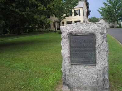
On Broadway (U.S. 4), on the right when traveling south.
Erected by Patrick Smyth about 1767 of timber taken from Fort Edward. The first tavern and scene of the first court in Charlotte County. Headquarters of Schuyler – Arnold – Burgoyne – Stark – 1777. Oldest house in . . . — — Map (db m9357) HM
On Buskirk Road (County Route 59) at Firehouse Road (County Route 103), on the right when traveling east on Buskirk Road.
Buskirk's Red
Covered Bridge
Rehabilitated in 2004.Built
Circa 1850 to Replace A
Previous Bridge Built in 1804.
This Crossing Served The
Great Northern Turnpike
Beginning In 1799.
— — Map (db m13751) HM
On South Prospect Street near West Washington Street (U.S. 40), on the right when traveling south.
This is the original site of "Mount Prospect," also known as "The Rochester House." Nathanial Rochester built the house in 1789 on ground which once belonged to Jonathan Hager, the founder of Hagerstown. The home was used as a "way station" during . . . — — Map (db m20852) HM
On U.S. 4 just south of Kingsbury Road, on the left when traveling south.
Burials from 1788. Located on trail of Burgoyne’s 1777 march to Sarasota. Rev War & other veterans. U.S. Representative Henry Martindale buried here. — — Map (db m248957) HM
"It turned out that a traveling carnival had set up there several years earlier and then didn't make enough money to pay the rent for the pasture. So they just left their 24-horse Carousel there. We got those hobby horses for a very reasonable . . . — — Map (db m177280) HM
On Farm to Market Road 539 0.2 miles south of Polly Lane, on the left when traveling north.
Joseph Henry Polley (1795-1869) was born in Whitehall, New York to Jonathan and Rachel Hubbard Polley. He later moved to Missouri, where he was a friend of Moses Austin, with whom he traveled to Texas in 1820. The next year, he returned to Texas . . . — — Map (db m167557) HM
On South Broad Street, on the right when traveling south.
Organized in March 1862 under the leadership of Capt. William Badham Jr., Lt. John M. Jones, and Lt. Nelson McClees, the Edenton Bell Battery was composed of men primarily from Chowan, Tyrrell, and Washington Counties. Lacking adequate artillery, . . . — — Map (db m34835) HM
On Slocum Avenue, on the right when traveling west.
(Front):123rd. New York Infantry 1st. Brigade 1st. Division 12th. Corps Historic.The 123rd. N.Y. was enlisted in Washington Co. in Aug. 1862; Mustered into the U.S. service Sept. 4; joined the Army of the Potomac and was engaged in the . . . — — Map (db m13668) HM WM
On New York State Route 74A near Route 372, on the right when traveling south. Reported missing.
Anna Mary Robertson born on Sep 7 1860 daughter of Russell King & Mary Shannahan Robertson in a home west of this sign. Nothing remains of the home or flax mill run by her father. — — Map (db m255028) HM
On East 9th Street at Cloud Street, on the right when traveling east on East 9th Street.
Hayes Rutherford Devore Born 1902Hayes was the second son of Zachary and Mary Devore, born in Elmira, New York. In January 1911, Hayes' relatives were unable to care for him and he was taken by the authorities to the Southern Tier . . . — — Map (db m212848) HM
On Martindale Avenue, on the left when traveling east.
Today’s Boat Basin Park was once a turn-around basin for canal boats that operated out of Hudson Falls. The Feeder Canal was built in 1824 to provide a steady supply of water from the Hudson River to the Champlain Canal. The original canal was only . . . — — Map (db m131746) HM
[Side A:]
Born in Massachusetts in 1805, Sala Bosworth spent all but nineteen years of his eighty-five years in Washington County. After studying at the Philadelphia Academy of Fine Arts, he returned to the county to paint many full size . . . — — Map (db m20127) HM
In Late March 1836, the Texian Army was in retreat ahead of Santa Anna's advancing Mexican forces. The retreat spurred the "Runaway Scrape" - a wave of settlers fleeing for their lives. To prevent the enemy from benefitting from San Felipe's . . . — — Map (db m206186) HM
On North Main Street (Business U.S. 65) at West Rush Avenue, on the right when traveling south on North Main Street.
Modern historical research has yielded information which was not readily available to those who designed the 1955 monument. Here is presented updated information and a modified more accurate map of the emigrants' route. Dedicated . . . — — Map (db m225248) HM
Born in Washington County, Tennessee, Henry Melville Doak was an adventurous young man who tried twice, at age 4 and at 7, to run away from home and join the militia headed off to fight in the Mexican War. Several years older, he gave up the study . . . — — Map (db m166491) HM
Near Railroad Avenue west of Depot St, on the left when traveling east.
Arthur St. Clair Colyar played a major role in the raising of Tracy City like a phoenix from the ashes of the Civil War to an industrial giant of the late 19th century. Born In Washington County near Jonesboro, he migrated at age of nine with his . . . — — Map (db m277155) HM
On West Haynes Street at Stacer Avenue, on the right when traveling west on West Haynes Street.
On Thursday, November 24, 1864, the 14th and 20th Corps of Union Major General William T. Sherman's army began entering Washington County. By November
26th the 28,000 soldiers of the two corps arrived in Sandersville, marching on separate roads . . . — — Map (db m103235) HM
On South Potomac Street at West Memorial Boulevard, on the right when traveling south on South Potomac Street.
1774
On July 2, 800 citizens meet in Elizabeth Town and pledge to boycott British goods, especially tea. This is done to support the citizens of Boston because their port had been closed by Parliament.
1775
In August, a colonial . . . — — Map (db m146011) HM
On West Memorial Boulevard 0.1 miles west of South Potomac Street (Maryland Route 56), on the right when traveling west.
1930
Municipal Stadium is constructed and the first home game is played by Hagerstown Hubs on May 8. Willie Mays plays his first professional baseball game here in 1950.
1931
Fairchild Aircraft moves to Hagerstown from New York and . . . — — Map (db m146064) HM
Born in Pennsylvania in 1824, Margaret Greenawalt was raised in the Greencastle area. By the Civil War, she lived with her sister and brother-in-law, George and Catharine Bowman, in Hagerstown. The Bowmans operated a confectionary (bakery and candy . . . — — Map (db m256130) HM
Historian and author William Hart Hill was born in Fort Edward, New York on April 29, 1891. His parents, Almon Perry Hill and Mary Northup Hill were both from nearby Hartford, New York. The Hill family name was originally Hills. At the time . . . — — Map (db m229641) HM
On Federal Lane 0.2 miles east of Tennessee Route 22, on the right when traveling east.
Cyrus Livingston Dunham left a promising political career to serve his country in the Civil War. He resigned his military commission November 18, 1863, his health broken
A Rural Upbringing
Cyrus Dunham was born and raised on a farm . . . — — Map (db m174108) HM
On North Union Street at Queen Street, on the right when traveling north on North Union Street.
Alexandria, D.C.
In 1791, Alexandrians applauded their inclusion in the District of Columbia, believing that the town would benefit economically as part of the Federal district. These positive feelings toward inclusion in the District . . . — — Map (db m239716) HM
Built in 1885, the Mulholland Point Lighthouse (photo 1) served as a guide for the many small coasters and freighters taking the shorter and more foul weather-protected route through the Lubec Narrows. Steamships, such as the . . . — — Map (db m63593) HM
On Pine Street West at Third Street South (County Highway 23), on the left when traveling west on Pine Street West.
Dedicated to the
Soldiers and Sailors of the
United States
Enlisting or Residing in
Washington County
———
Erected by the Citizens of
Washington County
1916
center panel
Minnesota
Alcorn James 2nd Cav. •
Barrisford . . . — — Map (db m72153) WM
Near Main Street north of Rices Landing Road (County Route 1010), on the left when traveling north.
Pennsylvania Railroad Company
Established in 1846, the Pennsylvania Railroad Company (PRR) was headquartered in Philadelphia, Pennsylvania. By 1882, it had become the largest railroad and transportation company in the world with a budget . . . — — Map (db m181582) HM
On 6th Avenue North, on the left when traveling north.
Ridge and Valley
The Ridge and Valley physiographic province is an area between the Cumberland Plateau on the west and the Mountains on the east. This 9,000 square mile great valley extends diagonally across east Tennessee from Virginia to . . . — — Map (db m206495) HM
On Lakeview Parkway near Shoosmith Road, on the left when traveling north.
During the first 18 months of the Civil War, President Abraham Lincoln chose not to act upon recommendations of Frederick Douglass, and others, to enlist Black men in the Union Army in the fight against the Confederacy. After the much-needed Union . . . — — Map (db m314862) HM
On Green Spring Road at Gibson Street SE, on the right when traveling north on Green Spring Road.
Black's Fort History
from History of Southwest Virginia, 1746-1786
Washington County 1777-1870
by
Lewis Preston Summers
In 1760, what was to become Abingdon received its first name, Wolf Hills, from Daniel Boone after his hunting party was . . . — — Map (db m210058) HM
On New York State Route 22 at Route 67, on the right when traveling north on New York State Route 22.
Lakes to Locks Passage takes you through a spectacular landscape laden with history. Follow this map to find your way through four story-filled regions that connect the historic waters of Lake Champlain and Lake George with the Champlain Canal . . . — — Map (db m148238) HM
On 5th Street (Ohio Route 60) at Park Street, on the right when traveling west on 5th Street.
Marvil Starlin, Sr. (1771-1852) received 100 acres of free land (Lot 6) in
the Allotment between Rainbow and Waterford in the Donation Tract.
A 1798 Waterford Township tax enumeration by Lt. Joseph Frye in
Special Collections at Marietta College . . . — — Map (db m313379) HM
Near Thomas Bridge Road (County Route 657) at Octagon House Road, on the left when traveling south.
(side 1)
The history of this storied house and the Thomas family entails much more than an eight-sided or octagon plantation house. According to family history, ancestors of the Abijah Thomas family were present during the initial European . . . — — Map (db m162857) HM
On Hartford Main Street (County Road 23) just north of East Street, on the right when traveling north.
First Baptist Church (west side) The history of the First Baptist Church of Hartford is a chronology of faithfulness, and its influence was commensurate with that of the New Nation. Shortly after the War for Independence, this . . . — — Map (db m298000) HM
Thin black lines indicate changes in relevance. Between each pair of lines entries are ordered geographically but all have the same relevance.
* Inflectional forms of words are their plurals, singulars, and possessives as well as gramatical tenses and similar variations.