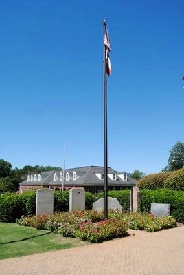
On East Court Street at North Spring Street on East Court Street.
Washington
Wilkes County, Georgia
was laid out first
under legislative act of
January 23, 1780
and a second time under
Legislative Provision
July 31, 1780 — — Map (db m93492) HM
Created from Wilkes County by Act of Dec, 10, 1790. Elbert County was settled in 1784 by Gen. George Mathews and a group from Virginia and Carolina. The site of Petersburg, the original settlement and third largest town in Georgia in its day, is . . . — — Map (db m21893) HM
On Monroe Street (Georgia Route 208) 0.1 miles west of Taylor Street, on the right when traveling west.
George Washington Towns was born in Wilkes County, Georgia, May 4, 1801, and died in Macon, Georgia, July 15, 1854. A lawyer and resident of Talbotton, Georgia, Towns served as state legislator, U.S. Congressman, and Governor of Georgia (1847-51). . . . — — Map (db m233834) HM
This is Anderson County's second court house. It stands on the site of the first small brick court house where the first court session in Anderson was held on the third Monday in October, 1820. The present building of pronounced Victorian . . . — — Map (db m10692) HM
Near Depot Street at Lagrange Street, on the left when traveling south.
David Meriwether was born in Virginia on April 10, 1755. During the American Revolution he served in the Continental Army from 1776 to 1783. The U.S. Daughters of 1812 honor his service to Georgia from the Revolution's end in 1783 to the . . . — — Map (db m286883) HM
On East Court Street at East Square, on the right when traveling west on East Court Street.
Secession sentiment was strong on Thursday, December 15, 1860, when a rally in Washington, Georgia raised a new flag over the cupola of the Wilkes County Courthouse located in the center of the town's square. It was a blue banner with a large . . . — — Map (db m200043) HM
On North Main Street at East Elford Street, on the right when traveling north on North Main Street.
Dedicated in reverence and admiration for their courage and integrity to the five signers of the Ordinance of Secession from Greenville County, December 20, 1860:
William Hans Campbell 1823-1901 •
Perry Emory Duncan 1800-1867 • . . . — — Map (db m41965) HM
On Spring Street (Georgia Route 47) at West Liberty Street when traveling north on Spring Street.
Organized in 1819, this Church is an outgrowth of Grant’s Meeting House, the first Methodist Church building in Georgia, erected 5 miles E. in 1787. In 1820, the Methodists built the first church building in Washington. It was shared by other . . . — — Map (db m25989) HM
On East Court Street at East Square, on the right when traveling west on East Court Street.
Wilkes County, an original County, was created by the Constitution of Feb. 5, 1777 from Creek and Cherokee Cessions of June 1, 1773. At first, it contained all of Oglethorpe, Elbert, Lincoln, and parts of Taliaferro, Hart, Warren, and Madison . . . — — Map (db m25454) HM
Near Memorial Drive west of North East Street, on the left when traveling west.
He was born near Madison, Virginia in 1773, the
son of Joel Early and Lucy Smith. His cousin, Jubal
Early, was the grandfather of Confederate General
Jubal Anderson Early (1816-1894). Peter Early
graduated from the Lexington Academy (current . . . — — Map (db m267646) HM
On Mallorysville Road (County Route 106) at Dunkhill Road (County Route 105), on the right when traveling west on Mallorysville Road.
At Clarke’s Creek, near here, on the night of February 13, 1779, American troops commanded by Col. Elijah Clark, Col. John Dooley and Col. Andrew Pickens, encamped. Very early the next morning, they launched a surprise attack on the British . . . — — Map (db m46840) HM
Near Capitol Avenue Southwest near Capitol Square Southwest, on the right when traveling north.
To prevent British soldiers from capturing the city of Augusta, the Battle of Kettle Creek was fought on Valentine's Day, 1779. 600 British loyalists occupied Wilkes County, a few miles from Washington, Georgia, at an area known to the locals as . . . — — Map (db m215342) HM
On East Robert Toombs Avenue (Business U.S. 78) at East Square, on the right when traveling west on East Robert Toombs Avenue.
(Upper marker)
The history of Africans forcibly bought to America spans centuries of struggle, resilience, and ingenuity, shaping the African American experience and making an indelible mark on the nation's economic and cultural . . . — — Map (db m292610) HM
On Settlement Road 0.3 miles west of War Hill Road, on the right when traveling west.
The Battle of Kettle Creek was the first major victory for Patriot forces in Georgia.
Coming just two months after the fall of Savannah, the victory boosted American
morale at a critical time and made headlines throughout the new nation.
This . . . — — Map (db m311521) HM
On Andrew Drive (County Route 41) 0.1 miles Spring Street ( Route 47), on the right when traveling west.
James Osgood Andrew was born in Wilkes County, Georgia, on May 5, 1794, about 400 yards N.E. of this marker, the son of Rev. John Andrew and Mary Cosby Andrew. He was licensed to preach in the Ellam Methodist Episcopal Church, Broad River Circuit, . . . — — Map (db m17257) HM
Remodeled 1959 after extensive fire
which destroyed the roof and upper
floor on December 24, 1958.
Board of Commissioners, Roads & Revenues
Wilkes County, Georgia
R.A. McLendon, Chairman
G.O. Holliday, C.R. Jackson
W.A. Pope, . . . — — Map (db m93598) HM
On State Highway 28 at Old Charleston Road (Local Road 38), on the left when traveling south on State Highway 28.
About four miles southeast is the site of the American Revolutionary Battle of Long Cane. On December 12, 1780, Lieutenant Colonel Isaac Allen and a British force of 400-500 men defeated Colonel Elijah Clarke and 100 Americans, an advanced . . . — — Map (db m241074) HM
On South Berrong Street at River Street, on the right when traveling east on South Berrong Street.
Towns County was created by Act of March 6, 1856 from Rabun and Union Counties. It was named for George Washington Towns, Governor of Georgia from 1847~1851. Gov. Towns was born in Wilkes County, May 4, 1801, of a Virginia family. Self-educated, he . . . — — Map (db m37370) HM
On West Robert Toombs Avenue (Business U.S. 78) 0 miles west of North Mercer Street ( Route 44), on the left when traveling west.
This is the site of Wilkes County Academy, built in 1797. The Academy was authorized by the Legislature in 1783, one of the first public schools charted by the State of Georgia. Commissioners were: Stephen Heard, Micajah Williamson, Robert Harper, . . . — — Map (db m25882) HM
On Calhoun Falls Highway (Georgia Route 72) at Bobby Brown State Park Road, on the right when traveling east on Calhoun Falls Highway.
“The Point,” where early settlers crossed into Georgia, is eight miles east of here. As soon as this area was ceded, Governor Wright opened a post at the confluence of the Broad and Savannah Rivers, known as Fort James. “The . . . — — Map (db m37051) HM
On Elijah Clark State Park (Drive) 1 mile north of U.S. 378, on the right when traveling north.
General Elijah Clark, "Hero of the Hornets Nest," and members of his family are buried in the enclosed cemetery. Their graves were first moved from their original burial places near Graball (10 miles North) to a site on the Community House Grounds . . . — — Map (db m9931) HM
On War Hill Road 0.2 miles south of Settlement Road, on the right when traveling west.
Following the decision by the British Crown to end the revolution in America by recruiting support from the southern back country, Loyalist Colonel John Boyd was successfully moving a force of 700 men from the Carolinas through Georgia until he . . . — — Map (db m311520) HM
On North Main Street (State Highway 121) at West Wheeler Circle, on the left when traveling north on North Main Street.
Built in 1957, the Stockyard has provided a livestock market for over two generations of farmers. Ralph T. McClendon and Georgia Senator Sam McGill opened this ultra-modern auction barn in Saluda. One newspaper article stated that the barn "is the . . . — — Map (db m41641) HM
On East Robert Toombs Avenue (Business U.S. 78) west of Jefferson Street, on the right when traveling east.
Site of W.T. Fluker Gun Smith (1867-1877) and Fluker & Brother Cotton Gin Manufactory (1875-1895). Also the location of W.T. Johnson's first store. A hardware store has been located here since 1884 — — Map (db m44334) HM
On Main Street (U.S. 78) at Gilmer Street, on the right when traveling east on Main Street.
George Rockingham Gilmer, of Scotch descent, was born in 1790 in that part of Wilkes Co. that is now Oglethorpe Co. Soon after admittance to the bar in 1813 he was appointed 1st Lt. in the regular army and served with distinction in the Creek . . . — — Map (db m26043) HM
Near War Hill Road 1.5 miles south of Tyrone Road.
Marker Front:
The Patriots whose names appear on this marker are those who have been proved to have participated in the Battle of Kettle Creek on February 14, 1779.
Many brave men fought on this hallowed ground, some were wounded and . . . — — Map (db m46285) HM
On West Court Street at North Spring Street / West Square, on the left when traveling west on West Court Street.
Erected
Anno Domini 1908
By the
"Last Cabinet" Chapter
United
Daughters of The Confederacy,
Ladies
Memorial Association,
and
Sons of Veterans.
—
A tribute
of abiding love
for our
Confederate Heroes.
(Left . . . — — Map (db m30352) WM
On Beaverdam Road (County Route 64) at Columbus Granade (County Route 65), on the left when traveling west on Beaverdam Road.
Son of Adam Granade and Rebecca Ansley
Teacher, Farmer, Author, Cartographer, Surveyor, Legislator, Soldier, Poet
Co F 12th Ga Batt Light Artillery
Army of Northern Virginia 1862 – 1865
Wilkes County School Board
Wilkes County . . . — — Map (db m110567) HM
Near Capitol Avenue Southwest south of M.L.K. Junior Drive Southeast, on the left when traveling north.
Expelled Because of Color” is dedicated to the memory of the 33 Black state legislators who were elected, yet expelled from the Georgia House because of their color in 1868.
The cinder block forms at the base of the sculpture symbolize the . . . — — Map (db m130191) HM
Thin black lines indicate changes in relevance. Between each pair of lines entries are ordered geographically but all have the same relevance.
* Inflectional forms of words are their plurals, singulars, and possessives as well as gramatical tenses and similar variations.