89 entries match your criteria.
Civil Rights in Education Heritage Trail Historical Markers
This set of markers, placed by Virginia’s Retreat, highlights the evolution of Civil Rights in Southside Virginia in the years from the Civil War into the 20th Century.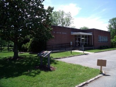
By Bernard Fisher, May 10, 2009
Virginia St & Church St
| 1 ► Virginia, Amelia County, Amelia Court House — 10 — Mrs. Samantha Jane Neil — Amelia Court House, Virginia — Civil Rights in Education Heritage Trail® |
| On Virginia Street at Church Street, on the right when traveling south on Virginia Street. Reported permanently removed. | |||
| 2 ► Virginia, Amelia County, Amelia Court House — AM2 — Mrs. Samantha Jane Neil — Amelia Court House, Virginia — Amelia County — |
| On Virginia Street (Virginia Route 1009) at Church Street (Virginia Route 1003), on the right when traveling south on Virginia Street. | |||
| 3 ► Virginia, Amelia County, Amelia Court House — 9 — Russell Grove Presbyterian Church and School — Amelia Court House, Virginia — Civil Rights in Education Heritage Trail® |
| On Otterburn Road (Virginia Route 614) 0.1 miles south of Leidig Street (Virginia Route 634), on the left when traveling south. Reported permanently removed. | |||
| 4 ► Virginia, Amelia County, Amelia Court House — AM1 — Russell Grove Presbyterian Church and School — Amelia Court House, Virginia — Amelia County — |
| On Otterburn Road (Virginia Route 614) 0.1 miles south of Leidig Street (Virginia Route 634), on the right when traveling north. | |||
| 5 ► Virginia, Appomattox County, Appomattox — 2 — Carver-Price School — Civil Rights in Education Heritage Trail — Appomattox, Virginia - Appomattox County |
| On Confederate Boulevard (U.S. 460), on the right when traveling west. Reported permanently removed. | |||
| 6 ► Virginia, Appomattox County, Appomattox — AP2 — Carver-Price School — Appomattox, Virginia — Civil Rights in Education Heritage Trail® — |
| On Confederate Boulevard (Business U.S. 460) at Virginia Route 9021, on the right when traveling west on Confederate Boulevard. | |||
| 7 ► Virginia, Appomattox County, Appomattox — 3 — Education in 1800's Rural Virginia — Civil Rights in Education Heritage Trail — Appomattox, Virginia - Appomattox County |
| On Old Courthouse Road. Reported permanently removed. | |||
| 8 ► Virginia, Appomattox County, Appomattox — AP3 — The First African American School in Appomattox — Appomattox, Virginia — Appomattox County — |
| On Old Courthouse Road (Virginia Route 24) 0.2 miles east of Gordon Drive, on the right when traveling east. | |||
| 9 ► Virginia, Appomattox County, Appomattox — 1 — Winonah Camp / Mozella Price Home — Appomattox, Virginia — Civil Rights in Education Heritage Trail® |
| On Confederate Boulevard (U.S. 460), on the right when traveling west. Reported permanently removed. | |||
| 10 ► Virginia, Appomattox County, Appomattox — AP1 — Winonah Camp / Mozella Price Home — |
| On Confederate Boulevard (Business U.S. 460) at Virginia Route 9021, on the right when traveling west on Confederate Boulevard. | |||
| 11 ► Virginia, Brunswick County, Alberta — 38 — Southside Virginia Community College — Alberta, Virginia — Brunswick County |
| Near Campus Drive (County Route 378) near Chritanna Highway (Virginia Route 46). Reported permanently removed. | |||
| 12 ► Virginia, Brunswick County, Alberta — BR1 — Southside Virginia Community College — Alberta, Virginia — Brunswick County — |
| Near Campus Drive (County Road 378) 0.1 miles west of Christanna Highway (State Route 46), on the left when traveling west. | |||
| 13 ► Virginia, Brunswick County, Broadnax — BR5 — Hospital and School of the Good Shepherd — Broadnax, Virginia — Brunswick County — |
| On Pleasant Grove Road (County Road 681) 0.2 miles west of Governor Harrison Parkway (U.S. 58), on the right when traveling west. | |||
| 14 ► Virginia, Brunswick County, Brodnax — 40 — Hospital and School of the Good Shepherd — Lawrenceville, Virginia — Brunswick County |
| On Pleasant Grove Road (County Route 681) 0.3 miles north of Governor Harrison Parkway (U.S. 58), on the right when traveling north. Reported permanently removed. | |||
| 15 ► Virginia, Brunswick County, Lawrenceville — 41 — Fort Christanna — Lawrenceville, Virginia — Brunswick County |
| On Fort Hill Road, 1.1 miles west of Christanna Highway (Virginia Route 46), on the right when traveling west. Reported permanently removed. | |||
| 16 ► Virginia, Brunswick County, Lawrenceville — BR4 — Fort Christanna Historical Site — Lawrenceville, Virginia — Brunswick County — |
| On Fort Hill Road (County Road 686) 1.2 miles west of Christanna Highway (State Route 46), on the right when traveling west. | |||
| 17 ► Virginia, Brunswick County, Lawrenceville — BR2 — Oak Grove School — Lawrenceville, Virginia — Brunswick County — |
| On Christanna Highway (Virginia Route 46) 0.1 miles east of Walkers Wood Lane, on the right when traveling east. | |||
| 18 ► Virginia, Brunswick County, Lawrenceville — 39 — Saint Paul's College — Lawrenceville, Virginia — Brunswick County |
| On College Drive, 0.1 miles north of Windsor Avenue (Virginia Route 46), on the right when traveling north. Reported permanently removed. | |||
| 19 ► Virginia, Brunswick County, Lawrenceville — BR3 — Saint Paul's College and James Solomon Russell-Saint Paul's College Museum — Lawrenceville, Virginia — Brunswick County — |
| On Athletic Field Road at Lawrenceville Plank Road (Business U.S. 58), on the right when traveling north on Athletic Field Road. | |||
| 20 ► Virginia, Buckingham County, Buckingham — 4 — One-Room Schoolhouse — Buckingham, Virginia — Buckingham County |
| Near Lee Wayside Road near Anderson Highway (U.S. 60). Reported permanently removed. | |||
| 21 ► Virginia, Buckingham County, Buckingham — BK1 — One-Room Schoolhouse — Buckingham, Virginia — Buckingham County — |
| Near Lee Wayside Road, 0.1 miles east of West James Anderson Highway (U.S. 60), on the left when traveling west. | |||
| 22 ► Virginia, Buckingham County, Dillwyn — BK2 — Buckingham Training School — Dillwyn, Virginia — Buckingham County — |
| Near Camden Street (Virginia Route 1001) 0.1 miles south of Hancock Street (Virginia Route 1001), on the left when traveling south. | |||
| 23 ► Virginia, Buckingham County, New Canton — 5 — Carter G. Woodson Birthplace — New Canton, Virginia — Buckingham County |
| On C G Woodson Road (Virginia Route 670) 0.2 miles north of Liberty Road (Virginia Route 759), on the right when traveling north. Reported permanently removed. | |||
| 24 ► Virginia, Buckingham County, New Canton — BK3 — Carter G. Woodson Birthplace — New Canton, Virginia — Buckingham County — |
| On C G Woodson Road (Virginia Route 670) 0.2 miles south of Bolling Woodson Lane, on the right when traveling north. | |||
| 25 ► Virginia, Charlotte County, Charlotte Court House — CR1 — Central High School — Charlotte Court House, Virginia — Charlotte County — |
| On Thomas Jefferson Highway (Route 47) north of Union Cemetery Road (Virginia Route 709), on the left when traveling north. | |||
| 26 ► Virginia, Charlotte County, Charlotte Court House — 30 — Charlotte County Library |
| On Legrande Avenue (Virginia Route 47) at David Bruce Avenue (Virginia Route 40) on Legrande Avenue. Reported permanently removed. | |||
| 27 ► Virginia, Charlotte County, Charlotte Court House — CR2 — Charlotte County Library — Charlotte Court House, Virginia — Charlotte County — |
| On Legrande Avenue (Virginia Route 47) just south of David Bruce Avenue (Virginia Route 40), on the right when traveling south. | |||
| 28 ► Virginia, Charlotte County, Keysville — 29 — Southside Virginia Community College — Keysville, Virginia — Charlotte County |
| On Tech Lane at Lunenburg Highway (Virginia Route 40) on Tech Lane. Reported permanently removed. | |||
| 29 ► Virginia, Charlotte County, Keysville — CR3 — Southside Virginia Community College — Keysville, Virginia — Charlotte County — |
| On Daniel Road just north of Lunenburg Highway (Virginia Route 40), on the right when traveling north. | |||
| 30 ► Virginia, Charlotte County, Red Oak — 31 — Salem School — Red Oak, Virginia — Charlotte County |
| On Cargills Creek Road (County Route 632) at Salem School Road (County Route 608), on the right when traveling west on Cargills Creek Road. Reported permanently removed. | |||
| 31 ► Virginia, Charlotte County, Red Oak — CR4 — Salem School — Red Oak, Virginia — Charlotte County — |
| On Cargills Creek Road (County Road 632) just west of Tobacco Hill Road (County Road 608), on the right when traveling west. | |||
| 32 ► Virginia, Chesterfield County, Ettrick — 11 — Virginia State University — Ettrick, Virginia — Chesterfield County |
| On Matthews Jefferson Drive at East River Road, on the right when traveling south on Matthews Jefferson Drive. Reported permanently removed. | |||
| 33 ► Virginia, Chesterfield County, Ettrick — CH1 — Virginia State University — Ettrick, Virginia — Chesterfield County — |
| On Matthews Jefferson Drive at East River Road, on the right when traveling east on Matthews Jefferson Drive. | |||
| 34 ► Virginia, Cumberland County, Cartersville — 6 — Hamilton High School — Cartersville, Virginia — Civil Rights in Education Heritage Trail® — |
| Near Cartersville Road (Virginia Route 45) at Columbia Road (Virginia Route 690), on the right when traveling south. | |||
| 35 ► Virginia, Cumberland County, Cartersville — 7 — Rosenwald School at Cartersville — Cartersville, Virginia — Civil Rights in Education Heritage Trail® — |
| Near Cartersville Road (Virginia Route 45) 0.1 miles north of Ampthill Road, on the right when traveling north. | |||
| 36 ► Virginia, Cumberland County, Cumberland — 8 — Jackson Davis — Cumberland Court House, Virginia — Civil Rights in Education Heritage Trail® |
| On Foster Road at Anderson Highway (U.S. 60), on the left when traveling north on Foster Road. Reported permanently removed. | |||
| 37 ► Virginia, Cumberland County, Cumberland — CM3 — Jackson Davis — Cumberland, Virginia — Civil Rights in Education Heritage Trail® — |
| On Foster Road at Courthouse Circle, on the right when traveling south on Foster Road. | |||
| 38 ► Virginia, Dinwiddie County, Dinwiddie — 17 — Early Education in Dinwiddie County — Dinwiddie, Virginia — Dinwiddie County |
| Near Sycamore Drive at Boydton Plank Road (U.S. 1). Reported permanently removed. | |||
| 39 ► Virginia, Dinwiddie County, Dinwiddie — DN3 — Early Education in Dinwiddie County — Dinwiddie, Virginia — Dinwiddie County — |
| On Sycamore Drive at Boydton Plank Road (U.S. 1), on the left when traveling south on Sycamore Drive. | |||
| 40 ► Virginia, Dinwiddie County, Dinwiddie — DN4 — Southside High School — Dinwiddie, Virginia — Dinwiddie County — |
| On Eastview Drive at Boydton Plank Road (U.S. 1), on the right when traveling west on Eastview Drive. | |||
| 41 ► Virginia, Dinwiddie County, Petersburg — 15 — Petersburg State Colony for the Negro Insane — Petersburg, Virginia — Dinwiddie County |
| Near 7th Avenue, 0.5 miles north of Albermarle Street. Reported permanently removed. | |||
| 42 ► Virginia, Dinwiddie County, Petersburg — DN1 — Southside Virginia Training Center — Petersburg, Virginia — Dinwiddie County — |
| On Bedford Street, 0.2 miles north of 7th Avenue, on the right when traveling north. | |||
| 43 ► Virginia, Dinwiddie County, Sutherland — 16 — Rocky Branch School — Sutherland, Virginia — Dinwiddie County |
| On Rocky Branch Road (Virginia Route 636) 0.3 miles south of New Cox Road (U.S. 460), on the left when traveling south. Reported permanently removed. | |||
| 44 ► Virginia, Dinwiddie County, Sutherland — DN2 — Rocky Branch School — Sutherland, Virginia — Dinwiddie County — |
| On Rocky Branch Road (Virginia Route 636) 0.3 miles south of Cox Road (U.S. 460), on the left when traveling south. | |||
| 45 ► Virginia, Emporia — GR1 — Greensville County Training School — Emporia, Virginia — Greensville County — |
| On Ruffin Street just east of North Main Street (U.S. 301), on the left when traveling east. | |||
| 46 ► Virginia, Halifax County, Halifax — HX2 — L.E. Coleman African American Museum — Mountain Road School No. 1 — Halifax, Virginia — |
| On Mountain Road (Virginia Route 360) 0.1 miles west of Ragland Loop, on the left when traveling west. | |||
| 47 ► Virginia, Halifax County, Halifax — 33 — Mary M. Bethune High School — Halifax, Virginia — Halifax County |
| Near Cowford Road (Virginia Route 651) near Mary Bethune Street. Reported permanently removed. | |||
| 48 ► Virginia, Halifax County, Halifax — HX3 — Mary M. Bethune High School — Halifax, Virginia — Halifax County — |
| On Cowford Road (Virginia Route 651) 0.1 miles east of North Main Street (Virginia Route 360). | |||
| 49 ► Virginia, Halifax County, Nathalie — 32 — Meadville Community Center — Vernon Hill, Virginia — Halifax County |
| On Chatam Road (Virginia Route 57) 0.3 miles west of Meadville Road (Virginia Route 642), on the right when traveling west. Reported permanently removed. | |||
| 50 ► Virginia, Halifax County, Nathalie — HX1 — Meadville Community Center — Nathalie, Virginia — Halifax County — |
| On Chatham Road (Route 57/832) 0.3 miles west of Meadville Road (Virginia Route 642), on the right when traveling west. | |||
| 51 ► Virginia, Halifax County, South Boston — 35 — Mizpah Church — South Boston, Virginia — Halifax County |
| On Ragland Street at Watkins Avenue, on the left when traveling east on Ragland Street. Reported permanently removed. | |||
| 52 ► Virginia, Halifax County, South Boston — HX5 — Mizpah Presbyterian Church — South Boston, Virginia — Halifax County — |
| On Watkins Avenue at Noblin Avenue, on the right when traveling west on Watkins Avenue. | |||
| 53 ► Virginia, Halifax County, South Boston — 34 — Washington-Coleman Elementary School — South Boston, Virginia — Halifax County |
| On Jeffress Boulevard, 0.1 miles east of Penick Avenue, on the right when traveling north. Reported permanently removed. | |||
| 54 ► Virginia, Halifax County, South Boston — HX4 — Washington-Coleman Elementary School — South Boston, Virginia — Halifax County — |
| On Jeffress Boulevard, 0.1 miles west of Park Lane, on the left when traveling west. | |||
| 55 ► Virginia, Lunenburg County, Meherrin — 22 — St. Matthew's Lutheran Church Christian Day School — Meherrin, Virginia — Lunenburg County |
| On Free State Road (County Route 630) 0.4 miles east of Payne Lane, on the right when traveling east. Reported permanently removed. | |||
| 56 ► Virginia, Lunenburg County, Meherrin — LN3 — St. Matthew's Lutheran Church Christian Day School — Meherrin, Virginia — Lunenburg County — |
| On Free State Road (Virginia Route 630) 0.2 miles east of Twin Crossings Drive, on the right when traveling east. | |||
| 57 ► Virginia, Lunenburg County, Victoria — LN1 — The Peoples Community Center — Victoria, Virginia — Lunenburg County — |
| On Tidewater Avenue just south of West 7th Street, on the right when traveling south. | |||
| 58 ► Virginia, Lunenburg County, Victoria — 21 — The People's Community Center — Victoria, Virginia — Lunenburg County |
| On Tidewater Avenue at West 7th Street, on the right when traveling east on Tidewater Avenue. Reported permanently removed. | |||
| 59 ► Virginia, Mecklenburg County, Boydton — 37 — Boydton Academic and Bible Institute — Boydton, Virginia — Mecklenburg County |
| On Highway Fifty Eight (U.S. 58) 0.1 miles east of Jefferson Street, on the right when traveling east. Reported permanently removed. | |||
| 60 ► Virginia, Mecklenburg County, Boydton — MK2 — Boydton Academic and Bible Institute — Boydton, Virginia — Mecklenburg County — |
| On U.S. 58, 0.2 miles east of Jefferson Street, on the right when traveling east. | |||
| 61 ► Virginia, Mecklenburg County, Chase City — 36 — Thyne Institute — Chase City, Virginia — Mecklenburg County |
| On Highway Forty Seven (Virginia Route 47) at Village Road (Virginia Route 874), on the left when traveling west on Highway Forty Seven. Reported permanently removed. | |||
| 62 ► Virginia, Mecklenburg County, Chase City — MK1 — Thyne Institute — Chase City, Virginia — Mecklenburg County — |
| On State Highway 47 just west of Village Road (State Route 874), on the left when traveling west. | |||
| 63 ► Virginia, Nottoway County, Blackstone — 18 — Blackstone Female Institute — Blackstone, Virginia — Nottoway County |
| On 4th Street at South Amelia Avenue, on the left when traveling west on 4th Street. Reported permanently removed. | |||
| 64 ► Virginia, Nottoway County, Blackstone — NT1 — Blackstone Female Institute — Blackstone, Virginia — Nottoway County — |
| On 4th Street at South Amelia Avenue, on the right when traveling east on 4th Street. | |||
| 65 ► Virginia, Nottoway County, Blackstone — 19 — Mount Nebo Church — Blackstone, Virginia — Nottoway County |
| On Mt. Nebo Road, 0.4 miles Walnut Hill Road, on the left when traveling north. Reported permanently removed. | |||
| 66 ► Virginia, Nottoway County, Blackstone — NT2 — Mt. Nebo Church — Blackstone, Virginia — Nottoway County — |
| On Mt. Nebo Road, 0.4 miles north of Walnut Hill Road (Virginia Route 726), on the left when traveling north. | |||
| 67 ► Virginia, Nottoway County, Burkeville — 20 — Ingleside Training Institute — Burkeville, Virginia — Nottoway County |
| On Miller Street at 5th Street SE (Virginia Route 9694), on the right when traveling south on Miller Street. Reported permanently removed. | |||
| 68 ► Virginia, Nottoway County, Burkeville — NT3 — Ingleside Training Institute — Burkeville, Virginia — Nottoway County — |
| On Ingleside Street at Virginia Route 9694, on the left when traveling south on Ingleside Street. | |||
| 69 ► Virginia, Petersburg — PB4 — Bishop Payne Divinity School — Petersburg, Virginia — |
| On South West Street just south of Willcox Street, on the left when traveling south. | |||
| 70 ► Virginia, Petersburg — 12 — Earliest Known Public High School for African Americans in Virginia — Petersburg, Virginia |
| On Harrison Street at Maple Lane, on the left when traveling south on Harrison Street. Reported permanently removed. | |||
| 71 ► Virginia, Petersburg — PB1 — Earliest Known Public High School for African Americans in Virginia — Petersburg, Virginia — |
| On Harrison Street just north of West Fillmore Street, on the right when traveling north. | |||
| 72 ► Virginia, Petersburg — 13 — McKenney Library — Petersburg, Virginia |
| On South Sycamore Street (U.S. 301) at Marshall Street, on the left when traveling south on South Sycamore Street. Reported permanently removed. | |||
| 73 ► Virginia, Petersburg — PB2 — McKenney Library — Petersburg, Virginia — |
| On South Sycamore Street just north of Marshall Street, on the right when traveling north. | |||
| 74 ► Virginia, Petersburg — 14 — The Peabody-Williams School — Petersburg, Virginia |
| On South Jones Street, 0.1 miles south of Lee Avenue, on the left when traveling south. Reported permanently removed. | |||
| 75 ► Virginia, Petersburg — PB3 — The Peabody-Williams School — Petersburg, Virginia — |
| On South Jones Street just south of Lee Avenue, on the right when traveling north. | |||
| 76 ► Virginia, Prince Edward County, Burkeville — PE8 — Prince Edward State Park for Negroes — Green Bay, Virginia — Prince Edward County — |
| On Route 697 just east of County Road 707, on the left when traveling west. | |||
| 77 ► Virginia, Prince Edward County, Farmville — 27 — Beulah AME Church — Farmville, Virginia — Prince Edward County |
| On South Main Street (U.S. 15) at 4th Street, on the right when traveling south on South Main Street. Reported permanently removed. | |||
| 78 ► Virginia, Prince Edward County, Farmville — PE2 — Beulah AME Church — Farmville, Virginia — Prince Edward County — |
| On North Main Street (Business U.S. 15) at 4th Street, on the right when traveling south on North Main Street. | |||
| 79 ► Virginia, Prince Edward County, Farmville — 25 — Farmville Female Seminary Association — Farmville, Virginia — Prince Edward County |
| Near High Street (County Route 643) south of St George Street. Reported permanently removed. | |||
| 80 ► Virginia, Prince Edward County, Farmville — PE3 — Farmville Female Seminary Association — Farmville, Virginia — Prince Edward County — |
| On High Street (County Road 643) near Randolph Street, on the right when traveling east. | |||
| 81 ► Virginia, Prince Edward County, Farmville — 26 — First Baptist Church — Farmville, Virginia — Prince Edward County |
| On South Main Street (U.S. 15) at 4th Street, on the right when traveling north on South Main Street. Reported permanently removed. | |||
| 82 ► Virginia, Prince Edward County, Farmville — PE1 — First Baptist Church — Farmville, Virginia — Prince Edward County — |
| On North Main Street (Business U.S. 15) just south of 4th Street, on the right when traveling north. | |||
| 83 ► Virginia, Prince Edward County, Farmville — 28 — Hampden-Sydney College — Hampden-Sydney, Virginia — Prince Edward County |
| On College Road (County Route 692) 0.3 miles south of Five Forks Road (County Route 658), on the right when traveling south. Reported permanently removed. | |||
| 84 ► Virginia, Prince Edward County, Farmville — PE6 — Hampden-Sydney College — Hampden Sydney, Virginia — Prince Edward County — |
| On College Road (County Road 692) 0.1 miles south of Crawley Drive, on the right when traveling south. | |||
| 85 ► Virginia, Prince Edward County, Farmville — 23 — Prince Edward County Public Schools — Farmville, Virginia — Prince Edward County |
| Near Zion Hill Road (County Route 628) 0.1 miles east of McClendon Drive. Reported permanently removed. | |||
| 86 ► Virginia, Prince Edward County, Farmville — PE5 — Prince Edward County Public Schools — Farmville, Virginia — Prince Edward County — |
| On Zion Hill Road (County Road 628) 0.1 miles west of McLendon Street, on the right when traveling west. | |||
| 87 ► Virginia, Prince Edward County, Farmville — 24 — R. R. Moton High School — Farmville, Virginia — Prince Edward County |
| Near Griffin Boulevard at Barrow Street. Reported permanently removed. | |||
| 88 ► Virginia, Prince Edward County, Farmville — PE4 — R.R. Moton High School — Farmville, Virginia — Prince Edward County — |
| On Griffin Boulevard at Barrow Street, on the right when traveling north on Griffin Boulevard. | |||
| 89 ► Virginia, Prince Edward County, Farmville — PE7 — The Beneficial Benevolent Society of the Loving Sisters and Brothers of Hampden County — Farmville, Virginia — Prince Edward County — |
| On College Road (County Route 692) just north of County Road 1006, on the left when traveling north. | |||