Captain John Smith Chesapeake National Historic Trail Historical Markers
When Englishman Captain John Smith explored the Bay in 1608, he documented hundreds of American Indian communities. The National Park Service has placed markers at many of these sites along the shores of the Chesapeake Bay.
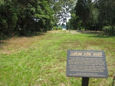
Near Bayside Beach Road, 2.3 miles east of Fort Smallwood Road (Maryland Route 173), on the right when traveling east.
On June 22-24, 1608, Captain John Smith and his small crew in an open boat explored the waters adjacent to Hancock's Resolution Park. This is proved by his mapping of the Magothy River, Bodkin Creek, and the Patapsco River (which he called the . . . — — Map (db m9279) HM
The Gwynns Falls Trail at Middle Branch Park is a splendid place to do some birdwatching, learn to row, try your luck fishing, and relax while enjoying views of the city’s skyline and harbor activities. To the north, under I-95, the Gwynns Falls . . . — — Map (db m65304) HM
John Smith and his crew visited this area in June 1608. After passing several shallow creeks, they entered the deep waters of the Patapsco River with hopes of finding exportable metals and a passage to the Pacific Ocean.
With only rotted bread . . . — — Map (db m95980) HM
About the Sassafras River The Sassafras River is a popular destination for recreation, boating, fishing and waterfowl. The Sassafras River is over 20 miles long and provides critical habitat wildlife and is an important flyway for migrating . . . — — Map (db m156879) HM
Explore the landscapes of the early 1600s along the Captain John Smith Chesapeake National Historic Trail. Learn about the thriving American Indian communities John Smith encountered and imagine the bountiful Chesapeake he observed. Experience the . . . — — Map (db m144819) HM
Captain John Smith Chesapeake National Historic Trail
“Passing along the coast, searching every inlet, and bay, fit for harbours and habitations…”
Captain Johns Smith, describing his explorations of the Chesapeake region in 1608. . . . — — Map (db m129116) HM
Near Crain Hwy (Maryland Route 301) 0.1 miles south of Clifton Drive.
Captain John Smith Chesapeake National Historic Trail
This unique trail is designed for you to experience by boat. It is America’s first waterway national historic trail and includes more than 3,000 miles explored by Captain John Smith.
The . . . — — Map (db m129104) HM
Near Rose Hill Road, 1.7 miles north of Port Tobacco Road.
Captain John Smith Chesapeake National Historic Trail
“Passing along the coast, searching every inlet, and bay, fit for harbours and habitations…”
Captain Johns Smith, describing his explorations of the Chesapeake region . . . — — Map (db m120538) HM
On Port Tobacco Road, 1.7 miles north of Port Tobacco Road.
Captain John Smith Chesapeake National Historic Trail
This unique trail is designed for you to experience by boat. It is America’s first waterway national historic trail and includes more than 3,000 miles explored by Captain John Smith. . . . — — Map (db m120541) HM
On Chapel Point Rd, 0.5 miles west of Aries Road, on the right when traveling west.
Captain John Smith Chesapeake National Historic Trail
This unique trail is designed for you to experience by boat. It is America’s first waterway national historic trail and includes more than 3,000 miles explored by Captain John Smith. . . . — — Map (db m135485) HM
On Sweden Point Road, 1 mile Chicamuxen Road (Route 224).
Captain John Smith explored the Chesapeake Bay in the early 1600s seeking precious metals and a passage to Asia. He traveled the James, Chickahominy, and York rivers in 1607, and led two major expeditions from Jamestown in 1608. Smith and his . . . — — Map (db m135465) HM
On Sweden Point Road near Chicamuxen Road (Route 224).
Explore the places Englishman John Smith traveled in the early 1600s. Learn about the thriving American Indian communities he encountered and imagine the bountiful Chesapeake he observed. Experience the natural and cultural richness that exists . . . — — Map (db m135466) HM
John Smith and his crew spent a month exploring the Potomac River in 1608, during the first voyage through the region. Smith mapped the town of Pamacocack at the mouth of the Mattawoman Creek.
This powerful creek with its teeming diversity still . . . — — Map (db m98210) HM
Boarded by two rivers that flow into the Chesapeake Bay, Dorchester County is graced with expansive marshes, fertile farmland, and scented pine forests. Here on the south shore of the Choptank River, the county seat of Cambridge boasts the only deep . . . — — Map (db m66638) HM
On Water Street, on the right when traveling north.
In 1608, when English Captain John Smith sailed up the Nanticoke River in a small, open boat, he met and traded with the native people near here. Today Vienna is a stop on the Captain John Smith Chesapeake National Historic Trail.
Founded in . . . — — Map (db m63298) HM
On Race Street at Market Street, on the left when traveling east on Race Street.
Welcome to Vienna, Maryland. Situated on a bend in the Nanticoke River, Vienna has been a crossroads, a trading center, and a gateway to the Chesapeake Bay for centuries. Today Vienna is busily planning for its future while embracing its past. With . . . — — Map (db m63292) HM
Captain John Smith explored the Chesapeake Bay in the early 1600s seeking metals and a passage to Asia. He traveled the James, Chickahominy, and York rivers in 1607, and led two major expeditions from Jamestown in 1608. Smith and his crew sailed . . . — — Map (db m63333) HM
On the Maryland House rest stop (Interstate 95 at milepost 82). Reported missing.
Explore the landscapes of the early 1600s along the Captain John Smith Chesapeake National Historic Trail. Learn about the thriving American Indian communities John Smith encountered and imagine the bountiful Chesapeake he observed. Experience . . . — — Map (db m212529) HM
The Sassafras River Water Trail
From the headwaters near the Route 301 Bridge to the river's mouth between Grove Point and Howell Point, the Sassafras River Water Trail winds past forested shorelines, bucolic farms, and high sandy cliffs for . . . — — Map (db m167808) HM
In 1608, English explorer Captain John Smith conducted two expeditions on the Chesapeake Bay. He was charged by the Virginia Company to seek precious metals and a water passage to the Pacific. His first voyage focused on the Bay's western shore. His . . . — — Map (db m64349) HM
This place has been the heart of the Piscataway people’s homeland for many centuries. Their leader’s town, Moyaone, was located here when John Smith and his crew visited in June 1608.
Smith did not write much about the Piscataway, except that . . . — — Map (db m96416) HM
Explore the places Englishman John Smith traveled in the early 1600s. Learn about the thriving American Indian communities he encountered and imagine the bountiful Chesapeake he observed. Experience the natural and cultural richness that exists . . . — — Map (db m96418) HM
Imagine you are parched and can’t find fresh water. That’s what happened to John Smith and his crew as they explored the Chesapeake’s Lower Eastern Shore in June 1608.
They sailed up the Pocomoke River, recorded on Smith’s map as the . . . — — Map (db m98726) HM
On Bayview Road west of Dave Bailey Road, on the right when traveling west.
Captain John Smith Chesapeake National Historic Trail
"Passing along the coast, searching every inlet, and bay, fit for harbours and habitations…"
Captain John Smith, describing his explorations of the Chesapeake . . . — — Map (db m204839) HM
On Bayview Road west of Dave Bailey Road, on the right when traveling west.
Captain John Smith Chesapeake National Historic Trail
This unique trail is designed for you to experience by boat. It is America's first waterway national historic trail and includes more than 3,000 miles explored by Captain John Smith. . . . — — Map (db m204840) HM
Near Cherry Street just west of Burns Street, on the left when traveling west. Reported permanently removed.
This modest open boat is a replica of one of the most important vessels in American History. In the summer of 1608, a small boat or "Shallop" similar to this was used by Captain John Smith to make the first detailed European exploration of the . . . — — Map (db m61332) HM
On Mill Street just west of Burns Street, on the left when traveling west.
In the summer of 1608, a small boat or a "shallop" like this was used by Captain John Smith to make the first detailed European exploration of the Chesapeake Bay. In the decades that followed, the knowledge gained from Smith's voyages played a key . . . — — Map (db m138304) HM
On Main Street at Smith Street, on the right when traveling south on Main Street.
In 1785, families from the young state of New Jersey moved to this area, led by brothers Reuben and Jeremiah Manning. They laid out streets for the new town of Waynesburg. Across the river, Scotch-Irish settlers headed for local taverns would . . . — — Map (db m200425) HM
Near Wilcox Neck Road (Virginia Route 623) 0.5 miles north of The Glebe Lane (Virginia Route 615).
(left panel)
Sustaining a Credible Illusion
The Jamestown settlement was facing a severe food shortage in November of 1607. Captain John
Smith set out to trade for corn with the Indians living along this river. He traveled from . . . — — Map (db m46511) HM
On Wilcox Wharf Road, 1.2 miles south of John Tyler Memorial Highway (Virginia Route 5).
(panel 1)
John Smith Explores the Chesapeake
Captain John Smith explored the Chesapeake Bay in the early 1600s seeking precious metals and a passage to Asia. He traveled the James, Chickahominy, and York rivers in 1607, and led . . . — — Map (db m89568) HM
Near Henricus Park Road, 1.3 miles east of Coxendale Road.
(panel 1)
John Smith Explores the Chesapeake
Captain John Smith explored the Chesapeake Bay in the early 1600s seeking precious metals and a passage to Asia. He traveled the James, Chickahominy, and York rivers in 1607, and led . . . — — Map (db m128321) HM
On Henricus Park Road, 1.4 miles east of Coxendale Road, on the left when traveling east.
As the small band of Jamestown colonists explored the upper reaches of the tidal James River in May 1607, they stopped twice at the town of Arrohateck, home to an estimated 255 Algonquian-speaking natives. On both occasions they were welcomed by . . . — — Map (db m149628) HM
On Henricus Park Road, 1.4 miles east of Coxendale Road, on the left when traveling east.
Captain John Smith explored the Chesapeake Bay in the early 1600s seeking precious metals and a passage to the Pacific. He traveled the James, Chickahominy and York rivers in 1607, and led two major expeditions on the Chesapeake from Jamestown in . . . — — Map (db m149625) HM
On Henricus Park Road, 1.4 miles east of Coxendale Road, on the left when traveling east.
Explore the places John Smith and the English colonists traveled in the early 1600s. Learn about the thriving American Indian communities and the bountiful richness that still exists in the region today.
For more than 3,000 miles, the . . . — — Map (db m149626) HM
Near Tidewater Trail (U.S. 17) 1 mile north of Airport Road (Virginia Route 627), on the left when traveling north.
(panel 1)
Bountiful Marshes
Meandering stretches of area rivers, such as this section of the Rappahannock, produce large freshwater marshes. Virginia Indians valued them as rich sources of food, often locating settlements nearby. . . . — — Map (db m97182) HM
On Newbill Drive (County Route T-1013) north of Prince Street, on the left when traveling north.
(panel 1)
Enduring Records
Smith explored the Rappahannock River in 1607 and 1608. He wrote of his encounters with local tribes in colorful stories of skirmishes and other adventures. Many of these accounts, some published 16 years . . . — — Map (db m97129) HM
Near High Point Road, 2.8 miles south of Gunston Road (Virginia Route 242/600).
(panel 1)
John Smith and other English settlers marveled at the abundance of birds in this area. Visitors today can still discover an amazing variety of birds here.
Known for its bald eagles, the Mason Neck Peninsula also hosts many . . . — — Map (db m98162) HM
On Gunston Road (Virginia Route 242) 0.2 miles south of Old Colchester Road (Virginia Route 611), on the right when traveling south.
Elizabeth Hartwell Mason Neck National Wildlife Refuge
…A serene place, where young blue herons learn to fish in the marshes, and wood thrushes trill their flute-like song through the stillness of hardwood forests. A place . . . — — Map (db m197456) HM
39 ► Virginia, Fredericksburg — No Outlet — Captain John Smith Chesapeake National Historic Trail — National Park Service, U.S. Department of the Interior —
Near Sophia Street, 0.2 miles south of Frederick Street, on the left when traveling south.
(panel 1)
No Outlet
Smith explored several Chesapeake rivers hoping to find a water passage to the Pacific Ocean. Instead, he discovered that even the longest rivers reached a point—a fall line—where higher ground . . . — — Map (db m97355) HM
On Main Street (Business U.S. 17) just west of John Lemon Lane, on the right when traveling west.
Along York River's Purtan Pay in Gloucester County lies perhaps the most significant American Indian landscape in the eastern United States. Captain John Smith describes visiting Werowocomoco below where the York divides into the Mattaponi and . . . — — Map (db m175984) HM
Near Osborne Turnpike north of Kingsland Road, on the right when traveling south.
(panel 1)
Curvy Course
Navigating the curving meanders of the river above Jamestown was tedious for boaters in John Smith’s day. Too difficult to sail, men had to row through long stretches known as the oxbows. Yet the colonists . . . — — Map (db m97344) HM
On Deep Bottom Road, 0.3 miles east of James Street, on the left when traveling south.
(panel 1)
John Smith Explores the Chesapeake
Captain John Smith explored the Chesapeake Bay in the early 1600s seeking precious metals and a passage to Asia. He traveled the James, Chickahominy, and York rivers in 1607, and led . . . — — Map (db m186658) HM
On North Airport Drive (Virginia Route 156) 0.3 miles north of Old Hanover Road, on the left when traveling north.
(left panel)
The Chickahominy Tribe
The Chickahominy Tribe originally lived in permanent villages along the Chickahominy River. The Chickahominy were among the first indigenous people to encounter European settlers. Tribal members . . . — — Map (db m92903) HM
More than 100,000 rivers, streams, and creeks flow through the Chesapeake region. This massive web of waterways includes some 11,000 miles of shoreline---more than that of the entire U.S. West Coast.
For centuries, these watercourses comprised . . . — — Map (db m98262) HM
Near Jamestown Road (Virginia Route 31) 0.4 miles south of Greensprings Road (Virginia Route 614), on the right when traveling south.
(panel 1)
John Smith Explores the Chesapeake
Captain John Smith explored the Chesapeake Bay in the early 1600s seeking precious metals and a passage to Asia. He traveled the James, Chickahominy, and York rivers in 1607, and led two . . . — — Map (db m97301) HM
Near York River Park Road (County Route 696) 2.1 miles north of Riverview Road (County Route 606), on the right when traveling north.
(panel 1)
Powhatan's Headquarters
At the time Captain John Smith traveled the York River, several Eastern Virginia Algonquian tribes paid tribute to a spiritual and political leader named Powhatan. In return, he provided . . . — — Map (db m97289) HM
Near Caledon State Park Road, 3.6 miles north of Caledon Road (Virginia Route 218).
(panel 1)
All that Glitters
When John Smith and his crew explored the Potomac River in 1608, they were looking for a passageway to the Pacific and for precious metals. They heard about a black ore with silvery glitters, which . . . — — Map (db m81200) HM
Near Belle Isle Road, 0.5 miles south of Creek Landing Road, on the right when traveling south.
(panel 1)
Trade Routes
Virginia Indians at the time of Captain Smith’s explorations were part of a vast commerce and communications network that extended to the Gulf Coast, New England, and the Great Lakes.
Native people on . . . — — Map (db m97199) HM
Near Jackson Creek Road (Virginia Route 660) 0.1 miles south of Bucks View Lane (Virginia Route 683), on the left when traveling south.
Nearby Stingray Point was named for a fish that almost killed John Smith in July 1608. After running aground in the sandy flats near the point, the explorers speared fish with their swords as they waited for the tide to rise.
Not realizing . . . — — Map (db m97223) HM
On Oyster Road (Virginia Route 1002) 0.2 miles north of Virginia Street (Virginia Route 602), on the left when traveling north.
(panel 1)
Smith's Snapshot
The semi-permanent nature of their towns reflected the highly sustainable lifestyle of Virginia’s Indians. They located towns next to waterways, in places with the best soils. As farming depleted . . . — — Map (db m97249) HM
On Outpost Road, 0.6 miles south of Rockahock Road, on the right when traveling south.
(left panel)
Sustaining Courage for Exploration
In December 1607 John Smith set out from Jamestown to continue his exploration of the Chickahominy River, which had begun with a series of trading voyages in November. He visited . . . — — Map (db m83910) HM
Near Riverpark Road north of Mercury Boulevard (U.S. 258), on the left when traveling north.
(panel 1)
Looking across the James here on June 2, 1608, you might have seen a strange sight. A large vessel sailed past with a smaller vessel in tow—neither resembling the canoes used by native people on this river.
The . . . — — Map (db m98385) HM
On Kiptopeke Drive (County Route 704) 1.4 miles west of Lankdorf Highway (U.S. 13).
(panel 1)
On June 2, 1608, John Smith and his crew set sail on the first of two voyages exploring the Chesapeake region. Their first stop was the Eastern Shore. At a place near today’s Cape Charles, they saw Indian men fishing with . . . — — Map (db m98497) HM
Near Daniel K Ludwig Drive, 2.3 miles south of Neabsco Road, on the right when traveling east.
(panel 1)
Swimming in Bounty
When John Smith and his crew reached the Potomac River in July 1608, they were amazed by the abundance of fish, having seen “neither better fish, more plenty, nor more variety” anywhere.
Virginia . . . — — Map (db m233923) HM
On Tredegar Street, 0.1 miles west of Brown's Island Way, on the left when traveling west.
Jamestown colonists first saw the falls of the James in May 1607 during an exploratory trip to find the head of the river. John Smith and Gabriel Archer described the falls in their journals. Smith recorded how the violent waters brought an abrupt . . . — — Map (db m182692) HM
On Brander Street east of Manchester Road, on the left when traveling south.
On May 21, 1607, a week after establishing Jamestown, Christopher Newport led a small band of colonists, including John Smith, up the James River. They were carrying out orders from their sponsors, the Virginia Company of London, to discover "the . . . — — Map (db m133683) HM
Near Brooke Road (County Route 608) 0.3 miles east of Sentinel Ridge Lane, on the right when traveling east.
(panel 1)
Captain Smith explored the Chesapeake Bay in the early 1600s seeking precious metals and a passage to Asia. He traveled the James, Chickahominy, and York rivers in 1607, and led two major expeditions from Jamestown in 1608. . . . — — Map (db m75973) HM
The English were eager to find precious metals that could
be exported for profit, as instructed by their sponsors — the Virginia Company of London. They learned that a black substance with silver glitters came from the Patawomeck tribe, who lived . . . — — Map (db m228062) HM
Captain John Smith explored the Chesapeake Bay in the early 1600s seeking precious metals and a passage to Asia. He traveled the James, Chickahominy, and York rivers in 1607, and led two major expeditions from Jamestown in 1608. Smith and his crew . . . — — Map (db m98298) HM
Indians cultivated fertile lands along the James River for centuries before the colonists arrived in 1607. They grew squash, corn, and beans to supplement their diet of native plants, fish, shellfish, and game. When the soils at a house site became . . . — — Map (db m98214) HM
Near Shore Drive (U.S. 60) near Cypress Swamp (Virginia Route 343), on the left when traveling east.
(panel 1)
After nearly five months at sea, 104 Englishmen landed here at dawn on April 26, 1607. To honor their prince, they named the site Cape Henry and planted a wooden cross.
Fearing rival Spanish vessels, the newcomers headed . . . — — Map (db m98478) HM
Near State Park Road (Virginia Route 347) 0.5 miles north of Virginia Route 686.
(panel 1)
Putting the Potomac on the Map
John Smith and his crews explored the Potomac in June 1608. The river, which Smith called the Patawomeck, is featured on his famous map of Virginia.
Smith returned to England in 1609 . . . — — Map (db m81214) HM
Near Water Street west of Buckner Street, on the right when traveling west.
Captain John Smith explored the Chesapeake Bay in the early 1600s seeking precious metals and a passage to Asia. He traveled the James, Chickahominy, and York rivers in 1607, and led two major expeditions from Jamestown in 1608. Smith and his crew . . . — — Map (db m64649) HM
Near Water Street west of Buckner Street, on the right when traveling west.
Explore the places Englishman John Smith traveled in the early 1600s. Learn about the thriving American Indian communities he encountered and imagine the bountiful Chesapeake he observed. Experience the natural and cultural richness that exists . . . — — Map (db m64647) HM
On Ballard Street (Virginia Route 1020) at Main Street, on the left when traveling north on Ballard Street.
With his contempt for the distant English gentlemen who demanded the colonists search for gold instead of focus on building a strong settlement, Smith foreshadows the anger that Americans felt under British rule.
The lowborn colonists who . . . — — Map (db m34005) HM