65 entries match your criteria.
Captain John Smith Chesapeake National Historic Trail Historical Markers
When Englishman Captain John Smith explored the Bay in 1608, he documented hundreds of American Indian communities. The National Park Service has placed markers at many of these sites along the shores of the Chesapeake Bay.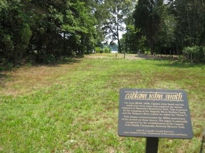
By F. Robby, July 6, 2008
Distant View of Bodkin Creek
| 1 ► Maryland, Anne Arundel County, Pasadena — Captain John Smith — |
| Near Bayside Beach Road, 2.3 miles east of Fort Smallwood Road (Maryland Route 173), on the right when traveling east. | |||
| 2 ► Maryland, Baltimore, Cherry Hill — Gwynns Falls Trail — Middle Branch Park at Waterview Avenue — |
| On Waterview Avenue. | |||
| 3 ► Maryland, Baltimore County, Sparrows Point — Hard Travel — Captain John Smith Chesapeake National Historic Trail — National Park Service, U.S. Department of the Interior — |
| On Old Bay Shore Road. | |||
| 4 ► Maryland, Cecil County, Earleville — The Sassafras River — Gateway to the Chesapeake Bay — |
| On Mount Harmon Road. | |||
| 5 ► Maryland, Cecil County, North East — Explore the Chesapeake — Captain John Smith Chesapeake National Historic Trail — |
| On Interstate 95. | |||
| 6 ► Maryland, Charles County, Newburg — Discover Southern Maryland’s Amazing Stories of Exploration, Hope, and Courage — |
| Near Crain Hwy, 0.1 miles south of Clifton Drive. | |||
| 7 ► Maryland, Charles County, Newburg — Ways to Explore Southern Maryland’s Scenic and Historic Routes — |
| Near Crain Hwy (Maryland Route 301) 0.1 miles south of Clifton Drive. | |||
| 8 ► Maryland, Charles County, Port Tobacco — Discover Southern Maryland’s Amazing Stories of Exploration, Hope, and Courage — |
| Near Rose Hill Road, 1.7 miles north of Port Tobacco Road. | |||
| 9 ► Maryland, Charles County, Port Tobacco — Ways to Explore Southern Maryland’s Scenic and Historic Routes — |
| On Port Tobacco Road, 1.7 miles north of Port Tobacco Road. | |||
| 10 ► Maryland, Charles County, Port Tobacco — Ways to Explore Southern Maryland’s Scenic and Historic Routes — |
| On Chapel Point Rd, 0.5 miles west of Aries Road, on the right when traveling west. | |||
| 11 ► Maryland, Charles County, Rison — John Smith Explores the Chesapeake — Captain John Smith Chesapeake National Historical Trail — National Park Service, U.S. Department of the Interior — |
| On Sweden Point Road, 1 mile Chicamuxen Road (Route 224). | |||
| 12 ► Maryland, Charles County, Rison — Join the Adventure — Captain John Smith Chesapeake National Historic Trail — National Park Service, U.S. Department of the Interior — |
| On Sweden Point Road near Chicamuxen Road (Route 224). | |||
| 13 ► Maryland, Charles County, Rison — Rich Resources — Captain John Smith Chesapeake National Historic Trail — National Park Service, U.S. Department of the Interior — |
| On Sweden Point Road. | |||
| 14 ► Maryland, Dorchester County, Cambridge — Discover: Dorchester — |
| On Rose Hill Place. | |||
| 15 ► Maryland, Dorchester County, Vienna — Discover: Vienna — Welcome to Vienna, Maryland — |
| On Water Street, on the right when traveling north. | |||
| 16 ► Maryland, Dorchester County, Vienna — Discover: Vienna Heritage — |
| On Race Street at Market Street, on the left when traveling east on Race Street. | |||
| 17 ► Maryland, Dorchester County, Vienna — John Smith Explores the Chesapeake — Captain John Smith Chesapeake National Historic Trail — |
| On Middle Street. | |||
| 18 ► Maryland, Harford County, Aberdeen — Explore the Chesapeake — Captain John Smith Chesapeake National Historic Trail |
| On the Maryland House rest stop (Interstate 95 at milepost 82). Reported missing. | |||
| 19 ► Maryland, Kent County, Betterton — Betterton — Sassafras River Water Trail — |
| On Ericsson Avenue, on the right. | |||
| 20 ► Maryland, Kent County, Turner's Creek Landing — Captain John Smith on the Sassafras River — |
| Near Turners Creek Road. | |||
| 21 ► Maryland, Prince George's County, Accokeek — Cherished Homeland — Captain John Smith Chesapeake National Historic Trail — National Park Service, U.S. Department of the Interior — |
| On Bryan Point Road. | |||
| 22 ► Maryland, Prince George's County, Accokeek — Join the Adventure — Captain John Smith Chesapeake National Historic Trail — National Park Service, U.S. Department of the Interior — |
| On Bryan Point Road. | |||
| 23 ► Maryland, Somerset County, Crisfield — Searching for Water — Captain John Smith Chesapeake National Historic Trail — National Park Service, U.S. Department of the Interior — |
| On Alfred Lawson Drive. | |||
| 24 ► Maryland, St. Mary's County, Coltons Point — Discover Southern Maryland's Amazing Stories of Exploration, Hope, and Courage — |
| On Bayview Road west of Dave Bailey Road, on the right when traveling west. | |||
| 25 ► Maryland, St. Mary's County, Coltons Point — Ways to Explore Southern Maryland's Scenic and Historic Routes — |
| On Bayview Road west of Dave Bailey Road, on the right when traveling west. | |||
| 26 ► Maryland, Talbot County, St. Michaels — Captain John Smith's Shallop — and America's First National Water Trail |
| Near Cherry Street just west of Burns Street, on the left when traveling west. Reported permanently removed. | |||
| 27 ► Maryland, Talbot County, St. Michaels — Shallop — Replica — Chesapeake Bay Maritime Museum — |
| On Mill Street just west of Burns Street, on the left when traveling west. | |||
| 28 ► Pennsylvania, Lycoming County, Jersey Shore — 'Let's Go to the Jersey shore!' — |
| On Main Street at Smith Street, on the right when traveling south on Main Street. | |||
| 29 ► Virginia, Charles City County, Charles City — Chickahominy Water Trail — |
| Near Wilcox Neck Road (Virginia Route 623) 0.5 miles north of The Glebe Lane (Virginia Route 615). | |||
| 30 ► Virginia, Charles City County, Charles City — John Smith Explores the Chesapeake — Captain John Smith Chesapeake National Historic Trail — |
| On Wilcox Wharf Road, 1.2 miles south of John Tyler Memorial Highway (Virginia Route 5). | |||
| 31 ► Virginia, Chesterfield County, Chester — John Smith Explores the Chesapeake — Captain John Smith Chesapeake National Historic Trail — |
| Near Henricus Park Road, 1.3 miles east of Coxendale Road. | |||
| 32 ► Virginia, Chesterfield County, Dutch Gap — Ill-Fated Friendship — Captain John Smith Chesapeake National Historic Trail — National Park Service, U.S. Department of the Interior — |
| On Henricus Park Road, 1.4 miles east of Coxendale Road, on the left when traveling east. | |||
| 33 ► Virginia, Chesterfield County, Dutch Gap — John Smith Explores the Chesapeake — Captain John Smith Chesapeake National Historic Trail — National Park Service, U.S. Department of the Interior — |
| On Henricus Park Road, 1.4 miles east of Coxendale Road, on the left when traveling east. | |||
| 34 ► Virginia, Chesterfield County, Dutch Gap — Join the Adventure — Captain John Smith Chesapeake National Historic Trail — National Park Service, U.S. Department of the Interior — |
| On Henricus Park Road, 1.4 miles east of Coxendale Road, on the left when traveling east. | |||
| 35 ► Virginia, Essex County, Tappahannock — Bountiful Marshes — Captain John Smith Chesapeake National Historic Trail — National Park Service, U.S. Department of the Interior — |
| Near Tidewater Trail (U.S. 17) 1 mile north of Airport Road (Virginia Route 627), on the left when traveling north. | |||
| 36 ► Virginia, Essex County, Tappahannock — Enduring Records — Captain John Smith Chesapeake National Historic Trail — |
| On Newbill Drive (County Route T-1013) north of Prince Street, on the left when traveling north. | |||
| 37 ► Virginia, Fairfax County, Lorton — Birds Then and Now — Captain John Smith Chesapeake National Historic Trail — National Park Service, U.S. Department of the Interior — |
| Near High Point Road, 2.8 miles south of Gunston Road (Virginia Route 242/600). | |||
| 38 ► Virginia, Fairfax County, Lorton — Elizabeth Hartwell Mason Neck National Wildlife Refuge / Explore a Trail Network — |
| On Gunston Road (Virginia Route 242) 0.2 miles south of Old Colchester Road (Virginia Route 611), on the right when traveling south. | |||
| 39 ► Virginia, Fredericksburg — No Outlet — Captain John Smith Chesapeake National Historic Trail — National Park Service, U.S. Department of the Interior — |
| Near Sophia Street, 0.2 miles south of Frederick Street, on the left when traveling south. | |||
| 40 ► Virginia, Gloucester County, Gloucester — A Sacred Place — Captain John Smith Chesapeake National Historic Trail — National Park Service, U.S. Department of the Interior — |
| On Main Street (Business U.S. 17) just west of John Lemon Lane, on the right when traveling west. | |||
| 41 ► Virginia, Henrico County, Richmond — Curvy Course — Captain John Smith Chesapeake National Historic Trail — |
| Near Osborne Turnpike north of Kingsland Road, on the right when traveling south. | |||
| 42 ► Virginia, Henrico County, Richmond — John Smith Explores the Chesapeake — Captain John Smith Chesapeake National Historic Trail — |
| On Deep Bottom Road, 0.3 miles east of James Street, on the left when traveling south. | |||
| 43 ► Virginia, Henrico County, Sandston — Chickahominy Water Trail — |
| On North Airport Drive (Virginia Route 156) 0.3 miles north of Old Hanover Road, on the left when traveling north. | |||
| 44 ► Virginia, Isle of Wight County, Smithfield — Liquid Maze — Captain John Smith Chesapeake National Historic Trail — National Park Service, U.S. Department of the Interior — |
| On Jericho Road. | |||
| 45 ► Virginia, James City County, Jamestown Settlement — John Smith Explores the Chesapeake — Captain John Smith Chesapeake National Historic Trail — National Park Service, U.S. Department of the Interior — |
| Near Jamestown Road (Virginia Route 31) 0.4 miles south of Greensprings Road (Virginia Route 614), on the right when traveling south. | |||
| 46 ► Virginia, James City County, Williamsburg — Powhatan’s Headquarters — Captain John Smith Chesapeake National Historic Trail — National Park Service, U.S. Department of the Interior — |
| Near York River Park Road (County Route 696) 2.1 miles north of Riverview Road (County Route 606), on the right when traveling north. | |||
| 47 ► Virginia, King George County, King George — All that Glitters — Captain John Smith Chesapeake National Historic Trail — |
| Near Caledon State Park Road, 3.6 miles north of Caledon Road (Virginia Route 218). | |||
| 48 ► Virginia, Lancaster County, Lancaster — Trade Routes — Captain John Smith Chesapeake National Historic Trail — |
| Near Belle Isle Road, 0.5 miles south of Creek Landing Road, on the right when traveling south. | |||
| 49 ► Virginia, Middlesex County, Deltaville — Fish Story — Captain John Smith Chesapeake National Historic Trail — National Park Service, U.S. Department of the Interior — |
| Near Jackson Creek Road (Virginia Route 660) 0.1 miles south of Bucks View Lane (Virginia Route 683), on the left when traveling south. | |||
| 50 ► Virginia, Middlesex County, Urbanna — Smith’s Snapshot — Captain John Smith Chesapeake National Historic Trail — National Park Service, U.S. Department of the Interior — |
| On Oyster Road (Virginia Route 1002) 0.2 miles north of Virginia Street (Virginia Route 602), on the left when traveling north. | |||
| 51 ► Virginia, New Kent County, Walker — Chickahominy Water Trail — |
| On Outpost Road, 0.6 miles south of Rockahock Road, on the right when traveling south. | |||
| 52 ► Virginia, Newport News, South Newport News — Heading Out — Captain John Smith Chesapeake National Historic Trail — National Park Service, U.S. Department of the Interior — |
| Near Riverpark Road north of Mercury Boulevard (U.S. 258), on the left when traveling north. | |||
| 53 ► Virginia, Northampton County, Cape Charles — A Good Start — Captain John Smith Chesapeake National Historic Trail — National Park Service, U.S. Department of the Interior — |
| On Kiptopeke Drive (County Route 704) 1.4 miles west of Lankdorf Highway (U.S. 13). | |||
| 54 ► Virginia, Prince William County, Leesylvania — Swimming in Bounty — Captain John Smith Chesapeake National Historic Trail — National Park Service, U.S. Department of the Interior — |
| Near Daniel K Ludwig Drive, 2.3 miles south of Neabsco Road, on the right when traveling east. | |||
| 55 ► Virginia, Richmond, Gambles Hill — Water Power — Captain John Smith Chesapeake National Historic Trail — |
| On Tredegar Street, 0.1 miles west of Brown's Island Way, on the left when traveling west. | |||
| 56 ► Virginia, Richmond, Manchester — Up-River Venture — Captain John Smith Chesapeake National Historic Trail — National Park Service, U.S. Department of the Interior — |
| On Brander Street east of Manchester Road, on the left when traveling south. | |||
| 57 ► Virginia, Stafford County, Stafford — John Smith Explores the Chesapeake — Captain John Smith Chesapeake National Historic Trail — |
| Near Brooke Road (County Route 608) 0.3 miles east of Sentinel Ridge Lane, on the right when traveling east. | |||
| 58 ► Virginia, Stafford County, Stafford — Searching for Silver — Captain John Smith Chesapeake National Historic Trail — National Park Service, U.S. Department of the Interior — |
| On Willow Oak Lane. | |||
| 59 ► Virginia, Suffolk, Sleepy Hole — John Smith Explores the Chesapeake — Captain John Smith Chesapeake National Historic Trail — National Park Service, U.S. Department of the Interior — |
| On Bennetts Creek Park Road. | |||
| 60 ► Virginia, Surry County, Surry — Working the Land — Captain John Smith Chesapeake National Historic Trail — National Park Service, U.S. Department of the Interior — |
| On Chippokes Park Road. | |||
| 61 ► Virginia, Virginia Beach, Cape Henry — Land Ho! — Captain John Smith Chesapeake National Historic Trail — National Park Service, U.S. Department of the Interior — |
| Near Shore Drive (U.S. 60) near Cypress Swamp (Virginia Route 343), on the left when traveling east. | |||
| 62 ► Virginia, Westmoreland County, Montross — Putting the Potomac on the Map — Captain John Smith Chesapeake National Historic Trail — |
| Near State Park Road (Virginia Route 347) 0.5 miles north of Virginia Route 686. | |||
| 63 ► Virginia, York County, Yorktown — John Smith Explores the Chesapeake — Captain John Smith Chesapeake National Historic Trail — |
| Near Water Street west of Buckner Street, on the right when traveling west. | |||
| 64 ► Virginia, York County, Yorktown — Join the Adventure — Captain John Smith Chesapeake National Historic Trail — National Park Service, U.S. Department of the Interior — |
| Near Water Street west of Buckner Street, on the right when traveling west. | |||
| 65 ► Virginia, York County, Yorktown — 34 — Yorktown — Captain John Smith’s Adventures on the Pamaunk Flu — www.johnsmithtrail.org — |
| On Ballard Street (Virginia Route 1020) at Main Street, on the left when traveling north on Ballard Street. | |||