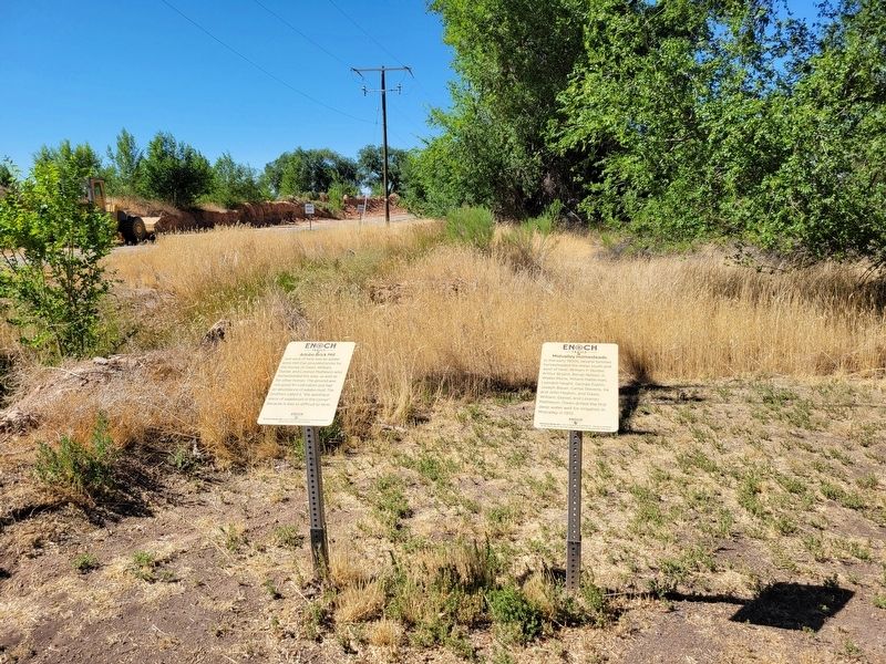
On West Midvalley Road, on the right when traveling west.
Just west of here was an adobe brick mill that provided bricks for the homes of Owen, William, Daniel, and Lorenzo Matheson who homesteaded the area, as well as for other homes. The ground was not good for cultivation but had an abundance of adobe . . . — — Map (db m256628) HM
On West Midvalley Road, on the right when traveling south.
The first school in the Midvalley area was a one-room building on land just west of here donated by Owen Matheson. In 1916 it was struck by lightning and burned to the ground. Students then moved south to William Matheson's adobe brick home, called . . . — — Map (db m256633) HM
On West Midvalley Road, on the right when traveling south.
Beginning in 1931, Midvalley students began attending school in Cedar City. At that time, the school bus only came as far as Fiddlers Canyon about five miles away. Owen Matheson and Millard Halterman took turns taking students to meet the bus in . . . — — Map (db m256631) HM
On West Midvalley Road, on the right when traveling west.
In the early 1900s, several families homesteaded the areas south and west of here: William P. Hunter, Arthur Bryant, Bengt Nelson Jr., Walter Murie, Millard Halterman, Leonard Haight, George Esplin, Joseph Bauer, Carlos Stevens, Ira and John . . . — — Map (db m256629) HM
On Matheson Way, on the right when traveling west.
This building is a replica of the Old Enoch School and the Second Midvalley School. It was built by Owen and Sarah Matheson's descendants. Another replica of 1850s Deseret schools is found at the Joel Hills Johnson Museum at 1198 West Midvalley . . . — — Map (db m256620) HM
On North Enoch Road, on the right when traveling south.
]Just west of here, Enoch residents banded together in 1891-92 to erect a building which would be used as a schoolhouse, community center, and church. It was about 34 feet long and 16 to 20 feet wide. For years theatrical performances,dances, . . . — — Map (db m255931) HM
On Midvalley Road, on the right when traveling west.
The city office building was built in 2001 and the library in 2003 on land originally homesteaded by George and Elizabeth Hunter. Between the city office and the library, you can still see ruts from the Old Spanish Trail. Further history of the . . . — — Map (db m256020) HM
On Veteran's Memorial Drive, on the right when traveling south.
Named after the Catholic Church's St. Joseph, the area across the street east of here was once a lush meadow that became a popular layover for travelers on the Old Spanish Trail. Here pioneers, explorers, and others could rest safely for a few days . . . — — Map (db m255950) HM
On West Midvalley Road, on the right when traveling south.
The Third Midvalley School was built on the southwest corner of Midvalley and Bulldog Roads in about 1928. The building had an exposed partial crawlspace where students would hide and play pranks on each other and their teachers. Midvalley students . . . — — Map (db m256632) HM
On West Midvalley Road, on the right when traveling west.
In the sandy ground that is now Pearly Lane south of here, Millard Halterman raised row crops (broccoli, carrots, cabbage, potatoes, etc.) and sold them to Union Pacific Produce to raise money to support the First and Second World War efforts. To . . . — — Map (db m256627) HM
On North Enoch Road, on the right when traveling south.
The "Whitey" and Haken Anderson families established a sawmill just west of here in 1949. It operated for over five years. The trees were harvested on Cedar Mountain in the summer, and the sawmill ran during the winter, creating lumber for many . . . — — Map (db m256015) HM
On Midvalley Road, on the right when traveling west.
The small whitewashed house just north of here was built by Joseph H. Armstrong in 1881-82. By this time, his family owned Johnson's Fort, and he took down the bastion there and used the adobe brick to build this house. It was also for some years . . . — — Map (db m256018) HM
On East Midvalley Road at N 600 E, on the right when traveling west on East Midvalley Road.
Sometime soon after a telephone line was strung to the Enoch Mercantile (Marker #8), William Henry Grimshaw wanted a phone in his two-story adobe house, which was the original home here. He could not afford to extend the line, so, ignoring the . . . — — Map (db m256600) HM
On Veteran's Memorial Drive, on the right when traveling south.
This land was originally owned by Sylvester Jones who donated a portion to the LDS Church for a cemetery. When Sylvester's son, Henry, died in World War I in 1918, the church asked Sylvester to pay $50 for a plot. He thought that was unfair and . . . — — Map (db m255951) HM
On North Enoch Road, on the right when traveling south.
Several miles west of here is a series of low mountains known as Three Peaks. The peaks were used as a landmark for many years by early settlers. Thus, when Enoch City decided in 2015 to create a new logo, artist Cordelle Morris used the sun . . . — — Map (db m255933) HM
On North Enoch Road, on the right when traveling south.
Across the street to the east is the old Enoch church, built from 1909 to 1911 and dedicated by LDS Apostle Richard R. Lyman on June 28, 1918. Charles Edward Jones was called as the first bishop in Enoch. The church was built at a cost of $6,000 on . . . — — Map (db m255946) HM
On North 600 East, on the right when traveling west.
William Henry (later known as Gramps) and May Hunter Grimshaw began clearing the land in this general area in about 1905. They had seven children who developed this area which later became known as Grimshawville. The land for the park west of here . . . — — Map (db m256614) HM
On East Midvalley Road, on the right when traveling west.
An Enoch native, Ivan Matheson was a revered public servant, serving in many positions, including 12 years as a Utah State Senator. He was instrumental in legislation supporting and building many projects throughout southern Utah. He was also a . . . — — Map (db m256618) HM
In 1853 early settlers built a fort about one-quarter mile west of here for protection. The building was directed by Joel Hills Johnson, the LDS Church presiding elder for this area. It was 165 feet square and made of adobe bricks. More information . . . — — Map (db m255936) HM
On North Enoch Road, on the right when traveling south.
This general area was the initial home of the first Anglo to live in Enoch. In November 1851, Joel Hills Johnson built a rough residence of two dugout shelters and moved part of his family here in December. He was a prolific writer of poems and . . . — — Map (db m255932) HM
The small park just to the east of here was named for J. Stanford and Helen Jones. On January 10, 1966, Enoch was incorporated as a town, with Stanford Jones as the first chair of the Enoch Town board. The population of the town was 102. On August . . . — — Map (db m256016) HM
The Cedar City Co-op and Livestock Company ran cattle on its pasture north and west of Johnson's Fort until 1898. At that time, the stock-holders sold the land to Collins, Porter, and Edgar Clark and donated many of the proceeds to build a heating . . . — — Map (db m255949) HM
On North Enoch Road, on the right when traveling south.
Across the street to the east was the village mercantile building, which sold basic necessities. When the residents desired a post office in 1884, they needed a unique community name. Since they lived under a form of the LDS United Order, or Order . . . — — Map (db m256013) HM
Long before European explorers and LDS pioneers arrived in this valley, it was inhabited by members of the Southern Paiute Tribe. The low, treeless knoll north of here was a site of Paiute Tribe powwows. The powwows started well before Johnson's . . . — — Map (db m256616) HM
On East Midvalley Road, on the right when traveling west.
This fence was built by George D Grimshaw from rings used to hold together wooden water pipes. He collected the bands when the pipes were changed to metal by the Southern Utah Power Company where he worked. A similar fence was built at the Enoch . . . — — Map (db m256598) HM
On East Midvalley Road, on the right when traveling west.
The shallow lake five miles north of here was a popular recreational area for valley residents where families enjoyed dances, boat rides, mule rides, ice skating, and vacations. It also was an exchange station hosting freighters, mail carriers, and . . . — — Map (db m256617) HM
Samuel Bell built a house on this site in the 1860s. It burned down in the 1930s and was replaced by the house you see here now. Bell was one of the first permanent settlers at Johnson's Spring and was the first schoolmaster in the old logschool . . . — — Map (db m255930) HM
On Midvalley Road, on the right when traveling west.
The Charles Maxwell, Walter Murie, David Bulloch, and Bengt Nelson families established farms and residences on the land southwest between here and Cedar City. The area became known as the Valley. Much of the land was later subdivided and annexed . . . — — Map (db m256019) HM
On North Enoch Road, on the right when traveling south.
John Pidding Jones and three of his sons (all early settlers) built homes in this area, although exact locations are unknown. John Pidding Jones moved here in about 1869. He operated an iron foundry to the north of here for 20 years. His three sons . . . — — Map (db m255945) HM
Just north of here was the old bishop's storehouse and tithing office. It was used to store the offerings of members of the LDS Church. These goods (crops and other items) were then used to help others in time of need as part of the church's local . . . — — Map (db m255947) HM