On State Road 7 at West Main Street on State Road 7.
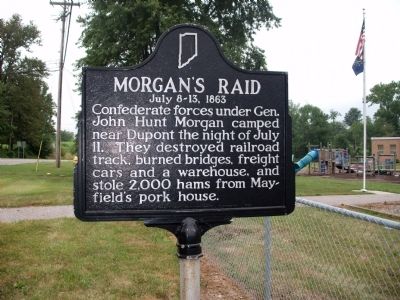
Confederate forces under Gen. John Hunt Morgan camped near Dupont the night of July 11. They destroyed railroad track, burned bridges, freight cars and a warehouse, and stole 2, 000 hams from Mayfield's pork house. — — Map (db m45875) HM
On Cragmont Street north of Presbyterian Avenue, on the right when traveling north.
Born in Madison 1839. Family home on West Main Street. Attended Hanover College 1856-1858 to pursue practice of law. Attended Kentucky Military Institute in Frankfort. Organized Madison City Greys 1858, which became part of Sixth Regiment Indiana . . . — — Map (db m206804) HM
On Elm Street at West First Street, on the right when traveling south on Elm Street.
Rendered his most important public service during the Civil War when he loaned Governor Oliver P. Morton over $400,000 to equip Indiana's troops. He later arranged additional loans to save the credit of the state. — — Map (db m180779) HM
On West 1st Street just west of Vine Street, on the left when traveling west.
One of Madison’s most prominent citizens was James Franklin Doughty Lanier. He was a pioneer and respected banker/financier. Lanier hired the talented architect Francis Costigan to design his magnificent mansion on the Ohio River, where it shines . . . — — Map (db m180800) HM
Near Michigan Road just south of East State Street, on the left when traveling south.
Born March 7, 1824, killed on his birthday March 7, 1862 during the battle of Pea Ridge, Arkansas Was the grandson of John Paul, credited with being one of the founders of Madison, Indiana Was the son of William Hendricks former Governor of the . . . — — Map (db m195501) HM
On West Street south of West Main Street, on the right when traveling north.
Side one
Born Staunton, Virginia 1813. Purchased Madison Courier 1849; transformed it from pro-Democratic to voice for newly forming Republican Party. Promoted the Union and objected to Fugitive Slave Law. Was active in Republican Party . . . — — Map (db m22055) HM
On South Old Michigan Road at U.S. 421, on the left when traveling west on South Old Michigan Road.
Hurriedly vacating Dupont early Sunday morning, July 12, 1863, General Morgan's 2,000 cavalrymen headed east. A Dupont resident, Thomas Stout, was commandeered as a guide. The raiders passed numerous farms destroying crops and gathering fresh . . . — — Map (db m100026) HM
On East Main Street west of Walnut Street, on the right when traveling east.
This shell was fired into Vicksburg, Miss. by Union Troops in 1863. Presented to the City of Madison by the Widow of Dr. W. A. Collins, Assistant Surgeon of the Sixth Indiana. — — Map (db m22058) HM
On State Road 250 at County Road 140W, on the right when traveling east on State Road 250.
Throughout the day of July 11, 1863, Morgan's Raiders streamed northward from Lexington, passing through Hinesville (now Blocher), Deputy, and Paris. As a diversionary tactic, a regiment of cavalry rode eastward on the Kent Road, creating a sense of . . . — — Map (db m99771) HM
On State Road 3, 0.1 miles south of State Road 7, on the right when traveling south.
Early Saturday morning, July 11, General Morgan and his raiders followed the roads northward from Lexington toward Vernon. At Vernon, Morgan demanded the surrender of the town, but was rebuffed. The Home Guard commander responded that the town was . . . — — Map (db m99774) HM
On North Pike Street north of Jackson Street, on the left when traveling north.
During the Civil War, Confederate General John Hunt Morgan led a raid into southern Indiana, July 8-13, 1863. On July 11, he demanded the surrender of Vernon. Colonel Hugh T. Williams, Indiana Legion,replied that Morgan must take it by hard . . . — — Map (db m242138) HM
On Jackson Street (State Road 7) east of North Pike Street, on the left when traveling east.
During the Civil War, Confederate General John Hunt Morgan led a raid into southern Indiana, July 8-13, 1863. On July 11, he demanded the surrender of Vernon. Colonel Hugh T. Williams, Indiana Legion, replied that Morgan "must take it by hard . . . — — Map (db m48965) HM
On Eisenhower Drive (State Road 252) at West River Road (a.k.a.: West Center Cross Street) (State Road 252), on the right when traveling east on Eisenhower Drive.
- - - - 1826 - - - -
Built by James Thompson and Isaac Collier.
1850 - Thompson erected larger four-story brick mill. All flour used by Union Army during Civil War ground here.
After a fire in 1872, John A. . . . — — Map (db m66784) HM
On Jefferson Street at North Main Street, on the right when traveling east on Jefferson Street.
To Commemorate the Valor
of the
Soldiers of Johnson Co.
In defense of the Union
1861 ———— 1865
— ∮— ( Relief ) — ∮—
This fountain is erected by
John T. . . . — — Map (db m55608) HM
On State Road 144 west of North Centerline Road, on the right when traveling west.
Site of presentation of an American Flag to Company F. 7th Indiana volunteer Infantry Regiment August 20, 1861. The 34-star flag, sewn by ladies of Hopewell Presbyterian Church, was received at a farewell picnic in a grove on the John H. Van Nuys . . . — — Map (db m66782) HM
Near West South Street at Ninevah Street, on the right when traveling west.
1861 1865
To honor and
commemorate the men
from
Johnson County, Indiana
who fought in the
Civil War
Erected by
Lincoln Chapter Daughters of the Union
May 30, 1940 — — Map (db m221856) WM
On North 7th Street at Broadway Street, on the right when traveling north on North 7th Street.
"In Grateful remembrance of the services and sacrifices of our soldiers in the war of The Union,
we, the people of Knox County have erected this monument." — — Map (db m23378) WM
On North 7th Street at Broadway Street, on the right when traveling north on North 7th Street.
( Upper Left Section )
Welcome to the Knox County Veterans’ Memorial Park. The monuments that stand before you are dedicated to the memory of all the military veterans from Knox County. Most prominent is the “Soldiers and . . . — — Map (db m23581) HM
Near South 6th Street west of Willow Street (Business U.S. 41).
Capt. O'Donnell was one of 1,527 recipients of the Medal of Honor during the American Civil War. The citation for his Medal of Honor reads "The Congressional Medal of Honor to Capt. Menomen O'Donnell, 11th MO. INF., for GALLANTRY at Vicksburg, MS., . . . — — Map (db m180814) HM
On Park Street south of Harrison Street, on the left when traveling south.
Two blocks South of this marker
on March 6, 1814, was born
Sarah Knox Taylor
Daughter of
Capt. And Mrs. Zachary Taylor
Miss Taylor married Lieut. Jefferson Davis
at Louisville, Kentucky on June 17, 1835
and died in West Feliciana . . . — — Map (db m23263) HM
On Vigo Street (State Road 441) at 2nd Street, on the right when traveling west on Vigo Street.
Commemorating the patriotism, devotion to duty, valor, energy and seamanship of those Americans who served in the ships
U.S.S. Vincennes
Each a man-of-war, these ships of the United States Navy carried out missions which expanded . . . — — Map (db m61817) HM WM
On Center Street at Buffalo Street, on the right when traveling west on Center Street.
These guns were donated by the government to Posts 114 & 442 G.A.R. and by them presented to Kosciusko County, to be dedicated as a monument to the Union soldiers of 1861-65. Dedicated Oct. 1897
These guns during the War of the Rebellion, . . . — — Map (db m16282) HM
On Center Street at Lake Street, on the left when traveling east on Center Street.
This memorial is dedicated in memory and in honor of the brave men and women of Kosciusko County who served God and Country in the armed force.
Rededicated July 4, 2005 — — Map (db m16278) WM
In memory of
Civil War Veterans
Village of Lima, 1864
Village of Lima Civil War Memorial
This Lima Cannon was one of two celebration cannons
for Lima & Ontario, produced in 1861 by Lima Foundry,
507 3rd Street. The villages fired . . . — — Map (db m212713) WM
On State Road 2 at Colfax Avenue, on the right when traveling west on State Road 2.
Two Civil War training camps: Colfax and Jackson, were located near La Porte. The 9th and 29th Indiana Volunteer Infantry regiments were organized and trained here. — — Map (db m43375) HM
On East Michigan Avenue (U.S. 35) at Carroll Avenue on East Michigan Avenue.
One of three Civil War training camps in La Porte County. Site is one fourth mile west. Named for Colonel Edward Anderson. Used 1863-1864 to train Indiana Union volunteers of the 127th, 128th, and 129th regiments. — — Map (db m969) HM
On W. Michigan Blvd (U.S. 12) at Washington Street, on the right when traveling east on W. Michigan Blvd.
Presented by
The Daughters of Union Veterans
of
the Civil War - 1861-1865
In memory of
our Fathers and
The Grand Army of the Republic
June 12, 1939 — — Map (db m72910) WM
(South Face)
One Country
One Flag
Sponsored by the Woman's Releif Corps
Geo. V. Rawson Post
46 Dept. Ind. G.A.R.
(East, North, and West Faces)
(List of Names) — — Map (db m77435) WM
On West Cross Street near North Illinois Street. Reported permanently removed.
On this spot where the Wanatah Station of the Monon Railroad once stood, the Lincoln funeral train made a brief stop on the morning of May 1, 1865 at approximately 7:40 a.m. The funeral train traveled 1,700 miles of its journey from Washington, DC . . . — — Map (db m3810) HM
Near North Illinois Street at West Railroad Street, on the left when traveling north.
At approximately 7:30 A.M. on the morning of May 1, 1865, the train that bore the body of Abraham Lincoln passed through Wanatah on its way from Washington to Springfield, Illinois. The train did not stop here, but slowed down to 5 miles per hour . . . — — Map (db m207793) HM
On Northshore Boulevard east of North Madison Avenue, on the right when traveling east.
At the beginning of the Civil War ground now occupied by Anderson Country Club was the site of Camp Stilwell, a training area for Union soldiers named in honor of Thomas N Stilwell, quartermaster of the 34th Indiana Regiment. The 34th, composed . . . — — Map (db m231402) HM
Civil War Dead
An estimated 700,000 Union and Confederate soldiers died in the Civil War between April 1861 and April 1865. As the death toll rose, the U.S. government struggled with the urgent but unplanned need to bury fallen Union . . . — — Map (db m233303) HM
Near Belvedere Place at West 34th Street, on the right when traveling south.
Camp Morton
Camp Morton, a training camp, was established on the Indiana State Fairgrounds in Indianapolis after President Abraham Lincoln called for 75,000 volunteers to suppress the Southern rebellion. Thousands of Indiana volunteers trained . . . — — Map (db m199029) HM
Near Belvedere Place at West 34th Street, on the right when traveling south.
Civil War Indianapolis
Indiana Governor Oliver Morton responded quickly to President Abraham Lincoln's 1861 call for 75,000 volunteers to help suppress the southern rebellion. Thousands of Hoosiers assembled in Indianapolis. Camp Morton, named . . . — — Map (db m199026) HM
Near West 38th Street east of Dr Martin Luther King Jr Street, on the right when traveling east.
Born Hertford Co. North Carolina
Sept. 12th, 1818.
Died New York City.
Febr. 26th, 1903.
The highest honors that the world can boast are subjects far too low for my desire. The brightest beams of glory are at most incomplete compared to my . . . — — Map (db m82207) HM
In memory of the unknown dead who fell in our country's service in the War for the Union A.D. 1861-65.
No name to bid us know who rests below.
No word of death or birth. Only the grasses wave over a mound of earth, over a nameless . . . — — Map (db m233305) WM
On West New York Street at North West Street (State Road 67), on the right when traveling east on West New York Street.
Was ceded to State by Congress in 1827. First City Park and site of the first State Fair 1852. Named by Gov. Morton to honor Gen. Jeremiah Sullivan. Marshalling Center during Civil War 1861-1864. — — Map (db m4619) HM
Near North West Street south of West Ohio Street, on the right when traveling south.
Philadelphia Depot Flag
(1863)
The Philadelphia Quartermaster's Depot commissioned independent contractors to manufacture the national colors issued to the Union Army during the Civil War. The 34-star double wreath pattern was particular to . . . — — Map (db m238964) HM
On North Blackford Street at Wabash Street, on the right when traveling north on North Blackford Street.
Military Park began its existence in the 1820s as a “Military Reservation” where the state militia occasionally trained. In 1852 the first Indiana State Fair was held on the grounds, and other state fairs occurred there over the next . . . — — Map (db m95385) HM
Near North Blackford Street north of Indianapolis Cultural Trail, on the right when traveling north.
Nestled in Harrison County's wooded hills and pastures, Corydon holds significant importance in Indiana's history. The city served as capital of the Indiana Territory and then as the first Indiana state capital. In 1863, John Hunt Morgan's . . . — — Map (db m238855) HM
Indiana’s only African-American Civil War regiment served as part of the 28th Regiment of U.S. Colored Troops. African-American infantry was authorized in 1863 to help fill federal quota for soldiers. The Reverend Willis Revels was recruiting . . . — — Map (db m1845) HM
On Virginia Avenue at East Street on Virginia Avenue.
Born 1798 in Ludlow, Vermont, Fletcher and his wife Sarah came to this newly-named state capital 1821. They lived here 1839–1855 on a 269-acre farm, Wood Lawn, which encompassed most of today’s Fletcher Place Historic District. He was active . . . — — Map (db m1853) HM
On North Capitol Avenue at West Market Street, on the right when traveling south on North Capitol Avenue. Reported missing.
Governor Oliver P. Morton established a state arsenal to supply Indiana's troops with ammunition. First located adjacent to the State Capitol, the arsenal was later moved to the present site of Arsenal Technical High School. — — Map (db m232356) HM
On West Washington Street (U.S. 40) at South Missouri Street, on the right when traveling west on West Washington Street.
Here, Feb 11, 1861, Abraham Lincoln, on his way to Washington to assume the Presidency, in an address said “I appeal to you to constantly bear in mind that not with politicians, not with presidents, not with office-seekers, but with you is the . . . — — Map (db m3809) HM
On North Capitol Avenue at West Market Street, on the right when traveling south on North Capitol Avenue.
Plaque One
Born in Wayne Co. Indiana August 4, 1823.
Died in Indianapolis November 1, 1877.
Aged 54 years, 2month and 25 days.
Admitted to the Bar in 1847.
Served as Governor of Indiana from January
16, 1861 to March 4, 1867. . . . — — Map (db m55573) HM
To Indiana's Silent Victors
War with Mexico 1846 1847 1848 Indiana Regiments No's. 1, 2, 3, 4, 5 4585 men
Indian and British War 1811-1812 Battle of Tippecanoe Indians defeated Nov. 7, 1811
War of the Revolution Capture of . . . — — Map (db m105767) WM
On North Meridian Street at East North Street, on the right when traveling north on North Meridian Street.
Originally known as , "Obelisk Square", this park was completed in 1930 and is situated between the American Legion Mall and the Indiana World War Memorial. Its main feature is the Obelisk fountain. This portion of the Plaza was designed originally . . . — — Map (db m132836) HM
On North Delaware Street north of East 11th Street, on the left when traveling north.
Entered the Union Army as 2nd Lt. of the 70th Indiana Regiment. He insisted on turning raw recruits into disciplined soldiers. He later was United States Senator from Indiana and the twenty-third President of the United States. — — Map (db m565) HM
Site selected by Lew Wallace as training camp for volunteers on old State Fairgrounds in 1861 and named for Governor Oliver P. Morton. Used as a camp for Confederate prisoners, 1862-65. Col. Richard Owen, Commandant. — — Map (db m1855) HM
On North Delaware Street south of East 13th Street, on the left when traveling north.
Home
of
Benjamin Harrison
23rd President of the
United States
Born August 20, 1833
Died March 13, 1901
Indiana's Own Citizen
In command of the
70th . . . — — Map (db m132870) HM
On South White River Parkway West Drive south of West Washington Street, on the right when traveling north.
Aegidius Nactner, Hanna Hornaday, Daniel Crosby Lane, and Phillip Kraus were among the early Indianapolis citizens buried at Greenlawn Cemetery founded by a citizens committee on a beautifully wooded high ground overlooking the White River in . . . — — Map (db m132747) HM
On West Georgia Street west of South Meridian Street, in the median.
The son of Indiana's sixth governor, Lew Wallace was a man of boundless ambition and restless spirit. Born April 10, 1827, in Brookville, Ind., Wallace was a lawyer, soldier, politician and author. A Mexican War veteran, he led the 11th Indiana . . . — — Map (db m187302) HM
On West Georgia Street west of South Capitol Avenue, in the median.
The grandson of President William Henry Harrison, Benjamin Harrison was born Aug. 20, 1833, in North Bend, Ohio. The 23rd President of the United States graduated Miami University (Ohio) before opening a law office in Indianapolis in 1854. . . . — — Map (db m132831) HM
On East Georgia Street west of South Pennsylvania Street, in the median.
Born in Maryland, Col. Eli Lilly (1838-1898) came to Indiana in the 1850s. He enlisted in the Civil War and organized the 18th Indiana Light Artillery Battery. After the war Lilly opened a pharmaceutical lab in Indianapolis that quickly became a . . . — — Map (db m132818) HM
Near John F. Kennedy Avenue (U.S. 231) at E. Main Street, on the right when traveling north.
(Left Panel)
The Martin County Guards
Company C, 14th Regiment Indiana Volunteers
Shortly after the firing on Fort Sumter in Charleston, South Carolina, President Abraham Lincoln called for the states remaining in . . . — — Map (db m98961) HM
On West 6th Street west of North Walnut Street, on the left when traveling west.
March 29, 1909
Presented by the War Dept. To Paul E. Slocum Post No. 85 G.A.R. and by the Post to Monroe Co.
In memory of her Soldiers of 1861-1865. — — Map (db m48388) HM
On Walnut Street north of West Kirkwood Avenue, on the left when traveling north.
March 29, 1909
Presented by the War Dept. To Paul E. Slocum Post No. 85 G.A.R. and by the Post to Monroe Co.
In memory of her Soldiers of 1861-1865. — — Map (db m48594) HM
On North Walnut Street at West Kirkwood Avenue, on the left when traveling north on North Walnut Street.
( Dates Carved Around Top )
1847 • 1861 • 1896 • 1917
( Left Panel )
Mexican War
1847
( Rest - Unreadable )
( Above Front Panel)
G. A. R.
( Front Panel )
(Eagle & Crest)
G. A. R.
L. W. . . . — — Map (db m48597) WM
On East Wabash Avenue at South Water Street, on the left when traveling east on East Wabash Avenue. Reported missing.
Home of Henry S. Lane (1811-81), Congressman, Governor, and Civil War senator. Chairman of the first Republican National Convention, 1856, he was a strong supporter of Lincoln and the Union. — — Map (db m231407) HM
On Wallace Avenue at East Pike Street, on the right when traveling north on Wallace Avenue.
As Indiana’s adjutant general he organized the state for war. He saw action at Ft. Donelson, Shiloh and Monocacy. Later served as governor of New Mexico Territory and minister to Turkey. Author of Ben Hur. — — Map (db m992) HM
This Memorial erected in Memory of the following soldiers who are buried in this Cemetery.
The exact location of some are unknown. ———————————
Revolutionary War
Thomas Mason • . . . — — Map (db m13280) WM
On South Grant Avenue south of West Wabash Avenue, on the right when traveling south.
~∮ ~∮ ~ ~ Roll of Honor ~ ~∮ ~∮
( Row One )
~ ~ ~ Major Generals ~ ~ ~
Lewis Wallace ▫ Edward R. S. Canby ▫ Joseph J. Reynolds
~ ~ ~ Brigadier Generals ~ ~ ~
John C. Black . . . — — Map (db m57968) WM
On U.S. 136 at State Road 25, on the left when traveling east on U.S. 136.
Estab. Dec. 1829, the Cemetery predates Waynetown (then Middletown) which was estab. July 1830. The last burial was in 1908. William Bratton, the only member of the Lewis and Clark Expedition (1804 - 1806) to be buried in Indiana, is buried here. . . . — — Map (db m81731) HM
On Rush Street at Orchard Street, on the right when traveling west on Rush Street.
Civil War training camp for the then 10th Congressional District was located at Kendallville. The 12th Indiana Cavalry and the 129th Volunteer Infantry were organized and trained here. — — Map (db m3386) HM
This cannon refurbished and maintained by VFW 2749 and American Legion 86 to preserve the memories of our veterans’ sacrifices in all wars
Dedicated November 11, 1992 — — Map (db m63845) WM
Near South Front Street north of 2nd Street, on the right when traveling north.
The war fought in the United States between northern and southern states in which the Confederacy sought to establish itself as a separate nation. Battle deaths (Union) 140,414. Battle deaths (Confederate) 74,524 — — Map (db m222452) HM
On Court Street (West Side) at West Main Street (U.S. 150), on the left when traveling south on Court Street (West Side).
1903
Presented by the Government
to Williamson Post No. 364, G. A. R.,
and by the Post to Orange County,
in Memory of Her Soldiers of
1861 - - - 1865 — — Map (db m47424) HM
Civil War training camp for the 59th Indiana Volunteer Infantry in 1861-62 was located one-half mile southwest of Gosport on White River. Named for former Indiana Congressman James Hughes. — — Map (db m552) HM
Near West Wayne Street west of South Water Street.
( Stone Base - Side 1 )
Cannon Used in War for the Unity
1861 - - 1865
Loaned by War Dept. U. S. A.
( Stone Base - Side 2 )
Dedicated to the
Union Soldiers of Owen County
By:
Gettysburg Post No. 93 G. A. R.
-and- W. . . . — — Map (db m19373) WM
On U.S. 41, 0.1 miles County Road 500N, on the left when traveling north.
A memorial to
Alfred & Rhoda Hadley
and others of Bloomindale
who maintained an
Underground Railroad Station
to assist fugitive
slaves to Freedom. — — Map (db m59730) HM
On Washington Street at Smith Street, on the left when traveling east on Washington Street.
The Indiana Cotton Mill is remarkable in many ways. Its presence in the town might be compared to a medieval Gothic cathedral towering over a European village. It was built between 1849-1851 under the direction of Charles T. James with land donated . . . — — Map (db m171728) HM
On Ohio River Scenic Byway (State Highway 66) 0.2 miles north of Thrifty Road, on the left when traveling north.
Captain Thomas H. Hines with 62 Confederate cavalrymen entered Perry County between Rome and Derby, June 17. Ambushed near Leavenworth, June 19, most of his command were captured. — — Map (db m171500) HM
On U.S. 20 at State Road 49, on the right when traveling east on U.S. 20.
Composed of infantry regiments from Indiana, Wisconsin, and Michigan, the Iron Brigade fought with Army of the Potomac during the Civil War (1861–1865). Received name for valor at battle of South Mountain, Maryland (1862). Sustained combat . . . — — Map (db m202747) HM
On East Main Street west of South Monticello Street (a.k.a.: US 35), on the left when traveling west.
U. S. Civil War
1861 - - 1865
From 1861 - 1865, Pulaski County men served the Union in the Civil War. Serving primarily in Co. B, 87th and Co. H, 46th Infantry Regiments of Indiana Volunteers, these soldiers valiantly gave their . . . — — Map (db m42691) WM
On South Vine Street at East Washington Street (Road 231), on the right when traveling south on South Vine Street.
The year 1861 would prove to be a very eventful year for the young Eli Lilly. On January 31, 1861, a marriage license was issued to the 22-year-old Eli Lilly and his local sweetheart, Emily Lemon. Shortly after his marriage, Eli opened the door of . . . — — Map (db m56304) HM
On South Cemetery Road (County Road 50 W) south of Veterans Memorial Highway.
Civil War Veterans
who died during the war
W. F. Boyd • J. W. Busby • W. Conklin
J. H. McGill • J. Singer
W. Ball • A. C. Batte • S. Baugh • G. Bealer • . . . — — Map (db m56560) WM
On West Franklin Street at South Main Street, on the right when traveling west on West Franklin Street.
In 1849 Union City was founded by Jeremiah Smith. The first railroad was established in 1853 and the population began to increase. In 1880 the discovery of natural gas brought a flood of people to the area. Education in the County has included the . . . — — Map (db m222811) HM
On Harlan Street south of East Fairground Avenue, on the right when traveling south.
Born 1802 in Virginia; admitted to the bar 1823. Moved to Jefferson County, Indiana 1829. Established law office in Versailles, Ripley County 1833. Served four terms in Indiana General Assembly. Elected as Whig to U.S. Congress 1841. Lost as Free . . . — — Map (db m45841) HM
On West Indian Trail (State Road 350) at County Road 450E, on the left when traveling east on West Indian Trail.
As General Morgan neared Pierceville, an urgent message was sent to Governor Oliver P. Morton reporting the threatening situation. At the time, what is now State Road 350 was a railroad bed. West of this location, detachments of the Raiders burned . . . — — Map (db m100061) HM
On State Road 101 north of Asche Road, on the right when traveling north.
Located on the southeast corner of State Road 101 and County Road 900N stands the Ferris Schoolhouse. The structure still stands and has been converted to a private residence. General Morgan spent the evening of July 12, 1863, inside the school . . . — — Map (db m100075) HM
On Tyson Street at South Washington Street, on the right when traveling east on Tyson Street.
The Morgan Raiders arrived in Versailles at 1 p.m., Sunday, July 12, 1863, and proceeded to rob the county treasury and to obtain fresh horses. The Raiders also captured and paroled 300 local men, who had assembled in hopes of defending Versailles. . . . — — Map (db m100052) HM
On North Main Street north of East Tyson Street, on the left when traveling north.
General John Hunt Morgan, Confederate cavalry commander, occupied Versailles on Sunday afternoon, July 12. Having seized county treasury he moved North at 4:00 P.M. as Union forces began to close in upon him. — — Map (db m45874) HM
On North Washington Street at Tyson Street, on the right when traveling north on North Washington Street.
Versailles Lodge No. 7 contracted with county, added to a brick building, occupied the second floor. Confederate raiders July 12, 1863 took officers’ jewels made from silver franc pieces. General Morgan, a Freemason, ordered property returned. — — Map (db m45928) HM
On North Park Boulevard at North Main Street, on the right when traveling south on North Park Boulevard.
Total Service Members (Union)...2,213,363
Battle Deaths (Union)...140,414
Other Deaths in Service (Union)...224,097
Wounded (Union)...281,881
Total Service Members (Confederate)...1,050,000
Battle Deaths (Confederate)...74,524
Other . . . — — Map (db m222507) WM
On South Cherry Street (State Road 203) south of Walnut Street, on the right when traveling south.
About dusk on July 10, 1863, Brigadier General John Hunt Morgan and his men rode into Lexington, then the county seat of Scott County. The raiders had ridden approximately 45 miles since camping the previous night in the Palmyra area. Lexington was . . . — — Map (db m99756) HM
On South Cherry Street (State Road 203) south of Walnut Street, on the right when traveling south.
Confederate Gen. John Hunt Morgan and his staff spent the night of July 10, 1863, in Lexington. He left for Vernon on the morning of July 11, 1863. — — Map (db m99754) HM
On Cherry Street (State Road 203) at English Drive, on the left when traveling north on Cherry Street.
On the night of July 10, 1863, most of John Hunt Morgan's cavalry camped along town Creek in these fields. the next morning, while some of the raiders stole what they wanted from Lexington businesses and homes, others scoured the area for horses to . . . — — Map (db m99760) HM