After filtering for Pennsylvania, 1961 entries match your criteria. The first 100 are listed. ⊳
US Civil War Topic
By Devry Becker Jones (CC0), November 11, 2020
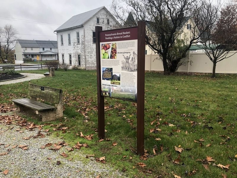
Pennsylvania Bread Basket: Feeding a Nation in Conflict Marker
| 1 ► Pennsylvania, Adams County, Arendtsville — Pennsylvania Bread Basket: Feeding a Nation in Conflict — |
| On South High Street north of Chambersburg Street, on the right when traveling south. | |||
| 2 ► Pennsylvania, Adams County, Biglerville, Franklin Township — The Battle of Gettysburg: The Cashtown Road — |
| On Lincoln Highway (Old U.S. 30) at Flohrs Church Road, on the right when traveling west on Lincoln Highway. | |||
| 3 ► Pennsylvania, Adams County, Bonneauville, Mount Pleasant Township — Third Pennsylvania Cavalry — |
| On Cavalry Field Road (Gregg Avenue), on the right when traveling west. | |||
| 4 ► Pennsylvania, Adams County, Cashtown, Franklin Township — Cashtown Inn — Conference in the Road — Gettysburg Campaign — |
| On Chambersburg Road (Old U.S. 30) at High Street, on the right when traveling west on Chambersburg Road. | |||
| 5 ► Pennsylvania, Adams County, Cashtown, Franklin Township — Gettysburg Campaign — |
| On Chambersburg Road (U.S. 30), on the right when traveling west. | |||
| 6 ► Pennsylvania, Adams County, Cashtown, Franklin Township — Imboden's Brigade — Stuart's Cavalry Division — Army of Northern Virginia — |
| On Chambersburg Road, 0.1 miles west of High Street, on the right when traveling west. | |||
| 7 ► Pennsylvania, Adams County, Cashtown, Franklin Township — Roads West — |
| On Main Street (U.S. 30) 0.2 miles west of High Street, on the right when traveling west. | |||
| 8 ► Pennsylvania, Adams County, East Berlin — 32 — Lion and the Lamb — |
| On West King Street (Pennsylvania Route 234) east of 6th Avenue, on the right when traveling east. | |||
| 9 ► Pennsylvania, Adams County, Fairfield — Army of the Potomac — July 6, 1863 — |
| On Main Street (State Highway 116) at Miller Street on Main Street. | |||
| 10 ► Pennsylvania, Adams County, Fairfield — Fairfield — Aftermath of Batle — Gettysburg Campaign — |
| On West Main Street (State Highway 116) at Spring Street, on the right when traveling west on West Main Street. | |||
| 11 ► Pennsylvania, Adams County, Fairfield — Field Hospital — |
| On Main Street (State Highway 116), on the right when traveling south. | |||
| 12 ► Pennsylvania, Adams County, Fairfield — Historic Fairfield Inn — |
| On West Main Street / Fairfield Road (Pennsylvania Route 116). | |||
| 13 ► Pennsylvania, Adams County, Fairfield — Major Samuel S. Starr — |
| On East Main Street at North 5th Avenue, on the right when traveling east on East Main Street. | |||
| 14 ► Pennsylvania, Adams County, Fairfield, Hamiltonban Township — Before The Battle Of Gettysburg — Events Along The Emmitsburg & Waynesboro Turnpike — |
| On Old Waynesboro Road north of Iron Springs Road, on the left when traveling north. | |||
| 15 ► Pennsylvania, Adams County, Fairfield, Hamiltonban Township — The Battle of Fountain Dale — |
| On Old Waynesboro Road at Iron Springs Road, on the right when traveling north on Old Waynesboro Road. | |||
| 16 ► Pennsylvania, Adams County, Fairfield, Hamiltonban Township — The Battle of Monterey Pass — |
| On 1340 Old Waynesboro Road, on the right when traveling south. | |||
| 17 ► Pennsylvania, Adams County, Fairfield, Hamiltonban Township — The Battle Of Monterey Pass — Citizens’ Stories and Kilpatrick’s Advance — |
| On Old Waynesboro Road north of Iron Springs Road, on the left when traveling north. | |||
| 18 ► Pennsylvania, Adams County, Fairfield, Liberty Township — The Fountaindale Lutheran Church and Cemetery — |
| On Jacks Mountain Road at Old Waynesboro Road, on the right when traveling north on Jacks Mountain Road. | |||
| 19 ► Pennsylvania, Adams County, Gettysburg — "… It was enough to frighten us to death!" — |
| On Carlisle Street (Business U.S. 15) at Chambersburg Street (U.S. 30), on the right when traveling south on Carlisle Street. | |||
| 20 ► Pennsylvania, Adams County, Gettysburg — "… you know nothing about the lesson anyhow." — |
| On North Washington Street at Delap Alley, on the right when traveling south on North Washington Street. | |||
| 21 ► Pennsylvania, Adams County, Gettysburg — "…expecting to find all dead." — |
| On Chambersburg Street (U.S. 30), on the right when traveling west. | |||
| 22 ► Pennsylvania, Adams County, Gettysburg — "…in less than half an hour…" — |
| On E High Street at S Stratton Street, on the left when traveling east on E High Street. | |||
| 23 ► Pennsylvania, Adams County, Gettysburg — "…run home as quickly as you can." — |
| On West High Street at South Washington Street, on the right when traveling east on West High Street. | |||
| 24 ► Pennsylvania, Adams County, Gettysburg — "…sights and sounds…too horrible to describe…" — |
| On Baltimore Street (Business U.S. 15) at West Middle Street, on the right when traveling south on Baltimore Street. | |||
| 25 ► Pennsylvania, Adams County, Gettysburg — "…the busiest scene I ever witnessed…" — |
| On Baltimore Street (Business U.S. 15) at West Middle Street, on the right when traveling south on Baltimore Street. | |||
| 26 ► Pennsylvania, Adams County, Gettysburg — "…the pathos of those poor wounded men…" — |
| On Chambersburg Street (U.S. 30) just east of South Washington Street, on the right when traveling east. | |||
| 27 ► Pennsylvania, Adams County, Gettysburg — "…what in your life you will never see again." — |
| On West Middle Street (State Highway 116) at South Washington Street, on the right when traveling west on West Middle Street. | |||
| 28 ► Pennsylvania, Adams County, Gettysburg — "by the skin of our teeth" — |
| On York Street (U.S. 30) at Carlisle Street (Business U.S. 15), on the right when traveling west on York Street. | |||
| 29 ► Pennsylvania, Adams County, Gettysburg — "Four score and seven…" — |
| On Steinwehr Avenue (Business U.S. 15) 0 miles north of Culp Street, on the right when traveling north. | |||
| 30 ► Pennsylvania, Adams County, Gettysburg — "harboring Confederates" — |
| On York Street (U.S. 30) at Carlisle Street (Business U.S. 15), on the right when traveling west on York Street. | |||
| 31 ► Pennsylvania, Adams County, Gettysburg — "if anyone showed himself…" — |
| On Lefever Street at Baltimore Street, on the right when traveling north on Lefever Street. | |||
| 32 ► Pennsylvania, Adams County, Gettysburg — "It seemed so awful..." — |
| On Carlisle Street (Business U.S. 15) at Racehorse Alley, on the right when traveling north on Carlisle Street. | |||
| 33 ► Pennsylvania, Adams County, Gettysburg — "The Great Peace Jubilee" — |
| On Steinwehr Avenue (Business U.S. 15) 0 miles north of Culp Street, on the left when traveling north. | |||
| 34 ► Pennsylvania, Adams County, Gettysburg — "The Isolated and Advanced Position" of the 8th Ohio Infantry |
| Near Emmitsburg Road (Business U.S. 15) at Long Lane, on the right when traveling south. Reported permanently removed. | |||
| 35 ► Pennsylvania, Adams County, Gettysburg — "uncertainty and dread" — |
| On Baltimore Street (Business U.S. 15) at High Street, on the right when traveling north on Baltimore Street. | |||
| 36 ► Pennsylvania, Adams County, Gettysburg — ...broken by gunfire... — |
| Near Baltimore Street north of Slocum Avenue, on the left when traveling north. | |||
| 37 ► Pennsylvania, Adams County, Gettysburg — ...Lincoln passed by... — |
| On Baltimore Street (Business U.S. 15) north of Locust Avenue, on the right when traveling north. | |||
| 38 ► Pennsylvania, Adams County, Gettysburg — “ . . . I Am Going To Die” — Saint Francis Xavier Roman Catholic Church — |
| On W High Street west of Washington Street, on the right when traveling west. | |||
| 39 ► Pennsylvania, Adams County, Gettysburg — “… the battle itself proved a relief.” — |
| On Washington Street at High Street, on the left when traveling north on Washington Street. | |||
| 40 ► Pennsylvania, Adams County, Gettysburg — “… your sister is dead.” — |
| On Baltimore Street (Pennsylvania Route 97) when traveling north. | |||
| 41 ► Pennsylvania, Adams County, Gettysburg — “bullets … rattling against our hospital … ” — |
| On E High Street west of S Stratton Street, on the left when traveling east. | |||
| 42 ► Pennsylvania, Adams County, Gettysburg — “I can see them yet…” — |
| On Baltimore Street at Breckenridge Street, on the right when traveling south on Baltimore Street. | |||
| 43 ► Pennsylvania, Adams County, Gettysburg — “The National Homestead at Gettysburg” — |
| On Baltimore Street (Pennsylvania Route 97), on the left when traveling north. | |||
| 44 ► Pennsylvania, Adams County, Gettysburg — 106th Regiment Pennsylvania Volunteers — 2nd Brigade, 2nd Division — 2nd Corps — |
| On Baltimore Pike (State Highway 97), on the right when traveling north. | |||
| 45 ► Pennsylvania, Adams County, Gettysburg — 11th Corps Headquarters — |
| On Baltimore Pike (State Highway 97), on the right when traveling north. | |||
| 46 ► Pennsylvania, Adams County, Gettysburg — 134th New York Infantry — 1st Brigade, 2nd Division — 11th Corps — |
| On Baltimore Pike (State Highway 97), on the right when traveling north. | |||
| 47 ► Pennsylvania, Adams County, Gettysburg — 134th Regiment New York Infantry — |
| On Coster Avenue at North Stratton Street, on the right when traveling east on Coster Avenue. | |||
| 48 ► Pennsylvania, Adams County, Gettysburg — 136th New York Infantry — 2d Brigade, 2d Division — 11th Corps — |
| On Taneytown Road / Washington Street (State Highway 134), on the right when traveling south. | |||
| 49 ► Pennsylvania, Adams County, Gettysburg — 13th New York Independent Light Battery — Artillery Brigade 11th Corps — Wheeler's Battery — |
| On Howard Avenue, 0.2 miles west of Carlisle Road (Pennsylvania Highway 34), on the right when traveling east. | |||
| 50 ► Pennsylvania, Adams County, Gettysburg — 14th Indiana Infantry — 1st Brigade, 3rd Division — 2nd Corps — |
| On Baltimore Pike (State Highway 97), on the right when traveling north. | |||
| 51 ► Pennsylvania, Adams County, Gettysburg — 154th New York Infantry — 1st Brigade, 2nd Division — 11th Corps — |
| On Coster Avenue at North Stratton Street, on the right when traveling east on Coster Avenue. | |||
| 52 ► Pennsylvania, Adams County, Gettysburg — 157th New York Infantry — 1st Brigade, 3rd Division — 11th Corps — |
| On Howard Avenue at Carlisle Road (Pennsylvania Highway 34), on the right when traveling east on Howard Avenue. | |||
| 53 ► Pennsylvania, Adams County, Gettysburg — 157th Regiment New York Volunteers — 1st Brigade, 3rd Division — 11th Corps — |
| On Howard Avenue at Mummasburg Road, on the right on Howard Avenue. | |||
| 54 ► Pennsylvania, Adams County, Gettysburg — 223 Baltimore Street — |
| On Baltimore Street (Business U.S. 15) south of Wall Alley, on the right when traveling south. | |||
| 55 ► Pennsylvania, Adams County, Gettysburg — 267 Baltimore St. — Gettysburg, Pennsylvania — |
| On Baltimore Street (Business U.S. 15) south of Wade Avenue, on the right when traveling south. | |||
| 56 ► Pennsylvania, Adams County, Gettysburg — 26th Pennsylvania Emergency Infantry — |
| On Chambersburg Pike (U.S. 30) near West Street, on the right when traveling east. | |||
| 57 ► Pennsylvania, Adams County, Gettysburg — 27th Pennsylvania Infantry — 1st Brigade, 2nd Division — 11th Corps — |
| On Baltimore Pike (State Highway 97), on the right when traveling north. | |||
| 58 ► Pennsylvania, Adams County, Gettysburg — 27th Pennsylvania Volunteers — |
| On Coster Avenue at North Stratton Street, on the right when traveling east on Coster Avenue. | |||
| 59 ► Pennsylvania, Adams County, Gettysburg — 45th New York Infantry — 1st Brigade, 3rd Division — 11th Corps — |
| On Howard Avenue at Mummasburg Road, on the right when traveling east on Howard Avenue. | |||
| 60 ► Pennsylvania, Adams County, Gettysburg — 4th Ohio Infantry — 1st Brigade, 3rd Division — 2nd Corps — |
| On Baltimore Pike (State Highway 97), on the right when traveling north. | |||
| 61 ► Pennsylvania, Adams County, Gettysburg — 55th Ohio Infantry — 2nd Brig, 2d Div, 11th Corps. — |
| On Steinwehr Avenue (Business U.S. 15) at South Washington Street (Pennsylvania Route 134), on the right when traveling north on Steinwehr Avenue. | |||
| 62 ► Pennsylvania, Adams County, Gettysburg — 61st Ohio Infantry — 1st Brigade, 3rd Division — 11th Corps — |
| On Howard Avenue, 0.2 miles east of Mummasburg Road, on the right when traveling east. | |||
| 63 ► Pennsylvania, Adams County, Gettysburg — 73rd Ohio Infantry — 2d Brigade, 2d Division — 11th Corps — |
| On Taneytown Road / Washington Street (State Highway 134), on the right when traveling north. | |||
| 64 ► Pennsylvania, Adams County, Gettysburg — 73rd Pennsylvania Infantry — 1st Brigade, 2nd Division — 11th Corps — |
| On Baltimore Pike (State Highway 97), on the right when traveling north. | |||
| 65 ► Pennsylvania, Adams County, Gettysburg — 74th Pennsylvania Infantry — 1st Brigade, 3rd Division — 11th Corps — |
| On Howard Avenue, 0.2 miles east of Mummasburg Road, on the right when traveling east. | |||
| 66 ► Pennsylvania, Adams County, Gettysburg — 75th Pennsylvania Volunteers — |
| On Baltimore Pike (State Highway 97), on the right when traveling south. | |||
| 67 ► Pennsylvania, Adams County, Gettysburg — 7th West Virginia Infantry — 1st Brigade, 3rd Division — 2nd Corps — |
| On Baltimore Pike (State Highway 97), on the right when traveling north. | |||
| 68 ► Pennsylvania, Adams County, Gettysburg — 7th West Virginia Infantry — |
| Near Wainwright Avenue, on the left when traveling north. | |||
| 69 ► Pennsylvania, Adams County, Gettysburg — 82nd Illinois Infantry — |
| On Howard Avenue, 0.1 miles west of Carlisle Road (Pennsylvania Highway 34), on the right when traveling east. | |||
| 70 ► Pennsylvania, Adams County, Gettysburg — 95th New York Infantry — July 1st, 1863 — 4 p.m. — |
| On Chambersburg Pike (U.S. 30) at Seminary Avenue, on the right when traveling east on Chambersburg Pike. | |||
| 71 ► Pennsylvania, Adams County, Gettysburg — A Few Appropriate Remarks — Gettysburg National Military Park — National Park Service, U.S. Department of the Interior — |
| On Soldiers’ National Cemetery. | |||
| 72 ► Pennsylvania, Adams County, Gettysburg — A Historic Year — Gettysburg College in 1863 — |
| On West Lincoln Avenue, on the right when traveling west. | |||
| 73 ► Pennsylvania, Adams County, Gettysburg — a pathway to safety — |
| On S Stratton Street at York Street (U.S. 30), on the right when traveling south on S Stratton Street. | |||
| 74 ► Pennsylvania, Adams County, Gettysburg — a site for two legends — |
| On York Street (U.S. 30) at Stratton Street, on the right when traveling west on York Street. | |||
| 75 ► Pennsylvania, Adams County, Gettysburg — A Tale of Two Brothers — |
| On Steinwehr Avenue (Business U.S. 15), on the right when traveling south. | |||
| 76 ► Pennsylvania, Adams County, Gettysburg — A Union General Escapes Capture — |
| On Baltimore Street (U.S. BUS 15) south of Breckenridge Street, on the right when traveling south. | |||
| 77 ► Pennsylvania, Adams County, Gettysburg — Adams County — |
| On West Middle Street at Baltimore Street (Business U.S. 15), on the right when traveling east on West Middle Street. | |||
| 78 ► Pennsylvania, Adams County, Gettysburg — Amos Humiston — Company C, 154th New York Volunteers — |
| On North Stratton Street, on the right when traveling north. | |||
| 79 ► Pennsylvania, Adams County, Gettysburg — Annoying “…the enemy very seriously ” — |
| On Baltimore Street at Breckenridge Street, on the right when traveling north on Baltimore Street. | |||
| 80 ► Pennsylvania, Adams County, Gettysburg — Army of Northern Virginia — June 27, 1863 — |
| On West Confederate Avenue, on the right when traveling south. | |||
| 81 ► Pennsylvania, Adams County, Gettysburg — Army of Northern Virginia — June 28, 1863 — |
| On West Confederate Avenue, on the right when traveling south. | |||
| 82 ► Pennsylvania, Adams County, Gettysburg — Army of Northern Virginia — June 29, 1863 — |
| On West Confederate Avenue, on the right when traveling south. | |||
| 83 ► Pennsylvania, Adams County, Gettysburg — Army of Northern Virginia — June 30, 1863 — |
| On West Confederate Avenue, on the right when traveling south. | |||
| 84 ► Pennsylvania, Adams County, Gettysburg — Army of Northern Virginia — July 2, 1863 — |
| On West Confederate Avenue, on the right when traveling south. | |||
| 85 ► Pennsylvania, Adams County, Gettysburg — Army of Northern Virginia — July 3, 1863 — |
| On West Confederate Avenue, on the right when traveling south. | |||
| 86 ► Pennsylvania, Adams County, Gettysburg — Army of Northern Virginia — July 4, 1863 — |
| On West Confederate Avenue, on the right when traveling south. | |||
| 87 ► Pennsylvania, Adams County, Gettysburg — Army of Northern Virginia — July 5, 1863 — |
| On West Confederate Avenue, on the right when traveling south. | |||
| 88 ► Pennsylvania, Adams County, Gettysburg — Army of Northern Virginia — July 1, 1863 — |
| On West Confederate Avenue, on the right when traveling south. | |||
| 89 ► Pennsylvania, Adams County, Gettysburg — Army of Northern Virginia — June 26, 1863 — |
| On West Confederate Avenue, on the right when traveling south. | |||
| 90 ► Pennsylvania, Adams County, Gettysburg — Army of the Potomac — July 7 1863 — |
| On Baltimore Pike (State Highway 97), on the right when traveling north. | |||
| 91 ► Pennsylvania, Adams County, Gettysburg — Army of the Potomac — July 6 1863 — |
| On Baltimore Pike (State Highway 97), on the right when traveling north. | |||
| 92 ► Pennsylvania, Adams County, Gettysburg — Army of the Potomac — July 5 1863 — |
| On Baltimore Pike (State Highway 97), on the right when traveling north. | |||
| 93 ► Pennsylvania, Adams County, Gettysburg — Army of the Potomac — July 4 1863 — |
| On Baltimore Pike (State Highway 97), on the right when traveling north. | |||
| 94 ► Pennsylvania, Adams County, Gettysburg — Army of the Potomac — July 3 1863 — |
| On Baltimore Pike (State Highway 97), on the right when traveling north. | |||
| 95 ► Pennsylvania, Adams County, Gettysburg — Army of the Potomac — July 2 1863 — |
| On Baltimore Pike (State Highway 97), on the right when traveling north. | |||
| 96 ► Pennsylvania, Adams County, Gettysburg — Army of the Potomac — July 1 1863 — |
| On Baltimore Pike (State Highway 97), on the right when traveling north. | |||
| 97 ► Pennsylvania, Adams County, Gettysburg — Army of the Potomac — June 30 1863 — |
| On Baltimore Pike (State Highway 97), on the right when traveling north. | |||
| 98 ► Pennsylvania, Adams County, Gettysburg — Army of the Potomac — June 29 1863 — |
| On Baltimore Pike (State Highway 97), on the right when traveling north. | |||
| 99 ► Pennsylvania, Adams County, Gettysburg — Artillery Brigade — Eleventh Corps — Army of the Potomac — |
| On Howard Avenue, 0.2 miles west of Carlisle Road (Pennsylvania Highway 34), on the right when traveling east. | |||
| 100 ► Pennsylvania, Adams County, Gettysburg — Artillery Brigade — First Corps — Army of the Potomac — |
| On Baltimore Pike (State Highway 97), on the right when traveling north. | |||
1961 entries matched your criteria. The first 100 are listed above. Next 100 ⊳