After filtering for Hawaii, 48 entries match your criteria.
Churches & Religion Topic
By Barry Swackhamer, August 31, 2017
First Christian Service in Hawaii Marker is missing
| 1 ► Hawaii, Hawaii County, Captain Cook — First Christian Service in Hawaii — |
| Near Puuhonua Road near Lower Nåpo'opo'o Road, on the right when traveling north. | |||
| 2 ► Hawaii, Hawaii County, Hilo — Lyman House Memorial — |
| On Haili Street near Kapiolani Street, on the right when traveling east. | |||
| 3 ► Hawaii, Hawaii County, Hilo — Saddle House - Hale Noho Lio — Daniel K. Inouye Highway — |
| On Daniel K. Inouye Highway (Saddle Road) (Hawaii Route 200 at milepost 24) near Mauna Kea Access Road, on the right when traveling west. | |||
| 4 ► Hawaii, Hawaii County, Hilo — The Spiritual Power of Stones — |
| On Waianuenue Avenue (County Route 200) near Ululani Street, on the left when traveling east. | |||
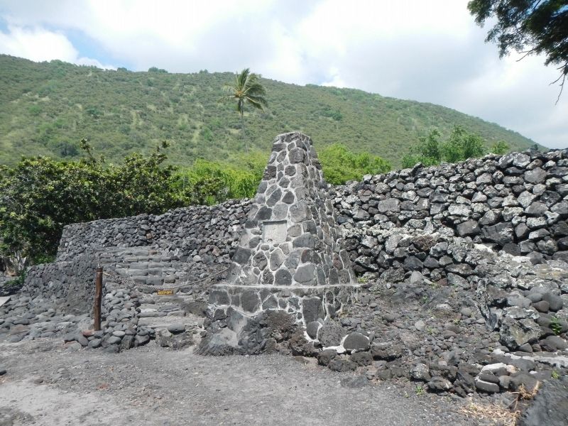
| 5 ► Hawaii, Hawaii County, Kailua-Kona — Ahu'ena Heiau — |
| Near Kaahumanu Place near Palani Road, on the left when traveling north. | |||
| 6 ► Hawaii, Hawaii County, Kailua-Kona — Hulihe‘e Palace / Moku‘aikaua Church — |
| On Alii Drive at Sarona Road, on the right when traveling north on Alii Drive. | |||
| 7 ► Hawaii, Hawaii County, Kailua-Kona — Kamakahonu — |
| Near Palani Road near Kaahumanu Place, on the left when traveling north. | |||
| 8 ► Hawaii, Hawaii County, Kailua-Kona — Kamakahonu / Kailua Pier — |
| On Kaahumanu Place near Palani Road, on the left when traveling north. | |||
| 9 ► Hawaii, Hawaii County, Kailua-Kona — Ki'ope Pond — |
| Near Alii Drive near Kahikina Lane, on the left when traveling north. | |||
| 10 ► Hawaii, Hawaii County, Kailua-Kona — Kuemanu Heiau — |
| On Ali'i Drive near Makolea Street, on the right when traveling south. | |||
| 11 ► Hawaii, Hawaii County, Kailua-Kona — The First Hawaiian Christian — |
| On Alii Drive at Sarona Road, on the right when traveling north on Alii Drive. | |||
| 12 ► Hawaii, Hawaii County, Kawaihae — Pu'ukohola Heiau — A Sacred Place Since Prehistoric Times — |
| On Kawaihae Road (SR270). | |||
| 13 ► Hawaii, Hawaii County, Kawaihae — Pu'ukohola Heiau National Historic Site — |
| On Kawaihae Road (SR270). | |||
| 14 ► Hawaii, Hawaii County, Keauhou — Kauikeaouli and Nāhi'ena'ena — |
| Near Kaleiopapa Street near Ehukai Street, on the right when traveling north. | |||
| 15 ► Hawaii, Hawaii County, Kona — Mokuaikaua Church — Congregational — Est. 1820 — |
| Near Ali‘i Drive. | |||
| 16 ► Hawaii, Hawaii County, Naalehu — Kauila and the Sea Turtles of Punalu'u — |
| Near Ninole Loop Road, 1 mile Mamalahoa Highway (Hawaii Route 11) when traveling east. | |||
| 17 ► Hawaii, Hawaii County, Pāhoa — Mokumanamana is a place of spiritual and geologic transition — |
| Near Chain of Craters Road near Hilina Pali Road. | |||
| 18 ► Hawaii, Hawaii County, Pāhoa — The spirit of Pu'uloa now surrounds you — |
| Near Chain of Craters Road (at milepost 16.3), on the left. | |||
| 19 ► Hawaii, Hawaii County, Pāhoa — These simple impressions embody the essence of Pu'uloa — |
| Near Chain of Craters Road (at milepost 16.3) near Hilina Pali Road, on the left when traveling south. | |||
| 20 ► Hawaii, Hawaii County, Papaikou — "KU" - Hawaiian God — |
| Near Old Mamalahoa Highway near Old Onomea Road, on the right when traveling north. | |||
| 21 ► Hawaii, Hawaii County, Papaikou — Remembrance Bell — |
| Near Old Mamalahoa Highway near Old Onomea Road, on the right when traveling north. | |||
| 22 ► Hawaii, Hawaii County, Papaikou — The Legend of Twin Rocks — |
| Near Old Mamalahoa Highway near Old Onomea Road, on the right when traveling north. | |||
| 23 ► Hawaii, Hawaii County, Volcano — Explosive eruptions rock Kīlauea volcano — |
| Near Crater Rim Drive near Mauna Loa Road, on the left when traveling west. | |||
| 24 ► Hawaii, Hawaii County, Waikoloa — Kamehameha II — (1797 - 1824) — |
| Near Waikoloa Beach Drive near Ku'uali'i Place, on the right when traveling north. | |||
| 25 ► Hawaii, Hawaii County, Waimea — Hale o Kapuni Heiau — |
| Near Kawaihae Road near Kawaihae Harbor Road, on the left when traveling north. | |||
| 26 ► Hawaii, Hawaii County, Waimea — Mailekini Heiau — |
| Near Kawaihae Road (Hawaii Route 270), on the left when traveling north. | |||
| 27 ► Hawaii, Hawaii County, Waimea — Pu'ukohlā Heiau — |
| Near Kawaihae Road near Kawaihae Harbor (Hawaii Route 270), on the left when traveling north. | |||
| 28 ► Hawaii, Hawaii County, Waimea — Pu'ukoholā Heiau — Pu'ukoholā Heiau National Historic Site — National Park Service, U.S. Department of the Interior — |
| Near Spencer Beach Park Road, 0.2 miles west of Kawaihae Road (Hawaii Route 270), on the right when traveling west. | |||
| 29 ► Hawaii, Honolulu County, Honolulu, Downtown — Father Damien — The Reverend Joseph Damien De Veuster, SS. CC. — Hawaii — |
| On South Beretania Street north of Punchbowl Street, on the left when traveling north. | |||
| 30 ► Hawaii, Honolulu County, Honolulu, Downtown — Hiram Bingham — |
| On Punchbowl Street at South King Street, on the left when traveling south on Punchbowl Street. | |||
| 31 ► Hawaii, Honolulu County, Honolulu, Downtown — Kawaiaha‘o Landmark — |
| On Punchbowl Street at South King Street, on the left when traveling south on Punchbowl Street. | |||
| 32 ► Hawaii, Honolulu County, Honolulu, Downtown — Kawaiaha'o Church — (The Stone Church) — |
| On Punchbowl Street, on the left when traveling east. | |||
| 33 ► Hawaii, Honolulu County, Honolulu, Downtown — Kawaiaha'o Landmark — The water of Ha'o... — |
| On Punchbowl Street, on the left when traveling east. | |||
| 34 ► Hawaii, Honolulu County, Honolulu, Downtown — King William Charles Lunalilo — Jan. 31, 1835 – Feb. 3, 1874 — |
| On Punchbowl Street at South King Street, on the left when traveling south on Punchbowl Street. | |||
| 35 ► Hawaii, Honolulu County, Honolulu, Downtown — Reverend James Kekela — Kekela O Ka Lani — |
| On Punchbowl Street, on the left when traveling east. | |||
| 36 ► Hawaii, Honolulu County, Honolulu, Waikiki — 13 — Kawehewehe — Waikīkī Historic Trail — |
| Near Kalia Road west of Beachwalk Street. | |||
| 37 ► Hawaii, Honolulu County, Laie, Koolauloa — Breaking Ground with a Vision: An Inspired Beginning — |
| 38 ► Hawaii, Honolulu County, Laie, Koolauloa — Mission School — |
| On Lanihuli St, on the left when traveling east. | |||
| 39 ► Hawaii, Kalawao County, Kalawao — St. Philomena Church and Cemetery — |
| Near Damien Road, on the left when traveling south. | |||
| 40 ► Hawaii, Kalawao County, Kalawao — The Baldwin Home — |
| On Damien Road, on the right when traveling south. | |||
| 41 ► Hawaii, Kauai County, Hanalei — Waioli Mission Hall — |
| Near Kuhio Highway (State Highway 560) at Mahimahi Road. | |||
| 42 ► Hawaii, Kauai County, Koloa — 11 — Kōloa Jodo Mission — Kōloa Heritage Trail — Ka Ala Hele Waiwai Ho‘olina o Kōloa — Preserving the Heritage of Po‘ipū & Kōloa — |
| On Waikomo Road south of Koloa Road, on the right when traveling south. | |||
| 43 ► Hawaii, Kauai County, Koloa — 14 — Kōloa Missionary Church — Kōloa Heritage Trail — Ka Ala Hele Waiwai Ho‘olina o Kōloa — Preserving the Heritage of Po‘ipū & Kōloa — |
| On Poipu Road (Hawaii Route 520) south of Koloa Road (Hawaii Route 530), on the left when traveling south. | |||
| 44 ► Hawaii, Kauai County, Poipu — 5 — Kihāhouna Heiau — Kōloa Heritage Trail — Ka Ala Hele Waiwai Ho‘olina o Kōloa — Preserving the Heritage of Po‘ipū & Kōloa — |
| Near Poipu Road east of the Poipu Road traffic circle, on the right when traveling east. | |||
| 45 ► Hawaii, Maui County, Kipahulu — Palapala Hoomau Congregational Church — |
| On South Hana Highway. | |||
| 46 ► Hawaii, Maui County, Kula — Holy Ghost Catholic Church — |
| 47 ► Hawaii, Maui County, Wailuku — Haleki'i and Pihanakalani Heiaus — State Historical Site — |
| On Hea Place. | |||
| 48 ► Hawaii, Maui County, Wailuku — Monument of Christian Faith — |
| Near Iao Valley Road. | |||