On California Avenue Southwest south of 5th Street Southwest, on the left when traveling south.
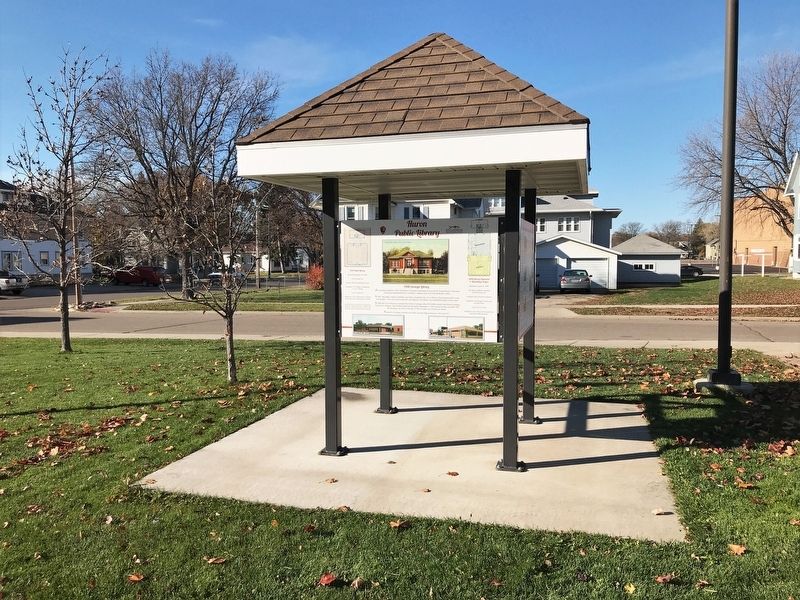
1908 Carnegie Library
At a meeting on March 8, 1883, the Women's Christian Temperance Union and the Young Women's Christian Association donated $38.00 to establish a reading room over Cash & Busby's Store.
In 1907, the public voted to . . . — — Map (db m185456) HM
On Lidice Street south of Chicago Street, on the right when traveling north.
This museum was built by the Czech Heritage Preservation Society in 2005. Funding for the museum was provided by the Mary Chilton Chapter - National Society Daughters of the American Revolution through the Mary Chilton DAR Foundation, Sioux Falls, . . . — — Map (db m242012) HM
Near Medary Avenue, 0.1 miles north of 9th Street, on the right when traveling north.
A memorable landmark for South Dakota State University and the city of Brookings, the Coughlin Campanile is the state’s tallest chimes tower. It was built in 1929-30.
Described in the campus newspaper as the most striking structure in South . . . — — Map (db m147593) HM
On South Main Street at 5th Avenue SE, on the right when traveling north on South Main Street.
The Masonic Temple
Has been placed on the
National Register
Of Historic Places
By the United States
Department of the Interior
Built 1899 — — Map (db m145323) HM
On 104th Street (County Road 3) at 391st Avenue (County Road 14), on the left when traveling east on 104th Street.
Savo Hall
has been placed on the
National Register
of Historic Places
by the United States
Department of the Interior
Built 1899 — — Map (db m206662) HM
Near 6th Avenue just north of Indian Street, on the left when traveling north.
A.G. Challis built the 1st plank jail in 1896 (for under $400) where City Hall now stands. Unfortunately, an exuberant “one-legged” celebrant arrested at the Black Hills Soldiers & Sailors Reunion, built a fire on the unusually cool night & burned . . . — — Map (db m234740) HM
On First Avenue SE, 0.1 miles east of Broadway, on the right when traveling east.
An example of Neo-classical architecture with Renaissance exterior elements, the Codington County Courthouse was built by Gray Construction under the direction of architects Freed and Perkins & McWayne. It cost $375,000.00 and was dedicated in June . . . — — Map (db m23930) HM
On Kemp Avenue East west of 2nd Street East, on the right when traveling east.
Built 1911 by Andrew P. Foley. Architect probably Maurice Hockman. 1919 Holt Motor Co., 1930's-1940's National Tea Food Store, Woolworths until 1994. — — Map (db m245329) HM
On Kemp Avenue East west of 2nd Street East, on the right when traveling east.
Built before 1911. Maurice Hockman probably architect. 1919 Petit's women's clothing store, Louis LaDou paints and Watertown Gas Company, basement home of Watertown Herald newspaper. — — Map (db m245330) HM
On Kemp Avenue East at Maple Street East, on the right when traveling east on Kemp Avenue East.
Built 1889 with a south addition 1910 designed by Maurice Hockman architect. First floor Gilruth's department store 1901. Second and third stories Goss Opera House. Later home of Krieser's Drug. — — Map (db m245260) HM
On South Broadway south of West Kemp Avenue, on the right when traveling south.
Built 1888 for Bill McIntyre. Facade added 1910 by architect Maurice Hockman. South half plumbing business since 1922. Redlinger Bros. — — Map (db m155099) HM
On Broadway Street at Kemp Avenue, on the right when traveling south on Broadway Street.
Built between 1883 and 1888 for Arthur C. Mellette and others. Housed Mellette's Law Offices. He was sworn in as last governor of Dakota Territory here. 1919 Dakota Life Insurance, 1926 Midland Life Insurance, 1938 Haggar Drug. — — Map (db m245261) HM
On East Kemp Avenue west of North Maple, on the right when traveling west.
Built after 1888 and before 1892. From 1892 to 1915 bank, U.S. Express Office, saloon, clothing store, and jewelry shop. 1940’s First Federal Savings & Loan. — — Map (db m154997) HM
On Broadway Street South at 1st Avenue Southeast, on the left when traveling south on Broadway Street South.
After years of renting spaces, the US Postal Service constructed the building on the corner of Broadway and First Avenue North in 1908 to 1909. By 1932, it was clear that the facilities were not adequate, which resulted in a well-blended . . . — — Map (db m113231) HM
On South Broadway south of West Kemp Avenue, on the right when traveling south.
Built after 1898 and by 1910. Has housed Post Office, Sternberg Clothing House, Olson Lee Clothing, Luck Shoe Shop, and Skagg’s Grocery. — — Map (db m154998) HM
On U.S. 16A, 0.6 miles west of Wildlife Loop Road, on the left when traveling west.
The State Game Lodge was built by
Cecil C. Gideon Contractor-Builder in 1919-1922
A.R. Van Dyck - Architect Monroe Nystrom - Stonemason
All three were from the Minneapolis area. Gideon and his wife Elma Mary were the genial hosts . . . — — Map (db m202736) HM
On 2nd Street east of Braddock Street (U.S. 281), on the right when traveling east.
The Douglas County Museum is housed in the original offices of the County Auditor and
Placed on the National Register of Historic Sites in 1976, this building was erected in 1902 at a cost of $ 3,625.00 to comply with state law which required . . . — — Map (db m180698) HM
On Main Street east of Bridge Street, on the right when traveling east.
This building is the Chicago Northwestern Depot built in 1906. This was also the year the railroad was built into Midland. It was purchased by the Midland Pioneer Museum Association in 1974 and moved from its site along the railroad tracks about . . . — — Map (db m124093) HM
On State Highway 240, 1.3 miles south of Interstate 90, on the right when traveling south.
Edgar I. Brown, born in 1854, came here with wife, Alice, and son, Charles, to homestead in the Badlands when he was 55. Their first and only home was a side hill, sod wall, dirt roofed house. About it they built up a humble homestead. Intact today, . . . — — Map (db m45288) HM
Near East Capitol Avenue at S. Pierre Street, on the right when traveling north.
The Old Hughes County Courthouse—South Dakota’s Temporary Capitol
The old Hughes County Courthouse, shown at left, was erected in 1883 and served an important role in the formation of the new South Dakota government in 1889. It was replaced . . . — — Map (db m157519) HM
On Dakota Avenue South at 1st Street SW, on the right when traveling north on Dakota Avenue South.
This courthouse was built in 1930 at a cost of $120,000. It had an unusual design for a courthouse at that time, being Modern American instead of Classical. The exterior is brick, trimmed with Bedford Stone. The interior has terrazzo floors, . . . — — Map (db m124590) HM
A fire in 1982 destroyed the historic Horace Clark and Apex buildings. The facades of the two buildings were replicated in 1997.
1900, Horace Clark Building (left); 1897, Apex Building (right).
Owner: Olympic Gaming SD, L.L.C.
Replication . . . — — Map (db m183225) HM
On Sherman Street (CanAm Highway) (U.S. 85) 0.1 miles south of Pine Street, on the right when traveling south.
Since 1877, four county jails have been constructed within the Deadwood city limits. The first jail was erected in May of 1877 in the Ingleside Townsite (today's Presidential Neighborhood) and consisted of a 30 x 50 foot log structure enclosed by a . . . — — Map (db m120998) HM
Harris Franklin, his wife Anna, and son Nathan arrived in Deadwood, Dakota Territory in 1877. A Jewish immigrant from humble beginnings, Harris Franklin earned his fortune through the wholesale liquor business and gradually diversified into cattle, . . . — — Map (db m183628) HM
On West Main Street (CanAm Highway) (U.S. 85) at Siever Street, on the left when traveling east on West Main Street (CanAm Highway).
Medical services at the Homestake Mining Company, one of the pioneers in the United States in the field of industrial health services, first began in 1877, when the company contracted with Dr. D. K. Dickinson to furnish medical and surgical . . . — — Map (db m121497) HM
On CanAm Highway / West Main Street (U.S. 85) at Stone Street, on the right when traveling north on CanAm Highway / West Main Street.
Lead's Post Office, which had been located in the Hearst Mercantile Building on North Mill Street since 1897, moved into this imposing structure in 1912.
Congress had appropriated money for the new post office several years earlier, but . . . — — Map (db m120056) HM
On South Phillips Avenue south of West 14th Street, on the right when traveling south.
McKinney-Beveridge Auto Company
McKinney Loan and Investment Company
All Saints Historic District
National Register of Historic Places — — Map (db m199744) HM
On North Duluth Avenue south of West 7th Street, on the right when traveling south.
On April 23, 1879, The Dakota Pantagraph announced: "R. F. Pettigrew will build him a fine residence in Bennett's addition this summer."
Richard Franklin Pettigrew (July 23, 1848-October 5, 1926) was a lawyer, surveyor, and land . . . — — Map (db m207164) HM
Near North Cherapa Place south of East 6th Street.
In 1902, the Manchester Biscuit Company came to Sioux Falls and built a two-story quartzite building on East Sixth Street. By 1909, the building had expanded to include a third floor and a three-story addition was added to the south. In 1915, the . . . — — Map (db m124638) HM
On North Main Avenue south of West 6th Street, on the right when traveling south.
This landmark structure was designed by Wallace Dow and built by Andrew C. Phillips in 1891-1892. Phillips, a lawyer and diplomat for the U.S. government, came to Sioux Falls in 1878 and invested in banking and real estate. This brick building with . . . — — Map (db m192230) HM
On Main Street (U.S. 16/385) at McGregor Street, on the right when traveling south on Main Street.
This building is listed on the National Register as the oldest commercial hand-hewn log building in continuous use in South Dakota.
Built in 1885 by the German immigrant Camillo Von Woehrman as a saloon and sleeping quarters; in 1890 he began . . . — — Map (db m119999) HM
On West Third Street at Broadway Avenue (U.S. 81), on the right when traveling east on West Third Street.
The Yankton County Courthouse stood at this site from 1905 to 2003. The handsome three-story building was dedicated Nov. 1, 1905. Speakers at that event estimated it would have "a long life of 25 years." The building far exceeded those expectations . . . — — Map (db m742) HM