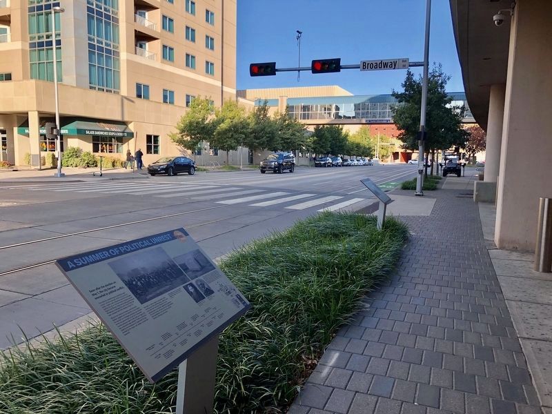
Soon after the election on May 1, the city became ensnarled in political conflict.
The rules for establishing lot ownership were unclear and the attempts of the city council to clarify matters with ordinances and lot certificates sold by . . . — — Map (db m141899) HM
Dedicated to the memory of those Oklahomans who have given their lives while serving their country as members of the United States Air Force and for the working men and women at Tinker Air Force Base, both military and civilian, who have and . . . — — Map (db m175360) WM
On April 19, 1995 at 9:02 a.m., a bomb exploded just a few hundred feet east of here. In that instant and the ensuing calamity, 168 people were known to be killed. Devastation covered this area. The parish house which stood on this corner was . . . — — Map (db m60345) HM
Journalist, Lawyer, Educator, Orator, and Author of Oklahoma City History
Arriving from Kansas on April 22, Angelo C. Scott, age 31 and his brother W.W. Scott started a newspaper, the Oklahoma Times, soon renamed the Journal, the first in . . . — — Map (db m142023) HM
By 1920 the number of automobile dealers in Oklahoma City had grown to 76; 52 of those were located on Broadway between North 4th Street and 10th Street, a section became known as Automobile Alley. — — Map (db m175236) HM
The V-8 engine was first used in an American production car in 1915. Thirteen years later, the same company was the first to employ safety glass and a synchromesh transmission. The company was called Cadillac. — — Map (db m175350) HM
In 1907, when Oklahoma became a state, 253 American companies produced 44,000 automobiles and trucks. In Oklahoma City, there were five companies that sold cars in 1906; five years later there were 34 dealers mostly located on Broadway. — — Map (db m175352) HM
Charles and Frank Duryea, bicycle mechanics, built the first successful American gasoline powered car in 1893, the same year 100,000 pioneers made the land run into Oklahoma's Cherokee Strip. — — Map (db m175354) HM
With a margin of only 14 votes, Beale claimed a mandate to overturn seven months of Seminole-dominated city rule. Within a month the city was in chaos and city governance was shut down by federal authorities.
Dr. A. J. Beale, the leader . . . — — Map (db m142036) HM
Engraved in the paving behind you are the emblems of the seventeen federal agencies and the three non-federal tenants that occupied the Alfred P. Murrah Federal Building on April 19, 1995.
For their contributions and losses they are . . . — — Map (db m60294) HM
(tablet 1) This monument commemorating the Oklahoma Land Run of 1889 was almost 25 years in the making. The tireless efforts of several visionary Oklahomans, generous contributions from a trio of initial donors, and extensive funding support . . . — — Map (db m157302) HM
Erected in 1910 as Oklahoma High School, at that time the city's only high school, this Gothic style building was a source of great civic pride. Many future leaders were educated here. — — Map (db m60387) HM
Cowboy, police chief, legislator, wildcatter, entrepreneur, and developer
Charles Colcord, a native of Kentucky, spent his formative years as a cowboy in western Oklahoma, Texas, and Arizona. In 1889, at age 29, he came to Oklahoma City . . . — — Map (db m141878) HM
Children were a significant part of the worldwide response in April 1995, responding with words of encouragement and messages of hope - for Rescue Workers specifically - and Oklahomans in general. Thousands of ceramic tiles were sent to Oklahoma . . . — — Map (db m60361) HM
Always short on revenue, the City eventually acquired its own building by evicting a saloon.
The Mayor and City Council of Oklahoma City first met on May 3, 1889 in the law office of councilman Ledru Guthrie on the south side of Main . . . — — Map (db m141902) HM
Although this edifice was dedicated in 1904, Methodists have met here since 1889, making this the oldest congregation in Oklahoma City still worshipping at the original location. The present structure was the first of the many large churches built . . . — — Map (db m175305) HM
The First Methodist Episcopal Church was organized June 23, 1889, with seventeen members. The Sunday school was organized June 9, 1889 by Dr. D.W. Scott. — — Map (db m175308) HM
An ardent promoter and businessman: perhaps the greatest of the founding fathers
Prior to the Run of 1889, Ohio native Henry Overholser arranged for 10 railroad cars of prefabricated wood-frame buildings and lumber to be waiting for him at . . . — — Map (db m141880) HM
Constructed in 1914 by the Markham Motor Company selling Cleveland & Chandler automobiles.
(2017 renovation credits not transcribed) — — Map (db m175349) HM
Lawyer, oilman, philanthropist, church layman
Governor of Oklahoma, 1943-1947 United States Senator, 1949-1963
Founder of Kerr-McGee Corporation
What so sets a life apart that a nation mourns when it ends?
As Oklahoma's first . . . — — Map (db m175356) HM
The south wall of the Journal Record Building directly faced the blast's impact and was heavily damaged by the April 19, 1995 bombing. Parts of the south wall were separated from the floor beams, and the arched section of the building's roof was . . . — — Map (db m60378) HM
Built in 1916, the Markham Motor Company was one of the early sales outlets and showrooms on Broadway Avenue. Like other small showrooms, the building was too limited for the changing industry and by the late 1930s it housed the Goodyear Tire and . . . — — Map (db m175237) HM
Nineteen Little Boys And Girls Killed In The OKC Bombing
April 19, 1995
"He took them up in his arms...."
Mark 10:16 (KJV)
Painting: Alice Murray — — Map (db m60381) HM
April 19, 1995
The grateful citizens of Oklahoma hereby express their gratitude to all Protective and Rescue Personnel, who amid death, danger, darkness and depression, rendered superb service above and beyond the call of duty. They were . . . — — Map (db m60382) HM
[Excerpts from marker]
This 24,000 square foot Museum exhibit tells the story of the April 19, 1995, bombing of the Alfred P. Murrah Federal Building. You hear the explosion, see the devastation immediately following and learn from family . . . — — Map (db m60376) HM
Before April 19, 1995, the two-block area between NW 4th and 6th Streets and Robinson and Harvey Avenues served as the northern edge of the downtown core. This area was a workplace to hundreds of people.
5th Street ran through the area where . . . — — Map (db m60377) HM
Built in 1909 and in advance of its time by the foresight of E.K. Gaylord, this neo-classic edifice has housed a company whose growth closely paralleled that of Oklahoma City. — — Map (db m175233) HM
When this structure was built skeptics criticized Edward K. Gaylord for building so far from the downtown business district. Designed by Solomon Layton, the building was placed on the National Register of Historic Places in 1978. — — Map (db m175234) HM
Most land claim disputes were resolved by settlement, or purchase and relinquishment. But some required lengthy litigation.
With territorial government authorized by Congress in May, 1890, a formal structure was established for resolving . . . — — Map (db m142054) HM
The Rescuer Orchard is in an area where the Oklahoma Water Resources and Athenian Building once stood. Both sustained heavy damage and required demolition.
The Orchard symbolically "rushes in" from both east and west on the Memorial Grounds . . . — — Map (db m60359) HM
The Citizens' Survey, begun the day after the Run, was reconciled with the survey of the Seminole Town and Improvement Company at a mass meeting on April 27.
As the Citizens' Committee and its surveyors worked north from the section line at . . . — — Map (db m142009) HM
On Saturday, April 27 the citizens of South Oklahoma elected G. W. Patrick mayor along with a full slate of city officials.
On April 23, 1889, G. W. Patrick began surveying south from the section line at Reno, as the Citizens' Survey began . . . — — Map (db m142057) HM
Known today as the "Survivor Tree," this American Elm survived the April 19, 1995 bombing. The Survivor Tree's bark protects it from disease and bugs. Please help us protect the Survivor Tree by not removing bark or placing coins in its bark. We . . . — — Map (db m60281) HM
This American Elm was surrounded by a parking lot filled with burning vehicles on April 19, 1995. It survived the impact of the explosion and became known as the Survivor Tree, an important symbol of resilience to the family members of those . . . — — Map (db m60380) HM
Lumberman, Banker, and Business Leader
On the afternoon of April 22, T.M. Richardson, and his son T.M. Jr., from Albany, Texas, staked a claim at the northeast corner of Clarke Street (later Grand, and today Sheridan) and Harvey, where the . . . — — Map (db m141891) HM
Team 5
4-19-95
We Search For the truth
We Seek Justice.
The Courts Require it.
The Victims Cry for it.
And God Demands it!
A Rescue Worker originally painted the message on this wall during search and recovery efforts in April 1995. . . . — — Map (db m60379) HM
Within minutes after 9:02 a.m. on April 19, 1995, this tranquil plaza was transformed into a scene of frantic lifesaving activities. Many individuals became heroes as they joined together to become "First Responder Teams" to pull men, women and . . . — — Map (db m60295) HM
A reporter from Harpers Weekly returned to Oklahoma City two months after its birth to find its progress remarkable beyond belief.
William Willard Howard writing an article called "The Building of Oklahoma" in the June 29, 1889 issue of . . . — — Map (db m141907) HM
Promising future prosperity, another railroad crossed downtown.
In August, 1889, an issue surfaced with settlers that would reverberate for years to come. The Choctaw Coal and Railway Company wanted to build a railroad (the "Choctaw Road") . . . — — Map (db m176270) HM
Overnight, a city of tents arose next to the railroad station. But where were the streets and lot lines? Amid the confusion, a mass meeting was called which elected a committee to bring order with a new survey.
Confusion reigned on . . . — — Map (db m142030) HM
A slate of candidates supported by the Seminole Town and Improvement Company, including the temporary mayor William Couch, was elected at the polls on Wednesday, May 1.
At the mass meeting on April 27, after the compromise survey was . . . — — Map (db m142027) HM
You are entering the area where the Alfred P. Murrah Building once stood. The granite used on this pathway was salvaged from the Murrah Building. The Field of Empty Chairs is a tribute to the 168 Americans who were killed April 19, 1995. The . . . — — Map (db m60358) HM
The race for free land began at noon on April 22, 1889, with an estimated 50,000 participants from all over the world.
At high noon on a bright and clear Monday, April 22, 1889, a drama roared to life when mounted soldiers fired their guns . . . — — Map (db m141908) HM
The unassigned lands were opened through a Land Run with more than 50,000 Americans vying for 160 acres or a town lot. At noon on April 22, 1889, competitors rushed in on wagons, horses, foot and trains. Towns were formed and homesteads were staked. . . . — — Map (db m157300) HM
Following enactment of the Organic Act in May, 1890, territorial, county, and city governments were quickly established. Federal townsite laws clarified the procedure for confirming and settling land claims, and a land office opened in Oklahoma . . . — — Map (db m142052) HM
On May 2, 1890, Congress passed long awaited legislation establishing federally sanctioned territorial government for Oklahoma.
The Organic Act defined Oklahoma Territory boundaries to include the lands west of Indian Territory and the . . . — — Map (db m142037) HM
First a boomer, then a sooner, then the first mayor of Oklahoma City, William L. Couch resigned as Mayor on November 11, 1889. Five months later, he died of a gunshot wound by a rival homestead claimant, the day before the first anniversary of the . . . — — Map (db m142056) HM
On April 22, 1889, one of the significant events of American History swept across this location and some 2,000,000 surrounding acres. On that day more than 50,000 men and women rushed to stake their claims in the Land Run of 1889. That one day . . . — — Map (db m157301) HM
A visit by influential members of Congress
in September 1889 was the most important
event in Oklahoma since the Run itself.
On Tuesday, September 17, 1889, six congressmen arrived by rail from
Guthrie for a first-hand look at life in the . . . — — Map (db m141875) HM
This is the site of the deadliest act of domestic terrorism the United States has ever seen. It was an act of hate, meant to breed chaos, fear and distrust. Instead, it was met with an outpouring of love, unity and resilience.
Today, the . . . — — Map (db m175309) HM