Isaac Lorraine, discoverer of the American Flag gold and silver mine, built this adobe house about 1877. It served as his residence and headquarters for nearby mining and ranching operations. On December 20, 1880, it became the first post office in . . . — — Map (db m29898) HM
The Mormon Battalion of the U.S. Army camped here enroute to California December 17, 1846. During the war with Mexico, on the longest infantry march of record, they were first to unfurl the flag of the United States in Tucson.
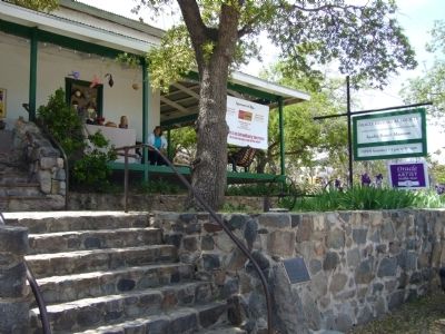
This marker . . . — — Map (db m92383) HM
This was the northern boundary of Baca Float Number 3, one of five 100,000-acre grants made to the Baca family, in exchange for land taken from them in New Mexico. An attempt was made to relocate this grant to include mines in the Santa Rita . . . — — Map (db m27152) HM
Garrisoned by Spanish
in 1752
First Town established in
Arizona by Europeans
Here on March 3, 1859
the Weekly Arizonian was published -- Arizona's
first newspaper. — — Map (db m68027) HM
Originally an Indian village, Tubac is the oldest European settlement in Arizona. It was established as the Royal Spanish Presidio San Ignacio de Tubac in 1752, after an uprising of Pima Indians. In 1775 Captain Juan Bautista de Anza led an . . . — — Map (db m27119) HM
Here stood the original Spanish presidio or fort established as San Ignacio de Tubac after the Pima uprising of 1751. Captain Juan Bautista de Anza was in command in 1775, when he led his famous expedition to California to found San Francisco. The . . . — — Map (db m68026) HM
Ash Fork is located near the 35th Parallel where, in the 1850's the Army Corps of Topographical Engineers began surveying a future railroad route. Camels were imported and used as beasts of burden, adding to the colorful history of the region. A . . . — — Map (db m33442) HM
Ashfork, Arizona
Founded 1882
The Coming of Route “66”
1926
Ash Fork was a junction point of the Old Trails (Route 66) and the Grand Canyon – Nogales Highways (US 89), leading to the southern sections of the state. . . . — — Map (db m33502) HM
Cypress Copper ― Bagdad Corporation
In memory of
WJ. Pace and J.M. Murphy
Who filed the Bagdad claim January 1, 1882;
John Lawler who patented the claim in
1889; and the Lincoln family who developed
the mine. — — Map (db m31552) HM
Site of original Camp Whipple established December 1863
From January 22 to May 18, 1864 the offices of the Territorial Government of Arizona were operated from tents and log cabins here, before being moved to Prescott the first permanent . . . — — Map (db m33444) HM
The U.V.C.C. Clarkdale smelter was built through the vision of William A. Clark, owner of the United Verde Mine in Jerome. The Smelter was constructed between 1912-1915 to replace the outdated Jerome smelter.
On May 26, 1915 the first furnace . . . — — Map (db m33199) HM
In 1863 Pauline Weaver and Abraham Peeples came from California to find gold. They found gold and the rush was on. In 1887 The Congress mine was formed and the town had a name. On March 14, 1895 the railroad came. Congress was booming. In 1910, . . . — — Map (db m59977) HM
With Jerome's rough and tumble early days came the red-light district and prostitutes. Much of the red-light district was located on Hull Avenue, the road below Main Street. In 1913, reformers helped pass an ordinance restricting houses of ill fame . . . — — Map (db m33154) HM
This is one of the two old furnaces found in place on The Hampton Lode, United Verde Copper Company Mines, at Jerome Arizona on March 5, 1888 when I first visited the property. I started operation on this furnace and also the other one on May 22, . . . — — Map (db m33147) HM
The original Jerome Town Hall was built in the late 1800s. The town quickly outgrew the small space and by 1929 a bond had passed to enlarge the old brick building. New construction was to be of concrete. In addition to enlarging town hall, a police . . . — — Map (db m33145) HM
The first mining claims were filed in 1876, within 20 years Jerome was a billion dollar copper mecca and one of the wildest, wickedest mining towns in the west. Drinking, gambling, brawls and frolicking with ladies of the night occurred . . . — — Map (db m33149) HM
In the late 1800's, Thomas Earnhart erected the Kirkland Store on the site of today's Kirkland Bar and Steakhouse.
In the early 1900's, Louis Haselfeld assumed ownership and opened the Haselfeld Store. The original wood frame building burned in . . . — — Map (db m33046) HM
Territory of Arizona
MCMX ― MCMXI
Home for Aged and Infirm Arizona Pioneers
Established by act of the Twenty-Fifth Legislature under the administration of Governor Joseph H. Kibbey.
Erected under the direction of the Board . . . — — Map (db m33047) HM
Originally this was the site of A.G. Dunn's Butcher Shop, which provided fresh locally grown beef from Dunn's ranch. This was followed by Hubbard's drug store which was later owned by W.W.Ross. The drug store was purchased by Harry Brisley in 1899. . . . — — Map (db m20292) HM
American History in Arizona is quite recent, although the history of the Native American, Spanish and Mexican occupation periods are much older. Encampments of Native Americans were drawn to the creeks, which offered a fairly reliable source of . . . — — Map (db m33064) HM
The one hundred block of South Montezuma Street has long been known as "Whiskey Row" for the numerous saloons which once lined the street. As Prescott poet Gail Gardner once wrote of "Whiskey Row":
"Oh they starts her in at the Kaintucky bar, At . . . — — Map (db m20622) HM
Originally a part of the Capitol Block, which was set aside in 1864 for a Territorial Capitol Building, the south half of the block was sold at auction. John Lawler, a miner, capitalist and real estate developer, bought the entire block and built a . . . — — Map (db m20618) HM
Founded 1864 on Granite Creek, early source of placer gold. Former territorial capital of Arizona. Now a center for ranching, mining, health, especially asthma relief. Located here on site of old Ft. Whipple is Whipple Veterans Hospital. Seat of . . . — — Map (db m20298) HM
Three very prominent buildings once stood on East Gurley Street between Alarcon and Marina Streets – The Territorial Capital Building, Prescott High School and the Yavapai Club.
Originally, the property between Alarcon and Marina streets . . . — — Map (db m33095) HM
Prescott's modern public library was dedicated on May 18, 1975. However, the history of a public library in Prescott goes back to August 1895, when seven local ladies founded the Women's Club of Prescott (now the Monday Club). They gathered a . . . — — Map (db m52912) HM
This is the site of ‘the crossing' on the Mojave-Prescott "Hardyville" toll road. The road was authorized by the first territorial legislature and was built by W. H. Hardy, connecting Prescott with Hardyville on the Colorado River.
William John . . . — — Map (db m72625) HM
Joseph and Margaret Ehle arrived in Prescott, Arizona Territory, on July 13, 1864 with their children, John Henry, Mary Jane, Amy E., Olive Joan, Sarah F. and Margaret Viola. Mr. Ehle helped to build the log Governor's Mansion (now part of Sharlot . . . — — Map (db m33133) HM
Founded in 1864, Prescott is Arizona's Mile High City and seat of Yavapai County government. Named for historian William Hickling Prescott, it was established on the banks of Granite Creek in 1864.
Today it is the home to the Bob Stump VA . . . — — Map (db m33042) HM
By the early 1870s a full block of saloons, gambling halls and hotels made this the wildest part of town. Some of the saloons brewed their own beer and most drinks sold for 12½ (cents) each. On July 14, 1900 a disastrous fire swept the Row and . . . — — Map (db m21164) HM
Cleator was established in 1884 as a placer gold mining site in the Turkey Creek Mining District. A post office opened in July of 1869, but closed a few months later. James Cleator came to Arizona in 1900 to prospect in the Bradshaw mountains. In . . . — — Map (db m74224) HM
A cool canyon sanctuary at the confluence of two creeks
Mayhew Lodge, constructed of hand-smoothed logs and adorned with a towering rock chimney, was a rustic retreat attracting politicians, and movie stars. But this grand lodge had . . . — — Map (db m99273) HM
During World War II, the Yuma proving ground of the United States Army Corps of Engineers was known as the Yuma Test Branch, which was used as a floating-bridge test facility. By 1944, more allied troop support was needed to conduct the bridge tests . . . — — Map (db m29059) HM
In January 1943 the Yuma Test Branch of the Engineer Board of the Corps of Engineers commenced test operations on fixed and floating bridges at Imperial Dam. Tests were conducted in both sluiceways as well as above and below the dam. Transportation . . . — — Map (db m29058) HM
From 1850 to 1877 all travelers crossing the Colorado River used the ferry. Several operated between the mouth of the Gila River and Pilot Knob. Steamboats arrived on the river in 1850 and the first railroad bridge was built in 1877. — — Map (db m29015) HM
Yuma Crossing, used since prehistoric times, played a significant part in the development of the West and continues to influence the affairs of the state and the nation. The Yuma City-County Bicentennial Commission in the spring of 1974 conceived . . . — — Map (db m28984) HM
In 1763 the Post of Arkansas became
Spanish territory when, by the Treaty of
Paris, the French King ceded Louisiana
to Spain. For several years after the
transfer, French officers and soldiers
remained at Arkansas Post.
In 1771 the . . . — — Map (db m108551) HM
lt is one of the town's oldest commercial buildings and was built in 1876.
The original building was a two story wooden structure and was replaced
after the tum of the century with a one story rock building The facade has
been updated several . . . — — Map (db m141821) HM
Front (West side)
"To the Confederate
soldiers of Chicot
County, the record
of whose sublime
self sacrifice and
undying devotion is
the proud heritage
of a loyal posterity."
Rear (East side)
We care not . . . — — Map (db m90255) WM
This home was built about the year 1848 for John H. Saunders and his wife Martha A. Pettit Saunders. During the Civil War engagement at Ditch Bayou in 1864 the house was used as a hospital for soldiers of both armies. A number of military dead were . . . — — Map (db m107737) HM
John S.T. Callaway owned forty
acres, including this site, after
receiving a United States land patent
for it in 1836. Then, in 1842, Benjamin S.
Duncan purchased the land at a
sheriff's auction and platted
Duncan's Addition in 1858.
Today, . . . — — Map (db m234829) HM
Near this site on April 1, 1864 Confederate General Joseph O. Shelby caught up with and attacked the rear guard of Union General Frederick Steeles army. Union General Samuel A. Rice, in charge of the supply, pontoon and brigade trains, rushed to . . . — — Map (db m121180) HM
Using advanced technology to understand the past.
Like the methods of Crime Scene Investigators, science provides a variety of ways to look beneath the surface of the Drennen House grounds for evidence of the past. Techniques like . . . — — Map (db m120491) HM
Hebe, Greek goddess of youth and happiness was placed in her fountain on the Crawford County Courthouse lawn in 1908 by the Women's Village Improvement Society.
Repairs were made to both Hebe and fountain in memory of Robert Benham who served . . . — — Map (db m97670) HM
Tulip was settled in 1838 by Moses Overton. Making it the oldest community in Dallas County. Prominent settlers were Tyre H. Brown, Gen. Nathaniel G. Smith, Col. Maurice Smith and Judge Willis L. Somervell. Tulip missed being the capitol of Arkansas . . . — — Map (db m121307) HM
This important river port, county seat of Desha County from 1838 to 1874, was located 24 miles east at the junction of the Arkansas River with the Mississippi. The town was finally abandoned after most of it washed into the Mississippi River. — — Map (db m107758) HM
The Rohwer internment camp included a 500-acre area for internee living quarters and more than 10,000 acres of surrounding land for farming and timber harvesting.Officially labeled a relocation center, the internment camps for Japanese . . . — — Map (db m167628) HM
Plaque Rohwer Relocation Center Memorial Cemetery Has Been Designated A National Historic Landmark This Site Possesses National Significance In Commemorating The History Of The United States of America 1992 . . . — — Map (db m167617) HM
Watson became the county seat of Desha County after Napoleon was abandoned to the Mississippi River. Lewis W. Watson donated the land and built the courthouse near this site. The county seat was moved to Arkansas City in 1880. Watson remained the . . . — — Map (db m107757) HM
Bathhouse Row is the historic heart of an American spa. Since the 1830s the city of Hot Springs has channeled much of its energy into becoming a national health resort. The Federal Government made “taking the waters” available to all by . . . — — Map (db m61775) HM
Notable individuals from all walks of life
have come to Hot Springs for their health
and entertainment. Among them were
Andrew Carnegie, Jack Dempsey, Sam Houston,
Helen Keller, Huey Long, Bat Masterson,
Carrie Nation, Babe Ruth, William . . . — — Map (db m211198) HM
In 1818 a French trapper, Joseph Bonne landed on the south bank of the Arkansas River with his dog and gun near the location of the original Jefferson County Courthouse. Driven to this high bluff after flood waters had threatened his homesite at . . . — — Map (db m30576) HM
Little River County was formed 1867 out of lands taken from Hempstead and Sevier Counties by Act 104 of the Arkansas Legislature approved March 7, 1867. The Act fixed the temporary county seat at the home of William M. Freeman, which was ½ mile . . . — — Map (db m121273) HM
The Ghost Town of Rush stands as mute testimony to the activities of a bygone era. Zinc carbonate ore was discovered in this valley in the late 1880's and the "rush" was on. Soon the hillsides were dotted with-mines sprouting colorful names such . . . — — Map (db m161923) HM
When establishing Buffalo National River in 1972, Congress recognized the need to preserve the valley’s culture as well as its free-flowing river. Here in Boxley Valley, a traditional farm community is being perpetuated within the borders of Buffalo . . . — — Map (db m61757) HM
"Helena occupies one of the prettiest situations on the river", wrote Mark Twain in Life on the Mississippi, and is rich in history and culture. Hernando DeSoto crossed the Mississippi near Helena in 1541, finding a thriving native culture. . . . — — Map (db m51928) HM
The City of West Helena was a vision in the early nineteen hundreds of Edward Chaffin Hornor and John Sidney Hornor, cousins. Their plans for the creation of West Helena on the western slope of Crowley's ridge was accomplished with the filing on . . . — — Map (db m51931) HM
Two and a half miles southeast of this point is the only locality in North America where diamonds have been found in the rock in which they were formed. They have been found principally in one igneous pipe which, with three small pipes, aggregates . . . — — Map (db m121290) HM
La Petite Roche ("the Little Rock") refers to the
rock outcropping on the Arkansas River used as a
navigation point during the early exploration of what
would become the state of Arkansas. Sometimes called
the Point of Rocks, it is the first . . . — — Map (db m116556) HM
The Little Rock was not always as it is now. To support
the Junction Bridge and ensure an adequate channel for
river traffic, much of the Rock was removed in 1872 and
1884. No one knows how the Point of Rocks looked
before progress took its . . . — — Map (db m116557) HM
Businesses at Home
Davidsonville's shops and businesses
often shared the same building as
the family house. For example, Jacob
Garrett's public house on Lots 34-35
was part of his residence, and John
Miller ran a store out of his home . . . — — Map (db m170926) HM
Jail Construction
Trials of the accused and
incarceration of the guilty are two
functions of a county seat, so the
building of a jail was paired with
that of the courthouse. The funds to
pay for its construction also came
from the sale . . . — — Map (db m170831) HM
Courthouse Architecture
Prominently placed in the center of the
town square sat the Lawrence County
Courthouse. Although no illustration
of the courthouse has been found,
research indicates it was built on a
plan commonly used in the . . . — — Map (db m170851) HM
A Place to Gather
In 1819 Jacob Garrett purchased this
lot, built a house, and in 1821 received
a license to “keep a public house of
entertainment."
A public house, or pub, was a place
licensed to sell alcoholic beverages.
In . . . — — Map (db m170835) HM
With the largest criminal jurisdiction of any federal court at the time, the Western District of Arkansas handled an extraordinary number of murder and rape cases. When a jury found defendants guilty in these capital cases, federal law mandated the . . . — — Map (db m59022) HM
Within a few short months El Dorado's population doubled, and, before the year
was out, it doubled again before peaking two years later at over 40,000. With the
population explosion came oilmen from Louisiana and Texas, but along with them
on . . . — — Map (db m121352) HM
A little over a year after the initial oil discovery by Dr. Busey, the Oil
Operators Trust--Murphy #1, a wildcat well staked on a geologic feature
called the Norphlet dome, drilled into the gas-cap of what would become the
huge Smackover Oil . . . — — Map (db m121356) HM
[Center and Main Marker:]
This plaque marks the terminus of the First Transcontinental Passenger train that started in New York City and terminated at Alameda Point Pier on September 6, 1869. Erected by the U.S. Naval Air . . . — — Map (db m150959) HM
City of Berkeley Landmark
designated in 1991
One of Berkeley’s romantic treasures, Orchard Lane is the formal pedestrian entrance to the Panoramic Hill residential neighborhood.
The walk and grand Classical staircase, complete with pillars, . . . — — Map (db m54692) HM
Berkeley History
The Panoramic Hill Historic District typifies Berkeley’s early hillside neighborhoods. Steep and narrow Panoramic Way, carved out in 1888, opened the hill to residential development. University professors and early Sierra Club . . . — — Map (db m54694) HM
City of Berkeley Landmark
designated in 1991
Rose Walk was designed by Bernard Maybeck and completed in 1913 with donations from the neighbors. The walkway linked the Euclid Avenue streetcar line with residences higher on the hill.
After . . . — — Map (db m53859) HM
City of Berkeley Landmark
designated in 2005
These entry gates help define one of Berkeley’s most gracious residential areas, Claremont Court, which was designed to attract the growing number of prosperous Bay Area professionals in the early . . . — — Map (db m54800) HM
On a once rural site now bordered by Russell Street, College Avenue, and Stuart Street, the Kelsey family planted orchards and grew ornamental plants on land they purchased in 1860. The 24-acre Kelsey Ranch supplied trees and plants for the grounds . . . — — Map (db m54691) HM
Mural designed by Osha Newmann, painted with O’Brien Thiele, Janet Kranzberg, Daniel Galvez and many others
Painted in 1976
Restored and enlarged in 1999
City of Berkeley Landmark
designated in 1990
The mural on this wall was painted . . . — — Map (db m54696) HM
This site was part of the original Don Castro Land Grant. In 1866 pioneer settler Josiah Grover Brickell made a land grant of this site for “educational purposes only” and paid the teacher’s salary, who taught children by day, in a one . . . — — Map (db m100557) HM
William born in Kilkenny, Ireland, 1845. Ellen Fallon Tehan, daughter of Ellen and Jeremiah Fallon, was a year old when she came west by covered wagon from St. Joseph, Mo., in 1846. William and Ellen’s marriage was the first in Old St. Raymond’s Jan . . . — — Map (db m201558) HM
[Side A:]
Mormon Pioneers
Mormon pioneers traveled far in search of a land where they could worship God in an environment of religious tolerance. Named below are some of the pioneers who settled in Washington Township. They sailed . . . — — Map (db m28707) HM
Thomas Jefferson Chadbourne and his wife Nettie built this Victorian carriage house in the 1870’s. He owned fine racing horses and stock horses and wanted them housed in suitable surroundings.
They purchased the property in 1872 from Charles C. . . . — — Map (db m28826) HM
Here, in 1883, James Concannon founded the Concannon Vineyard. The quality it achieved in sacramental and commercial wines helped establish Livermore Valley as one of America’s select wine growing districts. Grape cuttings from this vineyard were . . . — — Map (db m100553) HM
Here, Charles A. Wetmore planted his vineyard in 1882. The Cresta Blanca wine he made from its fruit won for California the first international award, the highest honor at the 1889 Paris Exposition, first bringing assurance to California wine . . . — — Map (db m100552) HM
The legend of Joaquin Murrieta is one of the most enduring and fascinating of chapters in California history. Facts, fiction and romantic tales entangle to create a legend of unique aura that had become part of California's folklore, especially in . . . — — Map (db m130947) HM
Here the first Wente Vineyards of 47 acres was established by C.H. Wente in 1883. In 1935 his sons, Ernest and Herman, introduced California’s first varietal wine label, Sauvignon Blanc. The efforts of the Wente family have helped to establish the . . . — — Map (db m100563) HM
Oakland in the late 19th century was a thriving waterfront city, the second largest in the state. A center of commerce and industry, it was also known for advanced notions of civic improvement. Public schools and academies, convenient transit, and . . . — — Map (db m18771) HM
The first known inhabitants of Fruitvale were the Ohlone. In 1820 the Spanish crown gave this land to Luis Peralta, making Peralta Hacienda the first non-native settlement in Oakland.
From 1820 to 1897, the family had a rancho at this site. . . . — — Map (db m28960) HM
[Panel 1:]
Pleasanton’s past and the rich stories of the people that have come before can be discovered in the landscape and features of this park. Three periods of occupation trace regional settlement from prehistory to the present day. . . . — — Map (db m24685) HM
John W. Kottinger one of pioneer founders and first Justice of the Peace of Pleasanton constructed this adobe brick barn about 1852. So built that part of it could house prisoners brought to justice in his court. Thus serving as Pleasanton’s first . . . — — Map (db m24592) HM
Governor Pablo de Solá, last Spanish Governor of California, awarded the San Antonio Grant to Don Luis Maria Peralta on August 13, 1820, in recognition of forty years of service. From this point northward the Grant embraced over 43,000 acres. Now . . . — — Map (db m100548) HM
Named in honor of Antonio Maria Sunol, merchant, naval man and cattlebarron, who acquired a Spanish / Mexican land grant in 1840.
Along with the vast ranching and fertile farmlands, coal and gold were found in the Sunol area in the 1870’s. . . . — — Map (db m24495) HM
The first court house where Alameda County government began, June 6, 1853. Officials met in two-story wooden building erected by Henry C. Smith and A. M. Church as merchandise store. Seat of government moved to San Leandro in 1856 following vote of . . . — — Map (db m28910) HM
About 200 yards offshore, in what was once Silver Valley lies the Reynold’s House. This house appears on an 1878 General Land Office map and was probably one of the many road houses along the route that catered to tourists and travelers. Reynold’s . . . — — Map (db m10999) HM
Below this ridge is what some pioneers dubbed the “Devils Ladder.” A name reflecting the steepness and extreme difficulty that pioneers experienced as they began their ascent over the Sierra Nevada. This climb was usually referred to as . . . — — Map (db m21284) HM
In February of 1844, John C. Fremont led a group of men over these mountains as they struggled to reach Sutter’s Fort. Little did they know that the pass, which lay 20 to 30 feet under the snow beneath them, would be a major route for the Gold Rush . . . — — Map (db m21278) HM
Here the Old Emigrant Road of 1848 swung down across the meadow now covered by Caples Lake (Twin Lakes) and climbed along the ridge at the right to the gap at the head of the valley. From this summit (9,460 feet) it descended to Placerville. This . . . — — Map (db m100570) HM
Telltale signs of geologic activity surround Grover Hot Springs State Park. Bold granite peaks to the northwest are the work of immense mountain building forces. Old lava flows cover hundreds of square miles to the east, giving the Markleeville area . . . — — Map (db m13239) HM