2017 entries match your criteria. The first 100 are listed. ⊳
Non-US Wars Topic
By J. Makali Bruton, February 16, 2018
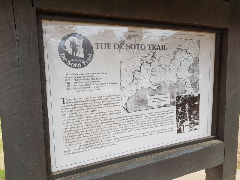
Hernando de Soto in Alabama Marker reverse
1 ► Alabama, Cleburne County, Muscadine — Hernando de Soto in Alabama — The De Soto Trail —  |
| Near Interstate 20 (Interstate 20) west of Alabama Route 37, on the right when traveling west. | |||
| 2 ► Alabama, Limestone County, Athens — Limestone County Beirut Memorial — (U.S. Marine Barracks Bombing) — |
| Near South Marion Street south of Market Street West, on the right when traveling south. | |||
| 3 ► Alabama, Mobile County, Mobile — Magnolia Cemetery — |
| On South Ann Street 0.1 miles north of Virginia Street, on the right when traveling north. | |||
| 4 ► Alabama, Monroe County, Perdue Hill — William B. Travis House — C. 1820 — |
| On U.S. 84 at County Road 1, on the left when traveling west on U.S. 84. | |||
| 5 ► Alaska, Sitka Borough, Sitka — Tlingits, Totems, and the Battle of Sitka — |
| On Lincoln Street at Monastery Street, on the right when traveling east on Lincoln Street. | |||
| 6 ► Alaska, Sitka Borough, Sitka, Mount Edgecumbe — History of Castle Hill (-1804) — |
| Near Harbor Drive. | |||
| 7 ► Arizona, Apache County, Chinle — The Place Where Two Fell Off — |
| Near Mummy Cave Overlook Road 1.5 miles east of North Rim Highway (Indian Route 64). | |||
| 8 ► Arizona, Pima County, Tucson, El Presidio — Hugo O'Conor — |
| Near West Paseo Redondo. | |||
| 9 ► California, Alameda County, Berkeley, Northside — Robert Hale Merriman Residence — Berkeley History — |
| On Virginia Street, on the left when traveling east. | |||
| 10 ► California, Los Angeles County, Carson — Jose Rizal — 1861-1896 — |
| On Carson Street 0.2 miles west of Interstate 405, on the right when traveling west. | |||
| 11 ► California, Los Angeles County, Los Angeles, Downtown Los Angeles — Bell of Dolores |
| On Los Angeles Street at North Alameda Street, on the right when traveling west on Los Angeles Street. Reported missing. | |||
| 12 ► California, Los Angeles County, Los Angeles, Echo Park — José Martí Monument — |
| On Glendale Boulevard at Park Avenue, on the right when traveling north on Glendale Boulevard. | |||
| 13 ► California, Los Angeles County, Los Angeles, Hollywood — Cahuenga Pass Treasure — At The Hollywood Bowl — |
| Near Highland Avenue south of U.S. 101, on the right when traveling south. | |||
| 14 ► California, Los Angeles County, Los Angeles, Lincoln Heights — Emiliano Zapata — 1873-1919 — El Parque de Mexico — |
| Near Mission Road at Valley Boulevard, in the median. | |||
| 15 ► California, Los Angeles County, Los Angeles, Mission Hills — Armenian History Timeline — |
| Near Mission Hills Road 0.2 miles west of Indian Hills Road. | |||
| 16 ► California, Los Angeles County, Los Angeles, Mission Hills — Khatchkar — Cross Stone — |
| Near Mission Hills Road 0.2 miles west of Indian Hills Road. | |||
| 17 ► California, Los Angeles County, Los Angeles, South Los Angeles — 159 — Ralph Bunche Home — |
| On 40th Place 0.2 miles east of Central Avenue, on the left when traveling east. | |||
| 18 ► California, Los Angeles County, Los Angeles, Westlake — Hungarian Freedom Fight of 1956 — |
| On 6th Street at Park View Street, on the right when traveling east on 6th Street. | |||
| 19 ► California, Marin County, Larkspur — Sir Francis Drake — Looking Beyond the Horizon — |
| Near Sir Francis Drake Boulevard. | |||
| 20 ► California, Orange County, Fountain Valley — Lebanese Civil War Memorial — |
| On Warner Avenue at Ross Street, on the right when traveling east on Warner Avenue. | |||
| 21 ► California, Sacramento County, Sacramento, Southside Park — Miguel Hidalgo y Costilla — |
| Near T Street west of 8th Street, on the left when traveling west. | |||
| 22 ► California, San Diego County, San Diego, La Jolla — Mt. Soledad National Veterans Memorial — |
| Near Soledad Park Road east of Via Capri, on the right when traveling west. | |||
| 23 ► California, San Francisco City and County, San Francisco, Lincoln Park — Jeanne d'Arc — |
| On Legion of Honor Drive near El Camino Del Mar, on the left when traveling north. | |||
| 24 ► California, San Francisco City and County, San Francisco, Mission Dolores — Mexico's Liberty Bell (A Replica) — |
| On Dolores Street at 19th Street, on the right when traveling south on Dolores Street. | |||
| 25 ► California, San Francisco City and County, San Francisco, Northern Waterfront — Egg War of the Farallones — |
| Near The Embarcadero. | |||
| 26 ► California, San Francisco City and County, San Francisco, The Castro — Roger Casement — 1864-1916 — Rainbow Honor Walk — |
| On Castro Street at 18th Street, on the right when traveling north on Castro Street. | |||
| 27 ► California, San Joaquin County, Stockton — José Maria Morelos y Pavón — |
| On N. Center Street near W. Fremont Street, on the left when traveling south. | |||
| 28 ► California, Santa Clara County, San Jose, Central San Jose — Shri Chhatrapati Shivaji Maharaj — (1630 – 1680) — |
| Near West Taylor Street. | |||
| 29 ► California, Tuolumne County, Columbia — Charles Crist Kress — |
| Near School House Street. | |||
| 30 ► Colorado, Custer County, Wetmore — Cuerno Verde |
| On Colorado 67 (at milepost 2) at County Road 19C, on the right when traveling south on Colorado 67. Reported unreadable. | |||
| 31 ► Colorado, Eagle County, Red Cliff — Camp Hale — |
| Near 10th Mountain Division Memorial Highway (U.S. 24 at milepost 160) at Camp Hale Spur 1B. | |||
| 32 ► Colorado, El Paso County, United States Air Force Academy — War in the Balkans — 1993-2000 — Air Warrior Combat Memorial — |
| Near Stadium Boulevard at North Gate Boulevard, on the right when traveling north. | |||
| 33 ► Connecticut, Capitol Region, Hartford, Downtown — Matthew Furlong — |
| Near Main Street (U.S. 44) at Chapel Street South, on the left when traveling north. | |||
| 34 ► Connecticut, Greater Bridgeport Region, Fairfield — Thomas Sherwood Memorial — |
| Near Beach Road at Sunnieholm Drive, on the left when traveling west. | |||
| 35 ► Connecticut, South Central Region, Milford — The Regicides — |
| On West River Street at River Street, on the right when traveling south on West River Street. | |||
| 36 ► Connecticut, South Central Region, New Haven, Downtown — Col Edward Whalley — |
| Near Temple Street 0.1 miles south of Elm Street, on the right when traveling south. | |||
| 37 ► Connecticut, South Central Region, New Haven, Downtown — Col William Goffe — |
| Near Temple Street 0.1 miles south of Elm Street, on the right when traveling south. | |||
| 38 ► Connecticut, South Central Region, New Haven, West Rock — Judges Cave — |
| Near Wintergreen Avenue 0.2 miles north of Brookside Avenue, on the left when traveling north. | |||
| 39 ► Delaware, New Castle County, Newark, Pencader Hundred — Historic Iron Ore Mining |
| On Dayett Mills Road south of Old Baltimore Pike, on the right when traveling south. Reported permanently removed. | |||
| 40 ► Delaware, New Castle County, Newark, Pencader Hundred — Historic Iron Ore Mining — |
| On Robert L. Melson Lane near Whitaker Road, on the left when traveling north. | |||
| 41 ► Delaware, New Castle County, Wilmington, Christiana Hundred — Éleuthère Irénée du Pont — |
| Near Hagley Creek Road north of Blacksmith Hill Road, on the right when traveling north. | |||
| 42 ► Delaware, New Castle County, Wilmington, Christiana Hundred — The Hagley Story / The du Pont Story — |
| Near Hagley Creek Road north of Blacksmith Hill Road, on the right when traveling north. | |||
| 43 ► Delaware, Sussex County, Millsboro, Indian River Hundred — Patton Medium Tank — M48A1 — |
| On Legion Road just east of John J Williams Highway (Delaware Route 5/24), on the left when traveling west. | |||
| 44 ► District of Columbia, Washington, Northeast Washington, Brookland — Tomb of the Virgin Mary — |
| Near 14th Street Northeast just south of Quincy Street Northeast, on the right when traveling north. | |||
| 45 ► District of Columbia, Washington, Northwest Washington, American University Park — Luis Alves de Lima e Silva — |
| On Wisconsin Avenue Northwest south of Chesapeake Street Northwest, on the right when traveling south. | |||
| 46 ► District of Columbia, Washington, Northwest Washington, Columbia Heights — Jeanne d'Arc — |
| Near 15th Street Northwest just north of Belmont Street Northwest, on the left when traveling north. | |||
| 47 ► District of Columbia, Washington, Northwest Washington, Columbia Heights — Pancho Villa Memorial — |
| On 16th Street Northwest south of Harvard Street Northwest, on the right when traveling north. | |||
| 48 ► District of Columbia, Washington, Northwest Washington, Dupont Circle — Admiral Miguel Grau — |
| On Massachusetts Avenue Northwest at 17th Street Northwest, on the right when traveling east on Massachusetts Avenue Northwest. | |||
| 49 ► District of Columbia, Washington, Northwest Washington, Dupont Circle — Assassination of Orlando Letelier and Ronni K. Moffitt — |
| On Sheridan Circle Northwest east of 23rd Street Northwest, on the right when traveling west. | |||
| 50 ► District of Columbia, Washington, Northwest Washington, Dupont Circle — Hungarian Veterans Memorial — 1703 - 1848 - 1956 — |
| On 20th Street Northwest north of Massachusetts Avenue Northwest, on the left when traveling north. | |||
| 51 ► District of Columbia, Washington, Northwest Washington, Dupont Circle — Lajos (Louis) Kossuth — |
| On 20th Street Northwest north of Massachusetts Avenue Northwest, on the left when traveling north. | |||
| 52 ► District of Columbia, Washington, Northwest Washington, Dupont Circle — Lajos (Louis) Kossuth — 1802 - 1894 — |
| On 20th Street Northwest north of Massachusetts Avenue Northwest, on the left when traveling north. | |||
| 53 ► District of Columbia, Washington, Northwest Washington, Dupont Circle — The Budapest Lad (Pesti Srac) Statue — |
| On Rhode Island Avenue Northwest west of 15th Street Northwest, on the right when traveling east. | |||
| 54 ► District of Columbia, Washington, Northwest Washington, East End — Holodomor — Famine Genocide in Ukraine National Mall and Memorial Parks Holodomor Memorial — National Park Service, U.S. Department of the Interior; Embassy of Ukraine — |
| On Massachusetts Avenue Northwest just west of North Capitol Street Northwest, on the right when traveling east. | |||
| 55 ► District of Columbia, Washington, Northwest Washington, Federal Triangle — Beyond the AEF — |
| On Pennsylvania Avenue Northwest just west of 14th Street Northwest, in the median. | |||
| 56 ► District of Columbia, Washington, Northwest Washington, Foggy Bottom — Benito Juárez Memorial — Statues of the Liberators — |
| On Virginia Avenue Northwest at 25th Street Northwest, on the right when traveling east on Virginia Avenue Northwest. | |||
| 57 ► District of Columbia, Washington, Northwest Washington, Foggy Bottom — Siege of Sarajevo Children's Memorial — |
| On E Street Northwest 0.1 miles east of Virginia Avenue NW, on the right when traveling west. | |||
| 58 ► District of Columbia, Washington, Northwest Washington, Foggy Bottom — Simón Bolívar — "Statues of the Liberators" — |
| On 18th Street Northwest at Virginia Avenue Northwest, on the left when traveling north on 18th Street Northwest. | |||
| 59 ► District of Columbia, Washington, Northwest Washington, Kalorama Heights — Vassil Levsky / Васил Левски — 1837 - 1873 — |
| On 22nd Street Northwest just south of R Street Northwest, on the right when traveling north. | |||
| 60 ► District of Columbia, Washington, Northwest Washington, Sheridan-Kalorama — General Manuel Belgrano — 1770 — 1820 — |
| On Connecticut Avenue Northwest south of Bancroft Place Northwest, on the right when traveling south. | |||
| 61 ► District of Columbia, Washington, Northwest Washington, Sheridan-Kalorama — Robert Emmet: Irish Patriot — Rock Creek Park — National Park Service, U.S. Department of the Interior — |
| On 24th Street Northwest north of Massachusetts Ave Northwest, on the left when traveling north. | |||
| 62 ► District of Columbia, Washington, Northwest Washington, Sheridan-Kalorama — Simón Bolívar (1783-1830) — |
| On California Street Northwest west of 24th Street Northwest, on the right when traveling west. | |||
| 63 ► District of Columbia, Washington, Northwest Washington, U Street Corridor — "All Men Are Brothers" — |
| Near U Street Northwest east of 14th Street Northwest, on the right when traveling west. | |||
| 64 ► Florida, Escambia County, Pensacola — General Francisco De Miranda — 1750-1816 — |
| On North Palafox Street just north of West De Soto Street, on the right when traveling north. | |||
| 65 ► Florida, Escambia County, Pensacola — D — Supremacy, Siege and the Sea — Pensacola Maritime Heritage Trail — |
| On Bayfront Parkway at South Alcaniz Street, on the right when traveling east on Bayfront Parkway. | |||
| 66 ► Florida, Franklin County, Apalachicola — Willoughby Ryan Marks Memorial — |
| On 4th Street at Columbus Street (U.S. 98), on the right when traveling north on 4th Street. | |||
| 67 ► Florida, Hillsborough County, East Lake-Orient Park — Boxer Rebellion 1898-1901 — Hillsborough County Veterans Memorial Park — |
| Near U.S. 301 0.2 miles East Dr. Martin Luther King Jr. Boulevard, on the right when traveling south. | |||
| 68 ► Florida, Hillsborough County, Tampa, Clair-Mel City — America’s Secret War. The Salvadoran Civil War — (1979 - 1992) — Hillsborough County Veterans Memorial Park — |
| Near U.S. 301 0.2 miles south of East Dr. Martin Luther King Jr. Boulevard, on the right when traveling south. | |||
| 69 ► Florida, Hillsborough County, Tampa, Clair-Mel City — NATO Air Campaign in Bosnia & Herzegovina (1995) — Hillsborough County Veterans Memorial Park — |
| Near U.S. 301 0.2 miles south of East Dr. Martin Luther King Jr. Boulevard, on the right when traveling south. | |||
| 70 ► Florida, Hillsborough County, Tampa, Clair-Mel City — Operation Deny Flight (1993-1995) — Hillsborough County Veterans Memorial Park — |
| Near U.S. 301 0.2 miles south of East Dr. Martin Luther King Jr. Boulevard, on the right when traveling south. | |||
| 71 ► Florida, Hillsborough County, Tampa, Clair-Mel City — Operation Golden Pheasant (1988) — Hillsborough County Veterans Memorial Park — |
| Near U.S. 301 0.2 miles south of East Dr. Martin Luther King Jr. Boulevard, on the right when traveling south. | |||
| 72 ► Florida, Hillsborough County, Tampa, Clair-Mel City — Operation Provide Promise (1992-1996) — Hillsborough County Veterans Memorial Park — |
| Near U.S. 301 0.2 miles south of East Dr. Martin Luther King Jr. Boulevard, on the right when traveling south. | |||
| 73 ► Florida, Hillsborough County, Tampa, Clair-Mel City — USS Liberty Incident (1967) — Hillsborough County Veterans Memorial Park — |
| Near U.S. 301 0.2 miles south of East Dr. Martin Luther King Jr. Boulevard. | |||
| 74 ► Florida, Hillsborough County, Tampa, Downtown — Captain Joseph Fry — Tampa's First Native Son Died for Cuban Liberty |
| On South Ashley Drive at Channelside Drive, on the right when traveling north on South Ashley Drive. Reported missing. | |||
| 75 ► Florida, Hillsborough County, Tampa, Ybor City — The 1937 Antifascist Women's March — |
| On East 7th Avenue just east of North 20th Street, on the right when traveling east. | |||
| 76 ► Florida, Miami-Dade County, Miami, Coral Way — Al Martirologio del Presidio Político Cubano — |
| On Southwest 13th Avenue north of Southwest 12th Street, on the left when traveling south. | |||
| 77 ► Florida, Miami-Dade County, Miami, Coral Way — General Antonio Maceo |
| On Southwest 10th Street at 13th Avenue Southwest, on the right when traveling east on Southwest 10th Street. Reported permanently removed. | |||
| 78 ► Florida, Miami-Dade County, Miami, Coral Way — José Martí |
| On Southwest 13th Avenue north of 10th Street Southwest, on the left when traveling north. Reported permanently removed. | |||
| 79 ► Florida, Miami-Dade County, Miami, Coral Way — José Martí Plaza — At the Cuban Memorial Boulevard Park — |
| On Southwest 13th Avenue north of Southwest 10th Street, on the left when traveling south. | |||
| 80 ► Florida, Miami-Dade County, Miami, Coral Way — Lt. General Antonio Maceo Grajales Plaza — At the Cuban Memorial Boulevard Park — |
| On Southwest 13th Avenue south of Southwest 10th Street, on the left when traveling north. | |||
| 81 ► Florida, Miami-Dade County, Miami, Coral Way — Memorial to the Fallen of Cuban Liberation |
| On 13th Avenue Southwest north of 10th Street Southwest, on the left when traveling north. Reported permanently removed. | |||
| 82 ► Florida, Miami-Dade County, Miami, Coral Way — Nestor A. Izquierdo |
| On 13th Avenue Southwest south of 8th Street Southwest, on the left when traveling south. Reported permanently removed. | |||
| 83 ► Florida, Miami-Dade County, Miami, Downtown Miami — Capitán Arturo Prat Chacón — |
| Near Biscayne Boulevard south of Northeast 4th Street, on the right when traveling north. | |||
| 84 ► Florida, Miami-Dade County, Miami, Downtown Miami — General D. José de San Martín — |
| On East Flagler Street near Biscayne Boulevard, on the right when traveling east. | |||
| 85 ► Florida, Miami-Dade County, Miami, Downtown Miami — Plaza Libertador Simón Bolívar — |
| On Biscayne Boulevard near Northeast 4th Street, on the right when traveling north. | |||
| 86 ► Florida, Miami-Dade County, Miami, Downtown Miami — Simón Bolívar Monument — |
| On East Flagler Street at Biscayne Boulevard, on the right when traveling west on East Flagler Street. | |||
| 87 ► Florida, Miami-Dade County, Miami, Little Havana — A la lucha guerrillera anticomunista / To the Anti-Communist Guerrilla — |
| Near Southwest 13th Avenue at Southwest 8th Street, on the right when traveling south. | |||
| 88 ► Florida, Miami-Dade County, Miami, Little Havana — General Máximo Gómez — |
| On 8th Street east of 15th Avenue, on the right when traveling east. | |||
| 89 ► Florida, Miami-Dade County, Miami, Little Havana — La Peña Versailles — |
| Near Southwest 8th Street (U.S. 41) at SW 35th Avenue, on the right when traveling west. | |||
| 90 ► Florida, Miami-Dade County, Miami Beach, South Beach — José Martí — 1853 - 1895 — |
| On 21st Street west of Collins Avenue, on the right when traveling west. | |||
| 91 ► Florida, Miami-Dade County, Miami Beach, South Beach — Simón Bolívar — |
| On 21st Street west of Collins Avenue, on the right when traveling west. | |||
| 92 ► Florida, Monroe County, Key West, Bayview Park — José Martí Monument — |
| On Virginia Street (U.S. 1) at Jose Marti Drive, on the left when traveling east on Virginia Street. | |||
| 93 ► Florida, Orange County, Orlando, Northeast Orlando — Simon Bolivar — |
| Near North Eola Drive close to East Central Boulevard, on the left when traveling north. | |||
| 94 ► Florida, Orange County, Orlando, Southwest Orlando — The Historic Arms — England, Scotland & Wales — |
| Near Universal Boulevard north of Hollywood Way, on the left when traveling north. | |||
| 95 ► Florida, Orange County, Orlando, Southwest Orlando — The Historic Arms — England, Scotland & Wales — |
| Near Universal Boulevard north of Hollywood Way, on the left when traveling north. | |||
| 96 ► Florida, Orange County, Orlando, Southwest Orlando — The Historic Arms of Ireland — |
| Near Universal Boulevard north of Hollywood Way, on the left when traveling north. | |||
| 97 ► Florida, Orange County, Orlando, Southwest Orlando — The Historic Arms of Ireland — |
| Near Universal Boulevard north of Hollywood Way, on the left when traveling north. | |||
| 98 ► Florida, Orange County, Orlando, Southwest Orlando — The Historic Arms of Spain & Portugal — |
| Near Universal Boulevard north of Hollywood Way, on the left when traveling north. | |||
| 99 ► Florida, Orange County, Orlando, Southwest Orlando — The Historic Arms of Spain & Portugal — |
| Near Universal Boulevard north of Hollywood Way, on the left when traveling north. | |||
| 100 ► Florida, St. Johns County, Crescent Beach — Massacre by Menendez — Fort Matanzas National Monument — |
| Near A1A Scenic and Historic Coastal Byway (State Highway A1A) 4 miles south of State Highway 206, on the right when traveling south. | |||
2017 entries matched your criteria. The first 100 are listed above. Next 100 ⊳