The Schuylkill Haven Heritage Trail, with Northern and Southern Loops, links Island Park with Bubeck Park through the downtown of this former industrial hub that once boasted one of the largest coal loading depots along the Schuylkill Canal, and numerous textile factories which two railroads shipped while also delivering goods to the town. The trail will eventually connect to the Schuylkill River Trail.
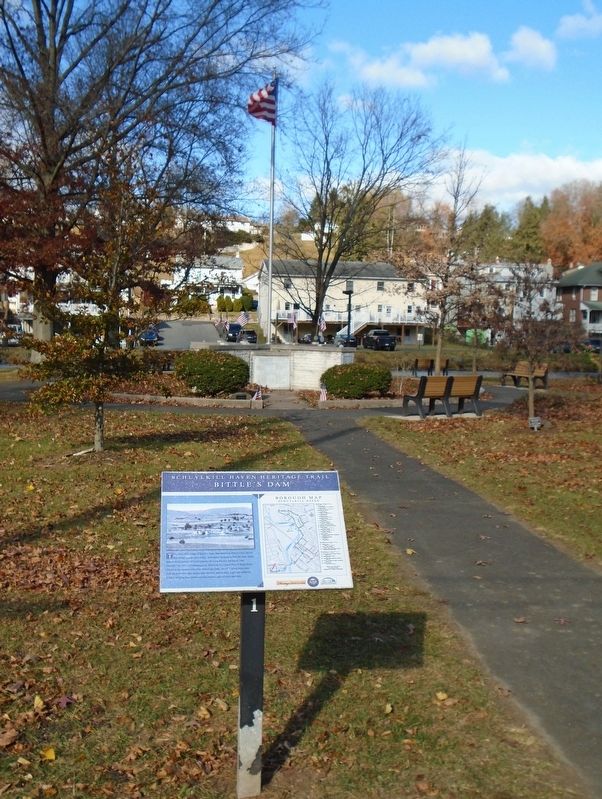
This circa 1910 image of Stoyer's Dam, then known as Bittle's Dam, shows few homes compared to today. Note there are farms within the town limits and no development north of Columbia Street in the area known as "The Orchard." In . . . — — Map (db m260869) HM
The imposing icehouse erected by Marcus Bittle is seen here, located on the south side of the dam on Washington Street. Sawdust was used to insulate the ice against melting. The Bittle family ran the business until it was sold . . . — — Map (db m260940) HM
This 1880 image shows Motzer's Bakery on present day Parkway, then known as Canal Street. Greenawalt's store was located here, beginning in 1926. Children stand near the edge of the Schuylkill Canal in the foreground. Stables, a . . . — — Map (db m232962) HM
This image shows the Columbia Hotel, located on the eastern end of the Columbia Street bridge. The three story, brick structure replaced the Cross Keys Hotel, originally on this site. The building was later the home of the local Veterans of . . . — — Map (db m233123) HM
Prior to the building of the concrete bridge at Columbia Street in 1921, the structure was a wooden covered bridge. This bridge replaced one that had been swept away in September of 1850, when the lower Tumbling Run Dam burst, . . . — — Map (db m260941) HM
The homes in this circa 1910 photograph were located directly across the
street from where you now stand. A lone horse and buggy travels the dirt
street, paving only being fully underway in 1913. The steeple on the right . . . — — Map (db m261040) HM
This 1911 image shows the trolley tracks of the Union Traction Company of
Pottsville on Dock Street. The trolley served Schuylkill Haven from
October 10, 1897 until August 24, 1932 when service was discontinued. This was
part . . . — — Map (db m261055) HM
Looking east on Main Street from the railroad tracks in this circa 1907 photo, one sees many changes compared to today. The buildings on the left in the foreground were destroyed by fire on Easter morning in April, 1960. The . . . — — Map (db m232958) HM
This view, looking west on Main Street, shows some buildings recognizable
today. The first building on the right was a hardware store at the time this early twentieth century photograph was taken. Other small shops including a . . . — — Map (db m261036) HM
This circa 1910 image shows a tree lined Main Street, interrupted by a lone horse and buggy. The church steeple in the right foreground was on Saint John's Reformed Church. This church and a home were demolished in 1925 to . . . — — Map (db m232888) HM
This image shows the original electric light plant on this location. The first electric current in Schuylkill Haven was turned on Thursday, October 2, 1891, by Clarence Moser, son of the Town Council President. At its inception, the plant . . . — — Map (db m233124) HM
On this site the Washington Hotel was built in 1831. In 1895 it was torn down and replaced with a four story brick structure, the Hotel Grand, seen in this circa 1908 photo. The Hotel Grand was destroyed by fire on March 8, 1932. . . . — — Map (db m232959) HM
Standing on the hill behind you, known in its day as "Goat Hill," you would
have seen this view of the present day "Island," complete with homes and small businesses. The rail yard in the foreground was part of the Reading . . . — — Map (db m260838) HM
This steel bridge spanning the Schuylkill River was constructed in 1872,
connecting the Irish Flat with Dock Street. When this circa 1910
photograph was taken, the Schuylkill Canal, which passed under the bridge, was
no longer . . . — — Map (db m260837) HM
Parkway was known as Canal Street when this circa 1908 photograph was taken. Many of the homes are still recognizable today. At this time, work had begun on reclamation of the canal bed in the foreground, for the purpose of establishing the . . . — — Map (db m233070) HM
Looking south on Parkway, this circa 1930 photograph shows the "islands" created as a park, where the canal had previously traversed through the town. The shoe factory on the immediate right was originally established in 1887 as Berger, . . . — — Map (db m233095) HM
Looking east on Haven Street, this early twentieth century image presents a very different picture than today. The Pennsylvania Railroad station stood at this location, a two story structure, with the second floor used as a dwelling for the . . . — — Map (db m233126) HM
This signal tower for the Reading Railroad was placed here in 1950. It
replaced individual watchmen at the three crossings in the borough; William Street, Main Street and here at Union Street. It was installed as a safety . . . — — Map (db m261024) HM
The Reading Blue Mountain and Northern Passenger Headquarters was once the passenger depot of the Philadelphia and Reading Railroad. Construction began in 1901 and the station opened in 1902. The station was considered one of the . . . — — Map (db m232933) HM
This 1910 image shows the rolling mill in Schuylkill Haven which was located directly in front of you along the Reading Railroad tracks. It was built circa 1869 as the Schuylkill Haven Direct Iron Company to produce iron before converting to . . . — — Map (db m233110) HM
This school building was originally constructed as the Schuylkill Haven High
School. This 1923 image shows what was at the time a modern school building. It was opened for occupancy in September of 1917 at a cost of $80,000. On . . . — — Map (db m261058) HM
This circa 1883 image gives a nice overview of the Schuylkill Canal in this
area. This view is looking south from Coal Street, which is several hundred yards behind where you are standing. Canal boats fill the water along the . . . — — Map (db m260840) HM
Standing on the corner to your left, this 1912 image shows a trolley car
traveling south on Saint John Street. The bypass for the trolley line, allowing cars to travel in either direction, was located at this intersection of . . . — — Map (db m261031) HM
Stoyer's Dam was known as Bittle's Dam in this March, 1906 image. Marcus Bittle established the dam in 1881 to establish an ice supply business, including erecting an ice house in the area where you now stand. Earl Stoyer opened . . . — — Map (db m260862) HM
This early twentieth century image shows Willow Street looking east toward
Dock Street with the trolley tracks of the Union Traction Company of Pottsville running through the dirt street. Willow Street was the first street in . . . — — Map (db m261043) HM
Looking west in this early twentieth century photo, West Main Street is much
different today. Small shops lined both sides of the beautiful tree lined street. The home in the rear center of the photograph at the corner of Parkway . . . — — Map (db m232961) HM