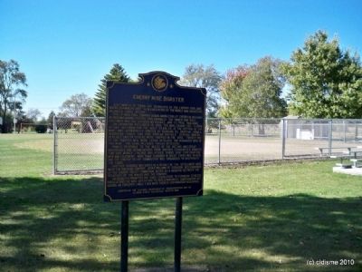
On Main Street (State Highway 89), on the right when traveling south.
Just north of town are remnants of the Cherry Coal Mine, where 259 miners lost their lives in one of the worst mine disasters in United States history.
The St. Paul Coal Company began mining coal at Cherry in 1905 and by 1909 was mining . . . — — Map (db m308284) HM
On North Main Street (Illinois Route 89) 0.1 miles south of Plank Road (County Highway 13).
Honor Roll
World War I
P. Francisco • J. Bobbio
World War II
J. Soldati • A. Shima • B. Manahan • W. Waite
World War One & World War Two
Ampusaitus J. • Bobbio M. • Branstatter J. • Burlech F. • Burnes J. • Calzia G. • Ciocketti J. • . . . — — Map (db m310291) WM
On East Maple Avenue (County Road 2125 N) west of North 2nd Street, on the right when traveling west.
The First State Bank of Manlius was organized March 21, 1902, by
Max P. Seibel with an initial capital of $25,000. It officially opened
June 14, 1902. Its original location was on the west side of Main
Street in Manlius, IL. The first officers . . . — — Map (db m253261) HM
On East Maple Avenue (County Road 2125 N) west of North 2nd Street, on the right when traveling west.
The Manlius Historical Society was incorporated on October 31,
2001 with the purpose of purchasing the old First State Bank
building, preserving its unique style of architecture and reopening
it as a museum.
Original 2001 Officers:
Dee . . . — — Map (db m253274) HM
On North Main Street (Illinois Route 26) north of Elm Place (U.S. 34), on the right when traveling north.
1005 N. Main St., c. 1885, originally a Meat Market.
This building has been placed on the National Register of Historic Places
Princeton North Main Street Historic District — — Map (db m253181) HM
On East Peru Street (U.S. 6) at 8th Street, on the left when traveling east on East Peru Street.
1849 land grant by Chauncey Colton - Three directors elected - School constructed 1850 - First session 1850 - Walls 12" thick - cedar shingles heated by pot bellied stove - outside dimensions 22'x 26 - Moved 12 miles from John Nelson farm to its . . . — — Map (db m253092) HM
On South Main Street (U.S. 34) south of West Marion Street, on the right when traveling south.
Originally a Grocery Store
This building has been placed on the National Register of Historic Places
Princeton South Main Street Historic District — — Map (db m253177) HM
On South Main Street west of Park Avenue, on the right when traveling north.
52nd Illinois Infantry
Colonel Edwin A Bowen
Co B
Captains
David D Bailey • DeWitt C Smith
1st Lieut Charles H Fish
1st Lieut Moses Canon
2nd Lieut George W Graves
2nd Lieut Chas D Tewksbury
Sergeants . . . — — Map (db m311346) WM
On South Main Street (U.S. 34) south of Lovejoy Way, on the left when traveling south.
originally a Furniture Store
This building has been placed on the National Register of Historic Places
Princeton South Main Street Historic District — — Map (db m253179) HM
On South Main Street south of Lovejoy Way, on the left when traveling south.
Originally a Dry Good Store
This building has been placed on the National Register of Historic Places
Princeton South Main Street Historic District — — Map (db m253156) HM
On North Main Street (U.S. 34) south of West Marquette Street, on the right when traveling south.
Originally
a Gentleman's
Clothing Store
This building has been placed on the
National Register of Historic Places
Princeton North Main Street Historic District — — Map (db m253137) HM
On North Main Street (U.S. 34) north of East LaSalle Street, on the right when traveling north.
Originally
a 5 & 10 Cent Store
This building has been placed on the
National Register of Historic Places
Princeton North Main Street Historic District — — Map (db m253134) HM
On N Main Street at W Marquette Street on N Main Street.
Originally a dry good store
This building has been placed on the National Register of Historic Places
Princeton North Main Street Historic District — — Map (db m253107) HM
On County Road 1950E 0.2 miles south of County Road 1900N, on the right when traveling north.
In memory of Enos and Elizabeth Mercer Matson
who came here in 1836
Peter and Jane Dawson Matson
who came here in 1845
these two brothers and their families
came from St. Clairsville, Belmont County, Ohio — — Map (db m195957) HM
On South Main Street (U.S. 34) at East Mechanic Street, on the right when traveling north on South Main Street.
In 2005 the Flags of Freedom were raised on Interstate 80, Exit 56 to honor our veterans, past, present and future. These flags symbolize the brave men and women who now serve and have served this great nation. These magnificent flags which are 30 . . . — — Map (db m253139) HM
On South Main Street at Park Avenue, on the right when traveling north on South Main Street.
In 2005 the Flags of Freedom were raised on Interstate 80, Exit 56 to honor our veterans, past, present and future. These flags symbolize the brave men and women who now serve and have served this great nation. These magnificent flags which are 30 . . . — — Map (db m253182) HM
On South Wyanet Walnut Road (County Road 8) 0.3 miles south of County Road 1900, on the right when traveling north.
First permanent white settlers in Bureau Co located here May 5, 1828. Col Zachary Taylor later Pres of U.S. and Jefferson Davis lodged here enroute to Galena on Peoria Galena State Road at beginning of Black Hawk War. Site of Ft Thomas. Also . . . — — Map (db m257428) HM
On County Road 1950 East 0.5 miles north of North Main Street ( Route 26), on the right when traveling north.
Conserving Both Nature and Culture
Throughout the Illinois River valley, human
history is entwined with a beautiful and abundant
landscape. In Bureau County, we're committed
to conserving our cultural and natural treasures.
One . . . — — Map (db m253253) HM
On South Main Street (U.S. 34) at West Central Avenue, on the right when traveling south on South Main Street.
World-renowned organist, master teacher, recording artist, innovative arranger, and concert star.
Son of Miles S. and Birdie Nichols Fox. Native of Princeton, IL. and graduate of Princeton High School. First organ lessons at Hampshire Colony . . . — — Map (db m253142) HM
Near East Peru Street (U.S. 6) at 8th Street, on the left when traveling east.
First permanent white settlers in Bureau County
May 5, 1828
First farmer, plowing first furrow
June 10, 1828
Parents of first white child born within county
Jan.15, 1830
First County . . . — — Map (db m310286) HM
On East Peru Street 0.1 miles east of South Bureau Valley Parkway/County Road 2100 E, on the left when traveling east.
This house was one of the most important stations in the Underground Railroad movement in Illinois. Runaway slaves were harbored by the Lovejoy family until arrangements could be made for them to travel to the next station on their way to Canada. — — Map (db m259404) HM
On Lovejoy Way at South Main Street (U.S. 34), on the left when traveling east on Lovejoy Way.
Lovejoy Way is a tribute to Owen Lovejoy. Lovejoy came to
Princeton in 1838 to minister at the Hampshire Colony
Church. He spent 17 years here. When he arrived, he
resided with the Butler Denham family, who lived on the
east edge of town. When . . . — — Map (db m253166) HM
On East Peru Street (U.S. 6) just west of 8th Street, on the right when traveling west.
This two-story frame structure was the home of abolitionist Owen Lovejoy, who was born in Maine in 1811. Lovejoy moved into the house in 1838, when he became a Congregationalist minister. He was leader in the formation of the Republican Party in . . . — — Map (db m310285) HM
On Lovejoy Way at South Main Street (U.S. 34), on the right when traveling east on Lovejoy Way.
Dick Nelson was born in Princeton to Francis and
Malcolm Nelson. He graduated from Princeton High
School in 1953. He served in the U.S. Army as a radar
operator in Virginia and Alaska from 1955 to 1957.
Dick married his wife, Judy, on . . . — — Map (db m253175) HM
On Princeton Street (U.S. 6) near East Street, on the right when traveling west.
In memory of Bureau County Pioneers. Sunk the first third Vein Coal mine in Hall Township in 1879. Sold in 1888 to C.W. & V. Coal Co. Mine closed in 1913. The town of Seatonville located on land owned by Seaton Brothers was named for them. This . . . — — Map (db m307719) HM
On West Dakota Street (U.S. 6) just east of North Strong Avenue, on the right when traveling east.
Pioneer resident of Spring Valley. Achieved national prominence in the settlement of the Pennsylvania Anthracite Miners Strike in 1902 with the co-operation of President Theodore Roosevelt. President of United Mine Workers, 1889-1908. Author of . . . — — Map (db m308286) HM
On South Spaulding Street at East Caroline Street, on the right when traveling north on South Spaulding Street.
Pioneer resident of Spring Valley. Achieved national prominence in the settlement of the Pennsylvania anthracite miners strike in 1902 with the co-operation of President Theodore Roosevelt. President of United Mine Workers, 1889-1908. Author of . . . — — Map (db m308287) HM
On North Greenwood Street north of East Erie Street, on the right when traveling north.
Honor Roll
1950 Korean War 1955
These made the supreme sacrifice
Joseph Cieslak • Frank Ogden
Spring Valley Korean veterans
Actis J • Alpaugh W • Anderson R • Andes J • Belski T • Bertalot F A • Bertotti R • Blum W • Bobbio L • . . . — — Map (db m185181) WM
On North Greenwood Street north of East Erie Street, on the right when traveling north.
[Top plaque]
Dedicated to the armed services men
and women of the Spring Valley area
who volunteered their lives to
preserve the freedom of our country.
American Legion Post 182
Spring Valley, Illinois
1994
[Bottom . . . — — Map (db m185185) WM
On North Greenwood Street north of East Erie Street, on the right when traveling north.
Honor roll
1961 Vietnam War 1975
He made the supreme sacrifice
Harry Lewis Jr.
Spring Valley Vietnam veterans
Actis R • Acuncius W • Andes J • Andreoni P • Andreoni W L • Angelo R • Ballerini L E • Ballerini L F • Ballerini L J • . . . — — Map (db m185172) WM
On North Greenwood Street north of East Erie Street, on the right when traveling north.
[Center plaque]
American Legion
Preamble · to · the · Constitution
For God and country we associate ourselves together for the following purposes: to uphold and defend the Constitution of the United States of America; to maintain law and . . . — — Map (db m185085) WM
On West North Street (Illinois Route 92) at North 2nd Street, on the right when traveling east on West North Street.
Don Marquis, American humorist,
dramatist, and poet, was born in Walnut,
July 29, 1878. In 1899 he went to
Washington, D. C., where he began his
career in journalism. He later worked
on newspapers in Atlanta and New York
City. In Atlanta he . . . — — Map (db m230562) HM
On South Main Street at Jackson Street, on the right when traveling north on South Main Street.
[Front] “The purpose of all war is ultimate peace” – Saint Augustine
[Side] In honor and memory of those who served. Our thanks to all at home and abroad who helped preserve our freedoms
Freedom of speech • Freedom of worship • . . . — — Map (db m230579) WM
Near North King Street north of East Main Street (U.S. 6/34), on the right when traveling north. Reported missing.
First permanent white settlers in Bureau County
May 4, 1828
First farmer, having plowed first furrow
June 10, 1828
Parents of first while child born within county
Jan. 15, 1830
First postmaster of Bureau County
1831
The . . . — — Map (db m310168) HM
On Hennepin Canal Parkway Trail (U.S. 6), on the left when traveling west. Reported unreadable.
[Sign #1]
Anatomy of a Canal: Canals like the Hennepin are manmade waterways for boats to travel on. Many canals are built to make shortcuts between two existing bodies of water. The Hennepin Canal was built to carry cargo barges . . . — — Map (db m44828) HM
On West Main Street (U.S. 6) west of North Locust Street, on the right when traveling west.
The Methodist Episcopal Church was formed in 1855, after a small group of worshippers started meeting in their homes in 1838.
A Church was erected on this lot in 1889. The Church was destroyed by fire on January 24, 1896 and was rebuilt in nine . . . — — Map (db m310281) HM
On South Walnut Street at 2nd Street, on the left when traveling south on South Walnut Street.
Erected in honor of the men & women from this community who served their country - and in sacred memory of those who paid the supreme sacrifice — — Map (db m310278) WM
On Community Avenue 0.1 miles south of Main Street (County Road 1), on the left when traveling south.
Honoring all Veterans of the Air force, Army Cost Guard, Marine Corp and Navy.
"And if words cannot repay the debt we owe these men; surely with our actions. We must strive to keep faith with them and the vision that led them . . . — — Map (db m226770) WM
On South State Street near East 2nd Street, on the right when traveling north.
This property is listed in the
National Register of Historic Places
by the
United States Department of the Interior
May 11, 2000
Beardstown Grand Opera House
c.1872
Heritage Preservation
Foundation
“Preserving our . . . — — Map (db m229612) HM
On Sangamon Street at N. Bay Street on Sangamon Street.
Rejecting a treaty, Black Hawk, a leader of the Sauk and Fox, led his hungry people back into Illinois from Iowa in early 1832, intending to plant corn. Black Hawk also hoped to form an alliance with the Winnebago and Pottawatomie. . . . — — Map (db m57691) HM
On West 3rd Street just west of South State Street.
In memory of
Abraham Lincoln
who, for the sake of a mother in distress, cleared her son Duff Armstrong of the charge of murder in this hall of justice.
May 7 1858 — — Map (db m57862) HM
On Sangamon Street at N. Bay Street on Sangamon Street.
Abraham Lincoln and his men were among the 1,500 or so volunteers who had poured into Beardstown for basic military drills. These men had answered Gen. John Reynolds' call to drive Black Hawk and his people out of Illinois. The military . . . — — Map (db m57689) HM
When Abraham Lincoln sought election to the Illinois legislature in 1832, his platform focused on his belief that improvements should be made to the Sangamon River, which he said would be "vastly important and highly desirable to the . . . — — Map (db m57856) HM
Abraham Lincoln first saw Beardstown in the Spring of 1831 as he, two friends, and Denton Offutt steered Offutt's flatboat laden with merchandise on their way to New Orleans. He returned in 1832, first in March to help get the steamer . . . — — Map (db m57693) HM
On South State Street at Main Street on South State Street.
Abraham Lincoln had just won an acquittal for his client William Duff Armstrong in what is now known as the celebrated Almanac Trial of May 7, 1858. At the conclusion of the trial, held on the second floor of the Cass County Courthouse . . . — — Map (db m57858) HM
People in Cass County knew Abraham Lincoln not only as a lawyer but also as a candidate for the Illinois legislature and U.S. Congress. Those earlier campaigns allowed Lincoln to hone his political skills for the 1858 senatorial content . . . — — Map (db m57861) HM
On West 3rd Street just west of South State Street.
It is the celebrated "Almanac Trial" of May 7, 1858 that has forever linked Abraham Lincoln with Beardstown. On that day, Lincoln defended William Duff Armstrong, the son of Lincoln's closest New Salem friends Jack and Hannah Armstrong. . . . — — Map (db m57859) HM
On East Main Street at Jefferson Street on East Main Street.
Travel in Abraham Lincoln's time was time-consuming, dirty, and usually downright uncomfortable. On many of his trips, Lincoln traveled by train to Meredosia. From there he had the choice of a steamboat or a bone-jarring ride in a . . . — — Map (db m57863) HM
On South Main Street (Illinois Route 78) at Virgina Road (County Road 10), on the right when traveling south on South Main Street.
The steel plow doomed the Illinois prairie over 150 years ago when blacksmith John Deere first introduced his invention design to ease the task of breaking the tough sod of what was to become the "Corn Belt."
(from article written by . . . — — Map (db m294537) HM
On South Main Street (Illinois Route 78) at East Springfield Street, on the right when traveling south on South Main Street.
In honor of all our brave men and women who give of themselves that others need not
World War I • World War II • Korea • Vietnam • Grenda • Panama • Persian Gulf
God bless our Cass County veterans — — Map (db m294533) WM
On South Main Street (Local Road 78) north of Virgina Road (Local Road 10), on the right when traveling south.
If it was not for the wood spoked wagon wheel American history would have to be rewritten. The westward track would have been a long walk and family heirlooms left behind if not for the wooden spoke wagon wheel. — — Map (db m294534) HM
On West Beardstown Street west of South Pitt Street, on the right when traveling west.
This is the site of the first building
erected as the seat of government of
Cass County, Illinois, on land provided by
Dr. H. H. Hall the founder of Virginia.
Circuit court was held here for the
first time in May, 1839 and the . . . — — Map (db m229610) HM
On East Division Street / Johnson Road (Illinois Route 113) 1 mile west of Interstate 55, on the right when traveling west.
The Diamond Mine of the Wilmington Coal Mining and Manufacturing Company, located near Braidwood on the Grundy-Will County line, was the site of a major mine disaster in Illinois.
The mine was on a marshy tract of land that had no natural . . . — — Map (db m6868) HM
On East Mazon Street at North Center Street on East Mazon Street.
Thank you to Bob and Peggy Kraft for donating this Route 66 Hall of Fame streetcar to Gardner.
The Krafts provided years of food, fun and nostalgia at their Riviera Roadhouse located on Route 66. The Riviera unfortunately burned down on June 8, . . . — — Map (db m159247) HM
On East Mazon Street at North Center Street, on the right when traveling east on East Mazon Street.
In 1948, the Gardner Chronicle had this headline:
He Saved the World! Gardner Man Should be Remembered
Reverend Christian Christiansen, affectionately known as “Little Chris,” was born on October 8, 1859 in Norway. As a young . . . — — Map (db m270448) HM
On East Benton Street at Liberty Street, on the right when traveling west on East Benton Street.
This building housed the depot and powerhouse for
the interurban streetcar line, as part of the Illinois
Traction System. The line ran between Joliet, Morris,
Ottawa and Princeton and closed in 1934.
Morris Downtown
Commercial . . . — — Map (db m239311) HM
In 1873 J. H. Hall started a school furniture factory at
this location. The following year the new owner, F. T.
June, built this building and named it Sherwood School
Furniture. Two years later Coleman Hardware moved in.
They made casters and . . . — — Map (db m239277) HM
On West Illinois Avenue at Liberty Street, on the right when traveling east on West Illinois Avenue.
[panel 1] "...How sweet the recollection, when my children were about me, then I felt I had protection, and no one dared to flout me." Elsie Armstrong wrote an epic poem that records the tragic deaths of four children. It . . . — — Map (db m233211) HM
On East Washington Street east of Liberty Street, on the left when traveling east.
Built by Max Frank, this building is a prime example of Italianate commercial architecture. In 1905 it was rented by the Morris Post Office. In 1942 it was purchased by the Colonial Furniture Co. — — Map (db m233164) HM
On Liberty Street south of West Jefferson Street, on the right when traveling south.
Built by Louis Gebhard, founder of the Gebhard Brewery. The ground floor originally housed Peterson's Grocery, Cronin Hardware and Sachse Saloon. Apartments were on the second floor, and the Masonic Lodge was on the third. This building has also . . . — — Map (db m239274) HM
On East Washington Street just east of Liberty Street, on the right when traveling east.
Erected and Dedicated to the memory of the Soldiers and Sailors of Grundy County 1861 — 1865. Missionary Ridge Shiloh Vicksburg Chickamauga — — Map (db m239304) WM
On East Washington Street at Liberty Street, on the right when traveling west on East Washington Street.
Abigail Atwater and N.C. Perry built this building to house the Grundy County Bank. The northern section was built by canal boat captain, Samuel Hull to house a grocery store and his living quarters upstairs. — — Map (db m233112) HM
Near East Washington Street just east of Liberty Street, on the right when traveling east.
In honor of the men of Grundy County who died in service in the Great War for Democracy that Peace might reign in the World Alfred Baker • Christ Beck • William Bridel • Joseph Cantwell • Paul Carter • Cesare Constantine • John Crosetto • Claude . . . — — Map (db m232998) WM
On Liberty Street just south of East Washington Street, on the right when traveling north.
Erected prior to 1700, over the grave of Chief Nucquette, near foot of Wauponsee Street, Morris.——— Moved by City Council — 1925 — — Map (db m232999) HM
Near West Illinois Avenue at Liberty Street, on the right when traveling east.
During World War II the Wisconsin Based Manitowoc Ship Building Company constructed twenty eight Gato/Bolao Class submarines. This bolstered the production of existing Naval Shipyards. The completed submarines made their way from Lake Michigan down . . . — — Map (db m233000) HM
On West Illinois Avenue at Liberty Street, on the left when traveling west on West Illinois Avenue.
Listed on the National Register of Historic Places January 31, 2006 A place of historical and architectural significance Established as the Grundy County Seat in 1842 — — Map (db m233107) HM
Near East Washington Street just east of Liberty Street, on the right when traveling east.
On April 12, 1842, Morris was confirmed as the site for the county seat of Grundy County. This tree is planted in commemoration of the 150th anniversary of the event. — — Map (db m239284) HM
Near West Illinois Avenue at Nettle Street, on the left when traveling west.
This half-faced camp, built by Joe Sukle of logs cut from the Aux Sable timber, is a replica of the one built by Henry Cryder, Nathaniel Tabler, and Zachariah Walley when they arrived at Aux Sable Creek on October 23, 1833. The original camp . . . — — Map (db m298014) HM
On West Illinois Avenue at Liberty Street, on the right when traveling east on West Illinois Avenue.
Canal commissioners were charged with platting towns to develop commerce along the canal. In 1841, the state's largest county — LaSalle County (to the west) was split with the eastern section becoming Grundy County. The location of the new county . . . — — Map (db m233167) HM
On West Illinois Avenue at Liberty Street, on the right when traveling east on West Illinois Avenue.
Morris blossomed into an important agricultural center when the I&M Canal opened in 1848. The remains of the historic Coleman Hardware building (now housing the Grundy County Historical Museum) and the nearby Gebhard Brewery are reminders of the . . . — — Map (db m233168) HM
On Mill Street at Elm Street, on the right when traveling north on Mill Street.
This ruin is all that remains of a building that was constructed in the middle 1800s of stone that was quarried locally from the bluffs along the Mississippi River. It was originally a private home and meeting place for the people of Elsah. The . . . — — Map (db m216141) HM
On Illinois Route 100, on the right when traveling east.
Beyond the river banks
The quick ride across the Brussels Ferry opens to a world of pristine countryside, flowering hillsides and a slow-paced lifestyle for which Calhoun County has become known during every season of the year.
. . . — — Map (db m225178) HM
On Great River Road (Illinois Route 100) just west of Grafton Hills Drive, on the right when traveling west.
Charles Brainerd House
420 E. Main
has been placed on the
National Register
of Historic Places
by the United States
Department of the Interior
c. 1885 — — Map (db m209840) HM
On Lodge Boulevard, on the right when traveling east.
An outspoken abolitionist, Lovejoy was owner and publisher of the Alton "Observer". His anti-slavery writings aroused dangerous animosity in the area. Three times his presses were destroyed by mobs, and replaced by the townspeople. The fourth time . . . — — Map (db m142763) HM
On West Main Street (State Road 100) at Mason Hollow Road, on the right when traveling west on West Main Street.
Where the rivers meet
The essence of the meeting of the Great Rivers National Scenic Byway is the celebration of the unique river communities found at the convergence of America's great rivers. At the confluence of the Mississippi and . . . — — Map (db m210702) HM
On Lodge Boulevard, on the right when traveling east.
A confederation of many Indian tribes living along the Mississippi and Illinois rivers. "Illiniwek" means "The Men". During French occupation of this area it was shortened to "Illini", and the French ending "ois" was added, giving the state of . . . — — Map (db m142760) HM
On Great River Road (Illinois Route 100) 1 mile west of Palisades Parkway, on the right when traveling west.
Pointe du Hoc was a prominent German defensive position on the coast of Normandie, France, placed atop 100-foot cliffs that jutted out between Utah and Omaha Beaches.
The Germans had a battery of heavy guns on top of the cliff. The guns had . . . — — Map (db m302019) HM WM
On Lodge Boulevard, on the right when traveling west.
Over the years, about 165,000 individuals were employed in at least 50 Illinois Civilian Conservation Corps camps in Illinois. Many of these worked on projects in Illinois' state parks.
One of the most successful programs to aid Americans . . . — — Map (db m142758) HM
The story of the "Dinky" begins with the Illinois Terminal Railroad Company. The company was unique in its operation of a combination steam and electric railroad lines under one corporate name. The "Railbus" evolved from steam-powered passenger . . . — — Map (db m281142) HM
482 entries matched your criteria. The first 100 are listed above. Next 100 ⊳