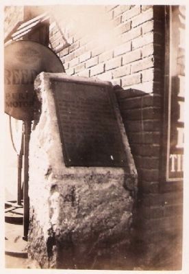
On Ohio Route 150 0.1 miles west of Main Street, on the right when traveling east.
Gen. John H. Morgan in command of Confederate Troops on July 25, 1863, passed Updegraff's Mills then located here; proceeded northward via "Dry Fork Valley" and Smithfield; pursued by Gen. James M. Shackleford commanding 14th Ill. Cav., First Ky. . . . — — Map (db m37753) HM
Near Bergholz-New Somerset Road 0.2 miles north of State Park-Mooretown Road.
Side A
In 1871 Robert and Martha McLaughlin George, erected Monument In the memory of their son Thomas and other soldiers from Ross Township, Jefferson County, Ohio who died in service to the United States during the Civil War. All were . . . — — Map (db m224967) HM WM
On Green Street at East Main Street (U.S. 250), on the right when traveling east on Green Street.
General John H. Morgan in command of Confederate Troops entered Jefferson County here July 25, 1863; proceeded northward via Short Creek Valley, Smithfield and other Villages, pursued, under orders of Gen. Ambrose E. Burnside, by Gen. James M. . . . — — Map (db m37146) HM
On West Vaughn Drive just east of Central Avenue, on the right when traveling east.
The completion of Madison's railroad connection to Indianapolis in 1847, the first in the state, heralded the peak of Madison's golden years as a manufacturing city, shipping port, and busy river town. Since the early 1800s, Madison had continued . . . — — Map (db m180813) HM
On West 1st Street just west of Vine Street, on the left when traveling west.
One of Madison’s most prominent citizens was James Franklin Doughty Lanier. He was a pioneer and respected banker/financier. Lanier hired the talented architect Francis Costigan to design his magnificent mansion on the Ohio River, where it shines . . . — — Map (db m180800) HM
Near County Route 49 0.1 miles west of Route 164, on the left when traveling west.
Gen. John H. Morgan in command of Confederate Troops passed here July 26, 1863: Burned a County bridge and proceeded northward via Nebo (now Bergholz) pursued by Gen. James M. Shackleford commanding 14th Ill. Cav., First Ky. Cav., 9th Mich. Cav., . . . — — Map (db m37439) HM
On Ohio Route 164 south of Local Road 263, on the left when traveling north.
The bronze tablet on this marker (#13) reads:
Gen. John H. Morgan in command of Confederate Troops passed here July 26, 1863: Burned a County bridge and proceeded northward via Nebo (now Bergholz) pursued by Gen. James M. Shackleford . . . — — Map (db m37759) HM
On Dry Fork Road (County Highway 8) at State Route 150, on the right when traveling north on Dry Fork Road.
Gen. John H. Morgan in command of Confederate Troops passed here July 25, 1863; proceeded northward via “Dry Fork Valley” present site of Bradley and Smithfield, pursued by Gen. James M. Shackelford commanding 14th Ill. Cav., 1st Ky. Cav., 9th Mich. . . . — — Map (db m37147) HM
On Ohio Route 43 at Mill Street, on the left when traveling east on Ohio Route 43.
Gen. John H. Morgan in command of Confederate Troops passed through this village July 26, 1863; proceeded northward via Circle Green and Nebo (now Bergholz) pursued by Gen. James M. Shackelford, commanding 14th Ill. Cav., First Ky. Cav., 9th Mich. . . . — — Map (db m37758) HM
On Ohio Route 152 at Route 213, on the right when traveling east on Ohio Route 152.
Born in Knoxville in 1840 and reared at a farm in New Somerset, William Pittenger mustered into the 2nd Ohio Volunteer Infantry, under a 90-day enlistment, in 1861. He fought at the First Battle of Bull Run and was the war correspondent for the . . . — — Map (db m75887) HM
On Ohio Route 164 at County Road 55, on the left when traveling east on Ohio Route 164.
Gen. John H. Morgan in command of Confederate Troops passed through this village July 26, 1863; proceeded northward toward Salineville pursued by Gen. James M. Shackelford, commanding 14th Ill. Cav., First Ky. Cav., 9th Mich. Cav., 11th Mich. Bat'y, . . . — — Map (db m37760) HM
On County Highway 74 at Local Highway 166, on the left when traveling east on County Highway 74. Reported missing.
(Plaque missing; text from 1913 Steubenville Herald)
Gen. John H. Morgan in command of Confederate Troops passed here July 25, 1863; proceeded northward up Cross Creek valley, via Wintersville, pursued by Gen. James M. Shackelford . . . — — Map (db m36217) HM
On New Alexandria Road (Ohio Route 151) at Chappel Hill Road (Local Highway 184), on the right when traveling west on New Alexandria Road.
Gen. John H. Morgan in command of Confederate Troops passed through this village July 25, 1863; proceeded northward via McIntire and Cross Creek Valleys and Wintersville, pursued by Gen. James M. Shackelford, commanding 14th Ill. Cav., First Ky. . . . — — Map (db m37752) HM
On Local Highway 166 0.5 miles north of County Highway 74, on the left when traveling north.
Gen. John H. Morgan in command of Confederate Troops passed here July 25, 1863; burned a bridge of the Steubenville and Indiana R.R. proceeded northward via Ekey Church, "Dry Fork Valley" and Wintersville, pursued by Gen. James M. Shackelford, . . . — — Map (db m36222) HM
On East Main Street (Ohio Route 43) at Route 152, on the left when traveling east on East Main Street.
Gen. John H. Morgan in command of Confederate Troops passed through this village July 26, 1863: proceeded northward via Circle Green and Nebo (now Bergholz) pursued by Gen. James M. Shackelford, commanding 14th Ill. Cav., First Ky. Cav., 9th Mich. . . . — — Map (db m37757) HM
On Main Street (Ohio Route 152) 0.2 miles south of Route 151, on the left when traveling north.
Gen. John H. Morgan in command of Confederate Troops passed through this village July 25, 1863; proceeded northward via New Alexandria, pursued by Gen. James M. Shackelford, commanding 14th Ill. Cav., First Ky. Cav., 9th Mich. Cav., 11th Mich. . . . — — Map (db m36213) HM
On 4th Street at Slack Street, on the right when traveling east on 4th Street.
Andrew Carnegie (1835-1919). Andrew Carnegie was born in Dunfermline, Scotland. He immigrated to Allegheny City Pennsylvania with his family when he was 13. While operating the telegraphs for the Pennsylvania Railroad, Carnegie perceived the . . . — — Map (db m62959) HM
On South 4th Street at Slack Street, on the right when traveling north on South 4th Street.
The Ohio Valley Steelworker Statue was cast at Centre Foundry and Machine Company in Wheeling, West Virginia and dedicated in 1989. Created by artist Dimitrios Akis, the statue honors the men and women who worked in area iron and steel industries . . . — — Map (db m139938) HM
On Canton Road (Ohio Route 43) 0.2 miles north of U.S. 22, on the right when traveling south.
Gen. John H. Morgan in command of Confederate Troops passed here “Two Ridges Church” July 25, 1863; proceeded northward via Richmond pursued by Gen. James M. Shackelford, commanding 14th Ill. Cav., First Ky. Cav., 9th Mich. Cav., 11th . . . — — Map (db m37754) HM
On Main Street (Ohio Route 43) at Fernwood Road, on the right when traveling east on Main Street.
Gen. John H. Morgan in command of Confederate Troops passed here July 25, 1863; proceeded northward via Richmond pursued by Gen. James M. Shackelford, commanding 14th Ill. Cav., First Ky. Cav., 9th Mich. Cav., 11th Mich. Bat'y, 86th Ohio Mounted . . . — — Map (db m35779) HM
On Ohio Route 78 at Unionville Road, on the right when traveling west on Ohio Route 78.
Big Muskie. On May 22, 1969, Central Ohio Coal Company invited dignitaries to Muskingum Mine for the unveiling of the world's largest drag-line: the Bucyrus - Erie model 4250W affectionately named "Big Muskie." Four crews worked together to . . . — — Map (db m283625) HM
On Portage Lakes Drive (County Route 75) at South Turkeyfoot Road (County Route 123), on the right when traveling east on Portage Lakes Drive.
Coventry Township. The land on which Coventry Township is situated was ceded in 1785 to
the United States by the Delaware, Chippewa, Ottawa, and Wyandot tribes under the Treaty of Fort McIntosh. The area was a choice location for Native . . . — — Map (db m277653) HM
On W Main Street at N 6th Street, on the right when traveling west on W Main Street.
A native of Wales, Williams came to Kentucky around 1780. In 1783, he built his distillery on the banks of the Ohio River, distilling whiskey from corn on the east side of what is now 5th Street. It is said to have been the first commercial . . . — — Map (db m104373) HM
On 1st Street Southeast at Tremont Avenue Souteast, on the right when traveling north on 1st Street Southeast.
Sergeant Company G, 2nd Ohio Infantry
5th to receive Medal of Honor on March 25, 1863
Born January 31, 1840 Knoxville, Jefferson County, Ohio. Died April 24, 1904, Fallbrook, San Diego County, CA. Buried Odd Fellows Cemetery, Fallbrook, CA. . . . — — Map (db m273275) HM WM
On South 2nd Street (Kentucky Route 1020) at West Cardinal Boulevard, on the left when traveling north on South 2nd Street.
Between 1750 and 1840, British colonists and later United States citizens acquired and settled millions of square miles between the Appalachian Mountains and the Mississippi River. The Ohio River bisects this vast region, flowing 981 miles from . . . — — Map (db m245720) HM
On West Main Street west of South 1st Avenue, on the right when traveling east.
Oldham was the 75th county created by the Kentucky Legislature. It was formed on January 15, 1824, from portions of Jefferson, Henry and Shelby Counties. The county is named for William Oldham, Revolutionary War patriot and early pioneer.
. . . — — Map (db m136163) HM
On Westport Road (Kentucky Route 524) at 4th Street, on the right when traveling west on Westport Road.
First called Liberty, located on 1780 grant to Elijah Craig. Ferry operated here by Levi Boyer early as 1800 formed a link in route to Illinois country. Town became a port to the west -- Westport. In the steamboat era, the town was a thriving port . . . — — Map (db m42974) HM
Near Jefferson Street south of East Main Street (Ohio Scenic River Byway) (U.S. 421), on the left when traveling south.
This bell, which once hung in the Courthouse cupola, survived the Courthouse fire of May 20, 2009 thanks to the efforts of 18 area volunteer fire departments. According to the inscriptions of its exterior, the bell was cast by the G.W. Coffin & . . . — — Map (db m181496) HM
Near North Blackford Street north of Indianapolis Cultural Trail, on the right when traveling south.
Jefferson County is home to a great boulder-strewn canyon that sunlight can only penetrate at high noon. Moss and ferns cling to the cliffs along Clifty Creek where Big Clifty Falls drops 60 feet in its run to the Ohio River. In 1846 the county . . . — — Map (db m238918) HM
On Breckenridge Lane (State Road 1932) south of Hillsboro Road, on the right when traveling south.
This pioneer fort, begun in 1779, one of five on Beargrass Creek, was situated 500 ft. west. Three were owned by Col. John Floyd who made his headquarters here. He served as first County Lieut. of Jefferson County, 1780 until killed by Indians, . . . — — Map (db m161997) HM
Near South Main Street south of Liberty Street, on the right when traveling north.
Side A
Born near Amsterdam. Forest was the youngest of four sons of Homer and Blanche Buchanan. By the age of 3, his burning desire for nature study was ignited following his older brother John through the local woods he called home. A . . . — — Map (db m208575) HM
On West 3rd Street at Mill Street, on the right when traveling west on West 3rd Street.
Madison was established upon a shelf of high ground Between the Ohio River and Crooked Creek. From Pittsburgh, Pennsylvania the Ohio River waters flow just south of this place all the way down to the Gulf of Mexico. From the Indiana hills just north . . . — — Map (db m289226) HM
On Rankin Hill Road (County Route 556) 1.5 miles east of North Second Street, on the right when traveling south.
John Rankin was born in Jefferson County, Tennessee, and lived in the state through college, his marriage, and his beginning as a minister. He was often opposed by congregations for frequently sharing his anti-slavery beliefs from the pulpit. In . . . — — Map (db m273122) HM
On East Main Street (Ohio River Scenic Byway) (U.S. 421) just east of Jefferson Street (U.S. 421), on the right when traveling west.
Jefferson County Courthouse [west side]Completed in 1855, the Greek Revival style brick and stone courthouse replaced a smaller octagon shaped courthouse that burned in 1853. In 1869 the roof was rebuilt with the steeper pitch . . . — — Map (db m181158) HM
On Mansfield Drive (U.S. 250) at North Main Street (U.S. 250), on the right when traveling east on Mansfield Drive. Reported permanently removed.
Col. Benjamin F. Kelley
Kelley, a railroad agent in Philadelphia and former resident of Wheeling, was called back to command the First Virginia (Union) Infantry--the first Union regiment raised in the South. He planned and led the attack on . . . — — Map (db m308160) HM
On E Washington Street (U.S. 340 Bus) at S Seminary Street, on the right when traveling east on E Washington Street.
The Federal offensive in the Shenandoah Valley begun in May 1864 faltered in the summer with Confederate victories and Gen. Jubal A. Early's Washington Raid in July. Union General Philip H. Sheridan took command in August, defeated Early . . . — — Map (db m238786) HM
On Opal Road NE (County Route 294), on the right when traveling west.
On July 26, 1863, Brigadier General John Hunt Morgan's plan to direct his Confederate raiders through Salineville had to be altered quickly when his scouts reported that Union troops occupied the village. Major General Ambrose Burnside, commander of . . . — — Map (db m173477) HM
On Michigan Avenue at East 11th Street, on the right when traveling north on Michigan Avenue.
Margaret McMullin Virden was one of two daughters of W.M. McMullin, Sr., a Union Veteran, who came to Lynn Haven in 1911 with five grown children and grandchildren. Known as “Millionaire’s Corner” this home was constructed by Margaret and husband . . . — — Map (db m297465) HM
On W Jefferson Street at S 5th Street, on the right when traveling west on W Jefferson Street.
City and County Named. Louisville, at the Falls of the Ohio, was founded in 1778 by George Rogers Clark. Site first served as a military outpost; the city which developed was named for Louis XVI. Kentucky Co., Virginia, was divided in 1780 . . . — — Map (db m104581) HM
On Stone River Road north of Old Leeds Lane, on the left when traveling north.
Wallace S. McElwain (1832-1888)McElwain trained in a gun factory in New York and in a foundry in Ohio before moving to Holly Springs, MS, where he operated Jones, McElwain and Company Iron Foundry. He was well known in the Southeast for his . . . — — Map (db m26266) HM
On Shelbyville Road (U.S. 60) at Whipps Mill Road, on the right when traveling west on Shelbyville Road.
Fort William
Established in 1785 by William Christian and his wife, Anne, a sister of Patrick Henry. On this site one of earliest stone houses in Kentucky was a famous tavern, The Eight Mile House, on Harrods Trace to Falls of the Ohio. From . . . — — Map (db m161983) HM
On North Samuel Street at East Washington Street (West Virginia Route 51), on the right when traveling north on North Samuel Street.
Jefferson County’s association with significant events in Civil War history began in October 1859, when abolitionist John Brown raided the U.S. Arsenal at Harpers Ferry. Quickly captured, Brown and his followers were brought here to Charles Town . . . — — Map (db m41671) HM
On North Street just south of Melbourne Street, on the right when traveling north.
Fort Sumner Park, located behind you acros North Street, began its history in 1775 during the Revolutionary War. Initially referred to as The Great Fort, and later, as The Citadel, it was commissioned in 1794 as the first . . . — — Map (db m311684) HM
On Melvin Road (County Road 17/2) 0.1 miles Flowing Springs Road (County Road 17), on the right when traveling east.
This station structure was erected in 1839 by landowner Richard Duffield, in cooperation with the Baltimore & Ohio Railroad. It is the oldest surviving purpose-built freight/passenger rail station in the United States, and is listed on the . . . — — Map (db m157741) HM
On Morgan Jaymes Drive west of Justine Court, on the right when traveling west.
This small family cemetery is all that remains of what was once Joseph Hite's 1000 acre estate. Joseph's son and intended heir, Stephen Hite (1700-1828), is buried here. Stephen's wife, Martha (1798-1830), and daughter, Sarah (1824-1827), are also . . . — — Map (db m223424) HM
On Market Street west of North 3rd Street, on the right when traveling west.
This cannon stands as a rare survivor of Ohio's early military history. Believed to have been forged in Steubenville in the mid-1820s under the direction of General Samuel Stokely for local militia service, this cannon is one of the few remaining . . . — — Map (db m307550) HM
On South Washington Street (Ohio Route 100/231) at East Market Street ( Route 18/101), on the right when traveling north on South Washington Street.
General Gibson believed the two most
important things in life were piety and
patriotism. In his creed they were linked
in indissoluble union. His piety was broad
enough to include every creed, his patriotism
wide enough to cover . . . — — Map (db m195296) HM WM
On Tennessee Route 35, on the left when traveling south.
Side A
* Jefferson County *
Established 1792: named in honor of
Thomas Jefferson
Secretary of State; formerly member of the Continental Congress; principal author of the Declaration of Independence; later Governor of . . . — — Map (db m81373) HM
On Route 9 Bike Path 0.4 miles south of Luther Jones Road (County Road 16/4), on the right when traveling north.
On the east side of WV 9 is one of the oldest standing frame (post and beam) buildings in West Virginia. It was constructed in three sections, with the oldest, 1½-story eastern section dating between 1751 and 1755. The voids between the studs . . . — — Map (db m207032) HM
On Baxter Street at Warfield Way, on the left when traveling east on Baxter Street.
Charles William Warfield, Sr. was born on December 8, 1870 in Harpers Ferry, West Virginia. He was the second child of James Oscar & Elizabeth (née Robinson) Warfield. Not much is known about his childhood. He married Mary Margaret (née Crane, . . . — — Map (db m267749) HM
On Washington Street, on the right when traveling north.
History of the Avenue Bridge 2
The 1864 bridge was destroyed by flood in
1867, despite the citizens' valiant effort to
defend it from unusually high spring waters.
Vigilant people had, however, saved as much
wood as they could in . . . — — Map (db m288404) HM
On Trail #7 east of State Park Drive, on the right when traveling east.
Trace the history of Rose Island through time. As time marches on, so does the history of this former resort. As you explore the park, find the reclamation logo and look around to see how nature is slowly reclaiming the land.
1700
Indian . . . — — Map (db m303869) HM
Sergeant Charles Floyd
Sergeant Charles Floyd was one of the outstanding members of the Lewis & Clark Expedition. Born in Jefferson County, Kentucky sometime between the years 1780 and 1785, his father and uncles served with George Rogers . . . — — Map (db m177298) HM
On W Main Street 0.2 miles north of Place Montpellier, on the right when traveling west.
York was the first African American to cross the United States from coast to coast. Born a slave belonging to the Clark family, York was assigned as a boy to be William Clark’s servant. He moved with the Clarks from Virginia to Jefferson County . . . — — Map (db m251354) HM
On Beechland Road (Kentucky Route 438) at Lincoln Park Road ( Route 528), on the left when traveling east on Beechland Road.
Pioneer Spirit
The westward movement was an enticement felt by many nineteenth century families, and the Lincolns were in the heart of it. A friend of the family was the infamous frontiersman Daniel Boone, and it has been reasoned that . . . — — Map (db m46249) HM
[Left Historical Marker]:
This Land Office was established by Congress
on May 10, 1800.
President John Adams appointed David Hoge
as Land and Title Registrar, which position
he held for forty years.
In 1801 Mr. Hoge bought the . . . — — Map (db m46886) HM
Near Chestnut Street (Pennsylvania Route 66) at West Spruce Street.
First called "Blood's Settlement", and then later Marien, then Marienville, after Marien (Blood) Hunt, daughter of Cyrus Blood, the founder of Forest County. Marienville is located on a flattened ridgeline known as the "Big Level", . . . — — Map (db m138604) HM
Near Battle Park Drive 0.4 miles west of Saratoga Drive, on the left when traveling west.
From this position near the Hoge Run creek bed, you have a view similar to that of the Confederate sharpshooters as they saw the Union defensive line along the stone wall by Pritchard's Lane. (Note that the creek bed has been significantly . . . — — Map (db m159170) HM
Thin black lines indicate changes in relevance. Between each pair of lines entries are ordered geographically but all have the same relevance.
* Inflectional forms of words are their plurals, singulars, and possessives as well as gramatical tenses and similar variations.