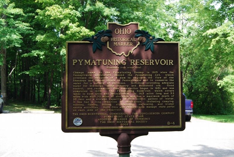
On Pymatuning Lake Road (County Route 274) 1.2 miles north of Martin Road (County Route 269), on the left when traveling south.
Pymatuning Wetlands The advancing and retreating mile-high glacial sheet of ice and snow shaped the countryside around this area. As the last of the ice masses melted, a great swamp developed, punctuated by towering white pines, bogs, and . . . — — Map (db m107661) HM
On South Main Street (U.S. 6) at East Main Street (Ohio Route 85), in the median on South Main Street.
[counter clockwise from the south: five individual stones]U.S. Air Force U.S. Coast Guard U.S. Army U.S. Navy U.S. Marines U.S. Merchant Marine — — Map (db m107658) WM
On Bridge Street (Ohio Route 531) at Goodwill Drive, on the right when traveling west on Bridge Street.
The location of Shaffner-Knox Drugs, built for Doxsie Dairy Company
1935-1952
Doxsie Dairy Company
1957-1970
Commercial Testing and Engineering Company — — Map (db m132361) HM
On Bridge Street (Ohio Route 531) west of Goodwill Drive, on the right when traveling west.
Built in 1889 by A.J. Beckwith
1889-1908
A.J. Beckwith Dry Goods
1912-1927
Globe Clothiers
1930
Turner's Drug Store
1934-1940
The Great A & P Tea Company
1941-1945
England . . . — — Map (db m132359) HM
On Goodwill Drive at Bridge Street ( Route 531), on the right when traveling south on Goodwill Drive.
Burrill Block
The location of Edward H. Burrill Meat Market, the Burrill Block was built in 1900
1896-1921
Burrill's Meat Market
1926
Ragnvald Wary Billiards
1941-1953
Corner Restaurant . . . — — Map (db m132362) HM
On Bridge Street (Ohio Route 531) west of Goodwill Drive, on the right when traveling west.
Built in 1889 by John & Oliver Topky
1889-1950
Topky Brothers Hardware & Ship Chandler
1951-1978
The Topky Hardware Company
1979-1995
Topky-Cook's Hardware Company — — Map (db m132356) HM
On Bridge Street (Ohio Route 531) west of Goodwill Drive, on the right when traveling east.
The location of Edward H. Burrill Meat Market, the Burrill Block was built in 1900
1900-1908
H. Bieder Company, confectioner, ice cream, cigars, news dealer
1909-1962
Christiansen Confectionery Store
Upstairs . . . — — Map (db m132364) HM
On West Bridge Street (Ohio Route 531) west of Goodwill Drive, on the right when traveling east.
The location of Cooper Butcher Shop, the Kunkle Block was built in 1900
1907-1918
F. J. Kempel Jeweler
1921
Century Club
1926-1931
Marine Sanitary Barber Shop
Wilfred Beauty Parlor
1944-1971 . . . — — Map (db m132295) HM
On Bridge Street (Ohio Route 531) east of Hulbert Avenue, on the right when traveling west.
Built in 1889 by John & Oliver Topky
1895-1897
Mills and Burton Drugs
1898-1914
H.T. & L.T. Carlisle Department Store
1914-1927
George S. Eddy Department Store
1929-1931
John Dellerba, . . . — — Map (db m132355) HM
On Bridge Street (Ohio Route 531) west of Goodwill Drive, on the right when traveling east.
The location of Cooper Butcher Shop, the Kunkle Block was built in 1900
1907
Sperra Café
1912
Charlie Patchin's Restaurant
1921
Reuben Russack Clothing
1926
Elite Tonsorial Parlor . . . — — Map (db m132321) HM
On Bridge Street (Ohio Route 531) west of Goodwill Drive, on the right when traveling east.
The location of the Herrick Hotel, built in 1916 for Peter J. Kapsanis
1916-1961
Harbor Sugar Bowl
1967-1971
West Fifth Club Tavern — — Map (db m132322) HM
On Bridge Street (Ohio Route 531) west of Goodwill Drive, on the right when traveling east.
The location of the Herrick Hotel, the Petros Block was built in 1916
1916-1931
Frank Petros Confectionery
1934-1945
Petros Brothers Men's Furnishings
1946-1972
Paul's Bar & Restaurant
1973-1997 . . . — — Map (db m132323) HM
On Bridge Street (Ohio Route 531) west of Goodwill Drive, on the right when traveling east.
The location of the Herrick Hotel, the Petros Block was built in 1916
1916-1960
Benjamin's Barber Shop
1977-1980
Harbor Sales Notions Store
1988-1997
Leeward Lounge Expansion
Upstairs
1916-1960 . . . — — Map (db m132324) HM
On Bridge Street (Ohio Route 531) east of Hulbert Avenue, on the right when traveling west.
1895-1912
I.H. Pardee, physician
J. Millard Chamberlain, attorney
Joseph J. Downey, insurance & real estate
Sullivan & Kullane, dressmakers
Mrs. Virginia T. Morell, dressmaker — — Map (db m132351) HM
On Bridge Street (Ohio Route 531) west of Goodwill Drive, on the right when traveling east.
Ducro Block
Built in 1901 by John Ducro
1901-1912
John Ducro's Son's Furniture, Undertaker & Ambulance Service
1915-1921
Harbor Post Office
1926
Frank Weiss Billiards
United Cigar Store
1931 . . . — — Map (db m132325) HM
On Bridge Street east of Hulbert Avenue, on the right when traveling west.
1889-1899
Margaret Shanahan, billiards & saloon
Dennis Shanahan, cigars & tobacco
1907-1912
Ed Kennedy Saloon
Kennedy Hotel upstairs
1918
R.J. Wang
1930
Michael Moinar Pool Room . . . — — Map (db m132350) HM
On Bridge Street (Ohio Route 531) east of Hulbert Avenue, on the right when traveling east.
Ducro Block
Built in 1901 by John Ducro
1901-1912
John Ducro's Sons Furniture, Undertaker & Ambulance Service
1915-1935
Max Karpel Clothing
1936-1956
Mollie Karpel Mens Clothing
1957-1965 . . . — — Map (db m132326) HM
On Bridge Street (Ohio Route 531) west of Hulbert Avenue, on the right when traveling east.
1895-1898
Diamond Palace Restaurant
1907
George H. Smith Café
1912
Frederick C. Jenkins, barber
1921
M. S. Cratsley, barber
1926-1934
Henry Kohus, barber
1937
Anthony . . . — — Map (db m132333) HM
On Bridge Street (Ohio Route 531) east of Hulbert Avenue, on the right when traveling east.
The location of Gregory, Burwell & Company, furniture & undertakers, built in 1912 by Harbor Building & Loan Co.
1912-1952
Harbor Building and Loan Company
1912-1926
Gregory-askew & Company Undertakers
Adams Express . . . — — Map (db m132334) HM
On Bridge Street (Ohio Route 531) west of Hulbert Avenue, on the right when traveling east.
1889-1929
Thomas J. Rennick Meats, also pure Lake Erie ice
1930-1960
Rennick's Meat Market
1961-1962
The Miller-Anderson Company Meat Market — — Map (db m132335) HM
On Bridge Street (Ohio Route 531) west of Hulbert Avenue, on the right when traveling west.
Built in 1910 by M.A. Hanna
1910-1929
Marine National Bank
1931-1952
Marine Savings Bank Co.
Office of the City Treasurer
1953-1962
Farmer's National Bank & Trust
1964-1986
Board of . . . — — Map (db m132345) HM
On Bridge Street (Ohio Route 531) west of Hulbert Avenue, on the right when traveling east.
1898
W.L. Irish, commission merchant
1918
Holland and Condon Prosperity Store
1921-1934
Bernardo Shoe Repair
1951-1961
I and W Supply Company
1964
Electromation Inc.
1969 . . . — — Map (db m132336) HM
On Bridge Street (Ohio Route 531) west of Hulbert Avenue, on the right when traveling west.
1896-1897
Wood & Parks Dry Goods
1898-1907
Henry Carlisle Dry Goods
1912
Gluck Department Store
1921
John Dellerba, pool
1926-1931
John Martin, billiards
Mrs. Antoinette Martin, . . . — — Map (db m132344) HM
On Bridge Street (Ohio Route 531) west of Hulbert Avenue, on the right when traveling west.
The location of Squires Livery & Feed, built c. 1925
1926-1931
City Savings & Loan Company
John E. Glantz, attorney
1937-1945
John E. Salo, barber
1953-1962
Marine Cafe — — Map (db m132340) HM
On Bridge Street at Morton Drive, on the right when traveling west on Bridge Street.
The Ashtabula River was delisted as an Area of Concern in 2021, after more than 30 years of dedicated efforts from federal, state, and local agencies, industrial partners, and many individual contributors.
As a result of significant remediation . . . — — Map (db m270676) HM
On Walnut Boulevard east of Hulbert Avenue, in the median.
U.S. Maritime Service
Trained 268,000 Officers and Crewmen for the Wartime Fleet
604 Men and Women taken prisoner
60 Died in Prison Camps
142 Merchant Marine Academy Cadets were lost in action
Dedicated to the men and . . . — — Map (db m132375) WM
On Bridge Street at Morton Street, on the right when traveling west on Bridge Street.
Side A
When the Pittsburgh, Youngstown and Ashtabula Railroad was finished in 1873, Ashtabula's harbor became a direct route to ship iron ore to the booming steel mills of Youngstown and Pittsburgh. On the west side of the Ashtabula River, . . . — — Map (db m121521) HM
On Lake Avenue at West 27th Street, on the right when traveling north on Lake Avenue.
Near this site, an iron truss bridge collapsed into the Ashtabula River during a blizzard, plunging a passenger train with 160 on board into the gulf below. Nearly 100 people were killed in this, one of the worst train disasters in American . . . — — Map (db m121524) HM
On Walnut Boulevard east of Hulbert Avenue, on the right when traveling east. Reported unreadable.
The "Bascule" Lift Bridge, a medieval term for draw bridge, works on the same counterweight system that raised and lowered drawbridges over moats that surrounded fortresses in the 15th and 16th centuries. In 1850, a pontoon bridge had been . . . — — Map (db m276943) HM
On Walnut Boulevard at West 1st Street, on the right when traveling west on Walnut Boulevard.
This homestead built in-1834 by Col. William Hubbard 1787-1863
Officer in the New York Infantry, War of 1812. Pioneer member of the Anti-Slavery Society. Here were harboured many fugitive slaves. — — Map (db m270642) HM
On Park Avenue at West 34th Avenue, on the right when traveling south on Park Avenue.
Reverend Joseph Badger was sent to the Western Reserve of Connecticut in Northeast Ohio in the winter of 1800 by the Connecticut Missionary Society with the task of forming churches of either Congregational or Presbyterian denomination in the . . . — — Map (db m270640) HM
Ashtabula Lighthouse Restoration and Preservation Society
The first Ashtabula lighthouse was constructed in 1836 and was built on a wooden crib approximately 40 feet square with a hexagon shaped tower. A ramp connected the crib to . . . — — Map (db m276766) HM
On Main Avenue 0.1 miles north of West 48th Street, on the right when traveling north.
Side A
The Hotel Ashtabula was built in 1920 during an economic boom that lasted most of that decade. Architecturally, it represents a combination of Second Renaissance Revival and Georgian Revival styles. The H.L. Stevens and Company of . . . — — Map (db m121527) HM
On Lakeshore Drive 0.5 miles Route 531, on the right when traveling west.
At 440 feet in length, the Lakeshore Park Main Pavilion, now known as the Ashtabula Township Park Lakefront Pavilion, is thought to be the longest and oldest lakefront pavilion in continuous use on the Great Lakes. Built in 1919, the pavilion, with . . . — — Map (db m121509) HM
On Main Avenue north of West 44th Street, on the left when traveling north.
Sunrise
5 April 1990
Sunset
7 August 2010
In Memoriam
Lance Corporal Kevin M. Cornelius,
USMC
"…First to fight for right and freedom
And to keep our honor clean
We are proud to claim the title of . . . — — Map (db m270637) WM
On Coyne Avenue at West 6th Street, on the left when traveling north on Coyne Avenue.
Mother of Sorrows
Church
has been placed on the
National Register
of Historic Places
by the United States
Department of the Interior
— — Map (db m132294) HM
On East Prospect Road (U.S. 20) at State Road, on the right when traveling east on East Prospect Road.
This land was donated to
Ashtabula Township
by
Peleg Sweet
Early settler and
Revolutionary Soldier
It was used as a
training ground for troops — — Map (db m132292) HM
On Walnut Boulevard east of Hulbert Avenue, on the right when traveling east. Reported damaged.
Where you are standing on this high bluff, overlooking the entrance to Ashtabula Harbor is referred to as Point Park. For almost two centuries, people have traveled here to observe the business activity of Ashtabula Harbor. This vantage point of . . . — — Map (db m276678) HM
On Bridge Street at Morton Drive, on the right when traveling west on Bridge Street.
Managing Contamination
Partnering companies purchased a 19-acre parcel in Ashtabula Township for a Sediment Consolidation Facility, where contaminated sediments from the riverbed would be stored. This facility was completed in 2006. . . . — — Map (db m270673) HM
On Walnut Boulevard east of Hulbert Avenue, on the left when traveling east.
Restoration of the Air Funnel made possible through a donation by Robert (Bob) Halman in Memory of his wife, Sara Halman.
A ship's air funnel is used to send cool air from the ships upper deck to the lower levels of the ship. It can be . . . — — Map (db m132377) HM
On East 24th Street 0.2 miles east of Harbor Avenue, on the left when traveling south.
You are standing near the site of the train & bridge disaster in which 97 of the 176 passengers lost their lives during a blinding snowstorm on the night of December 29th, 1876.
The Approach
The Lake Shore and Michigan Southern luxury . . . — — Map (db m262140) HM
On Bridge Street (Ohio Route 531) at Morton Drive, on the right when traveling west on Bridge Street.
More than 400 years ago, the Iroquois and Algonquin Native American tribes settled in the Ashtabula River basin, and named the river "Hash-tah-buh-lah"—"river of many fish."
The Ashtabula River became a shipping hub over the following . . . — — Map (db m132365) HM
Near Walnut Boulevard east of Hulbert Avenue, on the right when traveling east. Reported unreadable.
This Operator Station, "Bucket", and about 1/3 of the "Arm" were saved from one of the Ashtabula Huletts. Acquiring this was the idea of Joseph L. Rose. It was donated by the A & B Dock Company to the Maritime Museum. Only "18 foot" of the . . . — — Map (db m132366) HM
On Walnut Boulevard at West 1st Street, on the right when traveling west on Walnut Boulevard.
Built in the 1840s by William and Catharine Hubbard and known as "Mother Hubbard's Cupboard" or "The Great Emporium" by fugitive slaves, the Hubbard House was an important terminus on the fabled Underground Railroad in the years before the Civil . . . — — Map (db m121522) HM
On Bridge Street at Morton Drive, on the right when traveling west on Bridge Street.
Today both commercial and pleasure craft are returning to the river and we have a healthier community of fish species finding the river more hospitable.
The removal of contaminated sediments eliminated the likelihood of the contaminants . . . — — Map (db m270675) HM
On Walnut Boulevard east of Hulbert Avenue, on the left when traveling east.
In the summer of 2006, a "run away buoy" on Lake Erie washed up onto Walnut Beach in Ashtabula not far from our museum. Our Historian Ron McKinley received a call from city employee, Tony Tulino asking, "How would the museum like a . . . — — Map (db m132376) HM
On Main Avenue at West 44th Street, on the left when traveling north on Main Avenue.
This Veterans Memorial
honors
all men and women
of the United States
who served their country
Dedicated to
Those Who Served in
W.W. I
1917 - 1918
Served — 4,734,991 men — 21,480 women
Wounded — . . . — — Map (db m132288) WM
On Lakeshore Drive at East 1st Street, on the right when traveling west on Lakeshore Drive.
Ashtabula Lighthouse Restoration and Preservation Society
The first Ashtabula lighthouse was constructed in 1836 and was built on a wooden crib approximately 40 feet square with a hexagon shaped tower. A ramp connected the crib to . . . — — Map (db m270679) HM
This large millwheel is part of cargo from Holland, and was intended for Cleveland, Ohio. The millstone was part of cargo that was transferred after its long trip across the Atlantic Ocean to the schooner Gulnare (A Canadian Registry). This was done . . . — — Map (db m276767) HM
On Edgewood Drive at State Road, on the left when traveling east on Edgewood Drive.
Dedicated to the men & women of Ashtabula Township who serve, have served, or will serve in the Armed Forces of the United States of America — — Map (db m132293) WM
On Ohio 307 (Ohio Route 307) at Chestnut Street, on the right when traveling east on Ohio 307.
Austinburg takes pride
in these her sons and daughters
who served
in the armed forces of the United States
during World War II - 1941 - 1946
These men gave their lives for victory:
Cadmes, Victor, Jr. • Owen, Donald • Zieske, Clarence . . . — — Map (db m270588) WM
On Center Road (Ohio Route 45) 0.1 miles north of Lampson Road, on the right when traveling south.
Betsey Mix Cowles dedicated her life to fighting slavery and improving the status of women. Her desire for a formal education led her to Oberlin College, where she completed two years of study in 1840. An advocate of immediate abolition, Cowles . . . — — Map (db m121528) HM
On Western Reserve Greenway north of Route 307, on the right when traveling north.
Ashtabula County and The Western Reserve
Ashtabula County was part of the New Connecticut (or Western) Reserve, which spanned northeastern Ohio. Nearly two thirds of the early settlers in Ashtabula County came from Connecticut. Many took . . . — — Map (db m270757) HM
On Ohio Route 193 south of Grand Army of the Republic Highway (U.S. 6), on the right when traveling south.
To honor those who served in the armed forces of their country
World War 1
Clyde Boyle •
Bruce Burns •
Neil Hatch •
Dan Feffelfinger •
Natean Moschel •
Harold Rice •
Earl Robinson •
Charles Vaughn •
Omer Wolf •
Elmer . . . — — Map (db m202391) WM
On U.S. 322 (U.S. 46) at U.S. 322, on the right when traveling north on U.S. 322.
In memory of those from
Colebrook who served in the
armed forces during the
Korean War
N. L. Anderson • B. K. Beregsazy • J. H. Burns • R. H. Burns • J. J. Chmielowic • T. Chmielowic • E. Chunyo • G. Chunyo • J. E. Deimling • H. Eggleston • . . . — — Map (db m278780) WM
On Route 46 at U.S. 322, on the right when traveling north on Route 46.
In memory of those from
Colebrook who served in the
armed forces during the
Vietnam War
J. Anelli • L. H. Anderson • D. Barlon • G. R. Benton • E. Boone • J. J. Botos • S. J. Botos • B. N. Czako Jr. • P. R. Deimling • R. J. Deimling • J. . . . — — Map (db m278779) WM
On Ohio Route 46 at U.S. 322, on the right when traveling north on Ohio Route 46.
In memory
of those
who served
in World War II
Rogers M. N. • Rogers N. J. • Rozman E. J. • Rozman G. T. • Rozman S. J. • Sawicki C. A. • Sawicki J. • Sawicki S. F. • Sefcik J. F. • Segreto A. • Segreto F. • Segreto S. T. • Shatto . . . — — Map (db m278781) WM
On Mill Road west of Welton Road, on the right when traveling west.
Today, much more accurate information is known about the prehistoric occupation of Conneaut Fort thanks to scientific excavations conducted by a team from Case Western Reserve University in 1971. The styles of pottery and projectile points found . . . — — Map (db m213855) HM
On Mill Road west of Welton Road, on the right when traveling west.
The first Euro-American settlers arrived in the Conneaut area in 1798. As they began clearing the of prior Native American occupation of the area. Early settler Aaron Wright reported the existence of a graveyard containing some 2,000-3,000 . . . — — Map (db m213856) HM
On Depot Street at Sandusky Street, on the right when traveling west on Depot Street.
[Top plaque:]
The U.S. Dept.
of the Interior
has placed this
building on the
National Registry
of Historic Places
[Bottom plaque:]
This museum, which is housed in the former New York Central Depot, is dedicated as a . . . — — Map (db m132380) HM
On Buffalo Street at Main Street, on the right when traveling north on Buffalo Street.
This eagle is dedicated to the men and women of Conneaut, Ohio who served in the armed forces who wore the uniform proudly and to those who paid the ultimate sacrifice. Thank you for your service and protecting our way of life. You will not be . . . — — Map (db m213865) WM
On Main Street at Buffalo Street, on the right when traveling west on Main Street.
To the men and women of the United States who served in the Armed Forces
WWI • WWII • Korea • Vietnam • Desert Storm • POW/MIA You are not forgotten
United States Army • United States Navy • AmVets • American Legion • United States Air Force • . . . — — Map (db m270680) WM
On U.S. 20 east of Keyes Street, on the right when traveling east.
The viaduct of splendor that spans our winding stream,
Service untold will render and be the tourists' dream.
In the strength and beauty rising, our safety to insure
The friendship symbolizing, cemented to endure,
with hooks of steel we . . . — — Map (db m132381) HM
On East Main Road (U.S. 20) west of Tyler Avenue, on the right when traveling west.
The viaduct of splendor that spans our winding stream,
Service untold will render and be the tourists' dream.
In the strength and beauty rising, our safety to insure
The friendship symbolizing, cemented to endure,
with hooks of . . . — — Map (db m305765) HM
Near Depot Street at Sandusky Street, on the left when traveling east.
Hopper car and caboose donated by the Bessemer and Lake Erie Railroad Company to the City of Conneaut, Ohio in memory of those men of this community who contributed so much to the development of our country through the transportation of iron ore . . . — — Map (db m154536) HM
Near Depot Street at Sandusky Street, on the left when traveling east.
Nickel Plate Road Berkshire Locomotive No. 755, built in 1944, donated by the New York, Chicago, and St. Louis Railroad Company to the City of Conneaut, Ohio as a monument to the memory of those men in this community who contributed so much to a . . . — — Map (db m154534) HM
On Monroe Center Road (County Road 40) east of State Road, on the right when traveling east.
Built in 1824 by Caleb Blodgett, formerly: a coach stop, inn, tavern, dance hall, town meeting place, school, underground railroad station & safehouse, millinery shop, general grocery store, restaurant, ice cream parlor, as well as a general . . . — — Map (db m213868) HM
Near Depot Street at Sandusky Street, on the left when traveling east.
When ball is in the drum it meant “Stop”. When ball is raised high it was a signal to “Proceed” — better known as the “Highball”. — — Map (db m154535) HM
Erected in 1881 by a joint commission appointed by the states of Pennsylvania and Ohio to re-survey and re-mark the boundary line as established in 1786. — — Map (db m24070) HM
On Mill Road west of Welton Road, on the right when traveling west.
The prehistory of Ohio is generally divided into four major time periods: The Paleoindian, Archaic, Woodland, and Proto-historic periods. The Archaic and Woodland are each further sub-divided into Early, Middle, and Late time periods.
The . . . — — Map (db m214343) HM
On East Main Road (U.S. 20), on the right when traveling east.
The Western Reserve
Northeast Boundary Marker
of the Connecticut Western Reserve
conveyed to the United States, September 11, 1786
erected by
the Early Settlers Association
of the Western Reserve, Cleveland, Ohio
July 3, 1966
Early Settlers . . . — — Map (db m94754) HM
On Buffalo Street at Main Street, on the right when traveling north on Buffalo Street.
This war memorial is dedicated to all members of the armed forces who served their country honorably in the cause of freedom and liberty for our nation and the entire free world may they rest in peace. — — Map (db m213863) WM
On July 4, 1796, Moses Cleaveland and his survey party landed at the mouth of Conneaut Creek on the southern shore of Lake Erie in what is today Conneaut, Ohio. The Connecticut Land Company, a private land speculation enterprise, had hired General . . . — — Map (db m121508) HM
On State Road South (County Road 25) north of Plymouth Ridge Road, on the right when traveling west.
Volunteers staff most of these museums so the hours of operation vary. Some have admission fees. Please visit their website or call ahead of your visit for more information.
1. AC&J Railroad - Scenic Line
Experience as it once was and . . . — — Map (db m309257) HM
On State Road South (County Road 25) north of Plymouth Ridge Road, on the right when traveling west.
Indian Trails Park - Master Plan
Indian Trails Park Timeline ~1908-2010
November 7, 1908 First land purchased of Main Avenue in the river gulf (beginning of Indian Trails Park)
• Former riverside paths of Indians . . . — — Map (db m213953) HM
On State Road South (County Road 25) 0.3 miles north of Plymouth Ridge Road, on the right when traveling west.
At one time, hundreds of covered bridges dotted the northeast Ohio countryside. A popular construction in 18th century Connecticut, the early settlers of the (Connecticut) Western Reserve brought this charming architecture with them from New . . . — — Map (db m213951) HM
On State Road Street (County Road 25) 0.3 miles north of Plymouth Ridge Road, on the right when traveling west.
Ashtabula County is rich in history from Conneaut Township Park Beach to the Ashtabula Lighthouse and the Harbor's Bascule Lift Bridge. From Geneva-on the-Lake to the County seat of Jefferson, from Pymatuning Lake to the Grand Valley area. . . . — — Map (db m213952) HM
Near Lake Road East (Ohio Route 531) 0.1 miles east of Jolly Drive.
The automobile gave Americans the freedom to travel where and when they wanted, including to vacation spots. That changed the clientele and dynamics of the resort and created opportunity for those with mechanical skills and a knack for peddling . . . — — Map (db m175588) HM
On West Main Street west of South Broadway Street, on the right when traveling east.
Dedicated for
time
well served
Robert C. Salisbury
Mar. 15, 1958 - Dec. 31, 1981
Geneva's
first
City Manager
Dedicated
June 1996 — — Map (db m270603) HM
2396 entries matched your criteria. The first 100 are listed above. Next 100 ⊳