1605 entries match your criteria. Entries 201 through 300 are listed.⊲ Previous 100 — Next 100 ⊳
Historical Markers and War Memorials in Colorado
By Cosmos Mariner, May 27, 2018
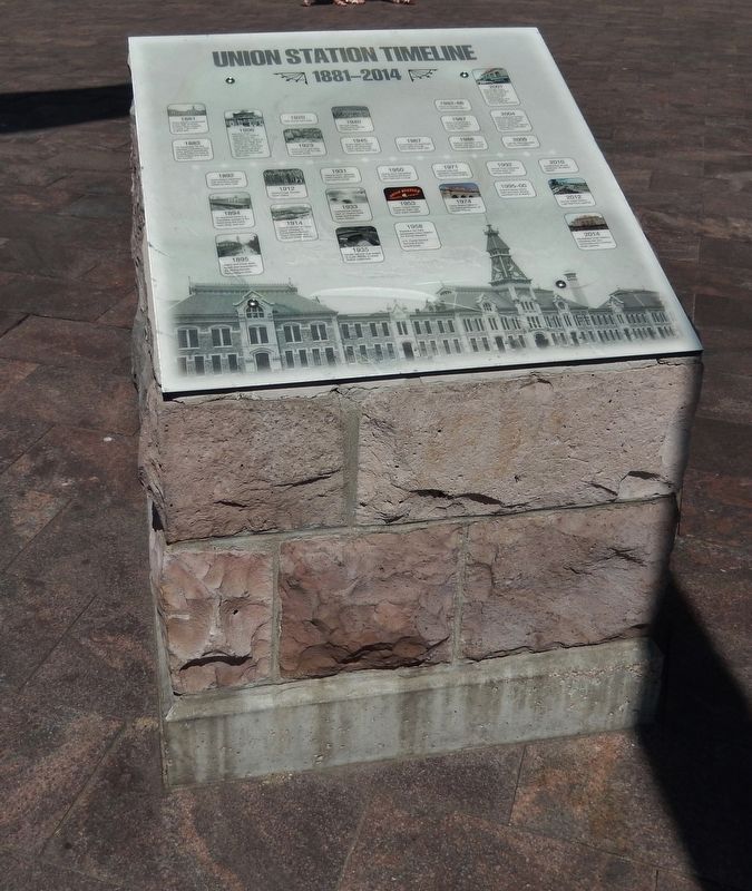
Union Station Timeline Marker (tall view)
| 201 ► Colorado, Denver County, Denver, Ballpark District — Union Station Timeline — 1881-2014 — |
| On Wynkoop Street at 17th Street, on the right when traveling south on Wynkoop Street. | |||
| 202 ► Colorado, Denver County, Denver, Ballpark District — Welcome to Union Station — Denver's Transportation Hub — 1881 - Present — |
| On Wynkoop Street at 17th Street, on the right when traveling south on Wynkoop Street. | |||
| 203 ► Colorado, Denver County, Denver, Ballpark District — When the Depot Became a Station — 1914 — |
| Near Wynkoop Street at 17th Street. | |||
| 204 ► Colorado, Denver County, Denver, Ballpark District — Windsor Farm Dairy Building / The Crocker Cracker Factory — Lower Downtown Walking Tour — |
| On Blake Street at 19th Street, on the left when traveling west on Blake Street. | |||
| 205 ► Colorado, Denver County, Denver, Central — 15th / Wazee Street — 1865-1875 — Lower Downtown Walking Tour — |
| On 15th Street at Wazee Street, on the left when traveling north on 15th Street. | |||
| 206 ► Colorado, Denver County, Denver, Central — Alfred Dach — |
| Near E. 14th Street. | |||
| 207 ► Colorado, Denver County, Denver, Central — Armenian Genocide — |
| Near E. 14th Ave. at Grant St.. | |||
| 208 ► Colorado, Denver County, Denver, Central — Barney Ford Building — 1863 — Lower Downtown Walking Tour — |
| On Blake Street. | |||
| 209 ► Colorado, Denver County, Denver, Central — Barteldes, Hartig Building — 1906 — Lower Downtown Walking Tour — |
| On 16th Street at Wynkoop Street, on the right when traveling north on 16th Street. | |||
| 210 ► Colorado, Denver County, Denver, Central — C. S. Morey Mercantile Building — 1896 — Lower Downtown Walking Tour — |
| On Wynkoop Street at 16th Street Mall, on the right when traveling east on Wynkoop Street. | |||
| 211 ► Colorado, Denver County, Denver, Central — 3e — Cherry Creek Emigrant's Song — Wall Street of the Rockies — Seventeenth Street Denver, Colorado — |
| Near 17th Street at Lawrence Street, on the left when traveling south. | |||
| 212 ► Colorado, Denver County, Denver, Central — Clark and Gruber Mint — 1860 — Lower Downtown Walking Tour |
| On 16th Street at Market Street on 16th Street. Reported missing. | |||
| 213 ► Colorado, Denver County, Denver, Central — Colorado Soldier's Monument |
| On Sherman Street. Reported permanently removed. | |||
| 214 ► Colorado, Denver County, Denver, Central — Colorado State Capitol Time Capsule — |
| Near E. Colfax Ave. at Grant St.. | |||
| 215 ► Colorado, Denver County, Denver, Central — Colorado State Veterans Memorial — |
| Near Lincoln Street. | |||
| 216 ► Colorado, Denver County, Denver, Central — Constitution Hall — |
| On Blake Street, on the right when traveling south. | |||
| 217 ► Colorado, Denver County, Denver, Central — Denver City — Lower Downtown Historic District — Established 1988 — |
| On Blake Street at 14th Street, on the right when traveling south on Blake Street. | |||
| 218 ► Colorado, Denver County, Denver, Central — Denver City Railway Building — 1883 — Lower Downtown Walking Tour — |
| On 17th Street at Wynkoop Street, on the right when traveling north on 17th Street. | |||
| 219 ► Colorado, Denver County, Denver, Central — Denver's Old City Hall — |
| On Larimer Street at 14th Street, on the right when traveling south on Larimer Street. | |||
| 220 ► Colorado, Denver County, Denver, Central — Edward W. Wynkoop — |
| On Wynkoop Street south of 18th Street, on the left when traveling south. | |||
| 221 ► Colorado, Denver County, Denver, Central — Henry Lee Building — 1907 — Lower Downtown Walking Tour — |
| On 16th Street Mall at Wazee Street, on the left when traveling east on 16th Street Mall. | |||
| 222 ► Colorado, Denver County, Denver, Central — Irving Hale — Scholar, Soldiers, Citizen — |
| Near E. 14th Avenue. | |||
| 223 ► Colorado, Denver County, Denver, Central — Joe P. Martinez — |
| Near Colfax Ave.. | |||
| 224 ► Colorado, Denver County, Denver, Central — Larimer Street — Lower Downtown Historic District — Established 1988 — |
| On Larimer Street at 15th Street on Larimer Street. | |||
| 225 ► Colorado, Denver County, Denver, Central — 2w — Let the Buyer Beware — Wall Street of the Rockies — Seventeenth Street Denver, Colorado — |
| Near 17th Street at Larimer Street, on the right when traveling south. | |||
| 226 ► Colorado, Denver County, Denver, Central — Logan’s Memorial Day Order — |
| Near E. 14th Avenue. | |||
| 227 ► Colorado, Denver County, Denver, Central — Lynching in America / The Lynching of Preston Porter, Jr. — Community Remembrance Project — |
| On Larimer Street, 0.1 miles west of 14th Street, on the left when traveling west. | |||
| 228 ► Colorado, Denver County, Denver, Central — Manny's Bridge — |
| On Wynkoop Street, 0.1 miles west of 15th Street, on the left when traveling west. | |||
| 229 ► Colorado, Denver County, Denver, Central — 1w — Mint Robbery February 1864 — Wall Street of the Rockies — Seventeenth Street Denver, Colorado — |
| Near 17th Street just west of Larimer Street, on the right when traveling south. | |||
| 230 ► Colorado, Denver County, Denver, Central — Oxford Hotel and Annex — Lower Downtown Walking Tour — 1891 — |
| On 17th Street near Wazee Street, on the right when traveling south. | |||
| 231 ► Colorado, Denver County, Denver, Central — 1e — Rocky Mountain Fashion — Wall Street of the Rockies — Seventeenth Street Denver, Colorado — |
| Near 17th Street at Larimer Street, on the left when traveling south. | |||
| 232 ► Colorado, Denver County, Denver, Central — 280 — Sand Creek Massacre — |
| On Colfax Avenue. | |||
| 233 ► Colorado, Denver County, Denver, Central — Spratlen-Anderson Building — 1906 — Lower Downtown Walking Tour — |
| On 15th Street at Wynkoop Street, on the right when traveling south on 15th Street. | |||
| 234 ► Colorado, Denver County, Denver, Central — St. Elmo Hotel — 1896 — Lower Downtown Walking Tour — |
| On 17th Street at Blake Street, on the left when traveling south on 17th Street. | |||
| 235 ► Colorado, Denver County, Denver, Central — Sugar Building — 1906 — Lower Downtown Walking Tour — |
| On 16th Street at Wazee Street on 16th Street. | |||
| 236 ► Colorado, Denver County, Denver, Central — The City Beautiful — Lower Downtown Historic District — Established 1988 — |
| On 17th Street south of Market Street, on the right when traveling south. | |||
| 237 ► Colorado, Denver County, Denver, Central — The Edbrooke Lofts — |
| On Wynkoop Street at 15th Street, on the right when traveling north on Wynkoop Street. | |||
| 238 ► Colorado, Denver County, Denver, Central — The Elephant Corral — The Lower Downtown Walking Tour — 1902 — |
| On Wazee Street, 0.1 miles south of Fifteenth Street, on the left when traveling west. | |||
| 239 ► Colorado, Denver County, Denver, Central — The Molly Brown House — |
| On Pennsylvania Street. | |||
| 240 ► Colorado, Denver County, Denver, Central — USS Colorado BB-45 — |
| Near E. 14th Ave. at Grant St.. | |||
| 241 ► Colorado, Denver County, Denver, Central — 58 — Votes for Women — Road to the 19th Amendment — National Votes for Women Trail — |
| On Pennsylvania Street north of East 13th Avenue, on the right when traveling north. | |||
| 242 ► Colorado, Denver County, Denver, Central — Warehouses — Lower Downtown Historic District — Established 1988 — |
| On Wynkoop Street south of 18th Street, on the right when traveling north. | |||
| 243 ► Colorado, Denver County, Denver, Central — Wynkoop Street RR Bridge — 1908 — Lower Downtown Walking Tour — |
| On Wynkoop Street, 0.1 miles west of 15th Street, on the left when traveling south. | |||
| 244 ► Colorado, Denver County, Denver, Central — 2e — Yo Soy Joaquin — Wall Street of the Rockies — Seventeenth Street Denver, Colorado — |
| On 17th Street at Larimer Street, on the left when traveling south on 17th Street. | |||
| 245 ► Colorado, Denver County, Denver, Central Business District — 9w — "The Bank that Looks Like a Bank" — Wall Street of the Rockies — Seventeenth Street Denver, Colorado — |
| Near 17th Street, on the right when traveling south. | |||
| 246 ► Colorado, Denver County, Denver, Central Business District — 20w — “I’m Either a Lawyer or I’m Not. Don’t Drag Being a Woman Into It.” — Wall Street of the Rockies — Seventeenth Street Denver, Colorado — |
| Near 17th Street at Tremont Place, on the right when traveling south. | |||
| 247 ► Colorado, Denver County, Denver, Central Business District — 17e — 17th’S 25th Anniversary — Wall Street of the Rockies — Seventeenth Street Denver, Colorado |
| Near 17th Street at Glenarm Place, on the left when traveling south. Reported missing. | |||
| 248 ► Colorado, Denver County, Denver, Central Business District — 5e — All Washed Up — Wall Street of the Rockies — Seventeenth Street Denver, Colorado — |
| Near 17th Street at Arapahoe Street, on the left when traveling south. | |||
| 249 ► Colorado, Denver County, Denver, Central Business District — 6e — Arapahoe Street — Wall Street of the Rockies — Seventeenth Street Denver, Colorado — |
| Near 17th Street, on the left when traveling south. | |||
| 250 ► Colorado, Denver County, Denver, Central Business District — 8w — Bonfils — Wall Street of the Rockies — Seventeenth Street Denver, Colorado — |
| Near 17th Street at Champa Street, on the right when traveling south. | |||
| 251 ► Colorado, Denver County, Denver, Central Business District — 13e — Boom and Bust — Wall Street of the Rockies — Seventeenth Street Denver, Colorado — |
| Near 17th Street at California Street, on the left when traveling south. | |||
| 252 ► Colorado, Denver County, Denver, Central Business District — 4w — Coal Miner's Daughter — Wall Street of the Rockies — Seventeenth Street Denver, Colorado — |
| On 17th Street, on the right when traveling south. | |||
| 253 ► Colorado, Denver County, Denver, Central Business District — 5w — D&F Tower and Skyline Park — Wall Street of the Rockies — Seventeenth Street Denver, Colorado — |
| On 17th Street at Arapahoe Street, on the right when traveling south on 17th Street. | |||
| 254 ► Colorado, Denver County, Denver, Central Business District — 15w — Denver Says "No" to Hate — Wall Street of the Rockies — Seventeenth Street Denver, Colorado — |
| Near 17th Street south of Welton Street, on the right when traveling south. | |||
| 255 ► Colorado, Denver County, Denver, Central Business District — 7w — Don't Panic — Wall Street of the Rockies — Seventeenth Street Denver, Colorado — |
| On 17th Street at Curtis Street, on the right when traveling south on 17th Street. | |||
| 256 ► Colorado, Denver County, Denver, Central Business District — 16e — Dow Jones Average — Local Boy Makes Good — Wall Street of the Rockies • Seventeenth Street Denver, Colorado — |
| Near 17th Street at Welton Street, on the left when traveling south. | |||
| 257 ► Colorado, Denver County, Denver, Central Business District — 12w — E is for Equitable — Wall Street of the Rockies — Seventeenth Street Denver, Colorado — |
| Near 17th Street, on the right when traveling south. | |||
| 258 ► Colorado, Denver County, Denver, Central Business District — 10w — Four Corners — Wall Street of the Rockies — Seventeenth Street Denver, Colorado — |
| Near Champa Street at 17th Street, on the right when traveling south. | |||
| 259 ► Colorado, Denver County, Denver, Central Business District — 21w — Gridlock — Wall Street of the Rockies — Seventeenth Street Denver, Colorado — |
| Near 17th Street at Court Place, on the right when traveling south. | |||
| 260 ► Colorado, Denver County, Denver, Central Business District — 19e — Help! — Wall Street of the Rockies — Seventeenth Street Denver, Colorado — |
| Near 17th Street at Tremont Place, on the left when traveling south. | |||
| 261 ► Colorado, Denver County, Denver, Central Business District — 19w — Human Rights Hero — Wall Street of the Rockies — Seventeenth Street Denver, Colorado — |
| Near 17th Street at Tremont Place, on the right when traveling south. | |||
| 262 ► Colorado, Denver County, Denver, Central Business District — 14e — March On — Wall Street of the Rockies — Seventeenth Street Denver, Colorado — |
| Near 17th Street at California Street, on the left when traveling south. | |||
| 263 ► Colorado, Denver County, Denver, Central Business District — 21e — Menu for the Brown Palace — Wall Street of the Rockies — Seventeenth Street Denver, Colorado — |
| Near 17th Street at Broadway, on the left when traveling south. | |||
| 264 ► Colorado, Denver County, Denver, Central Business District — 13w — Misery — Wall Street of the Rockies — Seventeenth Street Denver, Colorado — |
| Near California Street at 17th Street. | |||
| 265 ► Colorado, Denver County, Denver, Central Business District — 7e — National Woman Suffrage Movement — Wall Street of the Rockies — Seventeenth Street Denver, Colorado — |
| Near 17th Street at Curtis Street, on the left when traveling south. | |||
| 266 ► Colorado, Denver County, Denver, Central Business District — 12e — Origins — Wall Street of the Rockies — Seventeenth Street Denver, Colorado — |
| Near 17th Street at Stout Street, on the left when traveling south. | |||
| 267 ► Colorado, Denver County, Denver, Central Business District — 8e — Out with the Old... — Wall Street of the Rockies — Seventeenth Street Denver, Colorado — |
| Near 17th Street at Curtis Street, on the left when traveling south. | |||
| 268 ► Colorado, Denver County, Denver, Central Business District — 73 — Passing of the Street Car — |
| On West Colfax Ave near Broadway. | |||
| 269 ► Colorado, Denver County, Denver, Central Business District — 4e — Private Profits and the Public Good — Wall Street of the Rockies — Seventeenth Street Denver, Colorado — |
| Near 17th Street at Lawrence Street, on the left when traveling south. | |||
| 270 ► Colorado, Denver County, Denver, Central Business District — 6w — Rails and Mountains — Wall Street of the Rockies — Seventeenth Street Denver, Colorado — |
| On 17th Street at Arapahoe Street, on the right when traveling south on 17th Street. | |||
| 271 ► Colorado, Denver County, Denver, Central Business District — Rian Kerrane — The Oscar Wallpaper — PVC, cast aluminum, paint, fake flora, found plastic items — |
| On Court Place just north of 16th Street Mall, on the left when traveling north. | |||
| 272 ► Colorado, Denver County, Denver, Central Business District — 11e — Shock Treatment — Wall Street of the Rockies — Seventeenth Street Denver, Colorado — |
| Near 17th Street at Stout Street, on the left when traveling south. | |||
| 273 ► Colorado, Denver County, Denver, Central Business District — Silas S. Soule — |
| Near 15th Street near Arapahoe Street, on the right when traveling west. | |||
| 274 ► Colorado, Denver County, Denver, Central Business District — 40 — Smoky Hill Trail — |
| On Broadway at Colfax on Broadway. | |||
| 275 ► Colorado, Denver County, Denver, Central Business District — 10e — Solid Investment — Wall Street of the Rockies — Seventeenth Street Denver, Colorado — |
| Near 17th Street, on the left when traveling south. | |||
| 276 ► Colorado, Denver County, Denver, Central Business District — 9e — Take Your Pick — Wall Street of the Rockies — Seventeenth Street Denver, Colorado — |
| Near 17th Street at Champa Street, on the left when traveling south. | |||
| 277 ► Colorado, Denver County, Denver, Central Business District — 11w — The Barnes Dance — Wall Street of the Rockies — Seventeenth Street Denver, Colorado — |
| Near 17th Street at Stout Street, on the right when traveling south. | |||
| 278 ► Colorado, Denver County, Denver, Central Business District — The Birth of Denver Mass Transit — |
| On Broadway at 17th Street, on the right when traveling south on Broadway. | |||
| 279 ► Colorado, Denver County, Denver, Central Business District — 16w — The Black Baron — Wall Street of the Rockies — Seventeenth Street Denver, Colorado — |
| Near 17th Street at Welton Street, on the right when traveling south. | |||
| 280 ► Colorado, Denver County, Denver, Central Business District — 14w — The Stock Market Crash of 1929 — Wall Street of the Rockies — Seventeenth Street Denver, Colorado — |
| Near 17th Street south of California Street, on the right when traveling south. | |||
| 281 ► Colorado, Denver County, Denver, Central Business District — The Women's Suffrage Association of Colorado — |
| On 17th Street at California Street, on the left when traveling south on 17th Street. | |||
| 282 ► Colorado, Denver County, Denver, Central Business District — 20e — Those Illustrious Browns — Wall Street of the Rockies — Seventeenth Street Denver, Colorado — |
| Near 17th Street at Tremont Place, on the left when traveling south. | |||
| 283 ► Colorado, Denver County, Denver, Central Business District — 18e — Top of the World — Wall Street of the Rockies — Seventeenth Street Denver, Colorado — |
| On 17th Street at Glenarm Place, on the left when traveling south on 17th Street. | |||
| 284 ► Colorado, Denver County, Denver, Central Business District — 18w — Wall Street of the Rockies — Seventeenth Street Denver, Colorado — |
| Near 17th Street at Glenarm Place, on the right when traveling south. | |||
| 285 ► Colorado, Denver County, Denver, Central Business District — 15e — Welton Street — Wall Street of the Rockies — Seventeenth Street Denver, Colorado — |
| Near 17th Street at Welton Street, on the left when traveling south. | |||
| 286 ► Colorado, Denver County, Denver, Central Business District — 17w — Western Philosophy — Wall Street of the Rockies — Seventeenth Street Denver, Colorado — |
| Near 17th Street at Glenarm Place, on the right when traveling south. | |||
| 287 ► Colorado, Denver County, Denver, City Park — Civil War Artillery — G.A.R. Memorial — |
| On Steele Street. | |||
| 288 ► Colorado, Denver County, Denver, Civic Center — In Honor of Christopher Columbus — |
| Near Broadway. | |||
| 289 ► Colorado, Denver County, Denver, Civic Center — In Memory of Sadie M. Likens — 1840 — 1920 — |
| On Broadway (Business U.S. 287) at Colfax Avenue, on the right when traveling south on Broadway. | |||
| 290 ► Colorado, Denver County, Denver, East — Boeing RB-52B Stratofortress — USAF Serial Number 52-0005 — |
| Near East Academy Boulevard, 0.1 miles north of Rampart Way, on the left when traveling north. | |||
| 291 ► Colorado, Denver County, Denver, Elyria-Swansea — Platte River Trail — |
| On Brighton Boulevard (State Highway 265) at York Street, on the right when traveling north on Brighton Boulevard. | |||
| 292 ► Colorado, Denver County, Denver, Fort Logan — WWII 10th Mountain Division — United States Army — |
| Near Omaha Drive, 0.1 miles west of Denver Drive. | |||
| 293 ► Colorado, Denver County, Denver, Lincoln Park — Camp Weld — |
| On West 8th Avenue at Vallejo Street, on the left when traveling east on West 8th Avenue. | |||
| 294 ► Colorado, Denver County, Denver, Lincoln Park — The Buckhorn Exchange — Established 1893 — Denver’s Oldest Restaurant — |
| On Osage Street at West 10th Avenue on Osage Street. | |||
| 295 ► Colorado, Denver County, Denver, Northwest — 421 — Elitch Theatre — |
| On West 37th Place at Vrain Street, on the right when traveling east on West 37th Place. | |||
| 296 ► Colorado, Denver County, Denver, Northwest — Gold Was Discovered — |
| Near Sheridan Boulevard (Colorado Route 95) just north of West 49th Avenue, on the left when traveling north. | |||
| 297 ► Colorado, Denver County, Denver, Northwest — Theatre Alumni — The Historic Elitch Theatre — |
| On West 37th Place just east of Vrain Street, on the right when traveling east. | |||
| 298 ► Colorado, Denver County, Denver, Overland — Overland Park — |
| Near West Jewell Avenue at South Huron Street, on the right when traveling west. | |||
| 299 ► Colorado, Denver County, Denver, Sloan Lake — Manhattan Beach — |
| Near West Byron Place just east of Wolff Street, on the right when traveling east. | |||
| 300 ► Colorado, Denver County, Denver, West Highland — Roger W. Woodbury Branch - Denver Public Library — |
| On Federal Boulevard (U.S. 287) at West Highland Park Place (West 33rd Avenue), on the right when traveling south on Federal Boulevard. | |||
1605 entries matched your criteria. Entries 201 through 300 are listed above. ⊲ Previous 100 — Next 100 ⊳