1998
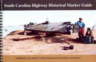
South Carolina Highway Historical Marker Guide
RANKED BY RELEVANCE
On North Calhoun Street, on the right when traveling north.
On Main Street (Business U.S. 15) at Calhoun Street, on the left when traveling east on Main Street.
On Ball’s Bluff Road, on the left when traveling east.
On North King Street (Business U.S. 15) at Oakcrest Manor Drive, on the right when traveling south on North King Street.
Near North Blue Ridge Avenue.
On Bristow Road (Virginia Route 619) just south of Nokesville Road ( Route 28), on the left when traveling south.
Near Battery Heights Boulevard at Quarry Road, on the left when traveling south. Reported permanently removed.
On Old Dumfries Road (County Route 667), on the right when traveling north.
Near Willis Avenue west of Hord Avenue, on the left when traveling west.
On Airmont Road (County Route 719) 1.4 miles south of Snickersville Turnpike (County Route 734), on the right when traveling south.
On Oaklawn Boulevard just west of South Blue Ridge Avenue, in the median.
On Sandusky Street (County Route 5) 0 miles south of Columbus Street (County Route 153), on the right when traveling east.
Near South Main Street at East Stevens Street, on the right when traveling south.
On East Market Street (U.S. 33), on the left.
Paid Advertisement
Near Ball’s Bluff Road, on the left when traveling east.
Near North Battlefield Boulevard (Business Virginia Route 168) at Watson Road, on the left when traveling south.
Near North Battlefield Boulevard (Business Virginia Route 168) at Watson Road, on the left when traveling south.
On James Madison Highway (U.S. 15/29) just south of Rappahannock River, on the right when traveling north.
On Courthouse Square west of Business U.S. 211.
On Beverly Ford Road (County Route 677) at St. James Church Road (County Route 676), on the left when traveling north on Beverly Ford Road. Reported permanently removed.
On College Drive (Virginia Route 375) 0.2 miles west of Germanna Highway ( Route 3), on the right when traveling west.
On Germanna Highway (Virginia Route 3) at College Drive ( Road 375), on the right when traveling east on Germanna Highway.
On South 3rd Street (Business U.S. 17) at Ann Street, on the right when traveling south on South 3rd Street.
Near Colvin Road 0.4 miles Rixeyville Road ( Route 229), on the right when traveling west.
On US 17 just south of Parker Place, on the right when traveling south.
On Leeds Manor Road (County Route 688) just north of Exit 18 (Interstate 66), on the right when traveling north.
On Germantown Road (County Route 649) 0.3 miles east of Catlett Road ( Route 28), on the right when traveling west.
On Alexandria Pike (Business U.S. 15/211) at North Street, on the right when traveling north on Alexandria Pike.
Near Balls Bluff Park east of Balls Bluff Road, on the right when traveling west. Reported permanently removed.
On Slabtown Road at Wisconsin Highway 35/81, on the right when traveling west on Slabtown Road.
Paid Advertisement
On John Mosby Highway (U.S. 50), on the right when traveling east.
On Catlett Road (Virginia Route 28) 0.5 miles south of Dumfries Road (County Route 605), on the left when traveling north.
Near Gold Dust Parkway at Rock Run Road (County Route 615), on the left when traveling east.
On Gold Dust Parkway at Rock Run Road (County Route 615), on the left when traveling east on Gold Dust Parkway.
On John Marshall Highway (Virginia Route 55) at Freezeland Road ( Route 638), on the right when traveling west on John Marshall Highway.
On Pearl Street north of Speed Street, on the right when traveling north.
On Old Due West Avenue, on the right when traveling east.
On West Braddock Road 0.2 miles west of Marlboro Drive, on the right when traveling west.
On Elk Run Road (County Route 806) 0 miles south of Midland Road (County Route 610), on the left when traveling south.
Near Ashby Street at Waterloo Street (Business U.S. 211). Reported permanently removed.
On Simon Kenton Memorial Bridge (U.S. 62) north of East 2nd Street, on the right when traveling south.
On West Main Street (Mississippi Route 467) at Port Gibson Street, on the right when traveling west on West Main Street.
On Rose Hill Drive, on the right when traveling west.
Near Maidstone Road (Virginia Route 713) near Winchester Road (U.S. 17).
Paid Advertisement
Near Ashby Street south of Waterloo Street (Business U.S. 211), on the right when traveling north.
Near Hospital Street near North 4th Street.
Near West Braddock Road 0.2 miles west of Marlboro Drive, on the right when traveling west.
On Rectortown Road (County Route 710) 0.3 miles north of Frogtown Road ( Route 702), on the left when traveling north.
On Main Street (Business U.S. 15) at Courthouse Square, on the right when traveling east on Main Street.
On Lincoln Road (Virginia Route 722) at Cooksville Road ( Route 778), on the right when traveling south on Lincoln Road.
Near College Road (Virginia Route 375) 0.3 miles west of Germanna Highway ( Route 3), on the right when traveling west.
Near Alexandria Pike (Business U.S. 211) south of North Street, on the left when traveling south.
On Waterloo Street (Business U.S. 211) at Ashby Street, on the left when traveling west on Waterloo Street. Reported permanently removed.
︽
Thin black lines indicate changes in relevance. Between each pair of lines entries are ordered geographically but all have the same relevance. * Inflectional forms of words are their plurals, singulars, and possessives as well as gramatical tenses and similar variations.
Nov. 13, 2026