By Tom Rue, August 18, 2005
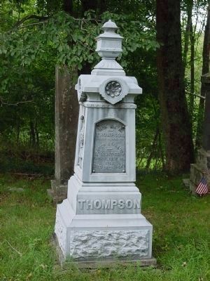
Grave of Judge William A. Thompson
RANKED BY RELEVANCE
| On Heiden Road (County Route 161) 0.1 miles north of Thompsonville Road. |
| On Wall Street south of John Street, on the left when traveling north. |
| On Wall Street 0.1 miles north of Main Street, on the right when traveling north. |
| On U.S. 209 8.5 miles north of New York State Route 17. |
| On John Street east of Crown Street, on the right when traveling east. |
| On Huguenot Street south of Broadhead Avenue, on the left when traveling south. |
| On New York State Route 212 at De Vall Road, on the right when traveling east on New York State Route 212. |
| On U.S. 209, on the right when traveling north. |
| On George Street 0.2 miles west of Bishop Place, on the right when traveling west. |
| On Main Street, on the right when traveling east. |
| On Broadway (New York State Route 42) near Prince Street, on the right when traveling east. |
| On Empire State Trail (New York State Route 199) west of River Road (County Road 103), on the right when traveling east. |
| On Broadway (U.S. 9W) at Salem Street, on the right when traveling south on Broadway. |
| On Park Street at Meadow Street on Park Street. |
| Near Parker Avenue (New York State Route 9G) 0.2 miles east of Washington Street ( Route 9G), on the left when traveling east. |
| Near Parker Avenue (New York State Route 9G) 0.2 miles east of Washington Street ( Route 9G), on the left when traveling east. |
| Near Parker Avenue (New York State Route 9G) 0.2 miles east of Washington Street ( Route 9G), on the left when traveling east. |
| Near Parker Avenue (New York State Route 9G) 0.2 miles east of Washington Street ( Route 9G), on the left when traveling east. |
| Near Parker Avenue (New York State Route 9G) 0.2 miles east of Washington Street ( Route 9G), on the left when traveling east. |
| On Broadway (New York State Route 197) at St. John Street when traveling east on Broadway. |
| On U.S. 209 just north of Russell Road, on the right when traveling north. |
| On Medoc State Park Road 1 mile south of North Carolina Route 4, on the right when traveling south. |
| Near Clermont Avenue 0.3 miles Woods Road (County Route 35). |
| On Post Hill Road, on the left when traveling north. |
| Near Broadway near Rondout Landing, on the left when traveling south. |
| On New York 52 at Loch Sheldrake Hurleyville Road, on the left when traveling north on New York 52. |
| Near Bova Road 0.1 miles west of U.S. 209, on the right when traveling west. |
| On Rock Hill Drive at Glen Wild Road, on the right when traveling west on Rock Hill Drive. |
| On Main Street (New York State Route 213) east of NY Thruway (Interstate 87), on the left when traveling east. |
| On Clinton Avenue south of North Front Street, on the right when traveling south. |
| On Partition Street south of Lafayette Street, on the right when traveling north. |
| On Partition Street south of Lafayette Street, on the right when traveling north. |
| On New York State Route 32, on the left when traveling south. |
| On Clinton Avenue south of North Front Street, on the right when traveling south. |
| On Broadhead Avenue west of Empire State Trail, on the left when traveling west. |
| On Indiana 129 0.2 miles east of Detour Road, on the right when traveling east. |
| On Route 199 0.6 miles east of River Road (County Route 103), on the right when traveling east. |
| On Ferndale Road west of Old Route 17, on the right when traveling west. |
| Near Burroughs Memorial Road 0.7 miles west of Fairway Drive, on the right when traveling west. |
| Near Main Street (New York State Route 23), on the right when traveling west. |
| Near Pleasant Valley Road at Peterboro Road (County Road 32), on the right when traveling north. |
| On U.S. 209 0.2 miles east of Mettacahonts Road, on the left when traveling east. |
Thin black lines indicate changes in relevance. Between each pair of lines entries are ordered geographically but all have the same relevance.* Inflectional forms of words are their plurals, singulars, and possessives as well as gramatical tenses and similar variations.
Nov. 12, 2026
