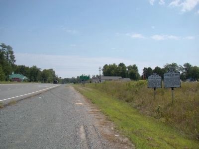
By J. J. Prats, August 30, 2009
History at Oak Grove and Westmoreland Association Markers
RANKED BY RELEVANCE
On Kings Highway (Virginia Route 3) just west of James Monroe Highway ( Route 205), on the right when traveling east.
On Leedstown Road (County Route 637) just east of Drakes Marsh Drive, on the left when traveling east.
On Kings Highway (Virginia Route 3) at Trigger Lane (County Route 683), on the right when traveling west on Kings Highway.
On Bridge Creek Road west of Popes Creek Road ( Route 204).
On U.S. 50 at Plaza Lane, on the right when traveling west on U.S. 50.
On Main Street (U.S. 24) south of 2nd Street, on the left when traveling south.
On Cople Highway (Virginia Route 202) just west of the Hampton Hall Bridge over Hampton Hall Branch, on the right when traveling east.
On Gordon Street at Lee Avenue, on the right when traveling west on Gordon Street.
Near James Monroe Highway (Virginia Route 205) 0.3 miles north of Old Road, on the left when traveling south.
On James Monroe Highway (Virginia Route 205) 0.2 miles north of Old Road, on the right when traveling north.
On James Monroe Highway (Virginia Route 205) north of Old Road, on the right when traveling north.
On South 6th Street (County Route 2005) at Market Street (County Road 2004), on the left when traveling south on South 6th Street.
Near South Cherry Street at Albemarle Street.
Near South Horner Boulevard (Business U.S. 421) west of Courtland Drive.
Paid Advertisement
On James Monroe Highway (Virginia Route 205), on the left when traveling south.
On Cople Highway (Virginia Route 202) 0.3 miles west of McGuires Wharf Road (U.S. 662), on the right when traveling west.
On South Main Street 0.1 miles north of 5th Avenue, on the right when traveling north.
On West Pennsylvania Avenue at Post Road, on the right when traveling east on West Pennsylvania Avenue.
On Richmond Road (U.S. 360) east of Main Street, on the left when traveling east.
On Stratford Hall Road (VA Highway 214), on the left when traveling east.
On East 14th Street near between Union Square East & West, on the right when traveling south. Reported permanently removed.
On East 14th Street east of Union Square East, on the right when traveling west. Reported permanently removed.
Near South Water Street west of West College Street.
On River Road, on the right when traveling east.
On Oak Hill Road (Virginia Route 610) 0.5 miles south of Yankee Point Road ( Route 730), on the right when traveling south.
Near James Monroe Highway (Virginia Route 205) 0.3 miles north of Old Road, on the right when traveling north.
On Leedstown Road (Route 637) just west of Drakes Marsh Drive, on the left when traveling east.
On Kings Highway (Virginia Route 3) west of Cople Highway ( Route 202), on the left when traveling east.
Paid Advertisement
Near Brooke Road (County Road 608) at Canterbury Drive, on the right when traveling north.
On West Woodruff Avenue at Mount Vernon Avenue, on the right when traveling west on West Woodruff Avenue.
Near S. Cherry Street at Albemarle Street.
Near James Monroe Highway (Virginia Route 205) 0.3 miles north of Old Road, on the right when traveling north.
On Sandy Point Road (County Route 604) at Cople Highway ( Route 202), on the left when traveling east on Sandy Point Road.
On Kings Highway (Virginia Route 3) at Templemans Road, on the left when traveling east on Kings Highway.
On Braun Avenue west of Carson Avenue, on the left when traveling west.
Near Hotwater Trail 1 mile west of Centerville Road (Route 614), on the left when traveling west.
Near Fort Lane close to Holladay Street, on the right when traveling north.
Near James Monroe Highway 0.3 miles north of Old Road, on the right when traveling north.
Near Childrens Center Road Southwest west of Harry Byrd Highway ( Route 7), on the right when traveling west.
On Old Virginia Street (County Route 602) west of Upton Lane, on the right when traveling west.
Near South Lee Highway (U.S. 11) at Rockbridge Road ( Route 130), on the left when traveling south.
Near Constitution Avenue Northwest (U.S. 50) east of 19th Street Northwest, on the right when traveling east.
On Leechburg Road east of Nevada Street, on the right when traveling east.
Paid Advertisement
On Leesburg Pike (Virginia Route 7) at Claiborne Parkway and Landsdowne Boulevard (Local Route 641), on the right when traveling east on Leesburg Pike.
︽
Thin black lines indicate changes in relevance. Between each pair of lines entries are ordered geographically but all have the same relevance. * Inflectional forms of words are their plurals, singulars, and possessives as well as gramatical tenses and similar variations.
Nov. 13, 2026