662 entries match your criteria. Entries 201 through 300 are listed.⊲ Previous 100 — Next 100 ⊳
National Cemeteries Historical Markers
The human carnage of the American Civil War led Congress in 1862 to authorize President Lincoln to purchase cemetery grounds to be used as national cemeteries. By 1870, the remains of nearly 300,000 Union dead had been buried in 73 national cemeteries. As of late 2018, there are 150 National Cemeteries, with the Department of Veterans Affairs' National Cemetery Administration maintaining most, while the US Army and the US Department of the Interior maintain several, with more than four million veterans of all US wars interred.
This series is intended to capture all markers about these national cemeteries as well as any war and veterans memorials on their grounds.
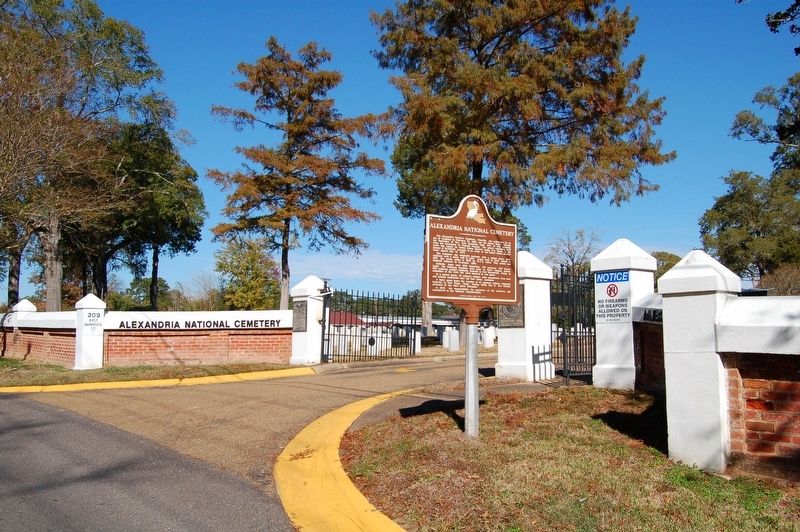
On East Shamrock Street (State Road 1250) west of Sanders Street, on the right when traveling west.
The Alexandria National Cemetery, Pineville, was authorized by an Act of Congress on February 22, 1867, and the United States, through the Secretary of War, took possession April 1871 of this property from the Succession of Franco Poussan. The . . . — — Map (db m110587) HM
Near East Shamrock Street (Business U.S. 165) near Main Street, on the left when traveling south.
Civil War AlexandriaAlexandria, Louisiana, served briefly
of the Confederate Department of the Trans-Mississippi,
as the headquarters a vast area encompassing states and territories west of the
Mississippi River.In spring 1863, the . . . — — Map (db m136134) HM
On Chalmette National Park Scenic Road (Tour Loop Rd) 0.6 miles east of Battlefield Road, on the right when traveling north.
Chalmette National Cemetery was established in 1864 as a burial place for Union soldiers who died in the gulf area during the Civil War. It also served as the site for reburials of soldiers from battlefield cemeteries in the region. This plot of . . . — — Map (db m97175) HM
The United States Congress established this site as a National Cemetery in 1864 for the re-interment of Union soldiers who died in Civil War hospitals and were buried in various nearby locations.
Over 15,000 veterans of American wars and their . . . — — Map (db m161730) HM
Near West Street (Maryland Route 450) west of Taylor Avenue ( Route 435), on the right when traveling west.
Civil War Dead
An estimated 700,000 Union and Confederate soldiers died in the Civil War between April 1861 and April 1865. As the death toll rose, the U.S. government struggled with the urgent but unplanned need to bury fallen Union troops. . . . — — Map (db m114568) HM
Near West Street (Maryland Route 450) west of Taylor Avenue ( Route 435), on the right when traveling west.
Civil War Annapolis
In April 1861, Gen. Benjamin Butler and his Massachusetts troops entered the Maryland capital to ensure the state remained in the Union. The U.S. Army then reformed the Department of Annapolis, headed by Butler, to . . . — — Map (db m114566) HM
Near Frederick Avenue (Maryland Route 144) west of McCurley Street, on the right when traveling east.
Civil War Dead An estimated 700,000 Union and Confederate soldiers died in the Civil War between April 1861 and April 1865. As the death toll rose, the U.S. government struggled with the urgent but unplanned need to bury fallen Union troops. . . . — — Map (db m135083) HM WM
Near Frederick Avenue (Maryland Route 144) west of McCurley Street, on the right when traveling east.
Four score and seven years ago our fathers brought forth on this continent, a new nation, conceived in Liberty, and dedicated to the proposition that all men are created equal.
Now we are engaged in a great civil war, testing whether that nation, . . . — — Map (db m135087) HM WM
Erected by the United States to mark the burial place of twenty-nine Confederate soldiers who died at Fort McHenry, Maryland, while prisoners of war, and whose remains were there buried, but subsequently removed to this section, where the individual . . . — — Map (db m7050) WM
Near Frederick Avenue (Maryland Route 144) just west of McCurley Street, on the right when traveling east.
In honor of those who gave the Ultimate Sacrifice in service to the United States of America and the families they left behind. The sacrifice will not be forgotten. — — Map (db m155129) WM
Near Frederick Avenue (Maryland Route 144) just west of McCurley Street, on the right when traveling east.
Past Commanders
George H. Bush, Private Co. C., 1st Md. Cav.
John J. Goodmason, Steamer Osceola, U.S.N. Died, April 28, 1919.
Joseph Brooks, Private Co. D, Mc's Cav. Died June 13, 1935. . . . — — Map (db m155130) WM
Near Frederick Avenue (Maryland Route 144) west of McCurley Street, on the right when traveling east.
National Cemetery (center panel)
In December 1861, the U.S. Sanitary Commission designated a small area of Loudon Park Cemetery for the burial of Union soldiers who died in Baltimore hospitals. The half-acre lot in the northeast corner . . . — — Map (db m135081) HM
The public spirited woman who made the 15 star flag that flew over Fort McHenry September 14, 1814, inspiring Francis Scott Key to write the Star Spangled Banner.
Site restored 1976 by the U.S. Daughters of 1812 and the Star Spangled Banner Flag . . . — — Map (db m89205) HM WM
Near Frederick Avenue (Route 144) west of McCurley Street, on the right when traveling east.
Maryland’s tribute to her loyal sons who served in the United States Navy during the War for the Preservation of the Union.
Port Royal • November 7th, 1861 Monitor & Merrimack • March 9th, 1862 New Orleans . . . — — Map (db m272507) WM
Near Frederick Avenue (Maryland Route 144) west of McCurley Street, on the right when traveling east.
(west side)
To the Sons of Maryland who perished in preserving to us and posterity the “Government of the People, by the People for the People,” secured by our fathers, through the Union. This memorial is erected by her . . . — — Map (db m135094) WM
Erected by the Women's Relief Corps Auxiliary to the Grand Army of the Republic.
[small plaque]
Department of MO. W.R.C.
Monument Committee
Ruth A. Graham
Florence J. Fink
Sallie A. Moore
Mary E. Wright
Clara A. Alford
Mary . . . — — Map (db m7048) HM
The Weiskettel Mausoleum has been placed on the National Register of Historic Places by the United States Department of the Interior. — — Map (db m61045) HM
Near Frederick Avenue (State Highway 144) at Mallow Hill Road, on the right when traveling east.
Four score and seven years ago our fathers brought forth on this continent, a new nation, conceived in Liberty, and dedicated to the proposition that all men are created equal.
Now we are engaged in a great civil war, testing whether that nation, . . . — — Map (db m134999) HM
On Outer Drive at Rostrom Drive, on the right when traveling south on Outer Drive.
World War II • 1942-1945
North China • 1945-1949
Korea • 1950-1955
Vietnam • 1965-1971
Southwest Asia • 1990-1991
Peacetime
Semper Fidelis
— — Map (db m183555) WM
On Rostrom Drive West at Outer Drive, on the left when traveling west on Rostrom Drive West.
World War II • 1943-1945
Okinawa
Makin
Solomons
Bougainville
Marshalls
Saipan
Guam
China
Japan
North China • 1945-1946
Semper Fidelis — — Map (db m183564) WM
On Portal Drive 0.1 miles south of Frederick Road ( Route 144), on the right when traveling south.
In honor of those who gave the ultimate sacrifice in service to the United States of America and the families they left behind. The sacrifice will not be forgotten. — — Map (db m183554) WM
Near Frederick Avenue (State Highway 144) at Mallow Hill Road, on the right when traveling east.
Dedicated to the U.S. Marine Divisions (FMF) World War II
To all those who made the ultimate sacrifice in the service of their country by the Maryland Chapter First Marine Division Association 1996 Flag Pole Erected by William Fosnaught, Jr. . . . — — Map (db m135100) WM
On Point Lookout Road (Maryland Route 5) at St. Michaels Manor Way, on the right when traveling south on Point Lookout Road.
Erected by the United States to mark the burial place of Confederate Soldiers and Sailors who died at Point Lookout, Md., while prisoners of war and were there buried to the number of 3384, but whose remains were subsequently removed, either to . . . — — Map (db m927) HM
On Point Lookout Road (Maryland Route 5) at St. Michaels Manor Way, on the right when traveling south on Point Lookout Road.
Erected by the State of Maryland in memory of the Confederate Soldiers who died Prisoners of War at Point Lookout, from March 1st, 1864, to June 30th, 1865.
(north face) “At the call of Patriotism and duty they encountered the . . . — — Map (db m943) HM
Near Point Lookout Road at St. Michael's Manor Way.
Camp Hoffman Prison
The Union prison at Camp Hoffman, Maryland — called Point Lookout — opened in 1863. A 15-foot-high plank fence surrounded the 40-acre prison compound. The first prisoners arrived in July 1863-Confederates . . . — — Map (db m128948) HM WM
On East Main Street (Maryland Route 34) 0.1 miles east of Truman Lane, on the right when traveling east.
After the battle over 4,000 bodies were buried in mass graves, along rock outcroppings, and in farmers' fields. Many more soldiers died of wounds or disease. The peaceful village of Sharpsburg was turned into a huge hospital and burial ground, an . . . — — Map (db m157772) HM
On Boonsboro Pike (State Highway 34), on the right when traveling east.
4th New York Vols. First Scott Life Guard 3rd Brigade, 3rd Division 2nd Corps
Mustered in service May 4, 1861. Participated with the Army of the Potomac in the Battles of South Mountain, Antietam, . . . — — Map (db m7282) HM WM
On Shepherdstown Pike (Maryland Route 34) 0.1 miles east of Truman Lane, on the right when traveling east.
Here lie 4,776 Union soldiers, more than a third of them unknown. Built by Maryland and other Union states, the Cemetery was dedicated five years after the battle. In 1878 it was transferred to the War Department and in 1933 the Cemetery and the . . . — — Map (db m157773) HM
Near E Main Street (Maryland Route 34), on the right when traveling east.
Squires’ Battery was posted on this high ground east of Sharpsburg (the National Cemetery was not here). They defended the center of the Confederate army, the crucial Middle Bridge, and the Boonsboro Turnpike. These guns helped repulse Union . . . — — Map (db m181491) HM
Near E Main Street (Maryland Route 34), on the right when traveling east.
Here lie the partial remains of four unknown Union soldiers of the Irish Brigade, killed September 17, 1862, during the Battle of Antietam, while assaulting the Confederate positions in “Bloody Lane.” After the war, portions of their bodies were . . . — — Map (db m41724) HM
Near Memorial Circle at Bennington Boulevard, on the right when traveling east.
Dedicated in memory of all the officers and enlisted men of the 102nd Field Artillery who served in WWI and WWII
Erected by
Second Corps Cadets Veteran Assoc., Inc.
Organized 1785 — — Map (db m184215) WM
126 Signal Battalion
26th YD Inf Division MARNG
This Memorial is dedicated to honor the memory of all the deceased members of the 126th Signal Battalion.
“So others may command” — — Map (db m183344) WM
Near Memorial Circle at Bennington Boulevard, on the right when traveling east.
A Memorial For The Deceased
Please Pray For Us ★ Modlcie Sie Zanami
Polish American Veterans of Massachusetts and its Auxiliary — — Map (db m183448) WM
Near Connery Avenue 0.8 miles east of Massachusetts Route 28.
Four score and seven years ago our fathers brought forth on this continent, a new nation, conceived in Liberty, and dedicated to the proposition that all men are created equal.
Now we are engaged in a great civil war, testing whether that . . . — — Map (db m136466) HM
Near Memorial Circle just east of Bennington Boulevard, on the right when traveling east.
In Memory Of The Men And Women Who Served Our Country In the Armed Services
You Stand Free
Because They Fought.
Commonwealth of Massachusetts — — Map (db m183409) WM
Near Memorial Circle at Bennington Boulevard, on the right when traveling east.
Dedicated in honor of all Korea War and Korea Defense service veterans who served in defense of the Korean Peninsula and to all who paid the ultimate price — — Map (db m184259) WM
"A nation reveals itself not only by the men it produces but also by the men it honors, the men it remembers."
President John F. Kennedy — — Map (db m183323) WM
Near Memorial Circle at Bennington Boulevard, on the right when traveling east.
"We shall never forget that it was our submarines that held the lines against the enemy while our fleets replaced loses and repaired wounds."
Admiral Chester W. Nimitz — — Map (db m183421) WM
Near Memorial Circle at Bennington Boulevard, on the right when traveling east.
In Remembrance Of All Our Comrades
New England Chapter 3rd Div.
United States Marine Corps
Bougainville • Guam
Iwo Jima • Vietnam — — Map (db m183530) WM
On Memorial Circle at Bennington Boulevard, on the right when traveling east on Memorial Circle.
These gallant men served on merchant ships to protect troops and supplies enroute to war zones around the globe a total of 144,970 personnel who served to protect 6,236 ships of which 710 were lost in battle. 1.810 men killed in action and 27 men . . . — — Map (db m183426) WM
Near Memorial Circle at Bennington Boulevard, on the right when traveling east.
United States LST Association
Massachusetts Chapter Inc
In Memory of those Who Served
The Amphibious Forces of the
United States — — Map (db m183561) WM
Near Memorial Circle east of Bennington Boulevard, on the right when traveling east.
In grateful recognition of the women who voluntarily served their country in war and peace in the Women's Army Auxiliary Corps and the Women's Army Corps. — — Map (db m184140) WM
On Garrison Road, on the left when traveling north.
The Post Cemetery is the final resting place for Fort Mackinac soldiers, their families and local officials.
Although the origin of the cemetery is lost in history, local lore from the nineteenth century suggests that both American and British . . . — — Map (db m107102) HM
On Cemetery Road 0.8 miles north of Maple Street, on the right when traveling north.
Four score and seven years ago our fathers brought forth on this continent, a new nation, conceived in Liberty, and dedicated to the proposition that all men are created equal.
Now we are engaged in a great civil war, testing whether that . . . — — Map (db m144113) HM WM
Near Cemetery Road 0.3 miles north of Maple Street, on the right when traveling north.
Civil War Natchez In 1860, Natchez was one of the wealthiest cities in the United States. Within the surrounding Adams County, population 19,000, nearly 70 percent were enslaved. A few individuals held the vast majority of those slaves. . . . — — Map (db m143536) HM
Near South Johns Street at Horton Street, on the right when traveling north.
And be it further enacted, That any person who shall willfully destroy, mutilate, deface, injure, or remove any monument, gravestone, or other structure, or shall willfully destroy, cut, break, injure, or remove any tree, shrub, or plant within . . . — — Map (db m89097) HM
Near U.S. 82 at Legion Road, on the right when traveling west.
Four score and seven years ago our fathers brought forth on this continent, a new nation, conceived in liberty, and dedicated to the proposition that all men are created equal. Now we are engaged in a great civil war, testing whether that nation, . . . — — Map (db m228700) WM
Near U.S. 82 at Legion Road, on the right when traveling west.
The Mississippi Carillon shall stand forever in symbolic repose to honor our nation’s heroes who lie beneath this sacred earth. Her steel represents the strength and resolve of those who defend our great nation. Her bell represents the liberty . . . — — Map (db m228933) WM
On Lindsey Street north of Buck Street, on the right when traveling north.
Front
In Memory of the men, from all states of the South, who fell in the defense of Vicksburg during a siege of 47 days - May 18 to July 3, 1863. A defense unsurpassed in the annals of war for heroism, endurance of devotion, and . . . — — Map (db m104277) WM
On Magnolia Street at Oak Street, on the right when traveling south on Magnolia Street.
These headstones represent soldiers from Louisiana and Mississippi who died at the hospitals located at Mississippi Springs and Coopers Wells. These soldiers from the Army of Mississippi died from disease contracted through the rigors of military . . . — — Map (db m133893) HM
On Sky Farn Avenue, on the left when traveling east.
Begun May 15, 1866 by Ladies Confederate Cemetery Assn. of Vicksburg. Remains of over 1600 soldiers who died in Vicksburg campaign & siege were re-interred here. — — Map (db m50918) HM
Near East McCarty Street just west of Locust Street, on the left when traveling west.
The remains of the members of Companies "A" "G" and "H" 39 Regiment Missouri Volunteer Infantry who were Killed in Action at Centralia, MO. on the 27th Day of September 1864 are interred here. — — Map (db m169372) WM
On East McCarty Street just west of Locust Street, on the left when traveling west.
Civil War Dead
An estimated 700,000 Union and Confederate soldiers died in the Civil War between April 1861 and April 1865. As the death toll rose, the U.S. government struggled with the urgent but unplanned need to bury fallen Union . . . — — Map (db m185496) HM
Near East McCarty Street just west of Locust Street, on the left when traveling west.
Civil War Jefferson City
In spring 1861, Missouri was a slave state divided over the issue of secession. An uneasy peace existed between pro-Confederate state government militia and Union forces headquartered in St. Louis. On June 11, 1861, . . . — — Map (db m169364) HM
Near East McCarty Street just west of Locust Street, on the left when traveling west.
With willing hearts and skillful hands
the difficult we do at once
The impossible takes a bit longer
Seabees Can Do
We Build We Fight
— — Map (db m169371) WM
Near East McCarty Street just west of Locust Street, on the left when traveling west.
In honor of those who gave the Ultimate Sacrifice in service to the United States of America and the families they left behind. The sacrifice will not be forgotten. — — Map (db m169374) WM
On East McCarty Street 0.1 miles west of Locust Street, on the left when traveling west.
History
When Missouri became a state in 1821, the temporary seat of government was in St. Charles, Missouri. The Constitutional Convention was charged with the duty of selecting a permanent set of government and after much discussion and . . . — — Map (db m169360) HM
On East Seminole Street, on the right when traveling east.
Civil War Dead
An estimated 700,000 Union and Confederate soldiers died in the Civil War between April 1861 and April 1865. As the death toll rose, the U.S. government struggled with the urgent but unplanned need to bury fallen Union . . . — — Map (db m162222) HM
Near East Seminole Street at South Waverly Avenue, on the right when traveling east.
The Confederate Cemetery
After the Civil War, women's groups in the South, known collectively as Ladies' Memorial Associations (LMA), undertook efforts to consolidate the remains of Confederate soldiers. In 1866, a group of women in . . . — — Map (db m162236) HM
Near East Seminole Street at South Waverly Avenue, on the right when traveling east.
(Side 1)
To the memory of the Missouri Soldier in the army
of the
Confederate States of America
Major General Sterling Price
(Side 2)
Those who die for a right principle do not die in vain.
(Side 3)
Erected . . . — — Map (db m162226) WM
On East Drive just north of General Hogan Drive, on the left when traveling north.
In memory of members of
the U.S. Military forces
who gave their lives
during the Japanese attack
on Pearl Harbor and other
military installations on
Dec. 7, 1941
a date that will live
in infamy.
Remember Pearl Harbor
keep America . . . — — Map (db m162232) WM
In memory of the U.S. military forces who gave their lives during the Japanese attack on Pearl Harbor and other military installations on Dec. 7, 1941. A day that will leave in infamy.
"Remember Pearl Harbor"
"Keep America Alert" — — Map (db m62843) HM
On E. Seminole Street at Waverly Avenue, on the right when traveling east on E. Seminole Street.
During the Revolutionary War, almost 232,000 patriots served in the Continental Army with over 164,000 more serving in the militia many more also served in civilian positions. This marker is to commemorate all those patriots who served our nation . . . — — Map (db m162224) HM WM
On East Seminole Street, on the right when traveling east.
Civil War Springfield
Federal troops occupied Springfield, Missouri, in
June 1861. In August, when Confederate forces
marched on the city, Union Gen. Nathaniel Lyon led
his army out to meet them.
On August 10, 1861, the Confederate . . . — — Map (db m162223) HM
On East Seminole Street at South Waverly Avenue, on the right when traveling east on East Seminole Street.
In honor of those who gave the
ultimate sacrifice in service to
the United States of America and
the families they left behind.
The sacrifice will not be forgotten. — — Map (db m162225) WM
On Graves Drive at Rostrum Drive, on the left when traveling south on Graves Drive.
Dedicated to the memory of
those who served with the
Fourth Marine Division
Roi-Namur Feb. 1, 1944
Siapan June 15, 1944
Tinian July 24, 1944
Iwo Jima Feb. 19, 1945
Dedicated Sept. 24, 2005 — — Map (db m124967) WM
On Truman Drive south of Algonquin Road, on the left when traveling south.
To our honored dead and to all soldiers who have served their country in the 82nd Airborne Infantry Division.
Activated 25 August 1917 as the 82nd "All American" Infantry Division. Participated in the Lorraine, St. Mihiel and Meuse-Argonne . . . — — Map (db m124968) HM WM
Near Jefferson Boulevard 0.1 miles south of Sheridan Road, on the right when traveling south.
Civil War Dead
An estimated 700,000 Union and Confederate soldiers died in the Civil War between April 1861 and April 1865. As the death toll rose, the U.S. government struggled with the urgent but unplanned need to bury fallen Union troops. . . . — — Map (db m254979) HM
On South Drive at Monument Drive, on the right when traveling east on South Drive.
To honor the Union Women
who fought on the battlefields,
nursed and comforted the sick and dying,
and sacrificed their own lives
to preserve our nation
Dedicated June 2, 1996 — — Map (db m124971) WM
On Truman Drive, on the right when traveling north.
Dedicated To The Recipients Of The
Nation's Oldest Military Decoration
"The Purple Heart"
Combat Wounded Veterans
Military Order of
the Purple Heart 1782 - 1932
My stone is here for
the blood they shed. . . . — — Map (db m163587) WM
On South Drive 0.1 miles west of Monument Drive, on the left when traveling west.
Military Prison in St. Louis
St. Louis had two small Civil War prisons, each housing several hundred persons. Gratiot Street Prison was the former McDowell Medical College, located near Eighth and Gratiot streets and the Mississippi River. . . . — — Map (db m124972) HM
On Flagstaff Drive at Graves Drive, on the right when traveling east on Flagstaff Drive.
Dedicated to and
in remembrance of the
Marines and FMF Corpsmen
who gave the ultimate sacrifice
for our freedom
Dedicated September 28, 2013
——————————
No better friend, no . . . — — Map (db m124974) WM
On Omar Bradley Drive, on the right when traveling west.
In 1982, Jefferson Barracks National Cemetery adopted the use of flat granite markers to mark the gravesites of veterans, service members and family members. Jefferson Barracks became one of 78 VA National Cemeteries to provide a combination of flat . . . — — Map (db m163595) HM
662 entries matched your criteria. Entries 201 through 300 are listed above. ⊲ Previous 100 — Next 100 ⊳