Near East Street, on the left when traveling south.
The navy uses the magnetic silencing range to determine if a ship may be vulnerable to detection by magnetic mines, which can blow a hole in a vessel and cause it to sink. The range consists of a series of devices installed underwater that . . . — — Map (db m48381) HM
Near East Street, on the left when traveling south.
Maury Hall, a substantial two-story concrete building, stood on this site from the 1930s or early 1940s until 1999. It served as classrooms for the U.S. Maritime Service officers’ training program at Fort Trumbull during World War II. Known to the . . . — — Map (db m48303) HM
Near East Street, on the left when traveling south.
The U.S. Merchant Marine played a crucial role in World War II, transporting supplies, ammunition, and troops across the ocean to the battle front. Even before the United States entered the war, the merchant fleet provided much-needed goods to the . . . — — Map (db m48394) HM
Near East Street, on the left when traveling south.
Between 1875 and 1876, the army built this installation for heavy guns, known as the North Battery, to strengthen the military effectiveness of Fort Trumbull. Designed for five cannon aimed toward the water, the battery contained four gun platforms . . . — — Map (db m48258) HM
Near East Street, on the left when traveling south.
This building served as living space for officers for more than one hundred and fifty years. It was constructed in about 1830, before the existing fort was built, when the War of 1812-era fort still stood on the site. Army officers occupied the . . . — — Map (db m217135) HM
Near East Street, on the left when traveling south.
This parade ground appears on a map from the 1830s, when the second Fort Trumbull was still standing. Its use dates back at least that far. The army conducted drills and inspections of troops on this stretch of land until the early twentieth . . . — — Map (db m48272) HM
Near East Street, on the left when traveling south.
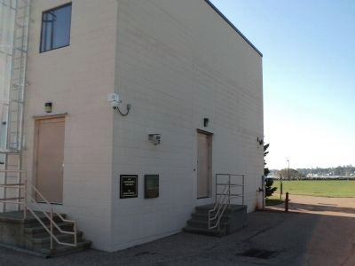
An industrial-looking building with few windows stood on this site directly in front of the fort from the 1770s until 1999. It was designed specifically for top-secret work in periscope technology. Originally, periscopes were simple tube-shaped . . . — — Map (db m48382) HM
Near East Street, on the left when traveling south.
After the Civil War fewer troops were stationed at Fort Trumbull, but at least one artillery company continued to serve here each year into the early twentieth century. It became evident during the Civil War that advances in weapons had caused the . . . — — Map (db m48356) HM
Near East Street, on the left when traveling south.
World War I broke out in Europe in 1914, and President Woodrow Wilson firmly resolved that the United States would stay neutral. However, public opinion turned to outrage in 1915, when a U-boat (a German submarine) fired two torpedoes at the . . . — — Map (db m48391) HM
Near East Street, on the left when traveling south.
Before the United States entered World War II, German U-boats again inflicted death and destruction on the seas by sinking Allied ships as they had in World War I. In January 1942, the month after the United States entered the war, the Germans . . . — — Map (db m48396) HM
Near East Street, on the left when traveling south.
On this rocky and windy promontory overlooking the Thames River, more than two hundred years of military history have unfolded. The history of this place and those who served here reflects strategic and technological developments from the American . . . — — Map (db m48647) HM
Near East Street, on the left when traveling south.
The army built this gun line, known as the South Battery, around 1840, while the present Fort Trumbull was under construction. By 1879, this battery contained eight cannon of two types, six Rodmans and two Parrotts. A low protective wall made of . . . — — Map (db m48262) HM
Near East Street, on the left when traveling south.
This building housed army enlisted men serving in the artillery or infantry from the 1830s until Fort Trumbull was downgraded to a supply post, in 1907. Built of rough-cut granite, the original stone section dates from about 1830, the same year . . . — — Map (db m48300) HM
Near East Street, on the left when traveling south.
Although the United States won the War of 1812, the searing memory of the nation’s capital in flames continued to disturb the public and Congress alike. The British had entered the Chesapeake Bay, continued up the Potomac River, and set fire to . . . — — Map (db m48353) HM
This monument marks the site of the largest United States Maritime Service Officers School during the course of events leading up to and including World War II.
During this period 15,000 Maritime Service Officers were graduated and went forth to . . . — — Map (db m66449) HM
Near East Street, on the left when traveling south.
In 1808, Congress again approved funds to fortify the coastline, prompted by the prospect of another war with England. England was at war with France, which was ruled by Napoleon Bonaparte at the time, and although the United States had not taken . . . — — Map (db m48283) HM
Near Main Street 0.4 miles east of Mystic Road, on the left when traveling east.
Connecticut Charter Oak Descendent
Planted in Commemoration of
the Bicentennial of the United States
of America 1976
planted and cared for by
the North Stonington garden club.
Plaque provided by
the NSGC in Commemoration of
the . . . — — Map (db m287020) HM
On Main Street south of Avery Lane, on the left when traveling south.
Settlement of this area had begun by the 1660s and was aided by land grants for public service. In 1720 the north religious society of Stonington was formed to erect a meetinghouse convenient for local worship. It was named North Stonington in . . . — — Map (db m287021) HM
On Main Street 0.4 miles east of Mystic Road, on the left when traveling east.
North Stonington, Connecticut
Area first settled 1680
Organized as North Society of
Stonington 1721
Incorporated as town of
North Stonington 1807
1776 Bicentennial 1976 — — Map (db m287019) HM
On Main Street 0.3 miles east of Mystic Road, on the right when traveling east.
Korean Veterans
This memorial is dedicated
to the veterans
of the Town of
North Stonington
who served their country
for the cause of freedom — — Map (db m286966) WM
On Main Street 0.3 miles east of Mystic Road, on the right when traveling east.
Vietnam Veterans
This Memorial is dedicated
to the Veterans
of the Town of
North Stonington
Who served their country
for the cause of freedom — — Map (db m287015) WM
On Main Street 0.3 miles east of Mystic Road, on the right when traveling east.
Roll of Honor
Dedicated to Those of the
Town of North Stonington
Who Served Their Country
In the World War.
Gardner Arzamarski · Harold Bliven · Raymond D. Brown · Chester Burdick · Walter Coon · Arthur Gould · Charles E. Gray · Vincent . . . — — Map (db m286967) WM
On Main Street 0.3 miles east of Mystic Road, on the right when traveling east.
Town of North Stonington, Conn.
Milltown
Inc. 1807
W.W.II.
Honor Roll
Anyzeski, Antonio · Arzamarski, Floyd · Babik, Frank · Baker, William · Bergius, Ruth G. · Bill, Frank · Brown, Clarence · Brown, Louis H. Jr. · Caswell, George · . . . — — Map (db m286975) WM
On Main Street 0.3 miles east of Mystic Road, on the right when traveling east.
This Planting
Is a Tribute to All Who
Served Their Country
In World War II
and
a Memorial to the Six Young
Men of North Stonington
Who Gave Their Lives for
the Cause of Democracy
Edmond Crider · Harry Eastland, Jr. · Harry Ericson · . . . — — Map (db m287017) WM
On Jewish War Veterans Memorial Highway (Interstate 95) west of Connecticut Route 49, on the right when traveling west.
Samson Occom was a Mohegan minister and educator. In 1775, he wrote this letter urging the Oneida Tribe to stay neutral in the Revolutionary War.
Occom was born in a wigwam on Mohegan land, near New London, CT in 1723. He learned about . . . — — Map (db m311716) HM
Near Jewish War Veterans Memorial Highway (Interstate 95) west of Connecticut Route 49, on the right when traveling south.
The Freedom Trail was authorized by the Connecticut General Assembly in 1995 to locate and promote sites in the state associated with the concept of freedom for African Americans. These sites include the graves of freed slaves and monuments to . . . — — Map (db m311717) HM
On Broadway at Union Street, on the left when traveling south on Broadway.
( inscribed around the obelisk )
June 14, 1863 · Port Hudson · May 27, 1863
( south side )
Erected
To the Memory
of the
26th Regiment
Conn. Volunteeer
Infantry
26th Regt. Conn. Vols.
( north side )
Total Membership
825 . . . — — Map (db m101860) HM
Near Lafayette Street at Williams Street, on the right when traveling south.
Once upon a time in Norwich...
nine victims of the Civil War were reinterred in this circle. Their stones are marked Andersonville. France's Devil's Island and the infamous Bataan Death March were parallel in horrors to Andersonville where they . . . — — Map (db m269248) HM
On Union Street at Broadway, on the left when traveling south on Union Street.
The Angelo Sanquedolce Memorial Plaza
Dedicated May 14, 1999
The Heritage Riverfront Park Plaza is hereby named and dedicated in honor of Angelo J. Sanquedolce, Comptroller of the City of Norwich from 1968 to 1998, for thirty years of exemplary . . . — — Map (db m101880) HM
On Union Street at Broadway, on the right when traveling south on Union Street.
Central Baptist Church
Central Baptist Church was founded in 1840 and under the zeal and energy of Rev. Miner G. Clarke grew rapidly to over 400 members. The church's first organist, Ithamar Conkey, composed the music to "In The Cross of Christ I . . . — — Map (db m101881) HM
On Broadway at Crescent Street, on the left when traveling north on Broadway.
Cristoforo
Colombo
1492 – 1992
Onorate
I Vostri
Genitori
( Behold Your Parents )
Presented to the
City of Norwich
by the
Italian – American
Citizens on the 500th
anniversary of the . . . — — Map (db m101856) HM
On Union Street at Broadway, on the left when traveling south on Union Street.
David Ruggles Freedom Courtyard
dedicated on the 19th day of October in the year 2013
and to honor the 150th anniversary of
The Emancipation Proclamation
signed by Abraham Lincoln on January 1, 1863
Whereas, on the twenty-second day of . . . — — Map (db m101879) HM
On Crescent Street near Broadway, on the left when traveling south.
Dr. Charles H. Osgood Fountain
Dr. Osgood was one of the original founding fathers
of the Norwich Free Academy in 1854.
The fountain was on his estate at the corner of
Washington and Broad Streets. In 1957,
Milton Green purchased and . . . — — Map (db m101943) HM
On Washington Street at Williams Street, on the left when traveling south on Washington Street.
Everlasting Vigilance
Spec Jacob D. Martir
US Army
Operation Iraqi Freedom
18 August 2004
1st Lt Keith N. Heidman
US Army
Operation Iraqi Freedom
28 May 2007 — — Map (db m101801) WM
On Washington Street at Williams Street, on the left when traveling south on Washington Street.
In Memory of
Captain Samuel Chester Reid
1783 — 1861
Born at Norwich, Conn. Aug. 25, 1783.
During the War of 1812 commander of the
American privateer General Armstrong.
Captain Reid planned the United States
Flag which was . . . — — Map (db m101775) HM
Near Crescent Street at Broadway, on the left when traveling south.
Nov. 4 A.D. 1886
This Building
Dedicated to the Education of the Young
And Commemorative of
John F. Slater
Is Erected by His Son
William A. Slater
And by Him Presented to the
Norwich Free Academy
In Grateful Recognition
Of . . . — — Map (db m101954) HM
Leased to Boston Hartford & Erie R.R. • 1869 Leased to New York & New England R.R. • 1886 Leased to New England R.R. • 1896 Leased to N.Y., N.H., & H. R.R. • 1898 Centennial Exercises sponsored by the New London Railroad Association May 11, 1940 . . . — — Map (db m172115) HM
On Washington Street at Williams Street, on the left when traveling south on Washington Street.
( south east plaque )
2nd Regt. Infantry: Enlisted Man: Joseph Stokes.
3rd Regt. Infantry: Enlisted Man: David C. Case.
5th Regt. Infantry: Enlisted Man: Alexander S. Avery.
6th Regt. Infantry: Enlisted Men:
Charles Meissor. Frank . . . — — Map (db m101792) WM
On Washington Street at Williams Street, on the left when traveling south on Washington Street.
Norwich Vietnam
War Memorial
In Honor Of The Brave
Servicemen Who Gave Their
Lives In Vietnam
Cooley, Robert Karl May 31, 1970
Donohue, Francis Charles March 1, 1967
Donovan, Thomas Edward March 23, 1968
Greene, James Leonard, Jr. . . . — — Map (db m101800) WM
On Washington Street at Williams Street, on the left when traveling south on Washington Street.
1917 1918
Dedicated To The Men And Women Of
Norwich
Who Served Their Country In The
World War
( 697 names are listed on the south side. The following have stars indicating they made the supreme sacrifice. )
Allen Horace H . . . — — Map (db m101794) WM
On Washington Street at Williams Street, on the left when traveling south on Washington Street.
( east side )
1941 1945
To Commemorate
Those
Who Served In World War II
And
To Those Who Paid The Supreme Sacrifice In Order That Our
Nation May Continue To The Glory Of God And To Continue
In His Principles Amongst Men . . . — — Map (db m101795) WM
On Union Street at Church Street, on the right when traveling south on Union Street.
Joseph Otis, who had earned his fortune elsewhere, returned to his hometown at the age of 70, and wishing to do something lasting for the people of Norwich, founded a public library in his name on this spot. He purchased the land and planned to have . . . — — Map (db m172119) HM
On Broadway at Crescent Street, on the left when traveling north on Broadway.
Slater Museum
Samuel Slater, possessing considerable knowledge of textile production and machinery emigrated from England in 1789. He was attracted to the United States because of the bounty offered here for skilled textile workers. British law . . . — — Map (db m101858) HM
On Washington Street at Broadway, on the left when traveling south on Washington Street.
The Freedom Tree
with the vision of universal freedom
for all mankind
This tree is dedicated to
Col. Paul G. Underwood
and all
Prisoners Of War
and
Missing In Action — — Map (db m101803) WM
Near Crescent Street at Broadway, on the left when traveling south.
The Shattuck
Building
Dedicated To The
Devoted Support Of
The Humanities As Was
Constantly Exhibited By
George E. Shattuck
During His Tenure
As Principal
1940 – 1965 — — Map (db m101945) HM
On Crescent Street at Broadway, on the left when traveling south on Crescent Street.
In Memoriam - U.S.S. Maine -
destroyed in Havana Harbor
February 15th 1898.
This tablet is cast from metal recovered from the U.S.S. Maine. — — Map (db m101859) WM
On Washington Street at Broadway, on the left when traveling south on Washington Street.
This Tract Of Land Is
Dedicated To Veterans
Of All Conflicts And Wars
By The Veterans Council Of
The Norwich Area
By City Council Resolution Sept. 1968 — — Map (db m101802) WM
On Main Street 0.1 miles east of Franklin Street, on the right when traveling east.
Once upon a time in Norwich, the Governor of the State of Connecticut, William A. Buckingham, resided in this building. Born in Lebanon, Connecticut, May 28, 1804, he attended Lebanon School, Bacon Academy in Colchester, and later took up residency . . . — — Map (db m171812) HM
On Crescent Street at Broadway, on the left when traveling south on Crescent Street.
William Ashby McCloy (1913-2000)
Aspirations, 1976
Core-ten steel 174 inches high
Commissioned with funds from The Connecticut Commission on the Arts
William Ashby McCloy was born in Baltimore and studied at Phillips . . . — — Map (db m101953) HM
On Lafayette Street at Williams Street, on the right when traveling south on Lafayette Street.
Historic Yantic Cemetery is an outstanding example of a Victorian-era landscape design referred to as a "Rural Cemetery," in which winding cart paths and circular drives formed the foundation for memorials, plantings and fountains, arranged for . . . — — Map (db m269247) HM
On Franklin Street at Willow Street, on the left when traveling north on Franklin Street.
Once upon a time in Norwich…
Hopkins & Allen Gun Factory was the city’s largest employer. During the Civil War, Norwich provided more arms for the Union forces than any other city. As the nation’s largest armory, Hopkins & Allen was just one . . . — — Map (db m101882) HM
On Elijah Street east of Boswell Avenue, on the left when traveling east.
Miantonimo, born circa 1600, became one of the greatest of Narragansett warriors and one of the tribe's most celebrated sachems. The nephew of the great sachem Canonicus, Miantonimo bowed to his uncle's wishes and attempted to befriend the . . . — — Map (db m306432) HM
On Vergason Ave west of Huntington Ave, on the right when traveling east.
Once upon a time in Norwich... Bean Hill, at the northwest end of the original English settlement of Norwich, was named for the traditional New England dish of baked beans. In 1729, the town set
aside the green for public use. Bean Hill soon . . . — — Map (db m268835) HM
On Washington Street (Connecticut Route 2) at Arnold Place, on the left when traveling south on Washington Street.
Benedict Arnold was born here in January 1741. He and a younger sister, Hannah, were the only survivors of eleven children. The original family home no longer exists.
As a young man of 14, he served an apprenticeship as a druggist with the . . . — — Map (db m267921) HM
On Washington Street at Lathrop Lane, on the left when traveling south on Washington Street.
Once upon a time in Norwich…
In 1789, when Norwich was the second largest city in the State, Thomas Leffingwell IV sold to the inhabitants of the East School District for 6 pounds, land “for the purpose of said inhabitants building a school . . . — — Map (db m101941) HM
On Old Cemetery Lane at Town Street ( Route 642) when traveling east on Old Cemetery Lane.
Honneur Patrie
En Mémoire
de Vingt Compagnons de Lafayette
morts pour la Liberté Amércicaine,
a la Ville de Norwich
pieuse gardienne du Souvenir Français,
La France reconnaissante.
Societe Nationale
du
Souvenir Francais . . . — — Map (db m269069) WM
The gravesite of Boston Trowtrow recalls a long-
forgotten practice in colonial New England of electing
"Black Governors," or "Kings," to represent local slave
populations. Trowtrow served as Norwich's Black
Governor from 1770 to 1772 and was . . . — — Map (db m269141) HM
On Town Street (Connecticut Route 642) at New London Turnpike, on the right when traveling east on Town Street.
The early life of John Mason in England (born circa 1600-01) is obscure. A Puritan, he served as an officer, under Sir Thomas Fairfax, in the Netherlands against Spain. He made the 63 day passage to the Massachusetts Bay Colony with Reverend . . . — — Map (db m306428) HM
On Washington Street at Lathrop Lane, on the right when traveling south on Washington Street.
John Olmstead, Norwich's first physician, settled here in 1661 and later sold his house to Samuel Lathrop. After the original house burned in 1745, it was rebuilt by Samuel's son, Dr. Daniel Lathrop. Near the family home, Dr. Lathrop opened the . . . — — Map (db m101913) HM
On Washington Street at Veterans of Foreign Wars Highway (Route 2), on the right when traveling south on Washington Street.
Leffingwell Inn
In 1675, Steven Backus built a simple two-room, side-chimney house. Over two centuries, it would be modified many times. Thomas Leffingwell, a founder of Norwich and friend of the Great Sachem, Uncas, bought the house in 1700 and . . . — — Map (db m101942) HM
On Washington Street at Lathrop Lane, on the right when traveling south on Washington Street.
Lowthorpe Meadows
Of this 18-acre meadow, the manor portion was deeded to a trust in 1907 by Emily Serena Gilman and Louisa Gilman Lane “in consideration of their love and goodwill to the inhabitants of Norwich, and in memory of their . . . — — Map (db m101911) HM
On West Town Street, on the right when traveling west.
In 1673, on the summit of
these rocks, was erected the
2nd meeting house in the township of Norwich. At this lofty
church-fort armed settlers &
militia braved Indian threats &
harsh elements to worship. — — Map (db m268921) HM
On East Town Street at Town Street, on the right when traveling north on East Town Street.
English settlers in southeastern Connecticut aided the Mohegan Tribe many times during the 17th century Pequot and Narragansett Wars. In 1645 Thomas Leffingwell and others helped lift a Narragansett siege of the Mohegans' Fort Shantok on the . . . — — Map (db m268167) HM
This burying ground was established in 1700 on land owned by Rev. James Fitch, Norwich's first minister, and Lt. Samuel Huntington. The land was chosen for the burying ground because it was hilly and unsuitable for farming. As Norwich grew, more . . . — — Map (db m268988) HM
On East Town Street, on the right when traveling west.
Once upon a time in Norwich...
about 1773, Joseph Carpenter, II, a clockmaker and goldsmith, had this building
constructed. It served him and his brother, Gardner, in jewelry, clocks, engraving
and mercantile. It is thought to be the only . . . — — Map (db m268922) HM
Near Town Street (Connecticut Route 642) east of Old Cemetery Lane, on the right when traveling west.
Once upon a time in Norwich...
an 18 year old Benedict Arnold stood on this spot and watched as
they lowered his long-suffering mother into her grave.
Benedict himself was an apprentice, bound by indentured
servitude to his mother's cousins, . . . — — Map (db m269115) HM
On West Town Street, on the right when traveling west.
In memory of
Private William M. Durr.
Co. B. 4th Infantry 3rd Division.
Killed in action at the Marne.
July 23rd 1918.
Memorial tree planted by the W.I.T'S. — — Map (db m268918) WM
On East Town Street, on the right when traveling east.
(Left Plaque)
In honor of the
Revolutionary
Soldiers
buried
within these grounds
these memorial gates
were placed
July 4, 1903
by
Faith Trumbull Chapter
D•A•R
(Right Plaque)
Revolutionary Soldiers . . . — — Map (db m269192) WM
On East Town Street, on the right when traveling east.
Lawyer, judge, diplomat, and president of the Continental
Congress, Samuel Huntington left an indelible mark on the
history of Norwich and the United States. His life reflected the
independence and ambition of a growing nation. He saw
Norwich . . . — — Map (db m269196) HM
On East Town Street at Town Street, on the right when traveling north on East Town Street.
In 1659 the Mohegan chief Uncas sold to settlers led by Major John Mason and the Reverend James Fitch “nine miles square”, part of which became Norwich.
According to Francis M. Caulkins’s history of Norwich, “At the end of the first century . . . — — Map (db m101910) HM
On Old Cemetery Lane at Town Street, on the right when traveling east on Old Cemetery Lane.
The cemetery dates from 1715. One of the first to be interred here was 21 year old Simon Huntington, who died from a rattlesnake bite, probably while haying.
Today, only 1,300 tombstones remain visible. It is thought that perhaps thousands may . . . — — Map (db m268924) HM
This tomb is the final resting place of Samuel Huntington (1731-1796) and of his wife Martha
(1738-1794). Samuel was born in Scotland, CT. and following a common school education his legal
profession was self-taught. Admitted to the bar in 1754, . . . — — Map (db m269144) HM
In memory of
twenty French soldiers
who, serving under
Lafayette,
died while in camp at
Norwich Town 1778
———
Placed by
Faith Trumbull Chapter D.A.R.
1901 — — Map (db m269071) HM WM
On Yantic Road north of Sunnyside Street, on the right when traveling north.
Dedicated to the memory of all deceased members.
"They do rest from their labors"
This bell served as a fire alarm from 1847 to 1921.
Erected by the Womens Auxiliary Yantic Fire Engine Co. No 1 on the company's 125th . . . — — Map (db m268833) HM
On Yantic Road, on the right when traveling north.
This flagpole is dedicated
to all members of
the Yantic Fire Engine Co. No. 1.
who have served in
the armed forces of
the United States of America
Presented May 17, 1987
by the members of
the Yantic Fire Engine Co.
and the Women's . . . — — Map (db m268832) WM
On Yantic Road, on the right when traveling north.
Plaque sponsored by the Yantic Volunteer Fire Department
The village of Yantic, located in the city of Norwich lies in the northwest corner, bordered
by the towns of Bozrah and Franklin. These towns were once part of the . . . — — Map (db m268372) HM
On Yantic Road, on the right when traveling north.
Members of the
Yantic Fire Engine Co.
who honorably served in the
United States military
during the Vietnam War era
William Banta •
Edward Barber • Arthur Becotte • Mitchell Chmielewski • Paul Chmielewski •
David Clang •
James . . . — — Map (db m268834) WM
On Yantic Road, on the right when traveling north.
Presented by the
Yantic Fire Engine
Co. No 1
on their 100th anniversary
July 19, 1947
in honor of those from this
community who served in
World War II
Ralph B. Barber · Ernest G. Bates ·
Arthur M. Beeman ·
Robert D. Beeman · . . . — — Map (db m268830) WM
On Old Shetucket Turnpike at Jewitt City Road (Route 164), on the right when traveling east on Old Shetucket Turnpike.
Downer-Doane Park
Homesite of
Dr. Joshua & Dr. Avery Downer
Revolutionary War Surgeons
also of
William Howard Doane
Hymn Writer — — Map (db m140818) HM
On Jewitt City Road (Connecticut Route 164) at Shetucket Turnpike ( Route 165), on the left when traveling south on Jewitt City Road.
Incorporated in 1687, Preston was settled mainly by sons and grandsons of founders of surrounding towns on land purchased from the Mohegan Indians. It was probably named for Preston in Suffolk, the English home of Thomas Parke, one of the . . . — — Map (db m302003) HM
On Jewitt City Road (Connecticut Route 164) at Old Shetucket Turnpike, on the left when traveling south on Jewitt City Road.
From This Town
Obedient to the Call of
Patriotism and Humanity
Went Forth
One Hundred and Fifty Men
As Soldiers in the Civil War
In Grateful Memory
Of Those Citizens of the Town of
Preston
Who Served Their Country in Arms
In the . . . — — Map (db m140891) WM
On Hallville-Poquetanuck Road (Connecticut Route 2A) 0.5 miles north of Lincoln Park Road, on the right when traveling north.
Several species of fish live in the ocean, but must come inland to fresh water in order to reproduce. These are known as "anadromous" species. For thousands of years this life cycle was part of the aquatic ecology in North America. When Europeans . . . — — Map (db m193115) HM
On Hartford Road (Connecticut Route 85) 0.3 miles north of Morgan Road, on the right when traveling north.
This area, called Paugwonk by Indians living near Fairy Lake, was settled about 1700. It was named New Salem Parish by the landowner Colonel Samuel Browne from Salem, Massachusetts, in 1725. Sections of Colchester, Lyme, and Montville were . . . — — Map (db m302004) HM
On Hartford Road (Connecticut Route 85) 0.3 miles north of Morgan Road, on the right when traveling north.
1950 Korea 1955
America Wrote Proud History in
Defense of Freedom. The Men and
Women Who Served Learned It Was A
Soldier’s Destiny to Suffer Perhaps
To Die. Let Us Remember With Pride
Those Who Returned, Those Who Died,
Those . . . — — Map (db m141150) WM
On Hartford Road (Connecticut Route 85) 0.3 miles north of Morgan Road, on the right when traveling north.
Revolutionary War Bicentennial
Erected April 26, 1975
Honoring the Men of New Salem Parish
Who Fought for Our Nations Independence
Isaiah Armstrong · Capt. Stephen Billings · John Deathick★ · Capt. Daniel Dodge★ · Cpl. Elihu . . . — — Map (db m141148) WM
On Hartford Road (Connecticut Route 85) 0.3 miles north of Morgan Road, on the right when traveling north.
1959 Vietnam 1975
Dedicated to the Men and Women of
The Armed Forces Who Exhibited a
Unique Blend of Heroism, Honor, and
Courage. Let Us Recall With Pride
Those Who Served. Let Us Remember
With Love Those Who Died. And Let
Us Pray . . . — — Map (db m141151) WM
On Hartford Road (Connecticut Route 85) 0.3 miles north of Morgan Road, on the right when traveling north.
1917 1919
In honor of the citizens
of Salem who served their
country in the World War
Ernest M. Beebe · Lawrence W. Beebe · Nathan Buchalter · ★Samuel Buchalter · George E. Day · Edward H. Dewolf · Nathan Eisenstein · Daniel M. Fraser . . . — — Map (db m141103) WM
On Hartford Road (Connecticut Route 85) 0.3 miles north of Morgan Road, on the right when traveling north.
1941 1945
In Honor of the Citizens of Salem
Who Served Their Country in World War II
James H. Beebe, Jr. · Alfred M. Bingham · Charles V. Brown · Hugh Chappell · Frederick Cherrick · Edwin R. Coffey · Victor Connell · William A. Cusimano · . . . — — Map (db m141145) WM
On Main Street (Connecticut Route 97) at W Main Street ( Route 207), on the left when traveling west on Main Street.
This area on the Shetucket River was part of the land deeded in 1659 by Uncas, the Mohegan Indian sachem, to form the town of Norwich. In 1786 it became parts of Franklin and Lisbon. Settlements were made at Hanover, established as an . . . — — Map (db m302001) HM
On W Main Street (Connecticut Route 207) at Main Street ( Route 97), on the left when traveling north on W Main Street.
Dedicated to Those Who Served In
The Civil War 1861 – 1865
Abbott, James · Acker, George · Allen, John · Bartlett, John S. · Batchelder, George E. · Bigelow, James S. · Bingham, Henry L. · Birch, William H. · Bishop, Nathan L. · Blake, . . . — — Map (db m141228) WM
534 entries matched your criteria. Entries 301 through 400 are listed above. ⊲ Previous 100 — Next 100 ⊳