English
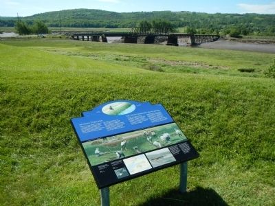
When the French settled at Port-Royal in the early 1600s, the shores of the Annapolis River were bordered with tidal salt marsh. In the 1630s, the French at Port-Royal started reclaiming this fertile land by building dykes.
The . . . — — Map (db m78488) HM
English
From its strategic setting, Annapolis Royal has witnessed pivotal events in the history of European settlement in Canada. Located on a former Mi’kmaq meeting place, the townsite and its environs were known as Port-Royal by . . . — — Map (db m78670) HM
In commemoration of the captures of Port Royal by New England expeditions under Maj. Robert Sedgwick 1654 and Colonel Francis Nicholson 1710. In this second expedition Col. Samuel Vetch was Adjutant-General. There were 36 transports, 4 ships of 60 . . . — — Map (db m78439) HM
English
Two cemeteries are located in this burial ground: the earlier Acadian parish cemetery and the later Church of England cemetery. The wooden markers once placed on most of the graves have long since decayed. The gravestones . . . — — Map (db m78605) HM
Two markers are located on these monument. Charles Fort / Le fort Charles English
A group of about 70 Scottish settlers began a colony here in 1629, eight years after King James I granted ‘Nova Scotia’ to Sir William . . . — — Map (db m78486) HM
In memory of
Daniel Auger de Subercase
1663-1732
Chevalier of the Military Order of St. Louis, last French commander of this fort and defender of Acadie.
Honour to unsuccessful valour — — Map (db m78442) HM
English
In September 1744, French soldiers and Aboriginal warriors attacked this fort. The took advantage of the overcast and rainy weather to attack at night under cover of darkness, sometimes managing to slip onto the outer works of the . . . — — Map (db m78606) HM
English
Before you, the Allain and Annapolis rivers meet, creating a stopping place used by travelers for many centuries. The Annapolis River makes access to the site easy, while the natural rise of land provides a good view downstream. . . . — — Map (db m78483) HM
English
Forts like this are called bastioned forts after one other principal pars - the bastion. The fort’s shape creates areas of crossfire which allow the land surrounding the fort to be moere easily defended. From the late 1600s to the . . . — — Map (db m78598) HM
The modern-day market in Annapolis Royal sits on land that for much of the town’s history was church property. The earliest Roman Catholic Church, built of stone, was located next to the fort and destroyed following Sir William Phips’ capture of . . . — — Map (db m78720) HM
English
A French Huguenot in the British army, Mascarene served here from 1710 to 1750. He was a member of the Council of Nova Scotia (1720-50), lieutenant-colonel of Philipps’ Regiment (1742-50), and administrator and commander . . . — — Map (db m78491) HM
This replica of the Masonic stone of 1606 was presented to the Masons of Nova Scotia as a gift from the Most Wor. Bro. Roy F. Lively past Grand Master of Nova Scotia 2008 - 2009 commemorating the 275th Anniversary of Masonry in Nova Scotia which . . . — — Map (db m78668) HM
English
When the French first came to the Annapolis Basin, Samuel de Champlain called it “Port-Royal” in recognition of its great size.
Eventually, the area surrounding the basin and along the Annapolis River became known as . . . — — Map (db m78449) HM
English
Since the 1740s, three wharves have been built where the ruins of the Queen’s Wharf now lie. Everything the fort needed was landed on the wharf: troops, provisions, weapons and much more. It served the needs of the military until . . . — — Map (db m78445) HM
English
Rose Fortune is a uniquely intriguing figure in Nova Scotia history. An independent businesswoman of African descent, she demonstrated remarkable character and indomitable resolve in her varied enterprises.
Operating a . . . — — Map (db m78671) HM
English
Adjutant-General of the force under Colonel Francis Nicholson which captured Port Royal, Capital of Acadia, in 1710.
First Governor and Commander-in-Chief. A notable figure in colonial history. An able soldier and administrator. . . . — — Map (db m78482) HM
To the illustrious memory of Lieut. Gen’l Timothé Pierre du Guast,
Sieur de Monts,
the pioneer of civilization in North America, who discovered and explored the adjacent river, A.D. 1604, and founded on its banks the first settlement of . . . — — Map (db m78443) HM
English
The Sinclair Inn is an important document in the history of building in Atlantic Canada. In the 1780s, tavern-keeper Frederick Sinclair created this inn by combining two existing structures. Both were frame, and the walls of one . . . — — Map (db m78701) HM
This tablet marks the Site of the Brith-place of General
Sir William Fenwick Williams
Baronet
1799 - 1883
“The Hero of Kars”
Pasha of Turkey. Grand Officier Legion of Honour, France.
Member of the British Parliament. . . . — — Map (db m78672) HM
The Black Hole
The French built this powder magazine into the earthworks of their new fort in 1702. Both the French and the British used it to store gunpowder. In the early 1800s, it was used briefly as a prison or “Black Hole.” . . . — — Map (db m78601) HM
[English:]
You are standing on the west bastion which, in the 1700s, was the principal bastion. This being the closest bastion to the river, a flag was flown here to show approaching vessels who controlled the stronghold. . . . — — Map (db m78603) HM
In the early hours of July 4, 1724, a combined force of Mi’kimaq and Maliseet warriors attacked Annapolis Royal, slipping into the town as its residents slept. They attacked the fort from the cover of the hollow near the east bastion. Although the . . . — — Map (db m78702) HM
Two plaques share a common stand.
William Wolseley
1756-1842
English
William Wolseley was born at Annapolis Royal, the son of an officier of the garrison. He entered the Royal Navy in 1769, and served with . . . — — Map (db m78607) HM
Commemorating two combats between British garrisons of Annapolis Royal and allied French and Indians in the half century of conflict for possession of Acadia: on the north bank of the Annapolis River, 10th June, 1711; and here, 8th December, 1757. . . . — — Map (db m197083) HM
On a clear day, 5 Nova Scotian counties are visible from this site. They are: Hants, Kings. Colchester, Cumberland and Pictou. By standing in the footprints engraved on the ground markers and reading the heading on each, you will be able to orient . . . — — Map (db m305856) HM
In memory
Alden Nowlan
Jan. 25, 1933- June 27, 1983.
Birthplace, childhood home
Stanley, N.S.
Poet, novelist, playwright There is a fountain filled with blood
drawn from Emmanuel's veins
and sinners plunged beneath that flood
lose . . . — — Map (db m138569) HM
This cairn marks the site of the
Acacia Villa School for Boys.
Founded in 1852 by
Joseph R. Hea,
he was principal until 1860.
Arthur McNutt Patterson
was principal from 1860 to 1907.
His son, Arthur H. Patterson
was principal from 1907 to . . . — — Map (db m139030) HM
This plaque commemorates the 235th year of the Grand Pre Marsh Body 1760-1995 in honour of the dykeland farmers, past and present, for their 235 years of dedication and sacrifice, and their continuing struggle to protect and maintain these dykelands . . . — — Map (db m138789) HM
English
The villages of Grand-Pré and Hortonville, and the fertile farmlands which surround them, comprise one of the oldest settlement and land use patterns of European origin in Canada. Acadians began settling near Grand-Pré . . . — — Map (db m78721) HM
In 1759, the British authorities subdivided Nova Scotia into counties. The County of
Kings was divided into three townships: Cornwallis; Falmouth and Horton.
The Horton Town Plot (or plan), sited on the hills above Horton Landing and . . . — — Map (db m139033) HM
L'église-souvenir
Un témoignage durable
L'église-souvenir représente l'attachement profond
du peuple acadien au lieu historique national du
Canada de Grand-Pré.
Construite en 1922 grâce à des fonds recueillis . . . — — Map (db m140428) HM
Fondue avant l'avènement de l'education publique en
Nouvelle-Écosse, cette école a offert une éducation classique
et morale aux fils de familles aisées des Maritimes. L'école
accueillait quelques externes, mais la plupart des élèves
étaient . . . — — Map (db m138917) HM
English
This statue of Evangeline, heroine of Longfellow’s epic poem, Evangeline: A Tale of Acadie, is a powerful emotive symbol of the Deportation. It connects the story of Evangeline to the history of Grand Prê.
Two . . . — — Map (db m78723) HM
On February 11, 1747 Grand
Pré was the scene of a surprise
attack on Col. Arthur Noble's
detachment of British troops from
Massachusetts who were billeted
in the houses of the inhabitants.
A French and Indian force under
Coulon de . . . — — Map (db m140191) HM
English
The expulsion of the Acadians began in 1755, on the eve of the Seven Years’ War. Frustrated with the neutrality of the Acadians who refused to swear an unconditional oath of allegiance to the Crown, British forces began . . . — — Map (db m78722) HM
How the Battle Unfolded
During the first half of the 18th century, France and Great Britain were at war for imperial domination of North America. Most Acadians, including those at Grand Pré, wanted to stay out of the conflict and be . . . — — Map (db m140430) HM
To entice the Planters to settle in Nova Scotia, the British colonial administration introduced an elected legislature in 1758, a form of representative government they had long known in New England. In the decades after their settlement . . . — — Map (db m140209) HM
In 1759, New England farmers and fishermen sent agents to Halifax to discuss with Governor Lawrence the settlement of the undeveloped areas of the province. Substantial immigration began in 1760 and, by late 1763, several thousand . . . — — Map (db m140207) HM
In the 1760’s, this spot was one of many to witness an influx of settlers from New England. The Planters called this region Horton Landing, a name it retains to this day. Within the Minas area, the newcomers established four agricultural . . . — — Map (db m140222) HM
In 1755, the worldwide struggle for empire between Great Britain and France had tragic consequences for the Acadians of Les Mines and elsewhere in Nova Scotia/Acadie
Lt-Col. John Winslow was the Massachusetts officer in charge of the . . . — — Map (db m140393) HM
Le lit desséché du crique que l’on aperçoit dans le pré à quelques pas d’ici est l’endroit ou furent embarques sur les chaloupes les victimes du Grand Dérangement de 1755 pour être transbordes sur les transports ancres dans le Bassin des . . . — — Map (db m138777) HM