By Craig Swain, August 3, 2007
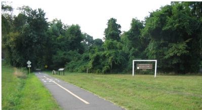
Marker Beside the Trail and Site of Old Station
RANKED BY RELEVANCE, THEN GEOGRAPHICALLY
| On Dry Mill Road, on the right when traveling south. |
| On Fairfax Station Road west of Ox Road (Virginia Route 123), on the right when traveling east. |
| On Hunter Mill Road (County Route 674), on the right when traveling north. |
| On East Fairfax Street at Douglass Avenue, on the right when traveling east on East Fairfax Street. |
| On West Broad Street (State Highway 7) at Washington Street (U.S. 29), on the right when traveling east on West Broad Street. |
| On Washington and Old Dominion Trail west of Grove Avenue, on the right when traveling west. |
| On Washington Street / Lee Highway (U.S. 29) at Tinner Hill Street, on the right when traveling west on Washington Street / Lee Highway. |
| On East Broad Street (State Highway 7). |
| On Blackburn Road at Admiral Black Drive, on the right when traveling south on Blackburn Road. |
| On Southern Avenue Southeast north of Suitland Terrace Southeast, on the right when traveling north. |
| On North Glebe Road (Virginia Route 120) just north of Fairfax Drive (Virginia Route 237), on the left when traveling north. |
| On Fairfax Boulevard (Lee Highway) (U.S. 50/29) west of Spring Street, on the right when traveling west. |
| On Sleepy Hollow Road (County Route 613) south of Leesburg Pike (Virginia Route 7), on the left when traveling south. |
| On South West Street just north of South West Street, on the left when traveling north. |
| On North Glebe Road (State Highway 120) at 41st Street, on the right when traveling south on North Glebe Road. |
| On South Four Mile Run Drive west of Shirlington Road, in the median. |
| On Pickett Road (Virginia Route 237) at Old Pickett Road, on the right when traveling south on Pickett Road. |
| Near Lynn Street north of Station Street, on the left when traveling north. |
| On Washington and Old Dominion Trail west of Maple Avenue East (Virginia Route 123), on the right when traveling west. |
| On Washington and Old Dominion Trail west of Smith Switch Road, on the left when traveling west. |
| On Harrison Street Southeast at Depot Court Southeast, on the left when traveling north on Harrison Street Southeast. |
| On 23rd Street at Sealy Avenue, on the right when traveling north on 23rd Street. |
| On King Street (Virginia Route 7) at North Columbus Street, on the left when traveling east on King Street. |
| On Outlet, 0.3 miles north of Lampert Road, on the right when traveling north. |
| On Hunter Mill Road (County Route 674), on the right when traveling north. |
| Near North Glebe Road (Virginia Route 120) just north of Fairfax Drive (Virginia Route 237), on the left when traveling north. |
| On Shreve Road (County Route 703) south of Leesburg Pike (Virginia Route 7), on the right when traveling south. |
| On Old Courthouse Road (Virginia Route 677) west of Battery Park Street, on the left when traveling west. |
| Near West Braddock Road, 0.1 miles east of North Howard Street, on the left when traveling east. |
| Near Columbia Pike (Virginia Route 244) east of Oak Hill Drive, on the right when traveling north. |
| On Allen Street west of South Prairie Street, on the left when traveling west. |
| On North Old Glebe Road south of North Randolph Court, on the right when traveling north. |
| Near Eisenhower Avenue, 0.4 miles west of Cameron Parke Court, on the right when traveling west. |
| Near Forney Loop, on the right when traveling east. |
| On South Four Mile Run Drive at South Shirlington Road when traveling east on South Four Mile Run Drive. |
| On Meadowlark Gardens Court south of Beulah Road. |
137 entries matched your criteria. Entries 101 through 137 are listed above.
⊲ Previous 100
* Inflectional forms of words are their plurals, singulars, and possessives as well as gramatical tenses and similar variations.
