By Jamie Abel
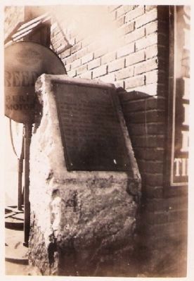
Morgan's Raid Marker
RANKED BY RELEVANCE
| On Ohio Route 150 0.1 miles west of Main Street, on the right when traveling east. |
| Near Bergholz-New Somerset Road 0.2 miles north of State Park-Mooretown Road. |
| On Green Street at East Main Street (U.S. 250), on the right when traveling east on Green Street. |
| On West Vaughn Drive just east of Central Avenue, on the right when traveling east. |
| On West 1st Street just west of Vine Street, on the left when traveling west. |
| Near County Route 49 0.1 miles west of Route 164, on the left when traveling west. |
| On Ohio Route 164 south of Local Road 263, on the left when traveling north. |
| On Dry Fork Road (County Highway 8) at State Route 150, on the right when traveling north on Dry Fork Road. |
| On Ohio Route 43 at Mill Street, on the left when traveling east on Ohio Route 43. |
| On Ohio Route 152 at Route 213, on the right when traveling east on Ohio Route 152. |
| On Ohio Route 164 at County Road 55, on the left when traveling east on Ohio Route 164. |
| On County Highway 74 at Local Highway 166, on the left when traveling east on County Highway 74. Reported missing. |
| On New Alexandria Road (Ohio Route 151) at Chappel Hill Road (Local Highway 184), on the right when traveling west on New Alexandria Road. |
| On Local Highway 166 0.5 miles north of County Highway 74, on the left when traveling north. |
| On East Main Street (Ohio Route 43) at Route 152, on the left when traveling east on East Main Street. |
| On Main Street (Ohio Route 152) 0.2 miles south of Route 151, on the left when traveling north. |
| On 4th Street at Slack Street, on the right when traveling east on 4th Street. |
| On South 4th Street at Slack Street, on the right when traveling north on South 4th Street. |
| On Canton Road (Ohio Route 43) 0.2 miles north of U.S. 22, on the right when traveling south. |
| On Main Street (Ohio Route 43) at Fernwood Road, on the right when traveling east on Main Street. |
| On Ohio Route 78 at Unionville Road, on the right when traveling west on Ohio Route 78. |
| On Portage Lakes Drive (County Route 75) at South Turkeyfoot Road (County Route 123), on the right when traveling east on Portage Lakes Drive. |
| On W Main Street at N 6th Street, on the right when traveling west on W Main Street. |
| On 1st Street Southeast at Tremont Avenue Souteast, on the right when traveling north on 1st Street Southeast. |
| On South 2nd Street (Kentucky Route 1020) at West Cardinal Boulevard, on the left when traveling north on South 2nd Street. |
| On West Main Street west of South 1st Avenue, on the right when traveling east. |
| On Westport Road (Kentucky Route 524) at 4th Street, on the right when traveling west on Westport Road. |
| Near Jefferson Street south of East Main Street (Ohio Scenic River Byway) (U.S. 421), on the left when traveling south. |
| Near North Blackford Street north of Indianapolis Cultural Trail, on the right when traveling south. |
| On Breckenridge Lane (State Road 1932) south of Hillsboro Road, on the right when traveling south. |
| Near South Main Street south of Liberty Street, on the right when traveling north. |
| On West 3rd Street at Mill Street, on the right when traveling west on West 3rd Street. |
| On Rankin Hill Road (County Route 556) 1.5 miles east of North Second Street, on the right when traveling south. |
| On East Main Street (Ohio River Scenic Byway) (U.S. 421) just east of Jefferson Street (U.S. 421), on the right when traveling west. |
| On Mansfield Drive (U.S. 250) at North Main Street (U.S. 250), on the right when traveling east on Mansfield Drive. Reported permanently removed. |
| On E Washington Street (U.S. 340 Bus) at S Seminary Street, on the right when traveling east on E Washington Street. |
| On Opal Road NE (County Route 294), on the right when traveling west. |
| On Michigan Avenue at East 11th Street, on the right when traveling north on Michigan Avenue. |
| On W Jefferson Street at S 5th Street, on the right when traveling west on W Jefferson Street. |
| On Stone River Road north of Old Leeds Lane, on the left when traveling north. |
| On Shelbyville Road (U.S. 60) at Whipps Mill Road, on the right when traveling west on Shelbyville Road. |
| On North Samuel Street at East Washington Street (West Virginia Route 51), on the right when traveling north on North Samuel Street. |
| On North Street just south of Melbourne Street, on the right when traveling north. |
| On Melvin Road (County Road 17/2) 0.1 miles Flowing Springs Road (County Road 17), on the right when traveling east. |
| On Morgan Jaymes Drive west of Justine Court, on the right when traveling west. |
| On Market Street west of North 3rd Street, on the right when traveling west. |
| On South Washington Street (Ohio Route 100/231) at East Market Street ( Route 18/101), on the right when traveling north on South Washington Street. |
| On Tennessee Route 35, on the left when traveling south. |
| On Route 9 Bike Path 0.4 miles south of Luther Jones Road (County Road 16/4), on the right when traveling north. |
| On Baxter Street at Warfield Way, on the left when traveling east on Baxter Street. |
| On Washington Street, on the right when traveling north. |
| On Trail #7 east of State Park Drive, on the right when traveling east. |
| Near South Lewis Boulevard 0.3 miles Lincoln Way. |
| On W Main Street 0.2 miles north of Place Montpellier, on the right when traveling west. |
| On Beechland Road (Kentucky Route 438) at Lincoln Park Road ( Route 528), on the left when traveling east on Beechland Road. |
| Near South Third Street east of Adams Street. |
| Near Chestnut Street (Pennsylvania Route 66) at West Spruce Street. |
| Near Battle Park Drive 0.4 miles west of Saratoga Drive, on the left when traveling west. |
Thin black lines indicate changes in relevance. Between each pair of lines entries are ordered geographically but all have the same relevance.* Inflectional forms of words are their plurals, singulars, and possessives as well as gramatical tenses and similar variations.
Nov. 12, 2026
