On John S. Mosby Highway (U.S. 50) at Atoka Road (County Route 713), on the left when traveling west on John S. Mosby Highway.
Here at Atoka (Rector’s Crossroads) on June 10, 1863, Company “A”, 43rd Battalion of Partisan Rangers, known as “Mosby’s Rangers”, was formally organized. James William Foster was elected Captain; Thomas Turner, First . . . — — Map (db m1467) HM
On Rectortown Road (Virginia Route 710), on the right when traveling north.
Unable to extend a truce with the Union army, Col. John S. Mosby assembled his command, the 43rd Battalion Virginia Cavalry, in a field just west of here on 21 Apr. 1865. As Mosby sat astride his horse, his final order was read aloud. It stated in . . . — — Map (db m1174) HM
On Dairy Lane at Bobwhite Lane, on the left on Dairy Lane.
Captain John Singleton Mosby and 69 of his Confederate ranger troop were surprised at dawn while sleeping here in the Miskel farmhouse and hay barn by 150 Union cavalry. Though greatly outnumbered, Captain Mosby led his rangers on foot with . . . — — Map (db m1794) HM
On North Royal Avenue north of West 14th Street (U.S. 340), on the left when traveling north. Reported permanently removed.
"Mosby will hang ten of you for every one of us!"
were William Thomas Overby’s last words to his
executioners before the rope tightened around his
neck here on Richardson’s Hill. This was the
final scene of a tragedy that began less than two . . . — — Map (db m804) HM
On Col. Joe M. Jackson Medal of Honor Highway (Georgia Route 34) at Thomas Overby Drive, on the right when traveling east on Col. Joe M. Jackson Medal of Honor Highway.
William Thomas Overby was born on this site in the 1840s. He enlisted May 31, 1861, in Co. A, 7th Regiment, Georgia Volunteer Infantry, C.S.A. Later served with the 43rd Battalion, Virginia Cavalry, Mosby’s Rangers, and participated in many raids . . . — — Map (db m32064) HM
Immigrant Peter Ruffner built this house about 1739. Before the Civil War, William A. Chapman bought it, and three sons reared here later fought for the Confederacy. For their exploits as members of Col. John S. Mosby’s Rangers, two of them, Lt. . . . — — Map (db m17210) HM
On Main Steet (Virginia Route 645) at Chapel Street, on the right when traveling south on Main Steet.
In 1876, George W. Tillet, along with other area men who served with Mosby’s Rangers during the Civil War, formed a Baptist Church with services held in his home. Subsequently, they built a one-room church on this site in 1877 which was replaced by . . . — — Map (db m110179) HM
On Elden Street (Virginia Route 606) east of Spring Street (Virginia Route 675), on the right when traveling east.
On March 17, 1863, "The Grey Ghost," Captain John Singleton Mosby, and his band of Confederate Rangers of the 43rd Battalion, Virginia Cavalry, conducted a surprise daytime attack near Herndon's railroad station. Mosby's Rangers captured Union . . . — — Map (db m115850) HM
Mosby’s Rangers (43d Bn., Va. Cav.) used this rock as a rendezvous point and met here to divide the spoils after raids. The renowned Southern spy and scout Laura Ratcliffe, who lived nearby, showed this rock to Col. (then Captain) John S. Mosby, . . . — — Map (db m9957) HM
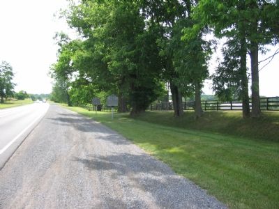
On Atoka Road at John S. Mosby Highway (U.S. 50), on the right when traveling north on Atoka Road. Reported permanently removed.
Here at Rector's Crossroads on June 10, 1863 Major John S. Mosby officially established Company A, 43rd Battalion Virginia Cavalry, known as Mosby's Rangers. It was here on June 23, 1863 that General J.E.B. Stuart set up headquarters and received . . . — — Map (db m2786) HM
Near Atoka Road (Virginia Route 713) just west of John S. Mosby Highway (U.S. 50), on the left when traveling west.
Built c. 1801 by the Nichols-Hatcher family, Quakers who operated a mill on nearby Cromwell's Run. The Rector House is named for the Civil War-era owners, Caleb and Mary Ann Hatcher Rector. Here at Rector's Crossroads on June 10, 1863 Major John S. . . . — — Map (db m151316) HM
On Catlett Road (Virginia Route 28) at Old Dumfries and Elk Run Road (County Route 667/806), on the right on Catlett Road.
To halt the flow of supplies to Union forces on the Orange & Alexandria R.R., Maj. John S. Mosby, C.S.A., destroyed a train near here on 30 May 1863. Removing a rail to stop the train, Mosby’s Rangers disabled the engine with a recently acquired . . . — — Map (db m2246) HM
On John Mosby Highway (U.S. 50) at Watson Road (County Route 860), on the right when traveling east on John Mosby Highway.
Mt. Zion Old School Baptist Church was founded in 1851. Just west of the church is a graveyard containing many 19th century grave markers. On July 6, 1864 nearby, Mosby's Rangers attacked and routed 150 Union cavalrymen. Over 100 Union soldiers were . . . — — Map (db m55727) HM
On James Madison Highway (U.S. 15) at Woodberry Forest Road (County Route 622), on the right when traveling south on James Madison Highway.
Two miles northeast is Woodberry Forest School, a college preparatory school for boys, founded in 1889 by Robert Stringfellow Walker, a captain with Mosby's Rangers. The school was named for the estate on which it stands, formerly owned by William . . . — — Map (db m4755) HM
This is the burial site of a Mosby Ranger who sacrificed himself for a friend. By the autumn of 1864, Confederate John S. Mosby's Rangers had so harassed Union troops, supply lines, and railroads in northern Virginia that Union Gen. Ulysses S. . . . — — Map (db m49528) HM
On Maidstone Road, on the left when traveling west.
On November 5, 1862, several weeks after a tainted victory at Antietam, the Army of the Potomac's Commander-in-Chief Gen. George Brinton McClellan established his headquarters here. That same day President Abraham Lincoln wrote the orders relieving . . . — — Map (db m1173) HM
On Center Street (Virginia Route 28), on the left when traveling east.
Built circa 1907. Served as the main community center for Manassas until the mid 1930s. It later was used by the Manassas Journal newspaper. — — Map (db m2472) HM
On Walney Road (Virginia Route 657) 0.1 miles Lewis Leigh Court, on the right when traveling north.
If this were the 1730's, you would be standing on a 4,142-acre parcel belonging to Major George Turberville.
Tuberville, Willoughby Newton, and Robert Carter owned most of the land in western Fairfax. In colonial Virginia that . . . — — Map (db m198326) HM
On Centreville Road (Virginia Route 657) at Lees Corner Road (Virginia Route 645), on the right when traveling south on Centreville Road.
Clover Hill, the residence of Alexander Turley, was built near here ca. 1823 on a high point of Turley's 450-acre farm. The two-story brick house featured Alexander Turley's initials incorporated into the chimney using glazed bricks. Slave cabins . . . — — Map (db m95088) HM
On Winchester Road (U.S. 17) at Crooked Run Road (County Route 831), on the right when traveling north on Winchester Road. Reported missing.
Sergeant James F. Ames of the 5th New York Cavalry deserted the Union army in Feb. 1863 and joined Lt. Col. John S. Mosby’s Partisan Rangers (later 43d Cavalry Battalion). Nicknamed “Big Yankee” Ames rose to the rank of 2d lieutenant. On the night . . . — — Map (db m230932) HM
On Davis Ford Road (Virginia Route 694) at Bacon Race Road, on the left when traveling west on Davis Ford Road.
The first of three churches, variously known as Occoquan Meeting House, Bacon Race Church, and Oak Grove Church, was built on this site c. 1774. Led by Elder David Thomas, it was Prince William County’s first Baptist Church. These churches were Old . . . — — Map (db m233876) HM
On Library Road (County Road 683) at Old Mill Road (County Road 683), on the left when traveling east on Library Road.
Freedom - upon death of owner
"I do hereby free and emancipate all my slaves that I may own at my death… Such of my said slaves are so nearly white as to render it unsafe for them to go to Liberia I desire may be sent to the State of . . . — — Map (db m171307) HM
On Winchester Avenue (U.S. 340/522) at Guard Hill Road (County Route 637) on Winchester Avenue.
On 23 Sept. 1864 in a fight south of town, some of Lt. Col. John S. Mosby’s Rangers mortally wounded Lt. Charles McMaster, 2nd U. S. Cavalry, after he allegedly surrendered. Union Gen. Alfred T. A. Torbert’s cavalrymen retaliated by executing six . . . — — Map (db m2447) HM
On Old Courthouse Road (Virginia Route 677), on the right when traveling south. Reported missing.
Small batteries called redoubts were constructed during the Civil War as part of the outer defensive lines that encircled Washington, D.C. Late in the war, the one in front of you was built here on Freedom Hill (according to tradition, named for . . . — — Map (db m208350) HM
On Valley Pike (U.S. 11), on the right when traveling north.
As the Federal army attempted to conquer and hold the Valley in 1864, its lines of supply and communication were extended and became susceptible to attack by bands of Confederate partisans. On May 24, 1864, under orders from Union Gen. David . . . — — Map (db m41658) HM
On Northstar Boulevard, on the right when traveling south.
"Mount up, the Yankees are coming!" -Pvt. Richard Moran April 1, 1863 prior to the "Battle of Miskel's Farm" Pvt. Richard (Dick) Moran is buried at this site. Moran was a member of the 43rd Va. Cavalry and leading member of "Mosby's . . . — — Map (db m20011) HM
On Market Street (Business State Highway 7) at King Street (Business U.S. 15), on the right when traveling west on Market Street. Reported permanently removed.
Before the war, the courthouse square was the location of slave auctions and militia recruiting activities. On October 21, 1861, after the Battle of Ball's Bluff, more than 500 Union prisoners, including Col. Milton Cogswell, 42nd New York Infantry, . . . — — Map (db m63738) HM
On Vlint Hill Road (State Road 215) at Burwell Road (County Route 604), on the right when traveling south on Vlint Hill Road.
Although several engagements occurred nearby, Greenwich escaped unscathed, in part because of the creative actions of resident Charles Green, an Englishman. Green flew the British flag over his Carpenter's Gothic Home, The Lawn, built in 1855 . . . — — Map (db m167451) HM
Near Wilkes Street, 0.1 miles east of Hamilton Avenue, on the right when traveling east.
Courtesy of Bethel Cemetery,
Est. 1885
on whose grounds rests ten members of Col. John Singleton Mosby's Rangers, 43rd BN CSA. The area of Northern Virginia was known during the war and ever since as Mosby's Confederacy
Ayre, George . . . — — Map (db m150722) HM WM
On Millville Road, on the right when traveling south.
This is the site of the last Civil War engagement in Jefferson County and one of the last fights involving Col. John S. Mosby’s Rangers. It also marked the end of the Independent Loudoun Rangers, a small cavalry unit recruited in 1862 from Loudoun . . . — — Map (db m59417) HM
On Baltimore Street (Business U.S. 15) south of Breckenridge Street, on the right when traveling south. Reported missing.
This 1860 home was the wartime residence of George and Hettie Schriver. The cellar housed Schriver's Saloon and Ten-pin Alley.
At the time of the battle, George was away serving in Cole's cavalry. In the early afternoon of July 1st, Hettie . . . — — Map (db m89163) HM
On Main Street / Clifton Road (Virginia Route 645), on the left when traveling south. Reported permanently removed.
Devereux Station, constructed in 1863 on the Orange and Alexandria (O&A) Railroad, was located down the tracks to your left. After the Confederate army withdrew from northern Virginia toward Richmond in March 1862, the U.S. Military Railroad . . . — — Map (db m196008) HM
On Arrowbrook Centre Drive west of Centreville Road (Virginia Route 657), on the left when traveling west.
Laura Ratcliffe, a spy for noted Confederate officers J.E.B. Stuart and John S. Mosby, lived here at Merrybrook after the Civil War. It is the only known remaining house associated with her. During the war, she lived two-and-a-half miles south of . . . — — Map (db m126642) HM
On Hunter Mill Road (County Route 674), on the right when traveling north.
At the beginning of the American Civil War in mid-1861, Union General Irvin McDowell, Commander, Army of Northeastern Virginia, knew that his army lacked an adequate supply of wagons. The Alexandria, Loudoun, and Hampshire Railroad (today's W&OD . . . — — Map (db m24864) HM
The Civil War arrived in Loudoun County on October 21, 1861, with the Battle of Ball’s Bluff. As Confederate forces gathered to protect Leesburg, Elizabeth Grayson Carter, the widowed mistress of Oatlands, wrote in her journal on October 17, . . . — — Map (db m1164) HM
On Library Road (County Road 683) at Old Mill Road (County Road 683), on the right when traveling west on Library Road.
While there were no large-scale military actions, several dozen skirmishes and many troop movements occurred here. As a gateway to the northern Shenandoah Valley, the county was a major thoroughfare for both Union and Confederate forces on a . . . — — Map (db m171306) HM
On West Court Square at North Court Square, on the left when traveling west on West Court Square.
In Memory of
William Thomas Overby
Confederate Hero.
Enlisted May 31, 1861, Co. A. 7th Ga. Infantry. Wounded at Second Manassas Aug. 30, 1862. Then joined Co. D, 43rd Batln. Mosby's Rangers.
Raided within Federal lines to . . . — — Map (db m70865) HM WM
On Fairfax Station Road west of Ox Road (Virginia Route 123), on the right when traveling east.
Monday, August 8, 1864, was a hot and sultry day. Capt. John McMenamin of the 15th New York Volunteer Cavalry and Capt. James Fleming of the 16th New York Volunteer Cavalry had stopped at St. Mary's Church on the Ox Road (now Fairfax Station . . . — — Map (db m186) HM
On Accotink Park Road, 1.2 miles west of Highland Street, on the left when traveling north.
After the Civil War began in 1861, railroads became strategically important to transport troops and supplies. Beneath Lake Accotink Park access road, where you are now, lies the original Orange and Alexandria Railroad bed. It was chartered in . . . — — Map (db m218369) HM
On Rose Hill Drive, on the right when traveling west.
On September 28, 1863, Confederate Maj. John S. Mosby raided the house that stood nearby on the bluff at the end of May Boulevard. The day before, Mosby and eight of his men road from Fauquier County toward Alexandria, where Mosby planned to . . . — — Map (db m67535) HM
On Accotink Park Road, on the left when traveling east. Reported missing.
The Lake Accotink access road here lies atop the original road bed of the Orange and Alexandria Railroad, chartered in 1849 to link the port city of Alexandria with Gordonsville in central Virginia. After the war began in 1861, railroads became . . . — — Map (db m2749) HM
On East Federal Street east of Liberty Street, on the right when traveling east.
After the Second Battle of Manassas, August 28-30, 1862, the Middleburg Baptist Church (to your right) served as a hospital for wounded Confederate Soldiers. Some of those who died there are buried in Sharon Cemetery, in front of you, the final . . . — — Map (db m238206) HM
Near Old Lee Highway at Heritage Lane, on the right when traveling west.
Margaret Conn Willcoxon Farr, known as "Grandma Farr" lived in "Grandma's Cottage" from about 1867 until her death in 1904. At that time, the house stood at its original location at the northeast corner of Main and North Streets. A sister of . . . — — Map (db m197422) HM
On Wolf Run Shoals Road (County Route 610) south of Henderson Road (County Route 643).
During the Civil War, both Union and Confederate forces considered Wolf Run Shoals an essential crossing point on the Occoquan River through 1963. Confederate regiments camped on the south side of the shoals and posted pickets there from the winter . . . — — Map (db m74885) HM
On Main Street/John Marshall Highway (Virginia Route 55) at Old Tavern Road/Fauquier Ave (Virginia Route 245), on the right when traveling east on Main Street/John Marshall Highway.
The Plains, situated on the Manassas Gap Railroad between Piedmont Station and Manassas Junction, was frequently traversed by troops from both sides.
Throughout the war, local resident Edward (Ned) Carter Turner kept a detailed diary. . . . — — Map (db m156110) HM
Near Lee Jackson Memorial Highway (U.S. 50) at Watson Road (Virginia Route 860), on the left when traveling west.
❶ Evening, July 4, 1864: Union Col. Charles Lowell sends Major William Forbes from Fairfax with 157 horse soldiers of the 2nd Massachusetts and 13th New York Cavalry (detachments) on patrol between Aldie and Leesburg to report any . . . — — Map (db m104378) HM
Near John Mosby Highway (U.S. 50) west of Zulla Road (Virginia Route 709), on the right when traveling east.
(preface)
After Confederate Gen. Robert E. Lee's stunning victory at Chancellorsville in May 1863, he led the Army of Northern Virginia west to the Shenandoah Valley, then north through central Maryland and across the Mason-Dixon Line . . . — — Map (db m164114) HM
The trail before you has had many names and descriptions in the hundreds of years it’s been in use. Its history is much longer than its 250 mile in Virginia might suggest. The original northern terminus in Virginia lay at Conroy Island in the . . . — — Map (db m224195) HM
Near Lt Billy Webb Avenue, 0.1 miles north of Cook Street.
The American Civil War (1861-1865) was the result of decades of tension between the North and the South. Chief among the issues were expansion of slavery into the western territories, the South's declining political power, states' rights, and the . . . — — Map (db m210072) HM
During the Civil War, Front Royal, a “cross-roads town” of fewer than 600 residents, was the economic center of Warren County. One soldier described the town as “...quite rural. The principal objects of interest are two small . . . — — Map (db m2436) HM
On Watson Road (Virginia Route 860) at John S. Mosby Highway (U.S. 50), on the left when traveling north on Watson Road.
Discover a slice of Civil War history, part of the study area for the battle of Aldie, at Gilbert's Corner Regional Park in Aldie, Virginia. The 156 acre park offers hiking trails, interpretive signage and rolling countryside with a view of the . . . — — Map (db m151324) HM
On Loudoun Street SW, on the right when traveling west.
“Leesburg! Paradise of the youthful warrior! Land of excellent edibles and beautiful maidens!” — so wrote a Confederate artilleryman in late 1861. A year later, a northern correspondent found Leesburg a weary town full of . . . — — Map (db m1544) HM