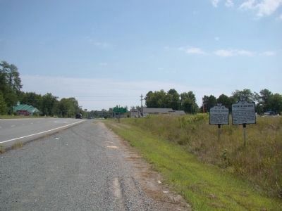
On Kings Highway (Virginia Route 3) just west of James Monroe Highway ( Route 205), on the right when traveling east.
At Leedstown, seven miles south, an association was formed to resist the enforcement of the Stamp Act, February 27, 1766. The Resolutions, drafted by the revolutionary leader, Richard Henry Lee, were one of the first protests against the Stamp Act . . . — — Map (db m22110) HM
On Leedstown Road (County Route 637) just east of Drakes Marsh Drive, on the left when traveling east.
The Pissaseck Indians lived along the Rappahannock River, here at Leedstown and in a few other villages in Westmoreland County. They spoke a language derived from the Virginia Algonquian family and were hunters and farmers. The Pissasecks were . . . — — Map (db m22106) HM
On Kings Highway (Virginia Route 3) at Trigger Lane (County Route 683), on the right when traveling west on Kings Highway.
King George County. Area 180 Square Miles. Formed in 1720 from Richmond, and named for King George I. James Madison, "Father of the American Constitution" and President of the United States, was born in this county. . . . — — Map (db m22268) HM
On Bridge Creek Road west of Popes Creek Road ( Route 204).
Three generations of George Washington’s forebears are buried here. The first burials were made in 1668, when John Washington’s wife Anne and two small children died. During the next thirty years, at least nine more Washingtons—including . . . — — Map (db m23077) HM
On U.S. 50 at Plaza Lane, on the right when traveling west on U.S. 50.
The community of Chantilly, Virginia was named after the Chantilly mansion built by Charles and Cornelia Calvert Stuart on this site about 1817. The name “Chantilly” originated in France with the Château de Chantilly, just north of Paris. Cornelia’s . . . — — Map (db m53620) HM
On Main Street (U.S. 24) south of 2nd Street, on the left when traveling south.
James Monroe was born at Monroe's Creek, Westmoreland County, Virginia on April 28, 1758 to Scots-Welsh parents. He attended the College of William and Mary in Williamsburg, Virginia but left school to enlist in the Third Virginia Regiment, . . . — — Map (db m149767) HM
On Cople Highway (Virginia Route 202) just west of the Hampton Hall Bridge over Hampton Hall Branch, on the right when traveling east.
Northumberland County. Area 205 square miles. Originally an Indian district called Chicacoan. In 1648 it became Northumberland County, named for an English county. The mouth of the Potomac River is here.
Westmoreland . . . — — Map (db m22471) HM
On Gordon Street at Lee Avenue, on the right when traveling west on Gordon Street.
Lee, born in Westmoreland County, Virginia, graduated from West Point in 1829 and joined the engineers. He saw action in the Mexican War. He served as superintendant of West Point 1852-55. He refused the offer to command the US troops at the . . . — — Map (db m82755) HM
Near James Monroe Highway (Virginia Route 205) 0.3 miles north of Old Road, on the left when traveling south.
On the morning of December 26, 1776, a small detachment of American Light Infantry, led by Lieutenant James Monroe, aged 19, breached the Hessian defenses at Trenton. This gallant action, in which Monroe was severely wounded, enabled the . . . — — Map (db m11942) HM
On James Monroe Highway (Virginia Route 205) 0.2 miles north of Old Road, on the right when traveling north.
James Monroe's public service career, the most extensive of any President of the United States, took him far from his Westmoreland County birthplace.
As a student at the College of William and Mary in Williamsburg, Monroe was inspired to . . . — — Map (db m176506) HM
On James Monroe Highway (Virginia Route 205) north of Old Road, on the right when traveling north.
"The Birthplace of a Nation"
Lying between the Rappahannock and Potomac rivers, the Northern Neck provided fertile land that supported production of tobacco, the first great cash crop of the Virginia colony.
Six counties were formed . . . — — Map (db m176507) HM
On South 6th Street (County Route 2005) at Market Street (County Road 2004), on the left when traveling south on South 6th Street.
George Washington | 1732-1799
Known as the "Father of His Country," George Washington was the first president of the United States and the commander of the Continental Army who led the Patriots to victory during the american Revolutionary . . . — — Map (db m306919) HM
Fifth President James Monroe was born April 28, 1758 in Westmoreland County, Virginia.
While attending the College of William and Mary he joined in the struggle for independence from Great Britain. James Monroe served with distinction during . . . — — Map (db m95589) HM
Near South Horner Boulevard (Business U.S. 421) west of Courtland Drive.
"Duty is the sublimest word in our language. Do your duty in all things. You cannot do more. You should never wish to do less."
Born January 19, 1807 at Stratford Hall, Westmoreland County, Virginia.
Son of Henry "Light Horse Harry" . . . — — Map (db m245028) HM
The marker is made up of two panels Since there is little natural stone in tidewater Virginia, tombstones were rare in the seventeenth and eighteenth centuries. Almost all had to be imported, usually from England. Many of the people buried . . . — — Map (db m100102) HM
On James Monroe Highway (Virginia Route 205), on the left when traveling south.
This marks the birthplace of James Monroe, April 28, 1758
Westmoreland County, Virginia
Attended college of William & Mary; Officer, Continental Army, American Revolution; Married Elizabeth Kortright, 1786; US Senator; Minister . . . — — Map (db m11941) HM
In 1664, John Washington, the great-grandfather of George Washington, built a small house on this site. From these modest beginnings, a powerful and prominent Virginia family would arise.
During his thirteen years here, John Washington . . . — — Map (db m34079) HM
On Cople Highway (Virginia Route 202) 0.3 miles west of McGuires Wharf Road (U.S. 662), on the right when traveling west.
The War of 1812. Impressment of Americans into British service and the violation of American ships were among the causes of America’s War of 1812 with the British, which lasted until 1815. Beginning in 1813, Virginians suffered from a British . . . — — Map (db m76407) HM
On South Main Street 0.1 miles north of 5th Avenue, on the right when traveling north.
Sheepskin Trail
History & Detail
The original rail line that defines much of the Sheepskin Trail was built in the 1890's as the Fairmont, Morgantown, and Pittsburgh branch of the B&O Railroad. It was to meet the needs of a booming coal . . . — — Map (db m203191) HM
On West Pennsylvania Avenue at Post Road, on the right when traveling east on West Pennsylvania Avenue.
On November 24, 1896, the United States Post Office Department established Pennsylvania's first two rural mail routes here in Westmoreland County. One operated from the post office here in New Stanton; the other operated out of nearby Ruffsdale . . . — — Map (db m55001) HM
On Richmond Road (U.S. 360) east of Main Street, on the left when traveling east.
In memory of the Honorable William Atkinson Jones, March 21, 1849 – April 17, 1918. United States Congress, First District of Virginia, 1890–1918.
Author, Philippine Independence Bill, 1916.
Dedicated June 20, 1926; the gift from a grateful . . . — — Map (db m23532) HM
On Stratford Hall Road (VA Highway 214), on the left when traveling east.
President of his majesty's council and Commander in Chief of the colony and dominion of Virginia 1749 - 1750
A leader in the movement which resulted in the treaty of Lancaster 1744 by which Virginia was united with Maryland and Pennsylvania in . . . — — Map (db m34442) HM
On East 14th Street near between Union Square East & West, on the right when traveling south. Reported permanently removed.
This impressive bronze equestrian portrait of George Washington (1732-1799), the first President of the United States, is the oldest sculpture in the New York City parks collection. It was modeled by Henry Kirke Brown (1814-1886) and dedicated in . . . — — Map (db m138392) HM
On East 14th Street east of Union Square East, on the right when traveling west. Reported permanently removed.
This impressive bronze equestrian portrait of George Washington (1732-1799), the first president of the United States, is the oldest sculpture in the New York City Parks collection. It was modeled by Henry Kirka Brown (1814-1886) and dedicated in . . . — — Map (db m242871) HM
Near South Water Street west of West College Street.
From Colonial Virginia in 1774 John Floyd, deputy surveyor for Fincastle County, led a party to locate Kentucky lands as compensation for soldiers of the French and Indian War. On July 7 Floyd and William Nash discovered a spring that became known . . . — — Map (db m88904) HM
In June 1778, with the French Alliance a reality and Valley Forge behind it, the
Board of War ordered an expedition against Fort Detroit to counter the British disruption
of the western frontier. Washington ordered the 8th Pennsylvania . . . — — Map (db m204297) HM
On Oak Hill Road (Virginia Route 610) 0.5 miles south of Yankee Point Road ( Route 730), on the right when traveling south.
Major Edward and his wife, Diana Skipwith Dale, were among the earliest settlers in Lancaster County. They lived nearby on surrounding land, as part of a 350-acre plantation purchased from William and Jane Clappam in Dec. 1664. Between 1653 and . . . — — Map (db m309516) HM
On Leedstown Road (Route 637) just west of Drakes Marsh Drive, on the left when traveling east.
Here at the then thriving port of Leedstown on February 27, 1766, ten years before the Declaration of Independence, the Leedstown Resolutions (or Westmoreland Association) were drawn. This association, a protest against the Stamp Act and a pledge of . . . — — Map (db m22085) HM
On Kings Highway (Virginia Route 3) west of Cople Highway ( Route 202), on the left when traveling east.
The A.T. Johnson High School was built in 1937 in the Colonial Revival style as the first public high school constructed for African Americans in Westmoreland County. The new school was named for Armstead Tasker Johnson (1857–1944), a black . . . — — Map (db m22352) HM
Near Brooke Road (County Road 608) at Canterbury Drive, on the right when traveling north.
1260-1300 A.D.
Per testimony of the Piscataway Tribe in 1660, they were allied with the Patawomeck and Susquehannock Tribes under the leader, Uttapoingassinem, who had come from Eastern Shore. The Patawomecks were later part of the Powhatan . . . — — Map (db m193702) HM
On West Woodruff Avenue at Mount Vernon Avenue, on the right when traveling west on West Woodruff Avenue.
In 1915, real estate developers William B. Welles and Badger C. Bowen formed the Ottawa Park Realty Company and in 1917 platted 323 residential lots near Toledo, Ohio. Named "Westmoreland" for the similarities with the rolling landscapes of . . . — — Map (db m289021) HM
Born: February 22, 1732, Westmoreland County, Virginia
Married: Martha Danbridge Curtis, (1732-1802), January 6, 1759
Children: John and Martha Curtis (adopted)
Died: December 14, 1799, at Mount Vernon, Virginia
Education: No formal . . . — — Map (db m89399) HM
Born in Westmoreland County 28” April 1758.
Died in the City of New York 4“ July 1831.
By order of the General Assembly, his remains were removed to this cemetery 5” July 1858 as an evidence of the affection of Virginia for her good and honored . . . — — Map (db m8017) HM
Near James Monroe Highway (Virginia Route 205) 0.3 miles north of Old Road, on the right when traveling north.
Monroe Creek is one of many tributaries of the Potomac River contributing to the form and character of Virginia's Northern Neck region.
Context
The creek owes its name to descendants of Andrew Monroe, the first Monroe to settle here in . . . — — Map (db m176552) HM
On Sandy Point Road (County Route 604) at Cople Highway ( Route 202), on the left when traveling east on Sandy Point Road.
Bennett and James McCoy, free men (probably
brothers) from Westmoreland County, were
among the many African Americans who
served in the Virginia militia and the United
States Army or Navy during the Revolutionary
War. Bennett McCoy served for . . . — — Map (db m22429) HM
On Kings Highway (Virginia Route 3) at Templemans Road, on the left when traveling east on Kings Highway.
Nomini Baptist Church was established on 29 April 1786 with 17 members. By 1809 it was reputedly the largest Baptist church in Virginia with 875 members. The original meetinghouse, built nearby in 1790 on land donated by a charter member, Captain . . . — — Map (db m22359) HM
On Braun Avenue west of Carson Avenue, on the left when traveling west.
The Haymaker Well
The famous Haymaker Well sits along the banks of Turtle Creek near this spot. The story of the Haymaker Well starts with two local brothers seeking their fortunes. Michael and Obediah Haymaker grew up on their family . . . — — Map (db m270089) HM
Near Hotwater Trail 1 mile west of Centerville Road (Route 614), on the left when traveling west.
This small house, with only 288 square feet of living space, has a brick chimney, glass windows, and stairs leading to an overhead loft. A house of this type would have been occupied by Anthony Brown, a farmer and former Lee slave freed in 1805. . . . — — Map (db m226543) HM
Near Fort Lane close to Holladay Street, on the right when traveling north.
Reverend Eskridge was one of several clergy and medical personnel who died in the service of the citizens of Portsmouth during the yellow fever epidemic. This dread disease, the cause not understood at the time, decimated he populations of . . . — — Map (db m297580) HM
Near Childrens Center Road Southwest west of Harry Byrd Highway ( Route 7), on the right when traveling west.
Henry and Anne Harrison purchased the land that is now Rust Sanctuary in 1909 and built the Manor House. William and Mary Rust bought the property in 1929, renovating portions of the house, adding the front and rear porches and a new grand . . . — — Map (db m130063) HM
On Old Virginia Street (County Route 602) west of Upton Lane, on the right when traveling west.
In 1763 Ralph Wormeley III of Rosegill sold this house to James Mills, a Scottish merchant. In 1791 Arthur Lee bought it and 1,000 adjacent acres to be his home in retirement. Lee named this estate Landsdowne in honor of his friend, William . . . — — Map (db m316385) HM
Near South Lee Highway (U.S. 11) at Rockbridge Road ( Route 130), on the left when traveling south.
Patrick Henry was born into slavery in 1787 in Westmoreland County, Virginia. He worked hard to purchase his own freedom, which he accomplished in 1811. He moved to nearby Lexington to be with family, and in 1816 purchased his wife Louisa's . . . — — Map (db m254014) HM
Near Constitution Avenue Northwest (U.S. 50) east of 19th Street Northwest, on the right when traveling east.
In Congress, July 4, 1776.Unanimous Declaration of the thirteen united States of America.And for the support of this Declaration,
with a firm reliance on the protection of Divine Providence,
we . . . — — Map (db m137039) HM
On Leechburg Road east of Nevada Street, on the right when traveling east.
1941 • 1945
In loving appreciation and grateful memory of the young men and women of Lower Burrell Township, Westmoreland County, State of Pennsylvania, who have served in the Armed Forces of our country during World War II, . . . — — Map (db m283948) WM
On Leesburg Pike (Virginia Route 7) at Claiborne Parkway and Landsdowne Boulevard (Local Route 641), on the right when traveling east on Leesburg Pike.
Belmont was patented early in the eighteenth century by Thomas Lee, of Stratford. About 1800, Ludwell Lee, an officer in the Revolutionary Army, built the house and he lived here until his death in 1836. Here he entertained Lafayette in 1825. In . . . — — Map (db m980) HM
Thin black lines indicate changes in relevance. Between each pair of lines entries are ordered geographically but all have the same relevance.
* Inflectional forms of words are their plurals, singulars, and possessives as well as gramatical tenses and similar variations.