By William J. Toman, September 6, 2010
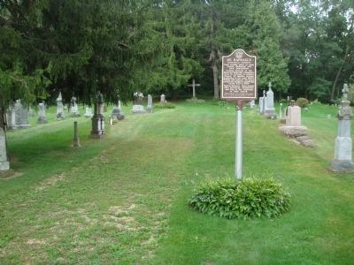
St. Raphael's Frenchtown Cemetery Marker
| On French Town Road, 1 mile east of Wisconsin Highway 69, on the right when traveling east. |
| On Mills Street (State Highway 78) at Spring Street, on the right when traveling south on Mills Street. |
| On County Route ID at Division Street (County Route F), on the left when traveling east on County Route ID. |
| On South Erbe Road, 2 miles south of U.S. 18-151, on the left when traveling south. |
| On East Church Road, 0.4 miles west of Hillside Road, on the right when traveling west. |
| On West Cottage Grove Road (County Highway Bb) 0.5 miles west of Main Street (County Highway N), on the left when traveling west. |
| On County Road P, 0.3 miles south of U.S. 14, on the left when traveling south. |
| On County Route Z, 0.5 miles west of Wisconsin Highway 78, on the left when traveling north. |
| On East Main Street (State Highway 113) 0.1 miles west of 2nd Street, on the right when traveling west. |
| On Dunroven Road at County Road DM, on the right when traveling south on Dunroven Road. |
| On South Main Street (County Highway CV) near Holum Street, on the right when traveling south. |
| On Wendt Road, 0.5 miles County Route M, on the left when traveling north. |
| On North Park Street at West Washington Avenue, on the right when traveling north on North Park Street. |
| On John Nolen Drive, 0.2 miles north of Olin Avenue, on the right when traveling north. |
| Near Highland Avenue at University Bay Drive, on the left when traveling south. |
| On West Wilson Street at South Hamilton Street, on the right when traveling west on West Wilson Street. |
| On Sherman Avenue at North Thornton Avenue, on the left when traveling north on Sherman Avenue. |
| On Edgewood Avenue at Jefferson Street, on the right when traveling east on Edgewood Avenue. |
| On Atwood Avenue, on the right when traveling west. |
| On South Pardee Street at Farnham Street, on the right when traveling south on South Pardee Street. |
| On State Highway 19, 0.5 miles east of County Route K, on the right when traveling east. |
| Near State Highway 19 at Matz Road, on the left when traveling west. |
| On Brodhead Street north of West Exchange Street, on the left when traveling north. |
| On State Highway 19 at County Highway F, on the right when traveling west on State Highway 19. |
| On Fish Camp Road, 0.2 miles east of County Highway AB, on the right when traveling east. |
| Near U.S. 51, 0.2 miles south of Burma Road, on the right when traveling south. |
| On Main Street (County Road MN) at Bashford Street, on the left when traveling south on Main Street. |
| Near Century Avenue (County Road M) 0.1 miles east of County Road Q, on the right when traveling east. |
| On State Highway 78, 0.1 miles north of County Road ID, on the right when traveling north. |
| On Town Hall Road at U.S. 18-151, on the right when traveling north on Town Hall Road. |
| On Sutter Drive at Wisconsin Highway 92, on the right when traveling south on Sutter Drive. |
| On County Road G at County Road J, on the right when traveling east on County Road G. |
| On County Highway G at Oak Grove Road, on the left when traveling south on County Highway G. |
| On County Road PB at Paoli Road, on the left when traveling south on County Road PB. |
| Near State Highway 188, on the right when traveling north. |
| On Water Street (County Highway B) at Adams Street, on the right when traveling south on Water Street. |
| On County Road Y, 0.1 miles west of St. Norbert Street, on the right when traveling west. |
| On County Highway B at Spring Road, on the right when traveling east on County Highway B. |
| On Williams Drive, 0.3 miles north of River Drive, on the left when traveling north. |
| On South Page Street at West Jefferson Street, on the right when traveling south on South Page Street. |
| On Linnerud Drive at Clarmar Drive, on the left when traveling west on Linnerud Drive. |
| On Portage Road, 0.2 miles north of Windsor Road (Wisconsin Highway 19), on the right when traveling north. |
| On Campus Lane, 0.1 miles west of Edgerton Road (Wisconsin Highway 106), on the left when traveling west. |
| Near County Road PB, 0.1 miles East Verona Avenue, on the right when traveling south. |
| On Easy Street, 0.3 miles east of County Route I, on the right when traveling east. |
| On State Highway 19, 0.2 miles east of Schumacher Road, on the left when traveling east. |