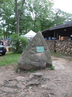
By Michael Herrick, September 17, 2011
First Fighting at Fort Clinton Marker
| Near Seven Lakes Drive at South Entrance Road, on the left when traveling west. |
| On Collyer Avenue at Lake Drive, on the left when traveling west on Collyer Avenue. |
| On Gilchrest Road north of Von Beaste Lane, on the right when traveling south. |
| On Lake Road (County Route 80) at Grant Avenue S, on the left when traveling west on Lake Road. |
| On Lake Road (County Route 80) at Burnside Avenue, on the right when traveling west on Lake Road. |
| On Dr Davies Road, on the right when traveling east. |
| On Kings Highway at Lake Road (County Route 80), on the right when traveling north on Kings Highway. |
| On Old Haverstraw Rd., 0.1 miles south of New York State Route 304. |
| On Gilchrest Road north of Von Beaste Lane, on the left when traveling south. |
| On Endicott Street at Pine Street, on the right when traveling west on Endicott Street. |
| On Zukor Road, 0.2 miles north of the Haverstraw Road and Main Street intersection, on the right when traveling north. Reported missing. |
| On S. Little Tor Road at Collyer Avenue, on the left when traveling north on S. Little Tor Road. |
| On South Main Street (County Route 29) at Congers Road, on the right when traveling south on South Main Street. |
| On U.S. 9W, on the right when traveling north. |
| On New Hempstead Road at Old Schoolhouse Road, on the right when traveling west on New Hempstead Road. |
| On New York State Route 59 at Mountainview Avenue, on the right when traveling west on State Route 59. |
| On S Broadway at Burd Street, on the right when traveling south on S Broadway. |
| On North Broadway at 2nd Avenue, on the left when traveling north on North Broadway. |
| On Burd Street, on the right when traveling east. |
| On N Highland Avenue (U.S. 9W) at Sickles Avenue, on the right when traveling south on N Highland Avenue. |
| On N Broadway, on the right when traveling north. |
| On Mountainview Avenue at New York State Route 59, on the right when traveling north on Mountainview Avenue. |
| On Orangeburg Road (County Route 20) at Hunt Road (County Route 16), on the right when traveling east on Orangeburg Road. |
| On U.S. 9W, on the right when traveling north. |
| On S Broadway at Division Avenue, on the right when traveling north on S Broadway. |
| On S Broadway at Depew Avenue, on the right when traveling south on S Broadway. |
| On Washington Avenue at Lafayette Avenue, on the left when traveling north on Washington Avenue. |
| On Lafayette Avenue at Washington Avenue, on the right when traveling east on Lafayette Avenue. |
| On Washington Avenue at Lafayette Avenue, on the left when traveling north on Washington Avenue. |
| On Old Tappan Road (County Route 8) at Hickory Hill Road, on the right when traveling west on Old Tappan Road. |
| On Kings Highway at Washington Street, on the right when traveling north on Kings Highway. |
| On Kings Highway at Washington Street, on the left when traveling north on Kings Highway. |
| Near Livingston Street at Oak Tree Road, on the right when traveling south. |
| On S Liberty Drive (U.S. 9W), on the left when traveling north. |
| On Strawtown Road at Samantha Way, on the left when traveling north on Strawtown Road. |
| On West Nyack Road at Strawtown Road, on the left when traveling west on West Nyack Road. |
| On Strawtown Road (County Route 23) at West Nyack Road (County Route 59A), on the right when traveling south on Strawtown Road. |
| On Strawtown Road at Germonds Road (County Route 27), on the left when traveling north on Strawtown Road. |
| Near Palisades Center Drive, on the left when traveling east. |
| On Germonds Road (County Route 27), on the right when traveling west. |
| On Strawtown Road at Germonds Road, on the left when traveling north on Strawtown Road. |
| On West Nyack Road (Alternate New York State Route 59) near West Nyack Way, in the median. |
| On Strawtown Road just north of New York State Thruway (Interstate 87), on the right when traveling north. |
| On Sickletown Road at Vanhouten Fields, on the right when traveling south on Sickletown Road. |
| On Strawtown Road near Old Mill Road, on the right when traveling north. |
