You are standing on ancestral lands of the Muh-He-Con-Neok, "the people of the waters that are never still." Called Mohicans by the English, these Algonquin-speaking peoples are now officially known as the Stockbridge-Munsee Community. By the . . . — — Map (db m244718) HM
Thé Mohican Blessing Fountain was erected by the New Lebanon Garden Club
in 1941 to give thanks to the Mohican Indians for their gift of the healing waters
of the thermal mineral springs to all people forever. The Mohicans were the
original . . . — — Map (db m135096) HM
The Albany-Hudson Electric Trail crosses the ancestral lands of the Muhheconneok, "People of the Waters that are Never Still," Native Americans whose name refers to
the tidal Hudson River. Called Mahicans by early Dutch settlers and Mohicans by . . . — — Map (db m230282) HM
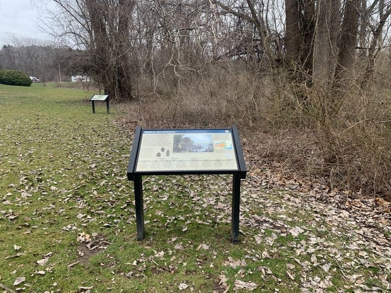
The Delaware Valley has been inhabited for thousands of years. At Chestnut Point, and in fields along the West Branch of the Delaware River, more recent local residents have found arrow points, pottery shards, scrapers and other artifacts left . . . — — Map (db m137644) HM
Three Hudson Valley Dutch
families arrived in 1763 to
settle the Delaware Valley
where the Lenni Lenape
first hunted and fished. — — Map (db m132108) HM
Th East Branch of the Delaware of and its many tributaries- - the Binnekill, Bush Kill, Plattekill, Mill Brook, Dry Brook, Bull Run, Batavia Kill, Red Kill and others
are central to the history of the Village of Margaretville and the wider Town . . . — — Map (db m132228) HM
Centuries ago, the land including this park was the site of a stockaded Indian village and burial knoll. Other Indian villages followed at intervals. The area is rich in Revolutionary history. In 1901, a factory was built on this and adjoining . . . — — Map (db m220624) HM
Named after Indian maiden famous in Indian legend on trail from Schoharie to Delaware and Susquehanna Rivers. Headwaters of Del. — — Map (db m205910) HM
A cavern, with a waterfall
refuge of Sassacus, Pequot
chief, fleeing from rout of
his tribe at New Loudon, Conn.
afterward killed by Mohawks. — — Map (db m137968) HM
Chief Sachem of the Wappinger Indians Born in Dutchess County was killed in engagement at Cortland’s Ridge N.Y. August 31, 1778 defending the American Cause. — — Map (db m46212) HM
The most heavily traveled road in Colonial America passed through here, linking areas from the Great Lakes to Augusta, Ga. Laid on ancient animal and Native American Trading/Warrior Paths. Indian treaties among the Governors of NY, PA, & VA and the . . . — — Map (db m44473) HM
Site of
Old Pine Trees
under pine trees chiefs of
a Mohican Indian tribe were
buried. Pine Plains named
for these trees on plains. — — Map (db m144628) HM
Although the river dates back some 60 million years, the river we see today was shaped during the last Ice Age. About 16,000 years ago, a massive ice field gouged the riverbed to a depth below sea level, thus allowing water from the Atlantic Ocean . . . — — Map (db m142780) HM
In 1803, Charles Johnson purchased 50 acres of open land in the forest, paying $2.25 per acre. He built the town's first log cabin in 1804 and raised the first frame barn in 1807. Johnson owned another 30 acres containing visible remains of an early . . . — — Map (db m80592) HM
Town of Brant Memorial Park Originally named Sampton in 1820, Morse's Corners in 1835, and organized as BRANDT on Mar. 25, 1839 after the Mohawk Chief Col. Joseph Brandt. His Indian name, Pha-wan-da-nee-gah, meant "Wood partly burned" or . . . — — Map (db m104240) HM
Unity Island Discovered in 1679 by the men of LaSalle’s expedition, the Senecas knew this island as ”De-dyo-no-guh-doh,” or Divided Island because it was divided by a marshy creek called Smuggler’s Run. Presented in 1798 by the . . . — — Map (db m57108) HM
Final resting place of The Senecas of the Genesee Valley that the Mt. Morris Dam inundated. Buffalo Creek Council Fire. June 22, 1952 — — Map (db m137877) HM
.
First white women to reside within the limits of Buffalo. Taken as captives from Pennsylvania in 1780, they lived among the Seneca Indians until their release in 1782.
Original marker dedicated July 9, 1937.
Replaced by the New York . . . — — Map (db m137874) HM
Sa-Co-ye-Wat-Ha (He keeps them awake)
Died at Buffalo Creek January 20, 1830 aged 78 years.
"When I am gone and my warnings are no longer heeded, the graft and avarice of the white man will prevail. My heart fails me when I think of my people, so . . . — — Map (db m65478) HM
In this vicinity from 1780 to 1842 dwelt the larger portion of the Seneca Nation of the Iroquois League. In this enclosure were buried Red Jacket, Mary Jemison the white woman of the Genesee and many of the noted chiefs and leaders of the nation . . . — — Map (db m232547) HM
Historic Lake Erie Named for the Indian Nation of the Eries who dwelt on these shores before 1634 when they were conquered by the Iroquoian Confederacy. 1641 – Earliest mention of the lake in writing of French missionaries. 1669 – First white . . . — — Map (db m241046) HM
This monument is dedicated to the Onodowaga or People of the Many Hills (Seneca). Shown are: The Hiawatha Wampum Agreement which brouht together the Five Nations in the pursuit of peace. A Seneca traditional gastowa or headress signified by the one . . . — — Map (db m92936) HM
The defeated Indian League of the Iroquois received a large reservation across Erie County, at the end of the American Revolution. William Street forms part of the north boundary of this Buffalo Creek Indian Reservation. The final sale treaty, . . . — — Map (db m74063) HM
Welcome to Tonawanda Gateway Harbor - where the Niagara River meets the Erie Canal. Prior to the 1800's this area was a wilderness frequently traversed by Seneca Indians from the Iroquois Confederacy. The first known white settlers were Henry . . . — — Map (db m87802) HM
The Onondaga Village of Chief Big Sky once stood at the top of this slope. According to the report of Col. Thomas Proctor, it consisted of twenty-eight cabins in good repair, in 1791. — — Map (db m49033) HM
Seneca Chief Red Jacket (ca. 1758-1830) lived in a cabin on this site when this area was part of the Buffalo Creek Reservation. Known for his great oratory and keen mind, Red Jacket was an eloquent advocate for the preservation of the Seneca way of . . . — — Map (db m48885) HM
The town of Newcomb, in the geographical center of the Adirondack Park, was originally a part of the hunting grounds of the Iroquois and Algonquins. The first permanent European settlers arrived in 1816. Prominent among the earliest citizens were . . . — — Map (db m147513) HM
British soldiers who chose not to return to England following the Seven Years War mustered out of the army to settle on land they had seen during the campaigns against the French. The sandy loam soil around Streetroad has sustained a diversity of . . . — — Map (db m19722) HM
From this point south, this street follows the route of the Indian carry between the lakes and of Montcalm’s military road traversed by Washington and Franklin during the Revolution. Erected by Ticonderoga Chapter Daughters of the American . . . — — Map (db m9090) HM
This tablet marks the landing for the grand carry on the Great War Trail between the Indian tribes of the north and south country. It also marks the beginning of that carry between the lakes to avoid the falls and rapids, which later became the . . . — — Map (db m16309) HM
The tides of history have swept repeatedly through this valley, following the river
that drains Lake George into Lake Champlain, 220 feet below. When forests covered the land, people traveled by water, so this short link between the 33 miles of . . . — — Map (db m158367) HM
TiconderogaThe Lake Champlain Valley has long been at the crossroads of nations and peoples. The name Ticonderoga is a corruption of an Iroquoian word meaning a, “place between two waters,” an acknowledgement of its location which . . . — — Map (db m126401) HM
Through this pass to Trout Brook ran an Indian Trail, used by Robert Rogers after Battle on Snowshoes, 1758, on retreat to Fort Wm. Henry — — Map (db m9533) HM
For hastening to set a crown of freedom on this new land we lie possessed of praise that grows not old. And here were men coequal with their fate who did great things unconscious they were great. Back of Monument: Champlain – Iroquois . . . — — Map (db m15593) HM
Cultural Heritage- Ancient cultures flourished on abundant natural resources along the Seaway Trail. First Inhabitants Native people have lived here for thousands of years, using the natural resources found on land and in water. . . . — — Map (db m180207) HM
Just as the river has endured great change. we continue to meet challenges, and hold great hope for the future.
Akwesasne - "Land Where the Partridge Drums" is named for the sounds of the Long Sault Rapids on the St. Lawrence River. The river . . . — — Map (db m177551) HM
AKWESASNE CULTURAL
CENTER-MUSEUM
Giving thanks is the central meaning expressed
in Kanien'kehá:ka (Mohawk) culture.
321 State Route 37,
Akwesasne, NY 13655
518-358-2461
As is customary among our people, we begin each meeting or . . . — — Map (db m177555) HM
The Raquette River is the second longest river in New York State, running from Blue Mountain Lake through a scenic and historic travel corridor into the St. Lawrence River at Akwesasne
As the 174-mile-long river flows north it drains about 1,000 . . . — — Map (db m177547) HM
The Kanienʼkehá꞉ka people have been here for thousands of years prior to the formation of either the US or Canada, and are an integral part of the history of both of those countries. Other present day Mohawk communities are : Wáhta, . . . — — Map (db m177554) HM
Grave of Sir William Johnson
Baronet
1715 - MASON - 1774
His Indian name
Warraghiyagey
"he who does much business"
Founder of
Johnstown
St. John's Episcopal Church
St. Patrick's Lodge 4 F.&A.M.
First Free School
Supt. of Indian . . . — — Map (db m54281) HM
A man of strong character. A colossal pioneer. One of the greatest men of his time. Sole superintendent and faithful friend of the Six Nations and their Allies. Their Warragiyaey. Founder of Johnstown. He established here the first free school in . . . — — Map (db m57754) HM
Sir William Johnson (1715-1774) came from Ireland in 1738 to administer his uncle's lands in the Mohawk Valley. Johnson became a planter, trader, military officer, land speculator, statesman, Indian agent and churchman. He built a store to trade . . . — — Map (db m58944) HM
Jacob Dunham and Samuel, his son, killed here April 1779. Others of the family escaped by hiding in the woods. Site of their home. — — Map (db m33007) HM
The Seneca Indians, “Keepers of the Western Door” occupied this area since the formation of the Iroquois confederacy about 1550. Most numerous and most warlike of the Six Nations, they for a time dominated the tribes . . . — — Map (db m140045) HM
Son of William and Elizabeth Parker, born in a log cabin overlooking the water-falls, at Indian Falls, N.Y., then part of the Tonawanda Indian Reservation. Volunteered into the army, and became General Grant's Military Secretary. He was . . . — — Map (db m76082) HM
On Nov. 5 a treaty between the U.S. and the Tonawanda Seneca at the Meeting House restored about 8000 acres to the Tonawanda Senecas. — — Map (db m77771) HM
Est. ca. 1879 with opening of
post office. "Wawantepekook"
meaning "Round Head Place"
was name given nearby hill
by local indigenous peoples. — — Map (db m181009) HM
Historic New York
The Adirondacks
The Adirondack Mountains, consisting of rocky peaks, sheer cliffs and narrow valleys, also have wooded slopes and sparkling lakes. Forty three mountains have elevations 4000 feet or higher. Mount . . . — — Map (db m44731) HM
Historic New York
The Adirondacks
The Adirondack Mountains, consisting of rocky peaks, sheer cliffs and narrow valleys, also have wooded slopes and sparkling lakes. Forty three mountains have elevations 4000 feet or higher. Mount . . . — — Map (db m44686) HM
On route of scout Adam F. Helmer's famous run to warn settlers of German Flatts of approach of Brant's Indians September 17, 1778 — — Map (db m141358) HM
40 mile route taken by Gen. Herkimer Aug. 3-6, 1777 for the relief of Fort Stanwix. The Battle of Oriskany Aug. 6, between Herkimer's men and St. Leger with his Indians was the turning point of the Revolution.
At Fort Dayton, near this . . . — — Map (db m54261) HM
Ft. Hendrick
1754-1760
British post guarding
Mohawk Castle. Named for
King Hendrick killed
at Lake George, Sept. 1755
N.Y. State
Historical
Marker — — Map (db m57269) HM
Mohawk Upper Castle
Archeological Site
has been designated a
National Historic Landmark
This site possesses national significance
in commemorating the history of the
United States of . . . — — Map (db m57270) HM
In 1760, Johan Jost Herkimer deeded 500 acres, including valuable river frontage, to his eldest son Nicholas. Nicholas kept the south portage road open to the carrying place and probably provided wagons, draft animals, and labor to unload the . . . — — Map (db m65981) HM
During the American Revolution, almost half of the military actions in New York State occurred along the strategic corridor of the Mohawk Valley. In 1777 British, Native American and Loyalist battalions attacked from the west and north. Defeats at . . . — — Map (db m66016) HM
Lieutenant Adam F. Helmer
Famous Mohawk Valley Scout
On Aug. 6, 1777 carried military orders
for General Nicholas Herkimer
On Sept. 16, 1778 warned the settlers
at German Flats of the approach
of Joseph Brant and . . . — — Map (db m57361) HM
40 mile route taken by Gen. Herkimer Aug. 3-6, 1777 for the relief of Fort Stanwix. The Battle of Oriskany Aug. 6, between Herkimer's men and St. Leger with his Indians was the turning point of the Revolution.
General Herkimer
camped near . . . — — Map (db m54257) HM
Horse Island plays a role in the story of Sackets Harbor, both past an present. From its part in the War of 1812, to its lighthouse and water fowl habitat, the island is a key component of the community.
During the War of 1812, the Albany . . . — — Map (db m75794) HM
Trinity Park, on Gold Street between Sands and Nassau in downtown Brooklyn, is named in honor of the Missionary Servants of the Most Blessed Trinity also known as the Trinitarian Sisters. Under the auspices of the Catholic Settlement Association . . . — — Map (db m241391) HM
The potato, adapted to the wide variety of climates in the Andes Mountains, was among the first plants cultivated by people in Peru, more than 10,000 years ago. Maize (corn) is believed to have been grown originally in the fertile valleys of . . . — — Map (db m204040) HM
Brooklyn Botanic Garden occupies part of the unceded territory of the Munsee Lenape people, who were the stewards of this land before genocide and forced migration pushed the Lenape west and north to rebuild their nations in what are now . . . — — Map (db m204042) HM
Brooklyn Botanic Garden occupies part of the unceded territory of the Munsee Lenape people, who were the stewards of this land before genocide and forced migration pushed the Lenape west and north to rebuild their nations in what are now . . . — — Map (db m204053) HM
Brooklyn Botanic Garden occupies part of the unceded territory of the Munsee Lenape people, who were the stewards of this land before genocide and forced migration pushed the Lenape west and north to rebuild their nations in what are now . . . — — Map (db m204120) HM
Well known today as decorations in Day of the Dead celebrations in Mexico, marigold petals have been used for hundreds of years as a yellow dye plant by many Native American civilizations. — — Map (db m204018) HM
More than 7,000 years ago, people living in the Andes Mountains began cultivating the potato, eventually growing thousands of different kinds. Along the way they also developed chuño, potatoes preserved by freeze-drying, for use during food . . . — — Map (db m204038) HM
One of two species of Douglas fir, an important North American timber tree. The Okanagan Colville tribe in the Pacific Northwest used this tree for tent poles and spear shafts. Look for the cones easily identified by "rabbit ear" scales. — — Map (db m204055) HM
Enjoy your visit to Brooklyn Botanic Garden, 52 acres of specialty gardens featuring more than 12,000 species and cultivars of plants from around the world.
Be sure to stop by the Steinberg Visitor Center to learn about membership, programs, . . . — — Map (db m203989) HM
Fulton Street follows the original trail used by the Canarsee tribe centuries ago, predating the grid pattern in which Brooklyn streets would eventually be laid out. — — Map (db m242762) HM
Nicholas Galanin created this work with the same steel tubing used to construct the U.S.-Mexico border wall, also echoing its 30-foot height. The metal was cut and reassembled to spell out LAND in a format reminiscent of Robert Indiana's . . . — — Map (db m228761) HM
Nicholas Galanin created this work with the same steel tubing used to construct the U.S.-Mexico border wall, also echoing its 30-foot height. The metal was cut and reassembled to spell out LAND in a format reminiscent of Robert Indiana's . . . — — Map (db m228762) HM
"The King's Highway" formerly the road to Flatlands Neck passed this site. Over it the Indian braves and Captain John Underhill with his colonial soldiers passed. Lord Cornwallis, on August 25, 1776, at the head of the British troops silently . . . — — Map (db m233872) HM
Eleven plaques in two series illustration the history of the area.
Series 1:
Plaque 1: 1609 - Native American settlements in Brooklyn
Plaque 2: 1639 – Early Dutch settlement of New Netherlands
Plaque 3: 1767 – Brooklyn Ferry landing . . . — — Map (db m161635) HM
“The Greeter”
On October 29, 1804, Meriwether Lewis and William Clark met in council with tribal leaders on the Missouri River in what was now North Dakota. Few were more important to their mission of discovery than the Hidatsa chief Black . . . — — Map (db m126725) HM
Hilltop Playground, located at Hopkins and Saratoga Avenues and Pacific Street in Brooklyn, opened as a schoolyard operated by what was then known as the Board of Education. In 1990, it became a jointly operated playground, and a backstop was . . . — — Map (db m242947) HM
Originally a Lenape homeland, by the late 1800's the East River waterfront was lined with industries manufacturing oil, metal, kerosene, rope, boats, sugar, porcelain, glass, and beer, and shipping products to and from destinations worldwide. . . . — — Map (db m241484) HM
732 entries matched your criteria. Entries 101 through 200 are listed above. ⊲ Previous 100 — Next 100 ⊳