On S Queen Street at E Fleet Street, on the right when traveling north on S Queen Street.
This old stone marked the grave of John Abbott, son of town’s founder. Since 1763, in a fence row at upper end of town at a site 128 ft east of Abbott Street 35 feet south of Water Street. Moved to this place in 1976 to make way for a parking lot — — Map (db m118927) HM
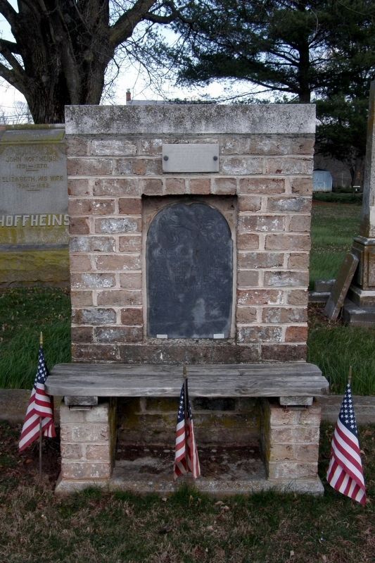
To the Glory of God, St. John Neumann, then Bishop of Philadelphia, laid the original cornerstone of St. Joseph's Church on July 31, 1859. The church was completed the following year through the work of Rev. Basil A. Shorb, founding pastor. This . . . — — Map (db m130320) HM
On Jacks Mountain Road at Old Waynesboro Road, on the right when traveling north on Jacks Mountain Road.
At this site, on December 8, 1842, the Lutheran Church of Fountaindale was consecrated by pastor Solomon Sentman. The church was built on land owned by Joseph and Isaac Baugher, and previously owned by Daniel Sprenkle. In 1842, there were 55 . . . — — Map (db m134154) HM
On Steinwehr Avenue (Business U.S. 15) 0 miles north of Culp Street, on the right when traveling north.
The rare image reproduced at right, courtesy of William A. Frassanito, Gettysburg Then & Now (Thomas Publications), is one of only 9 photos known to have been taken of the dedication ceremonies in Gettysburg on Nov. 19, 1863, during which . . . — — Map (db m19064) HM
On Long Lane just north of Lincoln Lane, on the right when traveling north.
In the days after the Confederate Army retreated from the North in July 1863, civilians labored to bury the thousands of soldiers lying dead in towns and hillsides across south-central Pennsylvania. It was an enormous task, and most of the bodies . . . — — Map (db m31235) HM
On Stienwehr Avenue (State Highway 134) at Washington Street, on the right when traveling north on Stienwehr Avenue. Reported missing.
The Right Worshipful Grand Lodge of Free and Accepted Masons of Pennsylvania laid and dedicated the cornerstone of the first battlefield monument on July 4, 1865. That Soldier's National Monument is located on the grounds of the Soldiers' . . . — — Map (db m16907) HM
Near Steinwehr Avenue (Business U.S. 15) at South Washington Street, on the right when traveling north.
Mortally wounded during Pickett's Charge, Confederate General Lewis Armistead, a Freemason, received aid and comfort from Union Captain Henry Bingham, a fellow Freemason. Their Freemasonry bond of brotherhood transcended battle lines and symbolized . . . — — Map (db m196111) HM
On Lincoln Lane, on the right when traveling west.
By the Sons of Goodwill, a society of black men for the burial of the colored citizens of Gettysburg.
-
Interred in this burial ground are 30 "United States Colored Troops" (USCT), Veterans of the Civil War, who were denied burial in the . . . — — Map (db m69156) HM WM
On North Washington Street at Chambersburg Street (U.S. 30), on the right when traveling south on North Washington Street.
A gift to Gettysburg College in 1990 from George W. Olinger and Mac E. Olinger, life long residents of Gettysburg, zestful supporters of local history, common sense preservationists and quiet, humanitarians. Their gift of these historic buildings . . . — — Map (db m29799) HM
Established in 1867 by the Sons of Good Will for the proper burial of Gettysburg’s African American citizens and Civil War veterans. Some thirty members of the US Colored Troops are buried here, having been denied burial in the National Cemetery . . . — — Map (db m31189) HM
On Long Lane just north of Lincoln Lane, on the right when traveling north.
Four months after the Battle of Gettysburg, President Abraham Lincoln spoke at the dedication of the Soldiers' National Cemetery. His Gettysburg Address, perhaps the single most famous speech in American history, described a "new birth of freedom" . . . — — Map (db m31242) HM
Near Baltimore Street (Pennsylvania Route 97), on the right when traveling south.
Jennie Wade Aged 20 yrs. 2 mos killed July 3, 1863 while making bread for the Union soldiers. < Right of Monument: > What soever God willeth must be though a Nation mourn. < Left of Monument: > With a courage born of loyalty, she hath done . . . — — Map (db m37949) HM
On Baltimore Street (Business U.S. 15) just south of West Middle Street (Pennsylvania Route 116), on the right when traveling south.
1. The 30th day of May, 1868, is designated for the purpose of strewing with flowers or otherwise decorating the graves of comrades who died in defense of their country during the late rebellion, and those bodies now lie in this . . . — — Map (db m241702) HM WM
On Long Lane at Lincoln Lane, on the right when traveling south on Long Lane.
About the Art
Monumental Stories is a dedication to the History, Heritage, and Honor of the African American community of Gettysburg, PA, and the United States Colored Troops (USCT).
The art is designed to communicate an everlasting . . . — — Map (db m67395) HM WM
On Legion Alley, 0.1 miles east of Baltimore Street (Business U.S. 15), on the left when traveling east.
Buried in this historic cemetery
are some of the pioneer organizers
of Methodism in Adams County.
To these and others known only to God,
the Congregation of the Gettysburg
United Methodist Church
dedicate this monument
October 1990 . . . — — Map (db m96250) HM
On Baltimore Street (Business U.S. 15) at East High Street, on the right when traveling north on Baltimore Street.
(top):
Abraham Lincoln attended services at this church on November 19, 1863, the day he dedicated the National Cemetery and delivered his Gettysburg Address. The pew he occupied has been retained in the sanctuary.
(lower): . . . — — Map (db m19248) HM
On Baltimore Pike (State Highway 97), on the right when traveling south.
"Here where they fell, Oft shall the widow's tear be shed, Oft shall fond parents mourn their dead; The orphan here shall kneel and weep…" Hymn by Benjamin B. French Sung at cemetery dedication November 19, 1863
On Long Lane at Kuhn Alley, on the right when traveling north on Long Lane.
The first half-acre of this cemetery was purchased in 1867 by a society of Black men calling themselves the “Sons of Goodwill,” and for many years this place was called the “Goodwill Cemetery.” The minutes of the Sons of . . . — — Map (db m18029) HM
On East Howard Avenue, 0.4 miles east of Biglerville Road (Pennsylvania Route 34), on the left when traveling east.
Here on Barlow's Knoll, Lieutenant Bayard Wilkeson, 19, directed Battery G, 4th US Artillery, from horseback. While dueling with Confederate batteries, an enemy shell mangled his right leg. He bound his leg, and amputated it with a pocket knife, as . . . — — Map (db m196915) HM
Near Blacksmith Shop Road, on the right when traveling south.
The field in front of you contained the hospital graveyard where some 185 Union and 20 Confederate soldiers were buried. Some of Spangler’s own wood supplies were used to make coffins for these soldiers and even a fence around the graveyard itself. . . . — — Map (db m78898) HM
Near Hancock Avenue, 0.5 miles north of Pleasonton Avenue, on the right when traveling north.
Abraham Brian, a free black man, lived on this 12-acre farm with his wife, Elizabeth, and two children. He purchased the land in 1857, grew wheat, barley, and hay, and tended a small apple and peach orchard. Afraid of being captured and sold into . . . — — Map (db m196646) HM
On Brooke Avenue, 0.5 miles west of Sickles Avenue, on the left when traveling north.
On July 5, photographer and Scottish immigrant Alexander Gardner and his assistants, Timothy O'Sullivan and James Gibson, arrived at Gettysburg to document the carnage. Gardner's photographs of the Antietam Battlefield in 1862 had elicited strong . . . — — Map (db m195397) HM
Near Taneytown Road (Pennsylvania Route 134) 0.3 miles south of Steinwehr Avenue (Business U.S. 15), on the left when traveling south.
After the battle, nearly 7,500 soldiers were hastily buried in shallow graves on the battlefield, while hundreds more died at field hospitals each day. Pennsylvania Governor Andrew Curtin worked with Gettysburg attorney David Wills to establish a . . . — — Map (db m165869) HM
Near Taneytown Road (State Highway 134), on the right when traveling north.
Prelude to Gettysburg One of the great debates of our Country's history and legacy is what scholars call "the two Civil Wars": the first a matter of campaigns, generals, and troop movements and the second focusing on the ways that the great . . . — — Map (db m11746) HM
On Taneytown Road (State Road 134), on the right when traveling north. Reported permanently removed.
"Here where they fell, Oft shall the widow's tear be shed, Oft shall fond parents mourn their dead; The orphan here shall kneel and weep…"
Hymn by Benjamin B. French Sung at cemetery dedication November 19, 1863
Near Baltimore Pike (State Highway 97), on the right when traveling north.
Four score and seven years ago our fathers brought forth on this continent a new nation, conceived in liberty and dedicated to the proposition that all men are created equal. Now we are engaged in a great civil war, testing whether that nation or . . . — — Map (db m27031) HM
Near Taneytown Road (State Highway 134), on the right when traveling north.
Army of the Potomac Artillery Reserve Third Volunteer Brigade Capt. James F. Huntington 1st New Hampshire Battery Capt. Frederick M. EdgellJuly 2d and 3d Engaged on Cemetery Hill. 1st Ohio Battery H Lieut. George W. NortonJuly 2d and 3d . . . — — Map (db m16815) HM WM
This flag flying in memory of
those that served their
country and community
All Those Who Have Served
They shall beat their swords
into plowshares — — Map (db m96359) WM
On Camp Letterman Drive south of Lincoln Highway (U.S. 30), on the left when traveling south.
Bordering Sheetz in front of you is Camp Letterman Drive, named after one of the largest field hospitals of the Civil War. The hospital was located on about 80 acres of the George Wolf farm, one-half mile west of where you are standing. Why such a . . . — — Map (db m133244) HM
On Presbyterian Church Road, on the left when traveling west.
In memory of the soldiers of the War of the Rebellion interred in the Great Conewago Cemetery Robert Bell Major, 21st Pa. Cav. Boreas Deatrick K Co., 184th Pa. Peter Decker F Co., . . . — — Map (db m64711) HM
On Presbyterian Church Road, on the left when traveling west.
In honor of the Revolutionary Soldiers buried in this cemetery Lt. Col. James Chamberlain • Lt. Col. William Gilliland • Major William Bailey • Capt. Hugh Campbell • Capt. John Graft • Capt. Hugh King • Capt. John McIlvain • Lt. Samuel Gilliland • . . . — — Map (db m64714) HM
On Christ Church Road, 0.2 miles north of Hanover Pike (Pennsylvania Route 194), on the right when traveling north.
In honor of revolutionary soldiers buried in this cemetery.
Johannes Bard Philip Rahn
Jacob Beihl George Jacob Scherman
Jacob Brothers Andreas Schreiver
John Crouse . . . — — Map (db m14861) HM
On Old Harrisburg Road (County Route 3001) 0.1 miles south of Carlisle Pike (Pennsylvania Highway 94), on the right when traveling south.
John Sadler deeded this land to the trustees of the Presbyterian Church of York Springs (then known as Petersburg) on October 4, 1858. The chapel was destroyed by fire in 1897 and a new church building was erected on Main Street in town. Prominent . . . — — Map (db m10843) HM
Near McCrady Road at Beulah Road (Pennsylvania Route 130).
This historic chapel, a landmark in the Pittsburgh area since 1837, is the third building occupied by the congregation of the Beulah Presbyterian Church, which was organized in 1784. Preceeded by two log buildings, the chapel is built of bricks made . . . — — Map (db m122316) HM
Beloved son of
J.D. and L.V. Foster
Born September 30, 1891
———————————
Corporal 43rd Co. 5th Reg't.
United States Marine Corps
American Expeditionary Forces
Killed in action at Bois-De-Belleau
Chateau . . . — — Map (db m224856) HM WM
On Bayard Street at 4th Avenue, on the left when traveling south on Bayard Street.
Elizabeth's first burying ground dates back to the laying out of the town in 1787. Though few markers remain, the people of Elizabeth wish to pay tribute to the past and to those who helped make their home what it is today — — Map (db m205552) HM
Dedicated in memory of the following people who are buried within the gates of this cemetery
Ross Carter Rosie Cotter
Margaret Cotter
------------
Matilda Eberly Isabela Eberly
------------
John Harris Joseph M. Harris
Margaret C. . . . — — Map (db m80709) HM
In memory of the
Soldiers and Sailors
of
Late Rebellion, 1861-1865.
——————————
Gettysburg
[Grant relief; representing soldiers]
——————————
Appomattox
[Farragut relief; representing sailors]
——————————
[Grand Army of the . . . — — Map (db m224874) WM
John McKee and other members of the family were buried in the "Old Graveyard" on Ninth Avenue, just outside the limits of the original townsite.
On account of the abandonment of that primitive burial-ground in 1871 their remains . . . — — Map (db m224870) HM
On East 22nd Street at Main Street, on the right when traveling east on East 22nd Street.
In these two adjoining cemeteries are buried six of the seven Carnegie Steel Company workers killed during the “Battle of Homestead” on July 6, 1892. The graves of Peter Ferris, Henry Striegel, and Thomas Weldon are here in Saint Mary's . . . — — Map (db m40891) HM
On Oliver Avenue just east of Wood Street, on the right when traveling east.
In commemoration of the grant of this land for the Presbyterian Church and for Trinity Church by the heirs of William Penn in 1787, and in honor of the officers of the Colonial and Revolutionary Armies who after assisting in the achievement of . . . — — Map (db m156265) HM WM
On Sixth Avenue, 0.1 miles south of Wood Street, on the right when traveling south.
This whole city block at one time held as many as 4,000 graves. An ancient Indian tumulus (burying ground) originally occupied part of the site and, subsequently, the French of Fort Duquesne (1754) and the British from Fort Pitt (1758), along with . . . — — Map (db m74735) HM
Born Nov. 2, 1888
Died Nov. 2, 1918 of wounds
received while removing a wounded
comrade from the field at
Chateau Thierry, France. — — Map (db m225172) WM
Near Butler Street north of Umpire Way, on the right when traveling north.
Civil War Dead
An estimated 700,000 Union and Confederate soldiers died in the Civil War (1861-1865). As the death toll rose, the U.S. government struggled with the urgent but unplanned need to bury fallen Union troops. This propelled the . . . — — Map (db m99059) HM WM
Son of
Calbraith Perry Rodgers
and
Maria Holmes Chambers Rodgers
Becoming interested in aviation he made his first flight June 6 1911. He entered the Open Aviation Meet at Chicago in August of the same year and won the duration prize. . . . — — Map (db m225096) HM
Born Jan. 26, 1838, in Sheffield, England, son of Henry and Ann Skelton Parkin. At the request of a large steel company, he came to Pittsburgh in 1860 to erect a hammer shop of his design. In 1865 he formed the partnership of Miller, Metcalf and . . . — — Map (db m225174) HM
Erected to the memory of
the gallant men who
gave their lives
in defense of their
country's honor
—————————
Rest, Soldier, for thy
country slain;
Sleep! Patriot true
and brave;
for honor decks thy
burial place,
and fame . . . — — Map (db m225210) WM
A.B. Miami University
Oxford Ohio 1857
Western Theological Seminary
of the Presbyterian Church 1859
Ordained 1859
D.D. Miami University 1914
A founder of the
Sigma Chi Fraternity
at Miami University
Oxford Ohio
June the . . . — — Map (db m225110) HM
[Mexican War Battles]
Vera Cruz • Las Vegas • Cerro Gordo • La Hoya,
La Perote • Humantle • Pueblo
[Civil War Battles]
Lookout M't • Nashville • Chattanooga • Stone River — — Map (db m225141) WM
Valuable tree for its lumber. Tannins from bark used for tanning leather. Acorns important for wildlife. Fast-growing oak, prefers sandy, loam soils that are well-drained. Withstands the polluted air of cities. — — Map (db m225166) HM
Pastor of
St. Mary's Congregation
from it's organization
in 1853
to the date of his death
July 1885,
aged 69 years.
———————•—————
May he rest in peace. — — Map (db m224946) HM
Born in Ireland A.D. 1768;
Came to Pittsburgh as Pastor
of Old. St. Patrick's April 1820;
Founded St. Paul's Church in 1829;
Died July 17, 1833.
——————————————
"Let the priests who rule well be
esteemed worthy of double honor; . . . — — Map (db m224940) HM
Born October 25, 1870
Ordained June 26, 1897
Died November 16, 1934
Erected in loving remembrance
of their first pastor
by the members of
The Church of the Assumption,
Bellevue, Pa. — — Map (db m224937) HM
Born County Kerry, Ireland
March 18, 1879
Ordained June 14, 1903
Died April 5, 1944
In memory of our pastor
Founder of the
Nativity of Our Lord Church
North Side, Pittsburgh, Pa. — — Map (db m224933) HM
U.S. Congressman 1851-55
Born 1808 • Died 1877
Mr. Howe took an active part in creating the Allegheny Cemetery and was an orignal and contributing Corporator from the date of its charter April 24, 1844 and President of the Board of Managers . . . — — Map (db m225137) HM
Founder and Pastor of
St. Anselm Parish, Swissvale
1903 - 1940
Born Macroom, Ireland Jan. 12. 1868
Ordained All Hallows June 25, 1893
Died Pittsburgh Mar. 31, 1940 — — Map (db m224934) HM
This memorial was erected by Allegheny Cemetery
and was dedicated on Memorial Day in the year
One Thousand Nine Hundred Thirty Seven
It is a tribute to those who served
their country both as home and abroad
———————————
A Nation that . . . — — Map (db m225213) WM
A member of
Co. M. 102. Regt. Pa. Vol.
Born June 12, 1833.
Was killed at the Battle
of Cold Harbor, Virginia.
June 2, 1864.
There is a heritage of deathless fame
that shall grow brighter with each [?]
In history's [?] shall live . . . — — Map (db m225102) WM
On Farm House Road north of Grafton Street, on the right when traveling north.
In 1788, Alexander Negley became one of the earliest settlers of the East Liberty Valley, bringing his family west from Philadelphia to a 300-acre farm in Pittsburgh. Part of the original Negley family farmland is now Highland Park.
Negley . . . — — Map (db m182059) HM
This cemetery contains the graves of over 1,300 patients, buried from May 26th, 1863 to March 8, 1937, some of whom were veterans of the Civil War, World War I and World War II. The hospital was closed in 1984, and demolished in 2006. — — Map (db m187567) HM
On Cemetery Lane, 0.2 miles north of Perry Highway (U.S. 19), on the right when traveling north.
Born on March 28, 1811 in Prachatitz, Bohemia · Ordained June 25, 1836 in New York City · In 1840 joined the Redemptorists · Became a United States citizen in 1848 · In 1852 named Bishop of Philadelphia by Pope Pius IX · Died January 5, 1860 · . . . — — Map (db m181790) HM
Doctor Woods was born at Cincinnati Ohio June 29 1862 • Granted the degree Doctor of Medicine by University of Tennessee 1882 • Practiced his profession at Vallonia and Seymour Indiana to 1885 • at Philadelphia Pennsylvania to 1888 • and at . . . — — Map (db m182025) HM
This log cabin, typical of the log cabins built by the first white settlers, is one of the very few original log cabins in Allegheny County. It was in cabins such as this that our forefathers established their hold on the soil and raised the first . . . — — Map (db m78438) HM
Near Meadowlark Drive, 0.1 miles west of Pleasant Drive.
This cemetery was established by George Baker on his land for his family and heirs. His was one of the first permanent families to settle in Beaver County. Cemetery is presently maintained by the trustees of The Blockhouse Baker Association. — — Map (db m47788) HM
On Ohio River Boulevard (Pennsylvania Route 65) at Logan Lane, on the right when traveling east on Ohio River Boulevard.
This cemetery was originally part of the Depreciation Lands (Leet's District), Tract #22, and was surveyed by Daniel Leet in 1785. Known as "McKean", it was patented to Governor Thomas McKean for his service in the American Revolution. After his . . . — — Map (db m46823) HM
On Pennsylvania Route 65, on the left when traveling north.
Founded 1819 by Jonathan Hill.
Redoubt and blockhouse of Legion
Ville Cantonment located in sw
corner. Indian burial mound on
western edge of cemetery.
Two veterans of the American
Revolution and seven union
soldiers are interred here. — — Map (db m176898) HM
On Georgetown Road, 0.5 miles south of Wallace Run Road (Pennsylvania Route 551), on the right when traveling south.
Brush Run Seceder Church James Duncan first pastor, held services in a 5 x 12 tent, later a log cabin. In 1811 a two acre cemetery created. The church relocated in 1848 as United Presbyterian church near Darlington, with B.F. Sawyer as pastor. — — Map (db m51798) HM
On Elmwood Boulevard, on the left when traveling east.
First site of the church where
Reverend Thomas E. Hughes was
ordained August 28, 1799 first
communion service north of
the Ohio River September 1, 1799
the Erie Presbytery organized
at this location April 13, 1802. — — Map (db m204315) HM
On Cannelton Road, 0.2 miles east of Ridge Road, on the right when traveling east.
Founded in Cannelton by John White in late 1800's. Owner of coal and clay mines, friend of Harmonists, he was superintendent of Darlington Cannal Coal Railroad. Cemetery marked by Italian marble statue depicting White's daughter. — — Map (db m49421) HM
On Pittsburgh Road at Allendale Road, on the right when traveling north on Pittsburgh Road.
First Catholic cemetery in Beaver County. Land given by Edward Daugherty for Catholic burials upon the death of his brother 1801. Transferred to sponsor parish Saint Peter and Paul, Beaver 1832. Burial ground for parish priests, Father James Reid . . . — — Map (db m50285) HM
Near East John Street east of South Juliana Street, on the left when traveling west.
Raised and equipped the 16th regiment
of Virginia Continentals. Fought at White Marsh Plains 1777 Valley Forge Campaign
1775 1783 — — Map (db m177115) HM
On East John Street at Huntingdon Avenue, on the right when traveling east on East John Street.
(Statement):
A full transcript of the original Presbyterian Burial Ground Patent is available to all those interested from the Memorial Park Conservancy
In June, 1766, in pursuance of an order from his Honour the Governor John Penn, . . . — — Map (db m176390) HM
On Quaker Valley Road (Pennsylvania Route 56) 0.1 miles south of Presnell Road, on the right when traveling south.
Top Marker
Friends Cemetery
Founded 1794
Originally 6 acres of ground was purchased from William Webb, Frederick County, Maryland, for 15 shillings per acre, August 30, 1794, by "Members of the Society of People called Quakers to . . . — — Map (db m114345) HM
Near Lincoln Highway (U.S. 30) 0.6 miles west of Market Street (Pennsylvania Route 96), on the left when traveling west.
This log church, built in 1806, on land donated by John Schell, the founder of Schellsburg, is the oldest church structure in Bedford County. Two congregations, the German Reformed and Lutherans, shared this church until both congregations moved to . . . — — Map (db m120991) HM
On Church Street north of Pine Street, on the right when traveling north.
To the memory of
Martin Kaercher Jr.
Founder of Hamburg
Martin Kaercher Sr., born in Germany in 1718, emigrated to Berks County in 1738. On Dec. 23, 1772 he acquired 'a certain tract of land called Hamburg' embracing 250 acres of . . . — — Map (db m141067) HM
On Schuylkill River Trail, 0.1 miles east of Lancaster Avenue (Business U.S. 222), on the right when traveling west.
The Fix Gerber Cemetery - From 200 Graves to 51 Tombstones
Imagine standing here in the early 1800's looking towards Reading across the Schuylkill River. Travel was by foot, horse and buggy, or by stagecoach. To your left, a wooden covered . . . — — Map (db m160559) HM
On Washington Street (U.S. 422) west of 6th Street, on the right when traveling west.
Dedicated to all who rest
in unmarked graves
One generation shall laud
thy works to another...
Psalm 145:4
———————————
Under this chapel lie the remains of
[Roll of . . . — — Map (db m111832) HM
This tablet is in commemoration of the services of Revolutionary War soldiers buried in Hain's Church (St. John's Reformed) Cemetery at Wernersville, Pa. This tablet is dedicated in grateful recognition of their patriotism and valor.
[Honor Roll . . . — — Map (db m39299) WM
773 entries matched your criteria. The first 100 are listed above. Next 100 ⊳