Near Meadow Road Northeast east of Eagle Nest Road Northeast, on the right when traveling east.
Mint was once a popular strewing herb in Italian churches. Several mints yield useful essential oils, and the dried leaves are added to potpourri. Peppermint and spearmint are used in perfumery as well as to scent soaps and toothpastes. — — Map (db m235693) HM
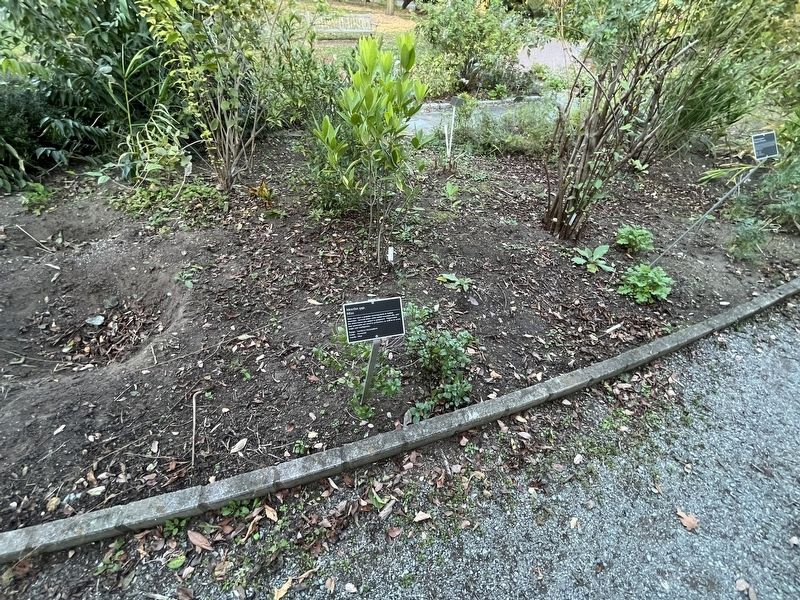
Near Meadow Road Northeast, 0.1 miles east of Eagle Nest Road Northeast, on the left when traveling west.
Rosemary was a favorite herb for cooking and strewing. As a symbol of remembrance and fidelity, it was added to wedding cakes and puddings, as well as tossed into coffins at funerals. — — Map (db m144636) HM
Near Eagle Nest Road Northeast, 0.1 miles south of Meadow Road Northeast, on the left when traveling south.
Smoke from the burning root was used by the Meskwaki to revive unconscious patients, to hush a crying child, and to cast spells. — — Map (db m144573) HM
Near Meadow Road Northeast, 0.1 miles east of Eagle Nest Road Northeast, on the left when traveling west.
This plant was used by the colonists in a favorite spring tonic known as "Sweet Mary tea." It was also widely used throughout eastern Massachusetts in nosegays or as bookmarkers to enjoy during long sermons. — — Map (db m144637) HM
On H Street Northeast at 8th Street Northeast, on the right when traveling west on H Street Northeast.
One year before Congress and the President arrived in their new capital city in 1800, Washington's Navy Yard opened at the foot of Eighth Street, two miles south of this sign. The yard soon became the city's biggest employer. In 1908 . . . — — Map (db m71680) HM
On 3rd Street Northeast at H Street Northeast, on the right when traveling north on 3rd Street Northeast.
The elegant Romanesque portion of the Senate Square condominium complex started life in 1874 as the Little Sisters of the Poor House for the Aged. St. Aloysius Church member Ellen Sherman, wife of Civil War General William Tecumseh Sherman, . . . — — Map (db m186806) HM
On H Street Northeast at 6th Street Northeast, on the right when traveling east on H Street Northeast.
Calvary Episcopal Church, half a block north at 820 Sixth Street, has been a community anchor since 1901. For most of its early years, the congregation, led by founding rector Reverend Franklin I.A. Bennett, met at 11th and G. In 1941 it . . . — — Map (db m152487) HM
On H Street Northeast at 11th Street Northeast, on the right when traveling west on H Street Northeast.
The handsome church on this corner is the second to occupy this spot. The first was a small brick chapel built by John A. Douglas in 1878 for the new Memorial Methodist Episcopal Church. Soon after, it was renamed Douglas Memorial Methodist . . . — — Map (db m71691) HM
Near 14th Street Northeast at Quincy Street Northeast, on the right when traveling north.
Sacred to the memory of the servant of God
Aristides Leonori
Third Order of St. Francis.
Saintly Roman architect of this memorial church and monastery of the Holy Sepulcher, Wash. D.C.
Born - July 28, 1856
Died - July 30, 1938 . . . — — Map (db m208432) HM
Near 14th Street Northeast south of Quincy Street Northeast, on the right when traveling north.
In loving memory
Carlo Angelo Facchina
First Mosaicista
for
the Franciscan Monastery
Born
Sequals, Italia
1870
Died
Brookland, D.C.
1948 — — Map (db m111793) HM
Near 14th Street Northeast south of Quincy Street Northeast, on the right when traveling north.
Corinthian Capital Circa 2nd-3rd century AD. This capital, the top of a column, is from Jerusalem. Capitals of this type can be seen in Roman buildings constructed during the time of the Roman occupation of the Holy Land. Good examples can still . . . — — Map (db m111792) HM
Near 14th Street Northeast south of Quincy Street Northeast, on the right when traveling north.
Erected to the memory of the very Reverend Commissaries of the Holy Land for the United States; who have, since 1880 contributed to the preservation of the Holy-Places and prospered the charitable missionary activities of the Franciscan Custody . . . — — Map (db m111791) HM
On Rhode Island Avenue Northeast (U.S. 1) west of 13th Street Northeast, on the right when traveling west.
Este Templo fue consagrado
a la
Gloria de Dios
por el Excelentísimo
Apóstol de Jesucristo
Samuel Joaquín Flores
Washington, D.C. Julio 7 de 2002
[English translation:]
This Temple . . . — — Map (db m238259) HM
Near 14th Street Northeast at Quincy Street Northeast, on the right when traveling north.
To commemorate the establishment of the Middle Atlantic Lieutenancy in 1993 in the United States of America, of the Equestrian Order of the Holy Sepulchre of Jerusalem
H.E. Bernard J. Ficarra, KGCHS, Lieutenant •
H.E. James Cardinal . . . — — Map (db m208438) HM
Near 14th Street Northeast at Quincy Street Northeast, on the right when traveling north.
Bernard J. Ficarra, M.D., Ph.D.
Founding President
Brother Austin David Carroll, F.S.C., Ph.D.
Founding Secretary
Sustaining Academicians
John E. Albers, M.D. •
Julian L. Ambrus, M.D. •
George A. Antonelli, Ph.D. • . . . — — Map (db m208436) HM
Near 14th Street Northeast just south of Quincy Street Northeast, on the right when traveling north.
This edifice is a replica of the Tomb of Mary. The Shrine as it appears today was constructed by the Crusaders in the 12th century. It is located just east of Jerusalem. — — Map (db m208439) HM
On 14th Street Northeast north of Quincy Street Northeast, on the right when traveling north.
Sacred to the memory of
Very Rev. Charles A. Vissani, O.F.M.
First Commissary General of
the Holy Land for the United States
1880 - 1896
The first to conduct an American Catholic
pilgrimage to the Holy Land in 1889,
and to place the . . . — — Map (db m111788) HM
On 14th Street Northeast near Quincy Street Northeast, on the right when traveling north.
Sacred to the memory of
Very Rev. Charles A. Vissani, O.F.M.
Founder of the cause of the Holy Land
in the United States
Erected to commemorate the centenary of the
First Commissariat in New York City in 1880
Fr. Charles . . . — — Map (db m111789) HM
Near 14th Street Northeast south of Quincy Street Northeast, on the right when traveling north.
Sacred to the memory of Very Rev. Godfrey Schilling, O.F.M. 1896-1901 Commissary 1911-1922. Founder of this Memorial Church and Monastery of the Holy Sepulcher in 1897. Fr. Godfrey was the first American Missionary to the Holy Land. By the . . . — — Map (db m111787) HM
Near 14th Street Northeast north of Quincy Street Northeast, on the right when traveling north.
In
loving
memory of the
Very Reverend Father
Godfrey Schilling O.F.M.
Superior
Builder of this church
Dedicated 1899
Born 1855 - Died 1934
— — Map (db m208431) HM
On 11th Street Northeast south of C Street Northeast, on the left when traveling south.
Designed 1916
in Moorish Revival Style
Architect
William S. Plager
(1860-1946)
Photo: circa 1926
Goode Collection
Library of Congress
Redesigned 1941
in Art Deco Style
Architect
Mihran Mesrobian . . . — — Map (db m134068) HM
On F Street Northeast at 2nd Street Northeast, on the right when traveling east on F Street Northeast.
This is the western edge of what once was the rough, working-class Swampoodle neighborhood.
In the early days the marshy Tiber Creek ran between what are now North Capitol and First Streets, NE. Legend has it that lingering rain puddles . . . — — Map (db m130581) HM
Near Michigan Avenue Northeast west of 7th Street Northeast, on the right when traveling west.
A visionary parish priest through whose determined efforts The Knights of Columbus was founded in New Haven, Connecticut, in 1882 to strengthen the faith of Catholic men and to protect their families — — Map (db m96320) HM
On Sheriff Road Northeast just east of 43rd Place Northeast, on the left when traveling west.
This quaint frame building has served several church congregations since its construction in 1908. The First Zion Baptist Church stayed for more than 60 years. Since 1993 members of Joshua's Temple First Born Church have worshiped within its . . . — — Map (db m130784) HM
On Hunt Place Northeast just west of 46th Street Northeast, on the right when traveling west.
Lewis Giles, Sr. (1894-1974) was an influential Washington architect who designed this Colonial Revival/craftsman style house in 1929. He lived here the rest of his life, and worked in his home office.
Giles graduated from Armstrong . . . — — Map (db m187369) HM
On Sheriff Road Northeast just west of 50th Street Northeast, on the right when traveling west.
A monument for God
North West Beulah Baptist Church
Organized 1945
Built August 24, 1969
Rev. Moses Henderson
Founder and Pastor
Robert Nash, Architect
Elmer W. Sarbacher, Builder — — Map (db m244004) HM
On Harry Thomas Way Northeast at Q Street Northeast, on the right when traveling north on Harry Thomas Way Northeast.
Religious Organizations
Free and enslaved African Americans played vital roles in early Washington as laborers, servants, merchants, drivers and federal workers. They created Black charitable groups, schools, and churches, which served . . . — — Map (db m234907) HM
On 4th Street Northeast, 0.2 miles south of Michigan Avenue Northeast, on the right when traveling north.
In October, 1936, The Most Reverend John F. Noll, Bishop of Fort Wayne, Indiana, announced a fund drive in Our Sunday Visitor to erect a statue of Christ in the Nation's Capital, as suggested by Marjorie Lambert Russell of Topeka, Kansas. . . . — — Map (db m197694) HM
Near Lincoln Road Northeast near Bryant Street Northeast, on the right when traveling south.
The Glenwood Cemetery Chapel
designed by renowned architect Glenn Brown in 1892, has been designated a District of Columbia Historic Landmark and is also inventoried on the National Register of Historic Places. — — Map (db m129029) HM
On Nannie Helen Burroughs Boulevard Northeast at 50th Street Northeast, on the right when traveling east on Nannie Helen Burroughs Boulevard Northeast.
Atop this hill are the sprawling grounds on which Nannie Helen Burroughs (1879-1961) founded the National Training School for Women and Girls in 1909. Burroughs was an outspoken advocate for women's rights, civil rights, and religious . . . — — Map (db m184992) HM
On Rhode Island Avenue Northeast (U.S. 1) east of 20th Street Northeast, on the right when traveling south.
Congregation began about 1722, when Catholics first attended mass at chapel within Queen family mansion, on site approximately at present Evarts Street, N.E., near 20th Street. Building came to be called Queen’s Chapel. Destroyed by fire three . . . — — Map (db m143950) HM
On Massachusetts Avenue Northeast west of North Capitol Street Northeast, on the right when traveling east.
In memory of the millions
of innocent victims
of a man-made famine
in Ukraine engineered and
implemented by Stalin's
totalitarian regime
Ukrainian:
У пам'ять . . . — — Map (db m90872) HM
On Michigan Avenue Northeast north of Franklin Street Northeast, on the right when traveling north.
Trinity College commemorates with joy the visit of Pope John Paul II,
October 7, 1979.
He blessed the campus and the faculty, students, alumnae, board members, staff and friends assembled near the Main Building.
In Notre Dame Chapel, His . . . — — Map (db m7036) HM
On Colorado Avenue Northwest just north of Longfellow Street Northwest, on the right when traveling north.
Organized August 19, 1994
Rev. Carlton W. Veazey
Pastor and founder
Dedicated September 26, 1999
Carrie L. Leary
Chair, Diaconate Board
F. Alexis Roberson
Chair, Board of Trustees
On Georgia Avenue Northwest (U.S. 29) south of Missouri Avenue Northwest, on the right when traveling south. Reported missing.
English, Irish and German settlers, as well as enslaved and free African Americans, were the first non-natives to claim Brightwood. Farmers dominated until the Civil War. Then in the 1890s electric streetcars allowed government workers to live . . . — — Map (db m121018) HM
On Georgia Avenue Northwest (U.S. 29) just south of Allison Street Northwest, on the right when traveling south.
- founder -
Rev. Charles C. Hayes 1963
Destroyed by fire 1979
Rebuilt 1981
building fund chairman
Dea. Roy L. Dixon
co-chairman
Dea. Curtis M. Dudley
pastor
Rev. Charles C. Hayes
architect - Cass & . . . — — Map (db m243814) HM
On 16th Street, NW just south of Harvard Street, NW, on the right when traveling south.
Three dramatic religious structures dominate this corner. They are among some 40 religious institutions lining 16th Street between the White House and the Maryland state line.
Many serve as unofficial “embassies” representing the . . . — — Map (db m152206) HM
On Calvert Street Northwest at Biltmore Street Northwest, on the left when traveling east on Calvert Street Northwest. Reported permanently removed.
In 2013, Howard University archaeologists, working with concerned citizens, completed a seven-year survey of Walter C. Pierce Community Park. Their goal: to identify and protect two 19th Century cemeteries--the Colored Union Benevolent . . . — — Map (db m112588) HM
On Calvert Street Northwest at 20th Street Northwest, on the right when traveling west on Calvert Street Northwest.
In 2013, Howard University archaeologists, working with concerned citizens, completed a seven-year survey of Walter C. Pierce Community Park. Their goal, to identify and protect two historic cemeteries—the Colored Union Benevolent . . . — — Map (db m236781) HM
On 17th Street Northwest south of V Street Northwest, on the right when traveling south.
Calvin T.S. Brent (1854-1899), believed to be Washington's first African American architect, lived here briefly in the early 1890s. (His other residences have been demolished.) Brent began practicing in 1875 and after a two-year apprenticeship and . . . — — Map (db m129528) HM
On 16th Street Northwest at Fuller Street Northwest, on the right when traveling south on 16th Street Northwest.
Embassy of the Republic of Poland
A Beaux-Arts Beauty
You are now standing in front of the longest-serving embassy building among Washington DC's more than 180 diplomatic missions: the Embassy of the Republic of Poland. . . . — — Map (db m82636) HM
A social activist, recognized by Yad Vashem as one of the Righteous Among the Nations, who during World War II saved approximately 2,500 Jewish children.
She was born in 1910 in Warsaw. As a little girl she learned the Yiddish language . . . — — Map (db m200394) HM
On 16th Street Northwest just south of Fuller Street Northwest, on the right when traveling south.
The first researcher of the Cult of Spirits and Shamanism in Siberia.
She was the second European to receive a doctorate in Anthropology and taught at many of the world's universities.
A researcher of customs, author of books and . . . — — Map (db m210085) HM
On Calvert Street Northwest at 20th Street Northwest, on the right when traveling west on Calvert Street Northwest.
Today's Walter Pierce Park was once the site of two cemeteries—the Friends (Quaker) Burying Ground, in use from 1807 to 1890, and Mt. Pleasant Plains Cemetery, where more than 8,400 African Americans were buried between 1870 and 1890. . . . — — Map (db m236776) HM
On 16th Street Northwest just south of Fuller Street Northwest, on the right when traveling south. Reported permanently removed.
Paddling the Colca Canyon included more than thirty-three days of exploration and struggle with 94 kilometers of rushing mountain river squeezed between high rock walls that shut out the sunlight from the bottom of the abyss. Without any . . . — — Map (db m190150) HM
On Columbia Road Northwest north of Euclid Street Northwest, on the right when traveling south.
Furs by Gartenhaus and truffles by Avignon Freres. Hand-crafted ice cream from Budd's. Beginning in the 1910s, such neighborhood favorites occupied the commercial buildings to your right developed by Sanner and Barr. These fashionable shops . . . — — Map (db m130708) HM
On Albemarle Street Northwest at 42nd Street Northwest, on the right when traveling west on Albemarle Street Northwest.
Episcopalians first gathered here to worship in 1874, when St. Alban's Church, located on Wisconsin Avenue and Massachusetts, started a mission for the area. In good weather, services took place under a majestic oak tree on land donated by . . . — — Map (db m130927) HM
On River Road Northwest just west of Murdock Mill Road, on the right when traveling west.
Eldbrooke United Methodist Church's roots reach to about 1835, when Methodists gathered at the Loughborough Road home of Philip L. Brooke. Soon they built the simple, wooden Mount Zion Methodist Episcopal Church on land purchased from the . . . — — Map (db m184983) HM
On 44th Street Northwest at Yuma Street Northwest on 44th Street Northwest.
One of the oldest churches in Tenleytown is the Eldbrooke United Methodist Church located on River Road. This church was founded in 1840 as the Mount Zion Methodist Church. Some of Tenleytown's earliest inhabitants are buried in The Methodist . . . — — Map (db m112176) HM
On Nebraska Avenue Northwest at Van Ness Street Northwest, on the right when traveling south on Nebraska Avenue Northwest.
From 1927 until the late 1950s, the landscaped grounds across the street were the Hillcrest Children’s Center. It was founded downtown in 1814 as the Washington City Orphan Asylum by Marcia Burnes Van Ness and President Madison’s wife Dolley. . . . — — Map (db m130930) HM
Near Nebraska Avenue Northwest south of Van Ness Street Northwest, on the right when traveling north.
Established on the foundation of
The Church of the Covenant
and
The First Presbyterian Church
The Church of the Covenant
was organized in 1883 and
since 1885 has worshipped in
this edifice
The First Presbyterian . . . — — Map (db m130036) HM
On Yuma Street Northwest east of 42nd Street Northwest, on the right when traveling east.
The brick building across the street opened in 1928 as the Convent of Bon Secours (literally, “good help”). The convent’s sisters had arrived in Baltimore from France in 1881. In Baltimore they quietly nursed both wealthy and needy . . . — — Map (db m130928) HM
Near Nebraska Avenue Northwest south of Van Ness Street Northwest, on the right when traveling north.
To the Glory of God
and
in loving memory
of the men of the
Church of the Covenant
who gave their lives
in the Great War
William Strong Jr
Lieutenant January 1915 Expeditionary Force
Enlisted at Toronto • Gassed at . . . — — Map (db m130035) WM
Near Nebraska Avenue Northwest south of Van Ness Street Northwest, on the right when traveling north.
In honored memory of the men of this congregation who gave their lives for their country in the War 1941 - 1945
Samuel Kendall Angus, U.S.A. •
Charles Stone Borden, A.A.F. •
David Rumbough Donaldson, U.S.A. •
William B. Drysdale, . . . — — Map (db m130124) WM
On Macarthur Boulevard Northwest north of Whitehaven Parkway Northwest, on the right when traveling north.
Scripture: Isaiah (41:18-20): I will make rivers flow on barren heights heights, and springs within the valleys. I will turn the desert into pools of water, and parched ground into springs. I will put in the desert the cedar and . . . — — Map (db m241592) HM
On T Street Northwest at 1st Street Northwest, on the left when traveling east on T Street Northwest.
This busy stretch of Rhode Island Avenue was a racial dividing line even as DC became majority African American in 1957. "African Americans were not welcome on [the north] side of the street," commented Reverend Bobby Livingston years later, . . . — — Map (db m130840) HM
On T Street Northwest at North Capitol Street Northwest on T Street Northwest.
St. Martin of Tours Catholic Church celebrated its first Mass in 1901 in a nearby mansion. Father Eugene Hannan, a graduate of Gonzaga High School just south of here, founded St. Martin's to serve the growing Catholic population that dated to . . . — — Map (db m130841) HM
On Randolph Place Northwest at 2nd Street Northwest, on the right when traveling west on Randolph Place Northwest. Reported missing.
Bloomingdale of the 1940s and '50s was a village of high expectations. Within a block of this sign lived four young women who grew up to be judges.
Anna Diggs Taylor rose to chief judge of the U.S. District Court in Michigan. The . . . — — Map (db m130843) HM
On North Capitol Street Northwest at R Street Northwest on North Capitol Street Northwest.
Organized 1832.
2nd Church Built 1833.
Admitted to Philadelphia-Baltimore Conference, 1837.
3rd Church Built 1888.
Relocated present site, 1956.
Bishop Raymond Luthe Jones, Presiding Bishop, 4th Episcopal District.
Dr. William B. . . . — — Map (db m11042) HM
On 2nd Street Northwest near Elm Street Northwest, on the right when traveling north.
The Nathaniel Gage School for white children opened here in 1904, when Washington's public school system was segregated. By the 1930s, even though LeDroit Park was an African American neighborhood, Gage remained white only. "I had to walk by . . . — — Map (db m130839) HM
On 13th Street Northwest at Quakenbos Street Northwest, on the right when traveling north on 13th Street Northwest.
Elizabeth Proctor Thomas (1821-1917), a free Black woman whose image appears on each Brightwood Heritage Trail sign, once owned 11 acres in this area. Known, respectfully in her old age as "Aunt Betty," Thomas and her husband James farmed and . . . — — Map (db m72830) HM
On Georgia Avenue Northwest (U.S. 29) at Quackenbos Street Northwest, on the right when traveling south on Georgia Avenue Northwest. Reported permanently removed.
Across Quackenbos Street Emory United Methodist Church. Named to honor Bishop John Emory of Maryland (1789-1835), the congregation dates from 1832.
From the beginning, Emory welcomed all races but, like most Washington churches then, . . . — — Map (db m118907) HM
On Georgia Avenue Northwest (U.S. 29) at Quackenbos Street Northwest, on the right when traveling south on Georgia Avenue Northwest.
Across Quackenbos Street is Emory United Methodist Church. Named to honor Bishop John Emory of Maryland (1789-1835), the congregation dates from 1832.
From the beginning, Emory welcomed all races but, like most Washington churches then, . . . — — Map (db m147739) HM
On Tuckerman Street Northwest at 13th Street Northwest, on the right when traveling east on Tuckerman Street Northwest.
In the 1930s as now, this area was a family friendly, "move-up" destination for hard-working government clerks and professionals. Like many DC neighborhoods, Brightwood had covenants prohibiting sales to certain white ethnics and African . . . — — Map (db m72777) HM
On Wisconsin Avenue Northwest at Woodley Road Northwest on Wisconsin Avenue Northwest.
The Washington National Cathedral, standing majestically on the commanding heights of the city, was not the first religious institution on Mount Alban. Joseph Nourse, a Revolutionary War veteran who moved his family to the site in 1813, dreamed . . . — — Map (db m152177) HM
On 7th Street Northwest south of H Street Northwest, on the right when traveling south.
dragons to bring rain,
prosperity,
and friendship
More than 280 dragons, crowned by 700 glazed tiles, look down from the Chinatown Friendship Archway before you. Symbols of the spirits that bring rain and . . . — — Map (db m130938) HM
On 7th Street Northwest just south of H Street Northwest, on the right when traveling south. Reported permanently removed.
dragons to bring rain,
prosperity
and friendship
More than 280 dragons, crowned by 700 glazed tiles, look down from the Chinatown Friendship Archway before you. Symbols of the spirits that bring rain and . . . — — Map (db m130937) HM
On Quebec Street Northwest at Porter Street Northwest on Quebec Street Northwest.
In honor of those who risked their lives to save Jews during the Holocaust
1992 Jan Karski Poland •
1993 Preben Munch-Nielsen Denmark •
1994 . . . — — Map (db m150711) HM WM
On Newark Street Northwest at 35th Street Northwest, on the right when traveling west on Newark Street Northwest.
The Rosedale farmhouse is said to be the oldest house surviving in Washington, DC. It was named to the National Register of Historic Places in 1973.
The farmhouse is a private home.
Please do not enter farmhouse grounds.
. . . — — Map (db m112385) HM
On 14th Street Northwest at Monroe Street Northwest, on the right when traveling north on 14th Street Northwest.
When the smoke cleared after the civil disturbances of April 1968, Columbia Heights lay devastated. Many residents and businesses simply left. Others remained to pick up the pieces. But who would help rebuild?
Citizen groups, church . . . — — Map (db m152929) HM
Near 16th Street Northwest north of W Street Northwest, on the right when traveling north.
Buchanan was our only bachelor president and relied upon his orphaned niece, Harriet Lane, to act as his First Lady during his years in the White House (1857 to 1861). In her estate, Harriet Lane Johnson made a bequest to fund a memorial to her . . . — — Map (db m156671) HM
On 16th Street Northwest south of Harvard Street Northwest.
Straight ahead is All Souls Church, Unitarian, long known for its social activism, starting with abolitionism in the 1820s and ranging through nuclear disarmament and interracial cooperation. During the segregation era, All Souls was one of . . . — — Map (db m130753) HM
On Newton Street Northwest close to 16th Street Northwest, on the left when traveling east.
• 1957: First integrated Episcopal church in DC
• 1969: Began Loaves & Fishes feeding program; hot meals still served every Saturday and Sunday at Noon
• 1975: Ordained four women to the priesthood, resulting in the ordination of . . . — — Map (db m142192) HM
On Columbia Road Northwest at 14th Street Northwest on Columbia Road Northwest.
This block is home to some of the largest Latino organizations in the city, all founded as migration from Central America and the Caribbean increased in the 1970s. Several began with a boost from Cavalry United Methodist Church at 1459 Columbia . . . — — Map (db m130754) HM
Near Irving Street Northwest east of 15th Street Northwest, on the right when traveling east.
To The Glory of God
And in grateful memory of one of his servants
This building devoted to Christian education
Is named for
Woodrow Wilson
President of Princeton University 1902 — 1910
Governor of the state of New Jersey . . . — — Map (db m82615) HM
On Crittenden Street Northwest west of 16th Street Northwest, on the right when traveling east.
"I will make rivers flow on barren heights, and springs within the valleys. I will turn the desert into pools of water, and parched ground into springs. I will put in the desert the cedar and the acacia, the myrtle and the olive. I . . . — — Map (db m240396) HM
On New York Avenue Northwest at H Street Northwest, on the right when traveling west on New York Avenue Northwest.
The New York Avenue Presbyterian Church with this planting commemorates and honors the
80th Anniversary of Presbyterian Women in Cuba
Founded in 1927 by missionary Edith McHouston of Lexington, Virginia, celebrated in Camajuani, . . . — — Map (db m211821) HM
On K Street Northwest (U.S. 29) at 11th Street Northwest (U.S. 29), on the right when traveling east on K Street Northwest. Reported permanently removed.
"...watch yourselves closely
so that you do not forget the things
your eyes have seen...
...teach them
to your children
and to their children
and to their children after them."
Deuteronomy 4:9
Stories . . . — — Map (db m70316) HM
On K Street Northwest (U.S. 29) at 11th Street Northwest, on the left when traveling west on K Street Northwest.
"…watch yourselves closely
so that you do not forget the things
your eyes have seen…
…teach them
to your children
and to their children
and to their children
after them."
Deuteronomy 4:19
On Vermont Avenue Northwest at I Street Northwest, on the right when traveling south on Vermont Avenue Northwest.
Welcome to downtown Washington, DC — an area rich in history, culture, and places to see. You will enjoy visiting the following sites located in the vicinity of this sign.
St. John's Church
Every US president since James Madison . . . — — Map (db m112204) HM
316 entries matched your criteria. The first 100 are listed above. Next 100 ⊳