On U.S. 16 at milepost 70 near Werner Road, on the right when traveling east.
The fur industry ruled the northwest at the beginning of the 19th century; however, much of the interior of the western United States remained a mystery. The Lewis and Clark expedition constituted the only organized exploration, a fact which . . . — — Map (db m97954) HM
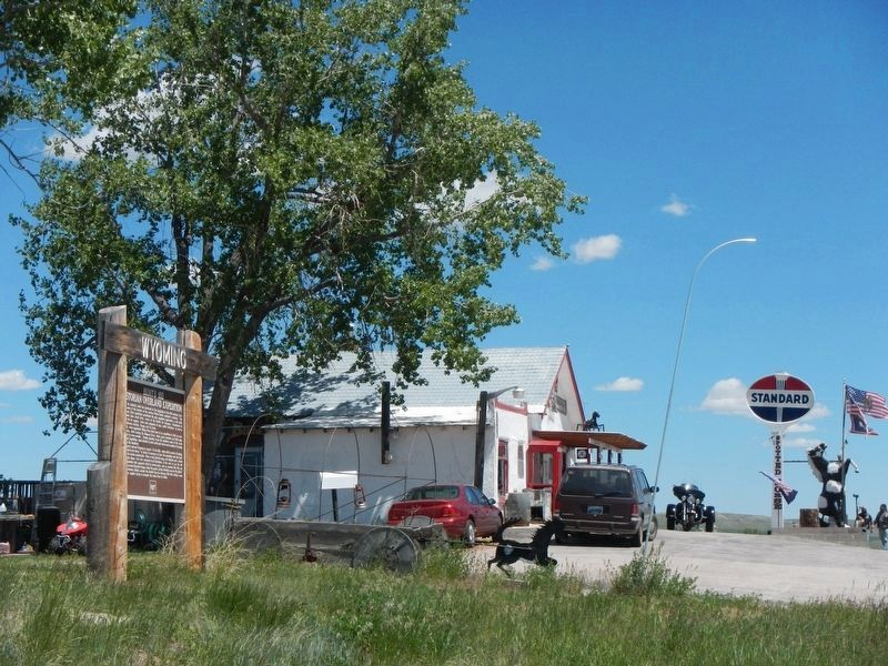
On 5th Street near West Buffalo Avenue, on the right when traveling west.
In the summer of 1867, a survey partly led by General Grenville M. Dodge seeking a route for the Union Pacific Railroad, stopped one half mile south west of here.
General John A. Rawlins, a member of the party, spoke of the spring there as the . . . — — Map (db m89705) HM
On South 5th Street near West Aspen Street, on the right when traveling north.
To All Pioneers
Who passed this way
and
in memory of
Pioneer Geologist
Ferdinand V. Hayden
Chief U.S. Geological Survey
of the Territories
1867-78
Born at Westfield, Mass, 1829 — — Map (db m92082) HM
On West Birch Street (U.S. 26) near Wyoming Highway 95, on the right when traveling east.
On July 26, 1842 John C. Fremont's first expedition to the far west guided by Kit Carson with Joseph Bissonette as interpreter, also L. Maxwell as hunter, camped in this rocky glen.
Names and dates of many of the 300,000 travelers of the . . . — — Map (db m92080) HM
On Deer Creek Road (County Highway 19) 1 mile south of I-25 (U.S. I-25), on the left when traveling south.
One of the first two stations built to supply the Mormon emigrants and mail station to accommodate the mail service by virtue of the mail contract awarded to Hyrum Kimball agent of the BYX.
Abandoned in 1858 due to the actions of the United . . . — — Map (db m151835) HM
On State Highway 24, 0.2 miles west of Oak Creek Road, on the left when traveling west.
During the summer of 1874, General George Armstrong Custer led the first official government expedition to the Black Hills, which the Sioux Indians claimed as their territory. Although the United States Government officially sent this expedition of . . . — — Map (db m34586) HM
On Interstate 90 at milepost 171, on the right when traveling west.
Though rising only 600 ft above the floor of the plains, Inyan Kara Mountain stands
as one of the most important cultural and historical landmarks of the Black Hills. Inyan
Kara forms an important part of the sacred geography of the Black Hills . . . — — Map (db m98275) HM
On State Highway 585 near Cold Springs Road, on the left when traveling south. Reported missing.
In July 1874 Lieutenant Colonel George Armstrong Custer, and more that 1000 soldiers, camped near here while engaged in a military expedition to explore the Black Hills. The expedition's official purpose was to locate a suitable site for an army . . . — — Map (db m98140) HM
Lieutenant Colonel George A. Custer's Black Hills Expedition crossed northeastern Wyoming from July 17-25, 1874, camping within three miles of this location. forged by 1000 men (cavalry, infantry, teamsters, scientists, miners, newspaper reporters, . . . — — Map (db m45381) HM
Near Union Pass Road (Forest Road 600) near Forest Road 534.
High in mountains where the natural environment changes swiftly, eroding or burying the past, for how long a time can vestiges of man's frailer achievements withstand obliteration? No matter!, for here man has brought or developed cultures which are . . . — — Map (db m180651) HM
Westbound Astorians led by Wilson Price Hunt in September, 1811, passed through Dubois region, over Union Pass, and on to the mouth of the Columbia River to explore a line of communication and to locate sites for fur trading posts across the . . . — — Map (db m96244) HM
Near Cemetery Lane near Trout Creek Road, on the left when traveling north.
This cemetery is named for the Shoshone woman who became an invaluable guide, interpreter and translator to the Lewis and Clark Expedition.
Fifteen year old Sacajawea accompanied her husband, fur trader Charbonneau, when he joined the Corps of . . . — — Map (db m96202) HM
On State Highway 789 near West 6th Street, on the left when traveling west.
Five hundred yards northwest of this marker stood the Bonneville Cabins, built by Captain B.L.E. Bonneville in 1835 to store his trade goods. Three cabins were constructed and later two more. They were long known as “The Five Cabins, : the . . . — — Map (db m80128) HM
On U.S. 287, 2.5 miles west of California Emigrant Road, on the right when traveling west.
A famous natural landmark used by Indians, trappers, and emigrants on the Oregon Trail. Site of Split Rock Pony Express 1860-1861, stage and telegraph station is on the south side of the Sweetwater. Split Rock can be seen as a cleft on the . . . — — Map (db m67007) HM
Near U.S. 287, 12 miles east of Wyoming Highway 28.
Viewed from Beaver Rim, the Wind River Mountains, part of the Rocky Mountain chain, boast 53 granite peaks over 13,000 feet high. The Continental Divide runs the length of the Wind River Range. Water on the east side of the Continental Divide flows . . . — — Map (db m67012) HM
On East Main Street (U.S. 287) near North 1st Street, on the right when traveling west.
Scouts and Trappers visited this area by 1811 and rendezvous were held in 1829, in 1830, and in 1836.
Camp Magraw, 1857, site 2.1 miles north.
Fort Thompson, 1857-1858, was located 4.4 miles north of here.
Camp Augur, 1869-1870, . . . — — Map (db m95785) HM
Near State Highway 28, 0.7 miles south of Lander-Pinedale Stage Road.
The demand for beaver pelts in the early 1800s led to the exploration and eventual settlement of the American West. South Pass was part of a major thoroughfare through the Rockies and its discovery is significant to the era known as the fur trade. . . . — — Map (db m67022) HM
On North Federal Boulvard (State Highway 789) at East Fremont Avenue on North Federal Boulvard.
In memory
of the Trappers, Traders
and Explorers, who
established the Rendezvous
at the Junction of the
Little and Big Wind Rivers — — Map (db m80127) HM
Near State Highway 160, on the left when traveling west.
. . . the articles of trade consist, on the one side, almost entirely of buffalo robes; and, on the other, of blankets, calicoes, guns, powder, and lead, [and] . . . cheap ornaments such as glass beads, looking-glasses, rings, vermillion for . . . — — Map (db m86968) HM
On U.S. 26 near Road 175, on the right when traveling west.
Following the Lewis and Clark Expedition, much of the interior of the western United States remained a mystery and most people traveling to the west coast went by ship. By 1811, at the height of the fur trade, John Jacob Astor, owner of the Pacific . . . — — Map (db m79700) HM
On Sneider Point Road near Pasture Road when traveling south.
In 1884 Joe Sneider with Ed Crapon passing through this area, noticed steam rising from the hot springs. Mistaking it for smoke and suspecting a hostile Indian Camp, the area was scouted from this point before descending to the valley. — — Map (db m97708) HM
On U.S. 189, 5.6 miles south of State Highway 235, on the right when traveling south.
He little knew that when he cut his name, or had it cut, in this stone, that it would be engraved in the annals of the West deeper than that of any other man. As one of the world's outstanding explorers he guided emigrants, railroads and army in the . . . — — Map (db m36660) HM
On U.S. 189, 12.8 miles north of State Highway 372, on the right when traveling north.
To the Shoshone Indian, this river was the Seeds-Kee-Dee Agie (Prairie Chicken River). On Sept. 16 1811, the Astorians near its headwaters termed it the Spanish River. To the Spaniards, far to the south, it was the Rio Verde (Green River). Jedediah . . . — — Map (db m36659) HM
On Fremont Canyon Road (County Route 408) near Kortes Road (County Route 407), on the left when traveling east.
Fremont Canyon was named after General John Charles Fremont, who explored the canyon in 1842 when he was a Lieutenant in the Army. Pathfinder Dam located three miles upstream was also named for the explorer known as the "Pathfinder" who was . . . — — Map (db m95573) HM
Near State Highway 220 at milepost 63,, 2.5 miles south of Buzzard Rd (County Route 410).
Thousands who traveled the Oregon Trail in central Wyoming were unaware that they were the beneficiaries of a long series of geological events. The granite peaks around you are mountains that rose, sank and then were buried in sand and ashy . . . — — Map (db m62149) HM
It is believed that William Sublette named this landmark Independence Rock during an Independence Day celebration here on July 4, 1830. Sublette, a fur trapper and mountain man, had stopped at the site while leading an expedition to the Wind River . . . — — Map (db m154136) HM
Here the present-day highway crosses what remains of an all but forgotten road. That road led to the remote goldfields of western Montana, booming since 1862. The government, in 1859, ordered Captain W.F. Raynolds, Topographical . . . — — Map (db m86918) HM
On Bessemer Bend Road (Route 308) near Speas Road (Route 311), on the right when traveling east.
Throughout history, humans have followed river banks in search of resources to support commerce. Rivers made possible the exploration and mapping of North America. Major waterways served as trade routes for native peoples, corridors for European . . . — — Map (db m91949) HM
On Bessemer Bend Road (County Route 308) near Speas Road (County Route 311), on the right when traveling east.
Field exploration by scientists in the late 1800s illuminated the American West. One of the most charismatic of these men was Dr. Ferdinand Vandiveer Hayden. Born in 1828 in Massachusetts and trained as a physician, Dr. Hayden first journeyed to the . . . — — Map (db m91976) HM
On Bessemer Bend Road (County Route 308) near Speas Road (County Route 311), on the right when traveling east.
The eighteenth century saw competition for control of North America among Spain, France, England, and the fledgling United States. Following a forty-year period of wars, treaties, territorial purchases, and establishment of trading posts, the future . . . — — Map (db m91947) HM
Near Fort Caspar Road, 0.1 miles west of Route 258, on the right when traveling west.
John C. Fremont, the “Pathfinder”, was born in 1813 and explored a large portion of central Wyoming including the Casper area. He made an independent survey to the Wind River Mountains of Wyoming in 1842, and the 13,743’ Fremont Peak of . . . — — Map (db m164515) HM
Near Fort Caspar Road, 0.1 miles west of Wyoming Route 258, on the right when traveling west.
Approximately eight miles southwest of here, Robert Stuart built the first cabin in the state of Wyoming. The cabin was built in a three day period in early November,1812, at a site on the North Platte River at Bessemer Bend.
Robert Stuart was . . . — — Map (db m164514) HM
Near W Yellowstone Avenue (U.S. 20), on the right when traveling west.
Off in the distance in front of you, a large red butte lies against a much larger mountain, Rattlesnake Mountain. Flowing down the valley is Trail Creek, named for the ancient Indian trail that crosses the Shoshone River at the Indian ford in the . . . — — Map (db m87571) HM
Near W Yellowstone Avenue (U.S. 20), on the right when traveling west.
Cedar Mountain, the mountain in front of you to the left of the canyon, was known to the Crow Indians as “the mountain of spirits.” Early settlers told of finding Indian tree burials on its northeast slope. Unfortunately, those sites . . . — — Map (db m87566) HM
On W Yellowstone Avenue (U.S. 20), on the right when traveling west.
John Colter, veteran of the Lewis and Clark Expedition, notably self-sufficient mountain man and indefatigable explorer, was the first white man known to have reconnoitered this locale. In 1807, possibly traveling alone but probably escorted . . . — — Map (db m86150) HM
On W Yellowstone Avenue (U.S. 20) 0.1 miles west of Demaris Drive, on the right when traveling west.
Looking west is the Shoshone Canyon, named for the Shoshoni Indians, who hunted in the region. However, most of the Big Horn Basin had been Crow territory until the Fort Laramie Treaty of 1868. West of the canyon, the north and the south forks of . . . — — Map (db m87558) HM
This monument, erected by the Brotherhood of the American Mountain Men, is "dedicated to all Mountain Men known and unknown for their essential part in the opening of the American West." It consists of two busts and six plaques honoring four . . . — — Map (db m91017) HM
On Wendover Road at Cottonwood Road, on the left when traveling north on Wendover Road.
Called Bitter Cottonwood Creek because of the groves of cottonwood trees growing there, this location was a welcome relief for emigrant pioneers as they traveled along the relatively treeless road to the west in the 1840s, 50s, & 60s. Many pioneer . . . — — Map (db m147855) HM
On Interstate 90, on the right when traveling south.
Jim Bridger first came west in 1822, working in the fur trade until that industry declined. He traveled throughout the west, becoming an expert on the Indians and the land. After working as a trader, he established the Bridger Trail through the . . . — — Map (db m86164) HM
On U.S. 191, 0.2 miles west of Miner Creek Road, on the left when traveling east.
On this site, Oct. 18, 1811, sixty-one Astorians of the Pacific Fur Company led by Wilson Price Hunt camped for 5 days. They were on their way to the Pacific Ocean from St. Louis and were the second group to cross the continent, just 5 years after . . . — — Map (db m47078) HM
On U.S. 189 near Forest Road 30530, on the right when traveling south.
West of this sign is the opening of Hoback Canyon. This canyon first provided a way through the mountains for game and Indians, and later for mountain men and settlers, but the rugged trail was hazardous for horses and wagons. On September 26, 1811, . . . — — Map (db m90923) HM
On State Highway 353 near Scab Creek Road, on the right when traveling south.
On June 10th, 1842, J. C. Fremont left St. Louis to explore the Wind River Mountains, with Kit Carson as guide, Charles Preuss, topographer, L. Maxwell, hunter, and 20 Canadian voyageurs, including Basil LaJeunesse. Eight two-wheeled mule-drawn . . . — — Map (db m96720) HM
On U.S. 191, 1.8 miles west of Wyoming Highway 351, on the right when traveling east.
This site is a crossing of the Lander Cut-off, the northern fork of the Oregon Trail. Originally called the Fort Kearney-South Pass-Honey Lake Wagon Road when it opened in 1858, it was the first federally-funded road project west of the Mississippi . . . — — Map (db m47092) HM
Buried on Fontenelle Creek, exhumed 1897, taken to the U.S.Circuit Court at St. Louis, Mo., returned by a court order to Sublette County, Wyoming to be buried here July 27, 1935.
Placed
July 4, 1936
The Historical Landmark Commission
of . . . — — Map (db m80513) HM
On West Pine Street (U.S. 191) near South Lincoln Avenue.
On Oct. 16, 1812, the Astorians (Robert Stuart, Ramsay Crooks, Robert McClellan, Joseph Miller, Benjamin Jones, Francis Eclair and Andy Vallee) passed this way and forded Pine Creek near here, the first white men known to have seen it. They were . . . — — Map (db m90931) HM
On State Highway 28, 0.1 miles west of U.S. 191, on the right when traveling west.
On Monday evening, June 28, 1847, Brigham Young and the Mormon pioneers met James Bridger and party near this place. Both companies encamped here over night and conferred at length regarding the route and the possibility of establishing and . . . — — Map (db m47138) HM
Long before the Oregon/California westward migration, animals instinctively stopped at the Big Sandy River during their migration process. With South Pass just 35 miles east, the river was also a natural East-West pathway for man. The pathway, in . . . — — Map (db m47136) HM
Near South 2nd East Street, on the right when traveling south.
Trapper, hunter, prospector, and tattoo artist - George Flavell and his passenger/partner Ramon Montez were the first men to float the "distance" of Green River, Wyoming to Needles, California primarily for the "adventure."
The two arrived in . . . — — Map (db m90188) HM
On Flaming Gorge Way at North Center Street when traveling north on Flaming Gorge Way.
From Green River, Wyoming on May 24, 1869 Major John Wesley Powell and a group of voyagers set out to discover the mysteries of one of the last unexplored regions in the continental United States--the Green and Colorado Rivers. Powell was a disabled . . . — — Map (db m13099) HM
Even before the end of the 1869 voyage, Powell knew he had to return to the river. The news of Powell's first expedition of 1869 captured the nation's imagination and admiration; and also helped persuade Congress to appropriate $10,000 for the . . . — — Map (db m90190) HM
Near South 2nd East Street near East 4th South Street, on the right when traveling south.
On May 24, 1869, the Powell - Colorado River Expedition, ten men and four boats strong, embarked from these environs on a voyage of adventure resulting in civilization's first definite knowledge of this continent's last unexplored major river . . . — — Map (db m90258) HM
Near South 2nd East Street, on the right when traveling south.
The search for "practical" uses of the canyons of the upper Green River had been on since the turn of the century. In 1914, a U.S. Geologic Survey expedition led by Eugene LaRue floated to the Utah border and noted several damsites in the Flaming . . . — — Map (db m90165) HM
Near South 2nd East Street, on the right when traveling south.
Teacher, Civil War veteran, scientist, and naturalist - John Wesley Powell was driven by the idea to explore the canyons of the Green and Colorado Rivers.
He arranged funds, men, and equipment in the winter of 1868-1869. The expedition was . . . — — Map (db m90191) HM
Near South 2nd East Street, on the right when traveling south.
Leaving Missouri in 1824, William Ashley led a large group of men west in search of riches - beaver. Ashley and his crew arrived on the banks of the Green River (or Seeds-ke-dee as it was called then) on April 9th, 1825 near the mouth of the Big . . . — — Map (db m90248) HM
On Main Street (State Highway 371) near Berta Street, on the left when traveling north.
In 1900, while prospecting was being carried on in the vicinity of Cumberland, Morgan Griffiths, Gus Paulsen and a party of prospectors went northeast from Rock Springs to prospect in Horse Thief Canyon, since outcrops of a promising deposit of coal . . . — — Map (db m92216) HM
On U.S. 191, 0.8 miles east of U.S. 89, on the right when traveling east.
"John Hoback, Jacob Reznor and Edward Robinson, trappers from Kentucky, in 1811 guided the Astorians land expeditions land expedition under Wilson Price Hunt across the northern part of present Wyoming to the Snake River. From this Junction of the . . . — — Map (db m47076) HM
On Cache Street (U.S. 26), on the left when traveling south.
First white man in Wyoming. Passed this way in 1807 and discovered Yellowstone Park Dedicated by the Historical Landmark Commission of Wyoming July 4, 1939 — — Map (db m88103) HM
Jenny Leigh, a Shoshone Indian, assisted the 1872 Hayden Survey. The expedition named this lake in her honor. Jenny and her husband Richard were expert guides who knew Jackson Hole well from summers spent hunting, trapping, and gathering native . . . — — Map (db m123283) HM
Near Colter Bay Village Road near Colter Bay Marina Road when traveling west.
This bay is named for
John Colter
discoverer of the Teton mountains and scenic wonders of the upper Yellowstone. Experienced as a hunter for the 1804-1806 Lewis and Clark Expedition, he explored this region in Winter of 1807-1808 in the . . . — — Map (db m90980) HM
On U. S. Forest Service 30010 (U.S. 287), on the left when traveling west.
Togwotee (pronounced "TOE-go-tee") Pass lies at the head of the Wind River, astride the Great Divide. This 9,658-foot pass was an ancient travel route for the Tukudika people, who lived among these high, rugged peaks and migrated on foot for . . . — — Map (db m96370) HM
On Business Interstate 80 near Main Street, on the right when traveling east.
The fort was established about 1842 by Jim Bridger discoverer of Great Salt Lake; notable pioneer, trapper, fur trader, scout and guide. Bridger was born at Richmond, Virginia, March 17, 1804 and died at Westport, Missouri, July 17, 1881. His . . . — — Map (db m36596) HM
Erected by
The Members of
the
Woodruff Stake
in Honor of
The Mormon Pioneers
Who passed this point
Wednesday July 7, 1847
and in subsequent years — — Map (db m36620) HM
On U.S. 16, 3 miles east of U.S. 85, on the right when traveling east.
Camp site of the first authorized military expedition into the Black Hills. On September 12, 1857 Lt. G. K. Warren of the U. S. Topographical Engineers and his party, camped here and erected a log corral. (17 years before the famous Custer . . . — — Map (db m4304) HM
On U.S. 16 at milepost 254 near Beaver Creek Road, on the left when traveling west.
One-half mile east of this spot was a supply depot for army units convoying the Professor W.P. Jenny Party, which in 1875, surveyed mineral and other resources of the Black Hills for the United States. By 1876 it was a station of the . . . — — Map (db m98226) HM