On Washington Street at Prospect Square, on the right when traveling west on Washington Street.
During the Civil War, enormous numbers of sick and wounded soldiers overwhelmed both medical science and available hospitals. Approximately fifteen buildings in Cumberland were pressed into service to care for the maimed and ill. Besides . . . — — Map (db m139091) HM
On Washington Street, on the right when traveling west.
Top Name of Cumberland Free Public Library changed to Allegany County Library July 1, 1960 Bottom 1798 • First public school in Western Maryland incorporated under Act of 1798 as "Visitors of Allegany County School." 1824 • School name changed to . . . — — Map (db m17676) HM
On Prospect Square just south of Washington Street, on the left when traveling south.
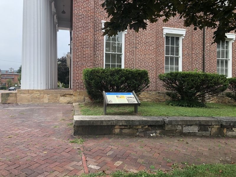
Lynching in America
Racial terror lynching between 1865 and 1950 claimed the lives of thousands of African Americans and created a legacy of injustice that can still be felt today. Following the Civil War and the premature end of . . . — — Map (db m236875) HM
On North Centre Street, on the right when traveling north.
The De La Salle Christian brothers came to Cumberland in 1851 and opened an
elementary school as one of the very early establishments of the Christian brothers in the
United States in the first Carroll Hall on this property at the request of . . . — — Map (db m219218) HM
On Headquarters Drive, 0.3 miles west of M. V. Smith Road NE, on the right when traveling west.
This trail allows the hiker to experience Green Ridge State Forest in miniature. The trail follows ridges and valleys along mountain streams and crosses open fields. One section of the trail opens up into an expansive view of Town Hill and the . . . — — Map (db m95913) HM
On East College Avenue just west of Alley 35, on the left when traveling west.
In 1927, construction began for an auditorium-gymnasium and central heating plant. This building was officially named Allegany Hall in 1951 in honor of the institution's host county, and was eventually incorporated into the Guild Center complex in . . . — — Map (db m199903) HM
Near Center Street north of American Avenue, on the left when traveling north.
In 1957 Wendell D. Allen Residence Hall for men was completed. This building was named for the member of the State Board of Education who served in 1935, 1942, 1949, and 1956, and served as Board President 1952 - 1957. — — Map (db m134380) HM
Near Park Avenue at Center Street, on the left when traveling north.
In 1965, Brady Health Center was completed. This building was named for Angela Brady, graduate of State Normal School #2 at Frostburg and faculty member for 30 years. — — Map (db m152822) HM
Near East College Avenue west of Wood Street, on the left when traveling west.
In 1963, Cook chapel was completed. It was located in the former dining room of Frost Hall and named for Carrie Edith Ricketts Cook, an English Instructor, who taught from 1925 to 1937. — — Map (db m134384) HM
Near University Drive south of Planetarium Drive, on the left when traveling south.
In 1970, Dunkle Hall was completed. This building was named for John L. Dunkle, Principal and President of Normal School #2 at Frostburg State Teachers College from 1923 - 1944. — — Map (db m134528) HM
Near Braddock Street (Maryland Route 736) west of Park Avenue, on the right when traveling west.
In 1978, the Administration Building opened. This building was dedicated in 1982 as the Elisabeth Hitchens Administration building to honor a 40-year employee of the College. Hitchins was the institution's first registrar (1934) and the first . . . — — Map (db m134389) HM
On Environmental Drive north of Planetarium Drive, on the left when traveling north.
In 1965, the Jerome Frampton, Jr., library was completed. This building was named for the President of the State Board of Education. — — Map (db m134527) HM
On East College Avenue west of Wood Street, on the left when traveling west.
In 1919, Frost Hall opened. Named for Catherine Frost, the daughter-in-law of the founder of Frostburg, this was the first residence hall and was designated for Women. — — Map (db m134386) HM
On Braddock Street (Maryland Route 736) west of Park Avenue, on the right when traveling west.
In 1968, Fuller House was acquired by the college. This building is the former residence of William Fuller, grandson of one of Old Main's builders. — — Map (db m134387) HM
Near Environmental Drive north of Planetarium Drive, on the right when traveling north.
In 1960, Gunter Hall opened as the new student center. Named for William A. Gunter, local attorney and former president of both the State Board of College Trustees and State Board of Education, this building originally housed a dining hall, snack . . . — — Map (db m134378) HM
Near East College Avenue at Wood Street, on the right when traveling east.
Near this spot, a vibrant African American neighborhood existed prior to the construction of the Frostburg State University campus.
The name and spirit of Brownsville emerged in the late 19th century largely due to the courage and dedication . . . — — Map (db m199904) HM
Near University Drive north of Stadium Road, on the right when traveling north.
In 1976, the library opened as the fourth location for institutional book holdings. In 1990, this building was named as the Lewis J. Ort Library to honor local business man and philanthropist. — — Map (db m134529) HM
Near East College Avenue east of Maple Street, on the right when traveling east.
In 1954 Lowndes Hall was completed. This building was named for two members of the Lowndes family - Lloyd, former governor of Maryland, and his son Taster, former President of the Maryland Board of Education. — — Map (db m134530) HM
Near Center Street east of East College Avenue, on the left when traveling north.
The Nelson P. Guild Human Resources Center opened in 1986, incorporating several existing buildings: Alleghany Hall, the second Laboratory School, and Garrett Hall. The Center is named for Dr. Nelson P. Guild, sixth president of the University . . . — — Map (db m134526) HM
Near East College Avenue at Wood Street, on the right when traveling east.
Ground was broken for Old Main on June 27, 1899. It was completed in 1900. This building was originally known as the Normal School. The colloquial use of the phrase "Old Main" was confirmed with the building's dedication in 1957. — — Map (db m134383) HM
On East College Avenue at Wood Street, on the right when traveling east on East College Avenue.
Frostburg State College was founded as a "Normal" school (two-year institution) by an act of the Maryland General Assembly in 1893. The cornerstone for Old Main, first building erected for the college, was laid in 1899. The school opened in 1902 and . . . — — Map (db m134382) HM
On University Drive south of Planetarium Drive, on the right when traveling south.
In 1983, the Public Safety Building opened. This building was formerly the Lincoln School, a public school for African-American students. — — Map (db m134385) HM
On Braddock Street (Maryland Route 736) west of Park Avenue, on the right when traveling west.
Pullen Hall, opened in 1959, is named for Dr. Thomas G. Pullen, Jr., State Superintendent of Schools. The building originally served as the third location of the laboratory elementary school and now houses various student service departments. — — Map (db m134388) HM
Near Environmental Drive north of Planetarium Drive, on the right when traveling north.
In 1957, I. Jewell Simpson Residence Hall for women was completed. This building was named for the State Supervisor of Elementary Schools who served as the Assistant State Superintendent of Schools for Elementary Instruction. — — Map (db m134379) HM
Near Center Street south of Oak Street, on the left when traveling north.
In 1965, Lowell Martin Sowers, Sr., Residence Hall for men was completed. This building was named for the college science professor who taught from 1950 - 1961. — — Map (db m134525) HM
On 1st Street close to Uhl Street, on the right when traveling west.
Erected in 1912, the St. Michaels' Parish Hall served the members of St. Michaels' Church and the Frostburg Community for the past 100 years. As the St. Michael parish continued to grow at the end of the 19th century, a school was added in 1891. . . . — — Map (db m199917) HM
On Main Street (Maryland Route 36) at Union Street, on the right when traveling north on Main Street.
In 1929, Grove opened "Lefty's Place"—a duckpin and ten-pin bowling alley and pool hall located diagonally from Lefty Grove Memorial Park, on Union Street. He operated the establishment, with help during the baseball season, until 1961. . . . — — Map (db m139842) HM
On East Main Street (Maryland Route 36) just north of Dutch Row, on the left when traveling north.
Mary led the effort in forming the Lonaconing Furnace Park Association for preserving the Lonaconing Iron Furnace, now a historic landmark, and in establishing the community park at this location. Revered and beloved as a public school teacher for . . . — — Map (db m139086) HM
Central High School
1890 - 1975
With Love and Loyalty
The Alumni dedicates this memorial plaque to the Alma Mater
Semper Fidelis — — Map (db m215877) HM
Near St Patrick's Church Road east of New Row Road NW, on the right when traveling east.
This monument commemorates St. Patrick School that stood near this site from 1900 to 2001. The cornerstone and bricks are from the original school. — — Map (db m177376) HM
On West Street (Maryland Route 450) west of Church Circle, on the right when traveling west.
1984
Banneker-Douglass Museum
As the official museum of African-American history and culture for the State of Maryland, the Banneker-Douglass Museum is dedicated to discovering documenting, preserving and promoting . . . — — Map (db m114557) HM
On Smithville Street, 0.1 miles east of South Villa Street, on the left when traveling west.
This site was the first freestanding secondary school for all African American children in Anne Arundel County. Citizens groups, including the Stanton Parent-Teachers Association, led the charge for its construction. Bates opened its doors on . . . — — Map (db m157089) HM
On Smithville Street, 0.1 miles east of South Villa Avenue, on the left when traveling west.
Wiley H. Bates High School has a strength beyond bricks and mortar — its real foundation has always been its people. The last African American class to put on robes of purple and gold and receive their diplomas was the class of 1966, but . . . — — Map (db m157085) HM
Near Duke of Gloucester Street at Newman Street, on the right when traveling east.
As a Redemptorist, Father Seelos was stationed in Baltimore, Pittsburg, Annapolis, Cumberland Detroit and New Orleans. He preached missions and retreats throughout the country.
Father Seelos served here as Pastor of St. Mary's Parish in 1857 . . . — — Map (db m200103) HM
This montage is the collaborative effort of George "Lassie" Belt, children from the Stanton Community Center (listed below), and Artwalk curator, Sally Wern Comport. This artwork, part of the Annapolis 300 celebration, is at the entrance to the . . . — — Map (db m130944) HM
On Main Street at Compromise Street, on the right when traveling south on Main Street.
In the 1700s, the shore of Annapolis followed approximately along the line of buildings that now front Dock Street, Market Space, and part of Compromise Street—everything closer to the water is built upon fill. Through the next three centuries, . . . — — Map (db m114794) HM
On Boundary Road west of Buchanan Road, on the left when traveling east.
Greg Harlin's magnificent historical painting honors the maritime and military heritage of Annapolis and it's significant role in our modern day liberties. The artwork features one of American history's legendary frigates, the Ranger . . . — — Map (db m125120) HM
Class of 1873. While Instructor at the Naval Academy in 11879 made first accurate measurement of speed of light. Invented interferometer. First American scientist to receive Nobel Prize, for physics in 1907. Performed with Morley ether drift . . . — — Map (db m66015) HM
In memory of Japanese Ambassador Hirosi Saito who died in Washington on Jan 26, 1939 & whose remains were by order of President Franklin D Roosevelt conveyed on board the USS Astoria to his native land. In grateful appreciation of American . . . — — Map (db m70122) HM WM
Mahan Hall
------
Named in honor of
Rear Admiral Alfred Thayer Mahan USN
1840-1914
U.S. Naval Academy Class of 1859
President U.S. Naval War College — — Map (db m63567) HM
Near Taylor Avenue (Maryland Route 435) north of Melrose Street, on the right when traveling south.
"Not for self, but for country" is the motto of the USNA Class of 1966—it exemplifies the tie that eternally binds together our Class, a graduate's branch of service, the Naval Service as a whole.
As a Class, we were forged in the crucible . . . — — Map (db m127933) HM WM
Near State Circle at East Street, on the left when traveling north.
This is the oldest state building in Maryland. It was used by the commissioners for emitting bills of credit from 1730 to 1779; by the Treasurer of the Western Shore from 1779 to 1851; by the Maryland State Treasurer from 1852 to 1903; and has . . . — — Map (db m241674) HM
Preble Hall
dedicated to
Commodore Edward Preble, USN
1761-1807
Educator of Naval leaders and Commander of our squadron before Tripoli, 1803-04.
— — Map (db m114825) WM
On Compromise Street north of Newman Street, on the left when traveling north.
Sally Wern Comport's two dimensional artwork "Shaping a City" on the Newman Park fence celebrates the foundation of our city: the working class, its farmers, its watermen, factory workers, carpenters, other highly skilled tradesmen, and suppliers of . . . — — Map (db m114859) HM
Near Taylor Avenue (Maryland Route 435) north of Melrose Street, on the right when traveling south.
The Smedberg Gate, sponsored by the USNA Class of 1958, honors Vice Admiral William R. Smedberg, III, USN, USNA Class of 1926, who served as Superintendent of the U.S. Naval Academy from 1956 to 1958. His inspirational leadership was the catalyst . . . — — Map (db m127931) HM
Joe Hunt transferred to the Navy Academy after having already won an intercollegiate national title in doubles (1938) while attending USC. A member of the U.S. Davis Cup team in 1939, Hunt won the intercollegiate national title in singles in 1941 as . . . — — Map (db m114816) HM WM
On Cooper Road at King George Street, on the right when traveling east on Cooper Road.
The Naval Academy has had a goat as its mascot since 1890 when, according to legend, on their march from the ferry station at Highland Falls up the steep hill to West Point to play the first Army-Navy football game, the Naval Cadets (as they were . . . — — Map (db m6465) HM
On West Street (Maryland Route 450) at West Washington Street, on the right when traveling west on West Street.
"This is a Community Built on Brotherhood"
Janice Hayes Williams, Historian
This intersection of West and West Washington Streets is the gateway to the "Old Fourth Ward," Annapolis' historic African American . . . — — Map (db m114537) HM
On U.S. Naval Academy Bridge (Maryland Route 450) 0.2 miles east of Badger Road, on the left when traveling east.
A bridge has served this area since 1836 when a timber trestle bridge with a swing span was built across the Severn River. It was replaced with a concrete and steel low-level drawbridge in 1924. After more than 70 years it became necessary to . . . — — Map (db m22547) HM
[Inscription in dark circle on plaza deck.] Thurgood Marshall's first major victory in his life-long struggle for equality under the law for all Americans took place in the Maryland Court of Appeals which then stood near this memorial. In . . . — — Map (db m7706) HM
On Smithville Street just east of South Villa Avenue, on the right when traveling east.
This weeping cherry tree represents an important era in the evolution of Wiley H. Bates High School which, in the 1940s, offered many agricultural classes where crops and livestock were raised for its cafeteria and for sale to the community. The . . . — — Map (db m157078) HM
On Smithville Street, 0.1 miles east of South Villa Avenue, on the right when traveling east.
This space is dedicated to the distinguished generation of African American administrators, teachers, and students who transformed this site into the cultural center for all African Americans in Anne Arundel County. For this generation, and for you . . . — — Map (db m157083) HM
On Smithville Street, 0.1 miles east of South Villa Avenue, on the left when traveling west.
A devoted community advocate, Bates believed that education and enterprise were the keys to African American advancement. He assisted others in starting businesses, founded the Bates Kindergarten, and lobbied for the reconstruction of the Stanton . . . — — Map (db m157086) HM
On Severn Avenue at First Street, on the right when traveling east on Severn Avenue.
This is the oldest house in Eastport. For nearly 100 years it belonged to the Williams family.
Jonas and Louisa Williams and their eight children moved here in 1876. They used the first floor as a grocery store, selling homemade sauerkraut . . . — — Map (db m114880) HM
Near Taylor Avenue (Maryland Route 435) north of Melrose Street, on the right when traveling south.
Alumni Arch
in honor of
Captain William S. Busik
and all
Naval Academy Alumni,
Past, Present, and Future.
"Barnacle Bill" was an All-American standout on the Navy Football team until his accelerated graduation . . . — — Map (db m127946) HM
Cadet West Point 1832-6; Lieutenant U.S. Army 1836-7; Professor of Mathematics U.S.N. 1841—99. Brigadier General U.S.V. 1861-5; Naval Academy 1845-61 and 1866-71.
One of the founders of the Naval Academy, his life’s best years were devoted to . . . — — Map (db m108106) HM
On King George Street (Maryland Route 450) 0.2 miles east of Baltimore Boulevard (Maryland Route 450), on the left when traveling east.
Coach, counsellor and friend of the midshipmen, Max Bishop directed the baseball program at the Naval Academy for twenty-four highly successful years, from 1938 to 1962. His teams won 306 games while losing 143.
This plaque is erected here . . . — — Map (db m142374) HM
On Decatur Road west of Maryland Avenue, on the left when traveling east.
Sampson Hall
Named In Honor Of
Rear Admiral William Thomas Sampson, U.S.N.
1840-1902
Head of Department of Physics and Chemistry
Chief of Bureau of Ordnance
Superintendent, U.S. Naval Academy
Commander in . . . — — Map (db m114853) HM WM
On King George Street (Maryland Route 450) 0.2 miles east of Baltimore Boulevard (Maryland Route 450), on the right when traveling east.
"Terwilliger Brothers Field" at the United States Naval Academy's Bishop Stadium baseball complex was dedicated in 2007 in recognition of a generous contribution by J. Ronald "Ron" Terwilliger, USNA Class of 1963, and his brother CDR Bruce K. . . . — — Map (db m142373) HM
On King George Street west of Cooper Road, in the median.
Presented to the
United States Naval Academy
by the
Members of the Class of 1950
Initially on the occasion of their 30th Anniversary - April 1980
Updated yard/campus changes at their 50th Anniversary - April 2000 . . . — — Map (db m114813) HM WM
On George and Marion Phelps Lane at Vincent Street, on the right when traveling north on George and Marion Phelps Lane.
The "Little Red Schoolhouse"…
…built in 1816, was the first recorded classroom for colored children in the Parole area. This one-room school was located in the general area just north of the existing intersection of West Street and . . . — — Map (db m232508) HM
Near Mansion Ridge Road, 0.1 miles east of Mansion Woods Road, on the right when traveling east.
Iglehart
1708 Mansion Ridge Road
is listed on
National Register
of Historic Places
by the United States
Department of the Interior
c. 1811
— — Map (db m142375) HM
Near College Avenue (Maryland Route 450) at Prince George Street, on the left when traveling east.
To honor the three hundredth anniversary of the coming to Maryland circa 1652 of Alexander Magruder, founder and progenitor of the Magruder family in America, and to the men of his blood who have been students at St. John's College. — — Map (db m5417) HM
Near King George Street (Maryland Route 450) west of College Avenue (Maryland Route 450), on the right when traveling east.
In memory of Edmund Berkeley Iglehart Lieutenant U.S.A. Commandant of St. John's College 1907 - 1909 through whose untiring efforts this gymnasium was built — — Map (db m232483) HM
Near College Avenue (Maryland Route 450) at Prince George Street, on the left when traveling east.
This tablet was fixed on McDowell Hall in 1946 to commemorate the two hundred and fiftieth anniversary of the founding of King William's School. To this hall in 1785, in the second year of the foundation of St. John's College, came the . . . — — Map (db m5423) HM
Near College Avenue (Maryland Route 450) south of King George Street (Maryland Route 450), on the right when traveling south.
Max and Elke Schiff were Jewish immigrants from Minsk who settled in Annapolis in 1913. Their goal in coming to America was to provide a complete education for their seven children.
These direct descendants of Max and Elke attended St. . . . — — Map (db m232488) HM
On College Avenue at Prince George Street, on the right on College Avenue. Reported permanently removed.
St. John's College has a long, rich history dating back to the founding of our nation. Its earliest incarnation, a grammar or preparatory school named after King William III, was founded in Annapolis in 1696, one year after Maryland's capital was . . . — — Map (db m63410) HM
On Hammonds Lane, 0.2 miles west of Governor Ritchie Highway (Maryland Route 2), on the right when traveling west.
Brooklyn Park High School opened its doors in September 1954, with Slater W. Bryant, Jr. as its first principal. Sounds of construction echoed down hallways, as workers hurried to finish the new building. Before closing in 1990, the school had . . . — — Map (db m114459) HM
On Third Street at Chester Avenue, on the right when traveling north on Third Street.
Many African-American families settled here more than a century ago. these families, who have lived here for four generations, are the heart and soul of this neighborhood. Their religious, educational and cultural institutions are pillars of . . . — — Map (db m5653) HM
On Huber Road at Ernie Pyle Street, on the right when traveling north on Huber Road.
In compliance with instructions contained in a letter from Adjutant General of the Army, dated March 17, 1924, a School for Bakers and Cooks was established at Camp Meade in April of that year. Throughout its existence at the post, the school's . . . — — Map (db m19702) HM
On Chamberlin Avenue at 4th Street, on the right when traveling south on Chamberlin Avenue.
When Great Britain introduced tank warfare to the battlefields of World War I, the face of battle changed forever. By providing support to infantry attacks, the usefulness of tanks was proven. For this reason, on January 26, 1918, Brigadier General . . . — — Map (db m19703) HM
On Solley Road, 1.6 miles south of Fort Smallwood Road (Maryland Route 173), on the right when traveling south.
This historic school is a significant example of a Rosenwald School design and represents a landmark era in black education in the period before federal support of local education. The school was built in 1927 with funds raised by the local . . . — — Map (db m9035) HM
On Dorsey Road (State Road 176) 0.1 miles west of Arundel Mills Blvd / New Ridge Road (State Road 713), on the right when traveling west.
An African American community and church were established nearby in the mid 19th century. In 1918 the Benevolent Sons and Daughters of Abraham, a mutual aid society, purchased and donated land on this site for a two-room school which was built . . . — — Map (db m49729) HM
On Millersville Road, 0.9 miles east of Crain Highway (Maryland Route 3), on the right when traveling east.
Site of private high school for boys and girls. Its aim: “To create a love for labor, honesty and a high moral life.” Phil Moore Leakin, founder and first principle, taught in rented log house, later in one-story school erected at cost . . . — — Map (db m2881) HM
On Mountain Road (Maryland Route 177/648) 0.1 miles east of Freetown Road, on the right when traveling west.
Established in the mid 19th century on land owned by Capt. James Spencer, who served in the Union Army during the Civil War, Freetown illustrates the principles of self-sufficiency and cooperation typical of African American communities. The first . . . — — Map (db m13567) HM
On Berlin Avenue at School Road, on the right when traveling north on Berlin Avenue.
The Patapsco Park area, widely known as Pumphrey, is an historic African American enclave with roots dating to well before the American Civil War. The largely Black community remained homogeneous for many years and prided itself with . . . — — Map (db m240357) HM
On Belle Grove Road (Maryland Route 170), on the right when traveling east.
Completed in 1923 on Berlin Avenue under the Rosenwald Program, which was instrumental in the education of African Americans in the early 20th century. The fund provided matching grants for more than 5,000 schools, shops, and teachers' residences . . . — — Map (db m79728) HM
On Queenstown Road, 0.1 miles south of Kearneys Lane, on the right when traveling north.
Built in 1932 on land provided by Sarah and Oscar Gaither, this three-room school, rare for the area, was the last Rosenwald school built in this county. After school consolidation, the building housed the Sunnyside School and later the Quarterfield . . . — — Map (db m244473) HM
On East North Avenue (U.S. 1) east of North Calvert Street, on the right when traveling west.
"You didn't go to Poly, you joined it." Such is the proud attitude of many Baltimoreans associated with this school, long considered to have one of the best college preparatory programs in the country. Conceived in 1883, the school opened its . . . — — Map (db m135068) HM
The Good Shepherd in honor of: Lizette Woodworth Reese, Poetess, Grace Trunbull, Sculptress.
Dedicated by Eastern High School graduates in honor and memory of their teachers and alumni 1844-1986. — — Map (db m102703) HM
On Park Avenue south of West Lafayette Avenue, on the right when traveling south.
Classicist author of The Greek Way. A leader in women's day-schooling First headmistress of Bryn Mawr School. *** Alice Hamilton, M.D. 1869-1970 Founder of industrial hygiene, pioneer in removing lead from paint. Harvard's first woman . . . — — Map (db m6466) HM
On West Lanvale Street at Park Avenue, on the right when traveling east on West Lanvale Street.
Early advisor to the World Health Organization. New York City Health Commissioner. Long time dean of Johns Hopkins School of Hygiene and Public Health. — — Map (db m6581) HM
Welcome to the Memorial Garden of Family and Children’s Services of Central Maryland. In Honor of Families and Children and their strivings to succeed-enter to enjoy, reflect, celebrate, remember and heal.
Established September 3, 1998 on the . . . — — Map (db m101956) HM
619 entries matched your criteria. The first 100 are listed above. Next 100 ⊳