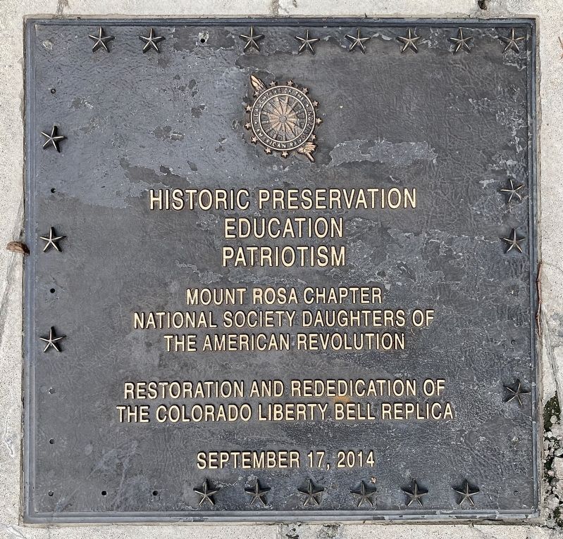
On Lincoln Street at 14th Avenue, on the left when traveling north on Lincoln Street.
Dedicated to you, a free citizen in a free land.
This reproduction of the Liberty Bell was presented to the people of Colorado
by direction of
the honorable John W. Snyder,
Secretary of the Treasury,
as the inspirational symbol of . . . — — Map (db m257734) HM
Near Washington Avenue, on the left when traveling north.
This marker commemorates the men and women who achieved American independence. These Patriots, believing the the noble cause of liberty, fought valiantly to found a new nation.
1775-1783 — — Map (db m305706) WM
This revolutionary soldier was donated by Greg and Sue Stevinson to honor the Golden Pioneer Museum's contribution to our community. The Son of Liberty stands as a tribute to our veterans and the freedoms they have provided to our country. — — Map (db m309541) WM
On East Kellogg Street 0.1 miles east of South Interocean Avenue (U.S. 385), on the right when traveling east.
This American Liberty Elm was named after "The Liberty Tree: Our Country's first Symbol of Freedom." On the morning of August 14, 1765, the people of Boston awakened to discover two effigies suspended from an elm tree in protest of the hated Stamp . . . — — Map (db m176792) HM WM
On Jonathan Trumbull Hwy (U.S. 6) at Hebron Road (Connecticut Route 136), on the right when traveling east on Jonathan Trumbull Hwy.
This Memorial is Erected
by the
Men and Women of Andover
To its Men Who Served
In the Military and Naval Forces
Of Their Country
In the Revolutionary, Civil, and
World War
1775 Revolutionary War 1781
John Buell · Abraham Burnap · . . . — — Map (db m207548) WM
On Bolton Center Rd at Hebron Rd, on the right when traveling east on Bolton Center Rd.
Bolton
French General Jean Baptiste Donatien de Vimeur, comte de Rochambeau, and thousands of French ground and naval forces Arrived in Newport in July of 1780 to assist the Americans in the War for Independence. After wintering in Newport, . . . — — Map (db m190090) HM WM
On Albany Turnpike (U.S. 44), on the right when traveling west.
On this site, in 1778, Phoebe Humphrey protected
her home from Hessian soldiers who were part of
Burgoyne’s captured army headed for Boston.
Because of her bravery, she became the namesake
of the Collinsville Chapter of the National Society
of . . . — — Map (db m94480) HM
On Lake Street at Monument Hill Road, on the left when traveling north on Lake Street.
Captain
Nathan Hale
1776
Born at Coventry
June 6, 1755
I only regret
that I have but one life
to lose
for my country
Died at New York
Sep 22, 1776 — — Map (db m12219) WM
On Lake St at Cross Street, on the left when traveling south on Lake St.
In grateful memory
Of those men of Coventry who gave
themselves unreservedly in the hour
of their country’s need
Among them was Nathan Hale
all might have echoed his immortal words
“I only regret that I have but one life to lose . . . — — Map (db m140941) WM
On Lake St at High Street, on the right on Lake St.
1781
This memorial was erected by
the citizens of Coventry to pay
tribute to the valor of General
Rochambeau and the soldiers of
his French Army who fought for
American Independence. Seven of
those courageous soldiers died
while on . . . — — Map (db m190089) HM WM
On Enfield Street (U.S. 5) at S. Road, on the left when traveling south on Enfield Street.
Thomas Abbey Born April 11, 1731. Died June 3, 1811.
A soldier in the French and Indian Wars. Took part in the capture of Fort Ticonderoga, 1758, and the conquest of Canada, 1761. Corporal First Regiment, Connecticut Troops, May 25 to . . . — — Map (db m113925) HM WM
On Farmington Avenue (Connecticut Route 4) at Main Street ( Route 10), on the left when traveling east on Farmington Avenue.
Lest We Forget
In honor and grateful remembrance of our French Allies in the Revolution, whose army, under the command of General Count de Rochambeau, marched past this spot enroute from Newport and Providence, R.I., to join General Washington on . . . — — Map (db m190186) HM
On Trinity Street south of Jewell Street, on the left when traveling north.
Israel Putnam (1718-1790), the legendary general of the French and Indian and Revolutionary Wars, is considered Connecticut's first authentic folk hero. At the outbreak of the Revolutionary War in 1775, at 57 years old, he is famous for riding 18 . . . — — Map (db m230347) HM
Near Main Street at Gold Street, on the right when traveling south.
[ east side ]
Deming In Memory Of
Capt. Pownal Deming
Son Of
David Deming & Mehitable Champion
Born Sept. 30, 1749
Died April 9, 1795
[ west side ]
An earnest patriot, he enlisted
in the Continental Army at the . . . — — Map (db m44066) HM
On Capitol Avenue at Trinity Street, on the right when traveling west on Capitol Avenue.
In Memory Of
Col. Thomas Knowlton
Of Ashford Conn.
Who as a boy served in several campaigns in the French and Indian Wars
Shared in the siege and capture of Havana in 1762
Was in immediate command of Connecticut troops at the Battle of . . . — — Map (db m52189) HM
On Main Street at Capitol Avenue, on the right when traveling north on Main Street.
Pulaski
"I came here, where freedom is being defended, to serve it, and to live or die for it . . ."
General Casimir Pulaski
was born in Poland in 1748. He led the unsuccessful revolt of Polish Patriots against Russia. Upon arrival in America . . . — — Map (db m52343) HM
Near Main Street near Central Row, on the right when traveling north.
Where You Are Standing
On September 20, 1780
Waits General George Washington,
Commander-in-Chief of the American Armies
During the American Colonies' Revolution
Against Great Britain.
He has come with Governor Trumbull and . . . — — Map (db m52783) HM
On Main Street at Gold Street, on the right when traveling north on Main Street.
George Washington
was entertained by
Colonel Jeremiah Wadsworth in his home on this site on June 30, 1775 when on his way to Cambridge to assume command of the Army.
On September 21, 22, 23, 1780 with Lafayette, General Knox and Governor . . . — — Map (db m151930) HM
Near Main Street at Atheneum Square, on the right when traveling north.
Col. Jeremiah Wadsworth
SAR Branch Connecticut
Erected MCMXIII
Here stood the home of Col. Jeremiah Wadsworth Commissary General of the American forces in the War for Independence and a trusted friend of George Washington and "Brother Jonathan . . . — — Map (db m52427) HM
Near Main Street near Central Row, on the right when traveling north.
Jonathan Trumbull
Where You Are Standing
From 1768 to 1784
Jonathan Trumbull guides the people of Connecticut
to independence as the colony's Royal Governor.
Governor Trumbull is the only colonial governor
to stand with the patriots . . . — — Map (db m52782) HM
On Central Row at Main Street, on the right when traveling west on Central Row.
Marquis de La Fayette
Where You Are Standing
On September, 1824
Arrives the Marquis de La Fayette in Daniel Wadsworth's carriage drawn by four white horses. Hartford's citizens shout hurrahs, wave banners and throw garlands of flowers at the . . . — — Map (db m43767) HM
Near Main Street at Central Row, on the right when traveling north.
This tablet commemorates the historic first meeting of General George Washington and General Comte de Rochambeau, commander-in-chief of the French army in America, which took place September 20, 1780.
On that occasion and in a subsequent meeting . . . — — Map (db m52914) HM
On Tower Square just west of Prospect Street, on the right when traveling west.
Jeremiah Wadsworth was Commissary-General in the Continental Army. His house which stood at the present site of the Wadsworth Atheneum was the meeting place for many leaders of the American Revolution, among them Washington, Lafayette, and . . . — — Map (db m151929) HM
On American Row at Main Street, on the right when traveling west on American Row.
Washington – Rochambeau Revolutionary Route
Hartford
French General Jean Baptiste Donatien de Vimeur, comte de Rochambeau, and thousands of French ground and naval forces arrived in Newport in July of 1780 to assist the Americans . . . — — Map (db m43739) HM
On Capitol Avenue at Washington and Lafayette Streets, in the median on Capitol Avenue.
A true friend of Liberty, who served as a Major General in the Continental Army with “all possible zeal, without any special pay or allowances” until the American colonists secured their freedom, and whose frequent visits to this State, as Aide . . . — — Map (db m3888) WM
On Columbus Boulevard at Arch Street, on the right when traveling south on Columbus Boulevard.
This plaque and the renaming of this bridge honor the Revolutionary War hero and distinguished citizen of Connecticut, Thomas Y. Seymour. Seymour, who later rose to the rank of Major in the Continental Army, was born June 19, 1757, the eldest . . . — — Map (db m52560) HM
On East Street 0.1 miles south of Allen Street, on the right when traveling south.
About thirty feet from this spot
stood the house in which
Brig. Gen. John Patterson
was born in 1743 - 4
Member of two Provincial
Congresses from Lenox Mass.
Leader in the War of Independence
Distinguished Jurist and Member of . . . — — Map (db m41611) HM
On Eddy Glover Boulevard at Commonwealth Avenue, on the right when traveling north on Eddy Glover Boulevard.
In Commemoration Of The
Bi-Centennial Anniversary Of The Birth Of
George Washington
These Trees Are Dedicated
Thanksgiving Day, November 24, 1932
Participating Organizations
American Legion, Eddy Glover Post No. 6 • American Legion . . . — — Map (db m221828) HM
On Burritt Street at Clinton Street, on the left when traveling north on Burritt Street.
Born 1746 Died 1817
Brigadier General
Tadeusz Kosciuszko
Born in Poland 1746. Fought in Revolutionary War
'Engineers' at Saratoga, New York, Charleston,
Yorktown, erected fortifications at West Point
Colonel and Adjutant to George . . . — — Map (db m41633) HM
Near Hopmeadow Street (Connecticut Route 10) at Station Street, on the left when traveling north.
1775 – 1783
We, the people of the Town of Simsbury, do hereby recognize the many hardships and countless sacrifices made by those brave American Revolutionary Soldiers; especially those from Simsbury, who died for our freedom from England. We . . . — — Map (db m88058) WM
Just to the south, on route 10, is Abigail’s, originally called the Pettibone Tavern.
Jonathan Pettibone built the first Pettibone Tavern about 1780 and, after it was largely destroyed by fire, rebuilt it in 1801. The large chimney stack is thought . . . — — Map (db m141164) HM
Near Flanders Street at Queen Street ( Route 10), on the right when traveling west.
Near this spot stood the first
meeting house of this town
from 1726 – 1757
This stone is also a memorial
to our Revolutionary soldiers — — Map (db m34236) HM WM
On Marion Avenue at Burritt Street, on the right when traveling north on Marion Avenue.
Rochambeau
Lieut. General
Commanding
The Auxiliary French Armies
Under
Washington
July 10, 1780 Jan 11, 1783
Rochambeau's letter to Congress
"We are your brothers. We shall
conduct ourselves as such with you.
We shall fight . . . — — Map (db m33706) HM
On Main Street (Connecticut Route 10) at Grove Street, on the left when traveling north on Main Street.
Southington
French General Jean Baptiste Donatien de Vimeur, comte de Rochambeau, and thousands of French ground and naval forces arrived in Newport in July of 1780 to assist the Americans in the War for Independence. After wintering in . . . — — Map (db m165804) HM
On Hyde Avenue (Connecticut Route 30) at East Street, on the right when traveling west on Hyde Avenue.
In grateful memory
of
★ General ★ Lafayette ★
whose love of liberty brought him to American shores and dedicate his life and fortune to the cause of the colonies, the Sabra Trumbull Chapter, Daughters of the American . . . — — Map (db m230443) HM WM
On Quaker Lane South at New Britain Avenue ( Route 173), on the right when traveling south on Quaker Lane South.
A group of elm trees formerly stood in a small triangle in the intersection of Quaker Lane South and New Britain Avenue, the old south road to Farmington. Ebenezer Faxon and other residents in southern West Hartford planted the elm saplings to . . . — — Map (db m66286) HM WM
Through the dedicated efforts of the Elmwood Business Associates and the West Hartford Lions Club, this park was established where the great stand of elms, from which Elmwood took its name, once grew. They were planted to commemorate the victory of . . . — — Map (db m66287) HM WM
On South Main Street south of Farmington Avenue, on the right when traveling north.
Reverend Lemuel Haynes
July 18, 1753-September 28, 1833
First African-American ordained as a minister in a mainstream Protestant church
Internationally recognized for his writings on freedom and republicanism
Lemuel Haynes was born in . . . — — Map (db m290911) HM
On North Main Street near Loomis Drive, on the right when traveling north.
Revolutionary War
provision cart driver
Managed estate
m. Rachel, father to Henry
Enslaved here
Freed 1780
Black governor 1780-84 — — Map (db m292858) HM
On North Main Street north of Loomis Street, on the right when traveling north.
In honor of
Revolutionary War patriot
Sarah Whitman Hooker Collins
Gave material aid - CT
Born 27 Feb. 1747 West Division Par., Hartford, CT
Died 6 Jan. 1837 West Hartford, Hartford, CT — — Map (db m296916) WM
On North Main Street north of Loomis Drive, on the right when traveling north.
To perpetuate the memory of these soldiers who fought in the American Revolution, buried in West Hartford
John Allen • Jonathan B. Balch • Henry Brace • Gideon Butler • Aaron Cadwell • Joseph Cadwell • Seth Collins • Gideon Deming • Theron . . . — — Map (db m290907) WM
On Main Street at Marsh Street, on the left when traveling north on Main Street.
This Plaque is Dedicated by
The Society of the Cincinnati
to
General George Washington
Who Was Its First President.
Samuel Blatchley Webb
Who Grew Up In This Home
The Comte De Rochambeau
Who Visited Here
and
The Marquis De . . . — — Map (db m46146) HM
On Main Street near Marsh Street, on the right when traveling north.
Washington – Rochambeau Revolutionary Route
Wethersfield
French General Jean Baptiste Donatien de Vimeur, comte de Rochambeau, and thousands of French ground and naval forces arrived in Newport in July of 1780 to assist the . . . — — Map (db m46299) HM
On Main Street at River Road, on the right when traveling north on Main Street.
During the 18th century shipbuilding and maritime trade were dominant industries in Wethersfield. The height of the trading period with the West Indies was prior to and following the American Revolution. Merchants, shipmasters and sailors . . . — — Map (db m302060) HM
On Main Street at Hart Street, on the right when traveling north on Main Street.
Famous as a hostelry during the Revolutionary War stood here
Washington and Rochambeau's retinue were quartered here during the Yorktown Conference held at the Webb-House May 19 to May 24 1781 — — Map (db m302057) HM
Near Old Post Road at Penfield Road, on the right when traveling north.
Peter Burr, chief justice of the Superior Court of colonial Connecticut, built the Burr Homestead around 1732. He passed it on to his grandson Thaddeus Burr and his wife Eunice Dennie Burr after their marriage in 1759. In 1775, the Homestead . . . — — Map (db m203754) HM
On Old Post Road 0.1 miles west of Beach Road, on the right when traveling east.
Home Of
Thaddeus And Eunice Dennie Burr
Here
Dorothy Quincy and John Hancock
President
Of The Continental Congress
Were Married in 1775
Burned By British in 1779
Rebuilt in 1790 — — Map (db m27371) HM
On Old Post Road at Beach Road, on the left when traveling south on Old Post Road.
This boulder commemorates
the settlement of Fairfield
by Roger Ludlow in 1639
and the burning of the Town
by the British July 8, 1779.
From the founding of the Town
the religious, military and civic life
of the people
has centered . . . — — Map (db m27227) HM
On Beach Road at Sunnieholm Drive, on the left when traveling west on Beach Road.
1775 1783
In everlasting memory
of the Patriots and Soldiers of
Fairfield who served in the War
of the American Revolution
———
Erected by the Eunice Dennie Burr Chapter
Daughters of the American Revolution
A.D. . . . — — Map (db m27171) HM
Near Old Post Road at Beach Road, on the right when traveling north.
Welcome to Fairfield’s Historic Town Green
How Did This Green Come to Be? Most New England towns began with a central common "green." Where you are standing is Fairfield's historic center and is as old as the town itself. In 1639 Roger . . . — — Map (db m204367) HM
On Bronson Avenue 0.1 miles north of Verna Hill Road, on the right when traveling north.
In memory of the
men of Greenfield Hill
who fought in
the American Revolution
John Alvord • Benjamin Banks 4th • Daniel Banks • David Banks • Ebenezer Banks Esq. • Ebenezer Banks • Elijah Banks • Eliphalet Banks • Gershom Banks • Gershom . . . — — Map (db m27420) HM
On Bronson Avenue 0.1 miles Verna Hill Road, on the right when traveling north.
Site of "Verna"
Home of Timothy Dwight
Chaplain in Continental Army
Pastor of Greenfield
Founder of Academy
Poet of "Greenfield Hill"
President of Yale 1795 - 1815 — — Map (db m27421) HM
On Connecticut Turnpike (Interstate 95 at milepost 21) east of Mill Plain Road, on the right when traveling south.
In 1776, Connecticut needed money. The General Assembly directed Timothy Green to print this paper currency.
When the Revolutionary War began, the Connecticut Colony's economy was precarious. Coins were scarce. On June 7, 1776, the . . . — — Map (db m311725) HM
On Monroe Turnpike (Route 111) at Moose Hill Road, on the right when traveling north on Monroe Turnpike.
The
Rochambeau
Route
1781 – 82
In the Vicinity
French Troops Under
Duc De Lauzun
Enroute From Newport
To Yorktown
Encamped During
June 29 Through
July 1st 1781
Erected by The
Sons of the American Revolution
Gen. Gold . . . — — Map (db m190233) HM
[Left Plaque]
In honor of
the men and women
who planted in the wilderness
the early homes of Stratford,
who fought bravely and suffered patiently
in the War of the American Revolution,
and who left to their descendents
a . . . — — Map (db m26099) HM
On Academy Hill 0.1 miles east of Main Street ( Route 113), on the left when traveling east.
American
Revolutionary War
1775 –– 1783
Dedicated to the brave Patriots
from Stratford who participated
in the struggle to achieve our
Independence
Killed in battle
Zachariah Blakeman
William Thompson
David Wooster . . . — — Map (db m25773) HM
On Huntington Turnpike (Connecticut Route 108) at Shelton Road, on the right when traveling north on Huntington Turnpike.
The northwest farmers of Stratford formed the Village of Unity in October, 1725. They united in 1744 with the Long Hill parish of the Stratfield section of Stratford to become the Society of North Stratford. The Society controlled its own religious . . . — — Map (db m88049) HM
On Cow Hill Road at Airline Road, on the right when traveling south on Cow Hill Road.
The American Liberty elm was named after "The Liberty Tree": Our Country's First Symbol of Freedom. On the morning of August 14, 1765, the people of Boston awakened to discover two effigies suspended from an elm tree in protest of the hated Stamp . . . — — Map (db m264943) HM WM
On Millington Road (Connecticut Route 434) 0.1 miles Tater Hill Road, on the left when traveling west. Reported permanently removed.
Side A 1714-1789
Near this Green was the site of
the General’s Farm, Store
and dwelling house
Side B
1714-1789
Officer in the French & Indian
and Revolutionary Wars
Delegate to the Continental Congress . . . — — Map (db m101985) HM
On Millington Road (Connecticut Route 434) at Tater Hill Road, on the right when traveling east on Millington Road.
Near this green was the site of the general's farm,
store, and dwelling house
This marker was originally
erected in 1976 by the East Haddam Bicentennial Commission
Maj. General Spencer was an officer in
the French & Indian and . . . — — Map (db m280515) HM
On Main Street (Connecticut Route 149), on the right when traveling south.
Nathan Hale
Scholar • Teacher • Soldier • Martyr
Born Coventry Connecticut, June 6, 1755
Graduated from Yale, 1773
Taught in this
"Little Red School House at the fork in the road"
from November 1, 1773 until May, 1774
Gave his . . . — — Map (db m281550) HM
On Old Shore Road at Buttonball Road, on the right when traveling west on Old Shore Road.
Soldier, mariner, fiddler
Enslaved
by Gov. Matthew Griswold
Baptized 1755, sold 1775
Served in
Revolutionary War
to gain his freedom — — Map (db m280542) HM
On Lyme Street at Academy Lane, on the left when traveling north on Lyme Street.
Born a short distance from this place, he later practiced law here
Responded to the Lexington Alarm as a colonel in April, 1775. Retired as a major general in July, 1782. Charter member, American Union Lodge, and master thereof, 1779. Elected . . . — — Map (db m268089) HM WM
Near College Street (Connecticut Route 154) east of Fenwick Street, on the left when traveling east. Reported permanently removed.
Ever since Adrian Block's discovery of the Connecticut River in 1614, the extensive bar at its mouth has been an obstacle for mariners, preventing vessels of deep draft from entering. The runoff from the source of the river in Canada traveling . . . — — Map (db m182715) HM
On College Street (Connecticut Route 154) west of Bridge Street ( Route 154), on the right when traveling west.
Ever Since Adrian Block's discovery of the Connecticut River in 1614, the elusive bar at its mouth has been an obstacle to mariner, preventing vessels of deep draft from entering. The runoff from the source of the river in Canada . . . — — Map (db m227281) HM
On Connecticut Turnpike (Interstate 95 at milepost 66) west of Spencer Plains Road ( Route 166), on the right when traveling east.
Benedict Arnold was a Continental Army general before he defected to the British. In response, Americans burned Arnold in effigy.
Arnold was born in Norwich, CT in 1741 and became a merchant in New Haven. After the Sugar and Stamp Acts . . . — — Map (db m311715) HM
On Boston Post Road (U.S. 1) at Essex Road, on the right when traveling south on Boston Post Road.
This community was settled in 1648 as Pochoug, an Indian word meaning "at the confluence of two rivers", the Pochoug and the Menunketesuck, by residents of the Saybrook Colony. Pochoug was the dwelling place of Obed and his tribe until 1676. The . . . — — Map (db m246369) HM
On Elm Street (Connecticut Route 243) at Platt Street, on the right when traveling north on Elm Street.
American Liberty Elm
Dedicated by the Derby Historical
Society July 10, 2002
on the 250th Anniversary of the
Birth of General David Humphreys
1752 – 1818
Sponsored by
The City of Ansonia — — Map (db m25567) HM
On Wakelee Avenue at Pork Hollow Street, on the right when traveling north on Wakelee Avenue.
Pork Hollow. Near this spot where hidden military stores belonging to the army of the Revolution during Tryon’s raid through Connecticut. — — Map (db m29526) HM
On Main Street South (Route 61) at West Road, on the left when traveling north on Main Street South.
In memory of
the citizens of Bethlehem
who fought for the defense of our rights
and the independence of our country
1776 – 1781
Andrew Martin, Capt. • Enos Hawlley, Lieut. • Nat’h Chapman, Ens • Alex’ Kasson, Clerk • John Steel, . . . — — Map (db m26561) HM
On Memorial Boulevard 0.2 miles east of East Street, on the right when traveling west.
In Memory Of The
Revolutionary War Patriots
Who Sacrificed Their Lives
And Fortune For Their Country
Placed By
Katherine Gaylord Chapter
Daughters Of The American Revolution
1964 — — Map (db m221637) HM
On Bellevue Avenue at Queen Street, on the left when traveling north on Bellevue Avenue.
[ east side ]
Nathan Hale
1755 – 1776
The Connecticut Patriot
Whose Last Words Were
I Only Regret That I
Have But One Life To Lose
For My Country
[ south side ]
Erected in Memory Of
Henry G. Bartley . . . — — Map (db m34243) HM
On Whittemore Road (Connecticut Route 188) at Village Green, on the left when traveling west on Whittemore Road.
Middlebury Honors Those Who Have Served
In The Wars Of Their Country
French – Indian War
Abner Munson
Revolutionary War
David Abbott, Benjamin Bemont, Aaron Benedict, Enos Benham, Samuel Benham, Edward Blackman, Michael Bowers, . . . — — Map (db m29503) WM
10066 entries matched your criteria. Entries 101 through 200 are listed above. ⊲ Previous 100 — Next 100 ⊳