On State Highway 21 at East Lake Forest Drive, on the right when traveling east on State Highway 21.
Concern for the safety of westward-bound emigrants became more immediate when news of the Utter party's disastrous confrontation with hostile Indians on September 9 and 10, 1860, reached western settlements. Colonel George Wright, commander of . . . — — Map (db m119004) HM
On West Main Street, 0.1 miles east of South 2nd Street, on the right when traveling east.
Legendary mule packer Jesus Urquides was a Boise pioneer and founder of a freighting business located on this site.
Born January 18, 1833 in Sonora, Mexico, Urquides migrated to the California gold fields in 1850 where he worked as a mule packer . . . — — Map (db m110694) HM
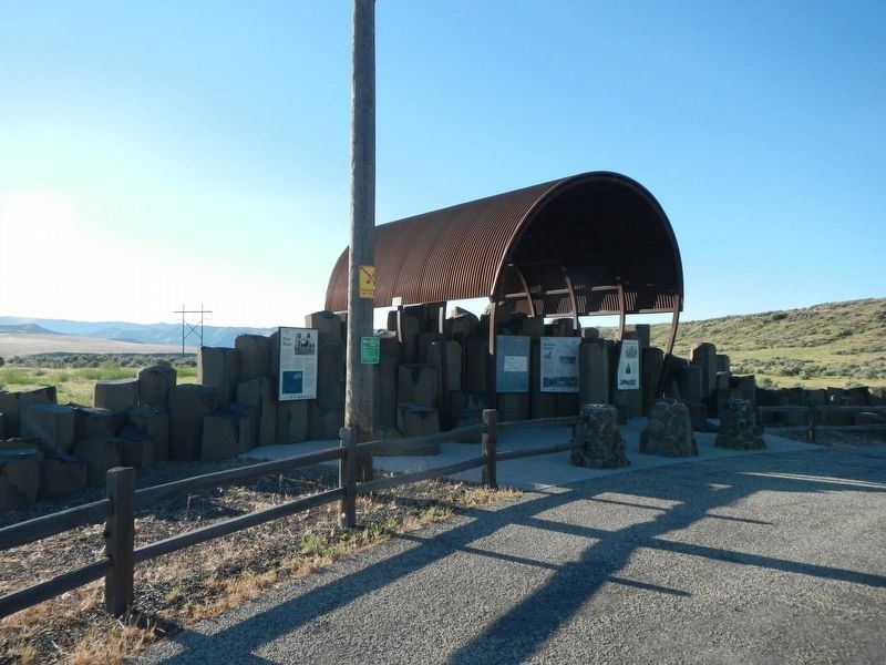
On South 5th Avenue at South 4th Avenue, on the left when traveling north on South 5th Avenue.
Chief Pocatello - Born in a Time of Change
It is hard to imagine the change Pocatello saw during his lifetime, and the challenges to his people's way of life to which he was forced to respond.
Early Life
Pocatello was . . . — — Map (db m108331) HM
On U.S. 20 at milepost 148 near Washington/Wheat Ranch Road, on the left when traveling west.
Angered by white encroachment on Camas Prairie lands which had been guaranteed to the Bannock Indians by treaty, Buffalo Horn's band went to war May 30, 1878
Trouble had been brewing on the reservation for years, and the government had . . . — — Map (db m110141) HM
On Lincoln Road, 0.2 miles east of Middleton Road, on the left when traveling east.
Only 2 young boys survived the Indian attack on Alexander Ward's 20 member party, Oregon bound on August 20, 1854. Military retaliation for the slaughter so enraged the Indians that Hudson's Bay Co. posts Fort Boise and Fort Hall had to be . . . — — Map (db m22328) HM
On South 3rd Street West near West 3rd Street South.
Floods of emigrants, gold seekers, and Mormon settlers entering the homeland of the Shoshone and Bannock people from the mid-1840s to early 1860s gave rise to conflict and often violent encounters. Despite Mormon effort to supply them with food, . . . — — Map (db m106723) HM
On South 3rd Street West near West 3rd Street South, on the right when traveling south.
Excitement and anxiety mounted as emigrants prepared to launch their ox-drawn prairie schooners from St. Joseph and Independence, Missouri - bustling river ports at the edge of the frontier in the 1840s. To them, the great, gray ribbon of the . . . — — Map (db m106710) HM
On Elba-Almo Road at 3000 South, on the right when traveling south on Elba-Almo Road.
Dedicated to the Memory
Of those who lost their lives in a most
Horrible Indian Massacre 1861
Three hundred immigrants west bound
Only five escaped — — Map (db m119536) HM
On A-2 Clark County Road (Main Street) near Old Highway 22, on the right when traveling east.
( six panels are located beneath the interpretive site shelter:)
A Region Where History Was Made
The scenic routes shown on this map will take you to several historic and scenic landmarks in northeastern Idaho. You will . . . — — Map (db m124526) HM
On A-2 Clark County Road (Main Street) near Interstate 15, on the left when traveling east.
When General O.O. Howard tried to get more than 600 Nez Perce Indians to settle on a North Idaho reservation in 1877, he ran into a lot of trouble here.
On their way to Yellowstone Park, Chief Joseph's Nez Perce people reached Hole in the . . . — — Map (db m124339) HM
On Custer Street (U.S. 93) near Capital Avenue, on the right when traveling north.
Mt. McCaleb, named for the Civil War veteran and local merchant, Jesse McCaleb, is the prominent 11,683 ft. peak visible north of MacKay.
In 1878, while helping escort supply wagons and arms to Challis, McCaleb and 13 others were attacked by . . . — — Map (db m140070) HM
Near U.S. 91 near Hot Springs Road, on the right when traveling north.
The four-hour fight left the Shoshone band decimated and terrified. Lodges, food caches and belongings were burned and women and children murdered. Chief Bear Hunter was cruelly tortured to death. When the killing ceased, the massacre field was . . . — — Map (db m165798) HM
Before dawn on the bitterly cold day of January 29, Shoshone leader Sagwich rose early to survey the area. As he looked toward the bluffs to the south he observed what seemed to be a mist of fog crawling down the bluffs across the river from the . . . — — Map (db m165797) HM
On U.S. 91 just south of Hot Spring Road, on the right when traveling north.
Very few Northwestern Shoshoni survived a battle here that turned into a massacre by Col. P.E. Connor’s California Volunteers.
In 1863, Conner and his force set out from Salt Lake City on a cold January campaign in response to friction between the . . . — — Map (db m165800) HM
On Highway 91 (State Highway 91) just south of Hot Spring Road, on the right when traveling north.
Attacks by the Indians on the peaceful inhabitants in this vicinity led to the final battle here January 29, 1863. The conflict occurred in deep snow and bitter cold. Scores of wounded and frozen soldiers were taken from the battlefield to the . . . — — Map (db m105785) HM
Near U.S. 91 near Hot Springs Road, on the right when traveling north.
The tensions between the Shoshone and the settlers eventually led to a call from Utah territorial leaders of help from the Army, but the Civil War was on and military resources were stretched thin. In 1861 the third California Volunteer Infantry has . . . — — Map (db m105801) HM
Near U.S. 91 near Hot Springs Road, on the right when traveling north.
End of a Way of Life
The delicate balance in which the Shoshone managed food resources for thousands of years was drastically altered by colonization. By the mid-1800s, the Oregon and California Trails brought thousands of pioneers and . . . — — Map (db m105799) HM
Near U.S. 91 near Hot Springs Road, on the right when traveling north.
Bia Ogoi - Big River
The Bear River -- called Bia Ogoi or Big River by the Shoshone people -- runs west and south through this semiarid valley, eventually emptying into the Great Salt Lake. The river and its many tributaries create . . . — — Map (db m105797) HM
On Highway 91 (State Highway 91) just south of Hot Spring Road, on the right when traveling north.
The Battle of Bear River was fought in this vicinity January 29, 1863 Col. P.E. Connor, leading 300 California volunteers from Camp Douglas, Utah against Bannock and Shoshoni Indian guilty of hostile attacks on emigrants and settlers engaged about . . . — — Map (db m105787) HM
Near U.S. 91 near Hot Springs Road, on the right when traveling north.
We cry for the loss and sacrifice of those who did not survive and we honor the strength of those who lived.
After the massacre, the survivors, now under Chief Sagwitch, were aided by other bands as they escaped southward. Most of the . . . — — Map (db m165799) HM
Near U.S. 91 near Hot Springs Road, on the left when traveling north.
Newe, The People
The Shoshone refer to themselves as Newe, the People. Their ancestral territory reached from the Wind River Range in western Wyoming to the middle of Nevada, and from the Salmon River in northeastern Idaho to central . . . — — Map (db m105795) HM
On Kilgore-Yale Road near U.S. 20, on the left when traveling west.
Two panels make up this marker:
Island Park describes the northern part of Fremont County from the top of the Ashton Hill to the Montana border. Within its borders is an ancient volcanic caldera that has been inactive for the last . . . — — Map (db m109006) HM
On U.S. 95 at Airport Road, on the right when traveling north on U.S. 95.
Following the Battle at White Bird Canyon on July 4, 1877, U.S. cavalrymen, entrenched nearby at Cottonwood, resisted attacks by Nez Perce warriors.
East of here on July 5, 1877, Nez Perce warriors created a strategic diversion by surrounding . . . — — Map (db m121140) HM
On U.S. 95 at Airport Road, on the right when traveling north on U.S. 95.
“I will not hide anything. That part of the fight was not long.” Yellow Wolf, Nez Perce warrior.
On July 3, 1877, 2nd Lt. Sevier M. Rains, civilian scout William Foster, and ten 1st cavalrymen rode from Norton’s ranch . . . — — Map (db m121142) HM
On U.S. 95 at Airport Road, on the right when traveling north on U.S. 95.
Erected in memory of the seventeen volunteers who engaged in battle with the Indians 2000 feet East from this point with two killed and three wounded the 5th day of July 1877 during the Nez Perce Indian War. Captain D.B. Randall, C.M. Day, James . . . — — Map (db m121144) HM
On Lolo Motorway (Forest Road 500) near Weites Butte Lookout Road, on the left when traveling west.
The Lewis and Clark Expedition passed through the valley of Hungery Creek in late September 1805, and on their return journey in late June, 1806. Five of the party's campsites are located in this valley to the south. Here you can see the extent of . . . — — Map (db m140826) HM
On U.S. 95 near Lake Road, on the left when traveling north.
Named for the blue flowering camas -- an important root food for all interior Northwestern Indians -- Camas Prairie is a traditional Nez Perce cultural center. Tolo Lake -- visible below -- provided a campground for Joseph’s Wallowa band and . . . — — Map (db m121138) HM
Near Lake Road near Tolo Lake Road, on the left when traveling south.
(Three panels outline the history of Tolo Lake)
The Nez Perce name for this lake is Tipahxlee’whum (Tepahlewam or Split Rocks). In early June 1877, five bands of Nimiipuu gathered here for their last taste of freedom before . . . — — Map (db m121267) HM
On U.S. 95 at milepost 227, on the right when traveling north.
Near the base of this hill, over 100 cavalrymen and volunteers met disaster in the opening battle of The Nez Perce War.
Rushing from Grangeville on the evening of June 16, 1877, Captain David Perry planned to stop the Indians from . . . — — Map (db m4643) HM
War has a way of making heroes and heroines of ordinary mortals. To some, Tolo, a Nez Perce Indian woman, was never ordinary. Her given name was Alab-lemot but because she loved to gamble, she was called Tolo which means "win" in the Chinook tongue. . . . — — Map (db m141246) HM
On U.S. 12 at State Highway 13, on the left when traveling east on U.S. 12.
(Four historical panels are located at the kiosk:)
The Lewis and Clark Expedition
The Lewis and Clark expedition known as the Corps of Discovery, passed through this area in September and October of 1805, on its way to find . . . — — Map (db m121344) HM
On U.S. 12, 0.5 miles east of State Highway 13, on the right when traveling east.
Looking Glass told army authorities: “Leave us alone. We are living here peacefully and want no trouble.”
But after a military attack, July 1, that destroyed his village, ruined his gardens and captured 750 Nez Perce horses, Looking . . . — — Map (db m109790) HM
Near U.S. 12 at Elk Meadows Road, on the left when traveling east.
On July 23, 1877, approximately 750 members of the Nez Perce Nation, with over 2,000 horses, crossed Lolo Pass to escape the pursuing U.S. Army. Leaving their homeland behind, they followed this trail across the Bitterroot Mountains in an attempt to . . . — — Map (db m123218) HM
On U.S. 12 at milepost 158 near Forest Road 1684, on the left when traveling west.
In July of 1877, nearly 800 Nimiipuu (Nez Perce) people traveled with heavy hearts across the Lolo Trail above you. They did not know if they would ever return to their homes. The women sang songs of sorrow and longing.
The journey began in the . . . — — Map (db m123163) HM
On State Highway 13 at milepost 21 near Stites Grade Road, on the left when traveling north.
After the Clearwater Battle on the heights above here, July 11-12, 1877, the Indians crossed the Lolo Trail to Montana.
Advancing northward along the high ground with 600 troops and artillery, General Howard found the Indians camped on . . . — — Map (db m121319) HM
On Lolo Motorway (Forest Road 500) near Liz Butte Road, on the left when traveling west.
The Lewis and Clark Expedition passed this site in late September, 1805. On their return journey in June 1806, they camped on the open hillside. The party has been traveling on top of several feet of snow in most areas so the grassy feed found here . . . — — Map (db m140792) HM
On Lolo Motorway (Forest Road 500) near Horseshoe Lake Lookout Road, on the left when traveling south.
"Our American horses were not used to the fodder of the native cayuse. We carried no forage. If we should chance upon one of the little mountain valleys where there should be grass, we found it either trampled down by Joseph's ponies or destroyed . . . — — Map (db m140784) HM
Near Old Highway 95 near Two Moon Trail, on the left when traveling north.
On the more distant of the ridges Lieutenant Theller halted and deployed his advance guard, at the same time sending word that the Indians were in sight. I immediately formed my company 'left front into line’ at a trot, gave the order to drop . . . — — Map (db m119505) HM
Near Old Highway 95 near Two Moon Trail, on the left when traveling north.
Five warriors, led by wet’itwe’tit hawalis . . . had been sent out . . . as a peace party to meet the soldiers. Of course they carried a white flag.
Peace might be made without fighting. -- himi'n maqsmaqs (Yellow . . . — — Map (db m119506) HM
On U.S. 95 near Trueblood Lane, on the right when traveling north.
(Three panels are located at this kiosk overlooking the White Bird Battlefield.)
We were marched into a deep canyon and to a country strange to us, and familiar to the enemy. If there was any plan of attack, I never heard of it. -- Sgt. . . . — — Map (db m121137) HM
Near State Highway 29 at milepost 13.6, on the left when traveling north. Reported missing.
This traditional Indian route provided access from Montana's buffalo country to Snake and Salmon river fishing streams.
Hudson's Bay Company trapping expeditions came this way after 1822 and prosectors followed searching for mines. Then in . . . — — Map (db m109408) HM
Near State Highway 28, on the left when traveling north.
Four panels in the Birch Creek Campground kiosk deal with the history of Birch Creek Valley
A Prehistory and History of
Lower Birch Creek Valley
a natural travel route between the Salmon River & the Snake River Plain . . . — — Map (db m109050) HM
Near Highway 28 near Haynes Creek/17 Mile Road, on the right when traveling north.
Whooping and yelling, Blackfeet Indians and white trappers "fought like deamons" in the defile before you in 1823.
After the Hudson's Bay Company trappers burned the Indians out of a strong position by starting a large brush fire, the . . . — — Map (db m109598) HM
On U.S. 12, 0.5 miles west of Dyche Road, on the left when traveling west.
The Lolo Trail winds its way along ridges of the Bitterroot Mountains from the Weippe Prairie in Idaho to the Bitterroot Valley at Lolo Montana.
This ancient travel route had served as a “Land Bridge” for a continental trade system used . . . — — Map (db m109776) HM
On U.S. 12, 0.3 miles north of Corbett Lane, on the left when traveling west.
This park links a series of widely separated sites of deep significance to the Nez Perce – historic villages, battlefields, and legend sites.
The park experience involves a journey across both time and territory.
Although firmly . . . — — Map (db m109994) HM
On Highway 78 near Bailey Street, on the left when traveling west.
Erected to the memory of the
Otter Massacre
1860
Forty four persons ambushed by Shoshoni Indians either killed or scattered. Most awful human experience. Site ten miles east on Sinker Creek. — — Map (db m110210) HM
On Murphy Grandview Road (State Highway 78) at Wees Road, on the left when traveling west on Murphy Grandview Road.
On September 9 & 10, the Utter Wagon Train engaged in a life-and-death struggle with attacking Indians.
The assault on the wagon train of forty-four emigrants led by Elijah P. Utter just north of here resulted in the death of six men, two . . . — — Map (db m110183) HM
On Wees Road near Nettleton Road, on the left when traveling north.
Near here the Elijah P. Utter wagon train was attacked by Indians on September 9 and 10, 1860. The two-day encounter resulted in the deaths of eleven emigrants and an estimated twenty-five to thirty Indians. The forty-four member train was composed . . . — — Map (db m110184) HM
Near Park Lane near Register Road, on the left when traveling west.
These reported incidents of Shoshone Indian attacks on emigrant wagon trains in this gap and surrounding area between 1851 and August 10, 1862, led to the naming of these rock outcrop as "Massacre Rocks."
The granite marker was dedicated by the . . . — — Map (db m124160) HM
Near Park Lane near Register Road, on the left when traveling west.
In this defile on August 10, 1862 a band of Shoshone Indians ambushed an Immigrant Train bound for Oregon killing nine white men and wounding six. — — Map (db m124159) HM
On Interstate 86 at milepost 30 near Register Road, on the right when traveling west.
Immediately west of here you will cross a small canyon that Oregon Trail emigrants regarded as their most dangerous exposure to Indians.
After 1854, they had good reason to be alarmed. Wagon traffic has ruined important traditional Indian . . . — — Map (db m124148) HM
On State Highway 33 near Creekside Meadows Avenue, on the right when traveling south.
Over 325 non-natives were in attendance. American Fur Company with 90 trappers; Rocky Mountain Fur Company with 100 men; several smaller fur companies and numerous free trappers joined 120 lodges of Nez Perce and 80 lodges of Flatheads. Trappers Jim . . . — — Map (db m108456) HM
On State Highway 55 at milepost 115 at Old State Highway, on the left when traveling south on State Highway 55.
While hunting stolen horses on Aug. 20, 1878, WM. Monday, Jake Groseclose, Tom Healy, & "Three Finger" Smith were ambushed in a rocky basin 9/10 mile by road from here.
Monday and Groseclose were killed immediately, and Healy wounded; Smith, . . . — — Map (db m23231) HM
On North Superior Street (U.S. 95) near West Hopper Avenue, on the left when traveling north.
This marker commemorates the Cuddy Mill.
Built by John Cuddy in 1869. Originally six miles north of here, at the foot of Cuddy Mountain. The General Howard Expedition against the Indians on the warpath under Chief Joseph had grain ground . . . — — Map (db m119371) HM