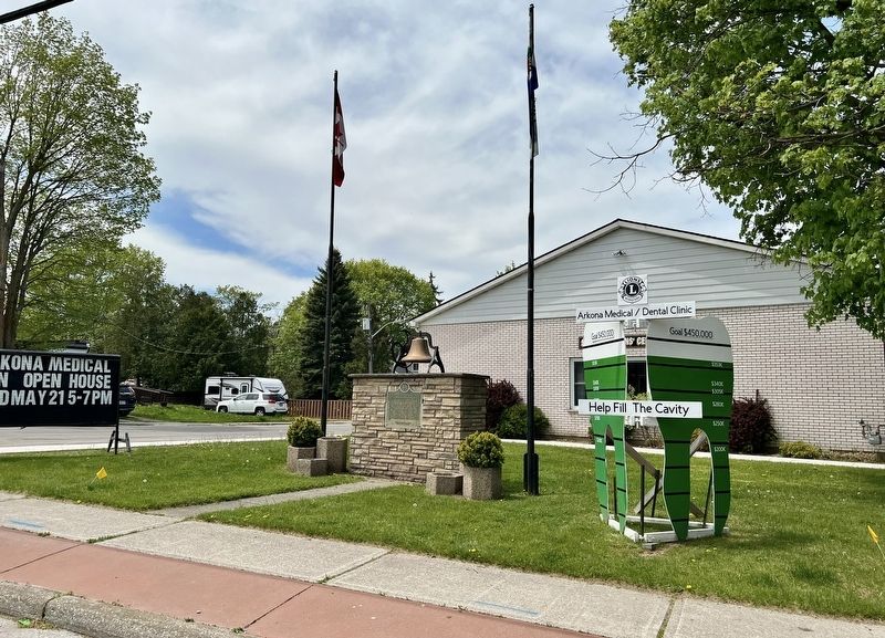
On Arkona Road (Lambton County Road 79) at Townsend Line, on the right when traveling south on Arkona Road (Lambton County Road 79).
By 1836 the earliest settlers on the site of Arkona, notably Henry Utter, Nial Eastman, and John Smith, had located in this vicinity. Within three years Utter, the first to arrive, had constructed a grist-mill around which a small community, the . . . — — Map (db m272868) HM
On Lyndoch Street 0.1 kilometers north of Hill Street, on the left when traveling north.
In 1823, an English explorative party came to survey this area as a possible location for the capital of Canada. They were in awe of a mighty forest on the eastern shore of the St. Clair River. The site was named Corunna, to commemorate the . . . — — Map (db m272638) HM
On Saint Clair Parkway at Church Street, on the right when traveling north on Saint Clair Parkway.
Froome (1807-1902) and Field (1815-74) Talfourd emigrated from England in 1832, and in the following year took up adjoining lots here in Moore township. Froome had previously served my H.M.S. Ariadne under Captain Frederick Marryat, the author. . . . — — Map (db m272669) HM
On Saint Clair Parkway at Church Street, on the right when traveling north on Saint Clair Parkway.
This site before you is what remains of St. Mary's Churchyard, built in 1840 with funds raised by
Froome Talfourd. This would be the only Church ever to be built in the village of Froomefield.
Originally an acre of land, it was donated by . . . — — Map (db m272673) HM
On Saint Clair Parkway 0.1 kilometers north of Thompson Street, on the left when traveling north.
At age 7, Stewart learned the rope trick "Knot of Enchantment" from "Boy's World" magazine, a Sunday School newspaper, published by the David C. Cook Publishing House in Elgin, Illinois. This is when Stewart began thinking seriously about magic. . . . — — Map (db m272609) HM
On Saint Clair Parkway at Thomson Street, on the left when traveling north on Saint Clair Parkway.
John George Stewart James (1908-1996) was born in Courtright and remained here his entire life. He lived in the house named "Aberystwyth" in honour of his family's place of origin in Wales. Stewart first performed magic at a public event in . . . — — Map (db m272579) HM
On Saint Clair Parkway 0.1 kilometers north of Thompson Street, on the left when traveling north.
Stewart James, who became known to magicians internationally. was born, raised and lived an outwardly simple life that defied his international reputation as "The Einstein of Magicians".
John George Stewart James (later given his mother's surname . . . — — Map (db m272607) HM
On Saint Clair Parkway 0.1 kilometers north of Thompson Street, on the left when traveling north.
Back from World War II, Stewart continued to create magic at a feverish pace, constantly discovering new principles in magic, with the help of the "Three Companions Who Never Were".
In 1956, Stewart became a rural mail contractor and . . . — — Map (db m272610) HM
On King Street West at The Rotary Way, on the right when traveling west on King Street West.
In 1858 Timothy Resseguie laid out the first village lots and the opening of a railway station here in 1859 on the recently completed Grand Trunk line from Guelph to Sarnia provided the nucleus around which this community grew. A general store was . . . — — Map (db m272866) HM
On Alberta Street at River Road, on the right when traveling west on Alberta Street.
Grand Bend derived its name from a hairpin turn in the Ausable (Aux Sables) River a short distance inland from Lake Huron where sand dunes blocked the river's outlet to the lake. Frequent flooding hampered farming in the region; . . . — — Map (db m272874) HM
On River Road at Alberta Street, on the left when traveling north on River Road.
It is without question that fishing was the first enterprise that newly arrived pioneers set upon in the early days of homesteading along the shores of the Great Lakes. Pioneers found the beautiful White Fish in abundance, fishing it foremost for . . . — — Map (db m272877) HM
On Emily Street at Victoria Street, on the left when traveling north on Emily Street.
This park located in Mooretown has been set aside to commemorate Canada's 150th anniversary (1867-2017). St. Clair Township is named for the St. Clair River which forms its western boundary. Lake St. Clair (Lac Sainte-Clair) and the St. Clair River . . . — — Map (db m272611) HM
On Emily Street 0.1 kilometers north of Victoria Street, on the left when traveling north.
The first block of land in Lambton County and the first township to be established within the bounds of the present St. Clair Township was purchased from the Chippewa First Nation by the Crown in 1796. It was named Shawanese Township and was known . . . — — Map (db m272613) HM
On Emily Street 0.1 kilometers north of Victoria Street when traveling north.
The Township of Moore
was incorporated in 1850 as part of
the County of Lambton, and celebrated
its 150th anniversary in the
millennium year 2000.
Prior to 1850, Moore Twp. was included
along with Sombra Twp. as part of
the original St. Clair . . . — — Map (db m272637) HM
Near Kelly Road close to Gum Bed Line, on the left when traveling south.
English
The presence of oil in this locality was observed by early travelers and by the pioneer farmers who used it for medical purposes. In 1858, near Oil Springs, James M. Williams dug the first oil well in Canada and later established a . . . — — Map (db m78424) HM
On Petrolia Line at Greenfield Street, on the right when traveling west on Petrolia Line.
The original Grand Trunk Railway Station was built in 1903. It was later bought by CN and the station closed in 1927. The Town of Petrolia opened its first official library here in 1937.
A commitment to maintain this designated heritage . . . — — Map (db m78422) HM
On Greenfield Street close to Petrolia Line, on the right when traveling south.
Following the discovery of oil at Oil Springs in 1857 prospectors extended their search to the entire township of Enniskillen. At the site of Petrolia, which contained two small settlements with post offices named Durance and Ennis, a well was . . . — — Map (db m78417) HM
On Greenfield Street close to Petrolia Line, on the right when traveling south.
English When Victoria Hall was built in 1889, Petrolia, in the midst of an oil boom, was one of the wealthiest towns in Canada. The opulent town hall reflects this stage in the town’s growth. While its first floor housed municipal offices, . . . — — Map (db m78421) HM
On Saint Clair Street at Michigan Avenue, on the left when traveling north on Saint Clair Street.
In 1838 John Slocum, a native of New York, established a
commercial fishery on the site of a former military reserve
here where the St. Clair River flows out of Lake Huron. The
area remained sparsely populated until 1859 when it became
the . . . — — Map (db m272778) HM
On Alexandria Avenue close to Michigan Avenue, on the left when traveling north.
The Commandant of the United States Coast Guard
Washington 20590
The Secretary of Transportation takes pleasure in presenting the
Gold Life Saving Medal to
Robert Earl Campbell
For acts as set forth in the following Citation
“For extreme . . . — — Map (db m197873) HM
On Alexandria Avenue at Michigan Avenue, on the left when traveling north on Alexandria Avenue.
First ship to sail Lakes Erie, Huron and Michigan, the “Griffon”, probably 40- 45 feet long, was built by Robert Chavelier, Sieur de La Salle, several miles above Niagara Falls in 1679. La Salle came to New France in 1667, became seigneur of . . . — — Map (db m197805) HM
This area marks the location of the earliest European
settlement of the Shawanese Township, which later
became Sombra Township. Francis Bâby (pronounced
"Baubee") moved here in 1815 and established a
settlement that would be known as Bâby . . . — — Map (db m272515) HM
On St. Clair Parkway 0.3 kilometers north of West Pointe Line, on the left when traveling north.
Maud Leonora Menten, was born in Port Lambton on March 20, 1879. This location marks the original Menten property. She graduated in medicine from the University of Toronto in 1911 and became one of the first Canadian women to receive a medical . . . — — Map (db m272551) HM
On St. Clair Parkway 0.4 kilometers north of West Pointe Line, on the left when traveling north.
Who could have imagined thousands of people travelling the St. Clair River on passenger ships?
In the late 1800s the era of steamships had arrived, carrying passengers and cargo. Two of the most famed fleets were the Red Star Line and the White . . . — — Map (db m272553) HM
On St. Clair Parkway at west Pointe line, on the left when traveling north on St. Clair Parkway.
Can you imagine Port Lambton with several hotels?
When settlers and visitors came to the area, they needed accommodations.
This inspired a vigorous hotel industry. The first hotels in this area were
established in Lambton County's first community . . . — — Map (db m272558) HM
On St. Clair Parkway 0.3 kilometers north of West Pointe Line, on the left when traveling north.
Who would think that along the St. Clair River between Port Lambton and Sarnia, Rum Runners were helping to quench the American thirst for alcohol?
The Volstead Act of Jan. 17, 1920 ushered in the era of prohibition. The act . . . — — Map (db m273790) HM
On Lambton Line at Dawn Mills Road, on the right when traveling east on Lambton Line.
Born on a nearby farm, Johnston became a co-founder and,
in 1915, the first president of the world's first Kiwanis
Club. He spent his childhood in this area, and in 1892
emigrated to Detroit, Michigan. Employed in the insurance
business, he . . . — — Map (db m284067) HM
On Lambton Line at Dawn Mills Road, on the right when traveling east on Lambton Line.
This bell chimed for 73 years at the Rutherford United Church, 4640 Lambton Line from 1937 to 2010. Members of the Prescott family and their descendants worshipped at the
Rutherford United Church. The bell was purchased and installed in accordance . . . — — Map (db m272400) HM
On Christina Street North 0.1 kilometers north of Charlotte Street, on the right when traveling north.
Constructed about 1861, this house is a fine example of a blend of several Revival styles termed Ontario Classic Architecture, popular throughout the province during the second half of the nineteenth century. It was built for John Mackenzie, a . . . — — Map (db m272771) HM
On Christina Street South 0.1 kilometers north of Clifford Street, on the right when traveling north.
Stimulated by the discovery of significant oil deposits in Enniskillen Township, Ontario's first commercial refineries were erected in 1857-62 at Sarnia, Oil Springs,
"Petrolea" and Hamilton. The industry, developed to produce coal-oil and . . . — — Map (db m272678) HM
On College Avenue North 0.1 kilometers south of George Street, on the left when traveling south.
The first woman to hold a vice-regal office in Canada, Pauline Emily Mills, was born in Sarnia, Ontario in 1910. After local schooling and a degree at Victoria College, University of Toronto, she married Donald Walker McGibbon in 1935. A . . . — — Map (db m272766) HM
Near Front Street North north of George Street, on the left when traveling north.
The Founding of Sarnia. The French-speaking families of Ignace Cazelet, Jean-Baptiste Pare and Joseph LaForge arrived here 1807-1810. Other settlers, many of Scottish descent, came in 1832-1834 folLowing the 1829 survey of Sarnia . . . — — Map (db m272729) HM
On Front Street North, on the right when traveling south.
The Honourable Alexander Mackenzie
The second Prime Minister
of Canada came to this country
from Scotland in 1842. He was a
contractor first at Kingston and
later at Sarnia, and constructed
a number of public buildings. . . . — — Map (db m272737) HM
On Saint Andrew Street 0.2 kilometers east of Christina Street South, on the left when traveling east.
The first international submarine railway tunnel in North America was built here, 1889-91, by the Grand Trunk Railway Company of Canada. It connects Sarnia with Port Huron, Michigan, To compete with U.S. railways for the lucrative Chicago and . . . — — Map (db m272707) HM
On Saint Andrew Street at Christina Street South, on the left when traveling east on Saint Andrew Street.
The St. Clair Tunnel
This was the first subaqueous tunnel in North America and one of the great engineering feats of the 19th century. Built in 1889-1891 to link the Canadian mainline of the Grand Trunk Railway with Chicago, the . . . — — Map (db m272708) HM
Near Hamilton Road at Wildwood Drive, on the left when traveling east.
In 1829 Henry Jones of Devon, England, a retired purser in the Royal Navy, brought a group of more than 50 emigrants from the United Kingdom to this area where he established a settlement on a 1,000 acre tract of land on Lake Huron. An early . . . — — Map (db m272851) HM
On Saint Clair Parkway at Forsyth Street, on the left when traveling north on Saint Clair Parkway.
On the morning of June 28, 1838, a group of armed
Americans and disenchanted Canadians crossed the St. Clair
River from Michigan and landed near Sombra. The raiders
plundered the general store and stole flour and oats from
the commissariat, then . . . — — Map (db m272577) HM
On Main Street at King Street, on the right when traveling east on Main Street.
In 1858, during the construction of the Grand Trunk Railway through this region, Nelson Southworth purchased land here on the line, donated a site for a station and laid out a village plot which he named Thedford. The hamlet which developed, . . . — — Map (db m272871) HM
On Warwick Village Road 0.4 kilometers south of London Line, on the left when traveling south.
Joseph Little came to Warwick Township from Ireland in 1833 to manage the estate of a large landowner. The poverty of many pioneers so shocked him that, indifferent to his own comfort, he gradually gave away his savings wages, clothing . . . — — Map (db m272859) HM