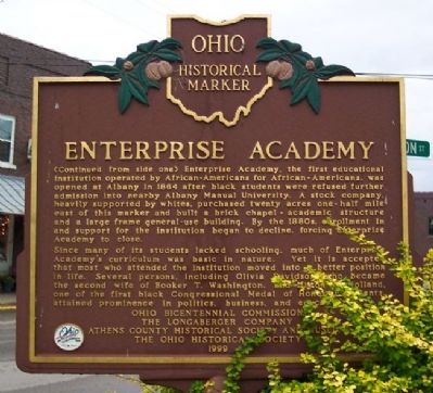
On West Clinton Street at Washington Road, on the right when traveling west on West Clinton Street.
Albany. The village of Albany was established in 1838 as a market center for the surrounding agricultural area, which saw its first white settlement in the early years of the nineteenth century. Education was always a major concern of Albany's . . . — — Map (db m52872) HM
On State Street (Ohio Route 550) 0.1 miles south of Main Street ( Route 329), on the right when traveling east.
Ohio was an incredibly important state to railroads; one of the nation's first opened in 1839, the Mad River & Lake Erie (a future component of the New York Central), and key cities were located there offering substantial business for the . . . — — Map (db m247090) HM
On State Street (Ohio Route 550) at Franklin Street, on the right when traveling east on State Street.
Over the years he contributed generously for the betterment of the village. His last bequest of land, building and money made the creation of this park possible. — — Map (db m15538) HM
On State Street (Ohio Route 550), on the left when traveling east on State Street.
Pioneers began arriving in Ames Township in 1797, making it one of the earliest settlements in the Northwest Territory. As early as 1804, the village purchased enough books to create a library. It is known today as the Coonskin Library because it . . . — — Map (db m15537) HM
On State Street at Main Street, on the right when traveling east on State Street.
It was all meant to be a joke. Alonzo Weed was unfit for the job, village citizens complained. He drank too much and had no respect for the office. But once the dust settled and the votes were counted, few were laughing: Amesville had just . . . — — Map (db m271190) HM
On State Street (Ohio Route 550) at Main Street ( Route 329), on the right when traveling east on State Street.
When Congress established the Northwest Ordinance in 1787, one of the provisions forbid slavery in any new future state admitted to the Union, north of the Ohio River. Later, Congress added to that ordinance, a law that made it a federal crime to . . . — — Map (db m247089) HM
On State Street (Ohio Route 550), on the right when traveling east.
In the years leading to Ohio statehood in 1803, Ames Township citizens decided to establish a stock-owned circulating library. Since cash was scarce during Ohio's frontier era, some citizens paid for their $2.50 shares by the sale of animal pelts, . . . — — Map (db m15540) HM
On North Court Street north of Washington Street, on the right when traveling north.
The Berry Hotel, one of America’s premier hotels, stood here from 1892 to 1974. Athenian Edward Cornelius Berry, a free black who had been educated at the Albany Enterprise Academy, and his modest wife, Martha Jane (Mattie) Berry, built, owned and . . . — — Map (db m122455) HM
On Union Street, on the right when traveling east.
The People of Athens County
erect
this monument
in memory of those who volunteered
as
Soldiers and Sailors
in defense of the Union
and to perpetuate
Free Government.
The People
will ever remember how much of
our national . . . — — Map (db m15558) HM
On Court Street at Washington Street, on the right when traveling south on Court Street.
To honor and commemorate
the Revolutionary Soldiers
buried in Athens County, Ohio
Daniel Anderson •
Thomas Arnold •
Isaac Barker •
Ebenezer Barrows •
Hopson Beebe •
Alvan Bingham •
Silas Bingham, Sr. •
William Bodwell •
John Bowman . . . — — Map (db m15544) WM
On Court Street at Washington Street, on the left when traveling north on Court Street.
Dedicated to the memory of
the Athens County residents
who lost their lives in Vietnam
November 1990
Richard A. Anders … 23
Joseph A. Bodnar … 22
Charles L Boling … 22
John W. Boyer … 27
Ronald L. Calentine … 20
Virgil L. Castle . . . — — Map (db m15546) WM
On East Washington Street 0.1 miles east of North Court Street, on the left when traveling east.
In the spring of 1797, Rufus Putnam sent eleven “substantial men ... possessing firmness of character, courage, and discretion” to found a settlement on the bank of the Hockhocking River. In 1800 the territorial legislature named the . . . — — Map (db m42163) HM
On Carpenter Street at North Court Street, on the left when traveling east on Carpenter Street.
In the first years of the twentieth century. Athens’ citizens formed
a new National Guard company. The guardsmen initially held drill
at the Campbell Block on Court Street, but soon the Athens
Commercial Club began advocating for an armory from . . . — — Map (db m122452) HM
On West State Street at Cemetery Lane, on the right when traveling west on West State Street.
Plaque A
In Memoriam
Civil War
James Bartlett •
James Brownlee •
John Bush •
John Buffington •
Rans Carpenter •
James Cambron •
Dave Carsey •
Thomas Day •
William Drake •
Henry Dean •
Capt. John Dean •
Chas. Finsterwald • . . . — — Map (db m173932) WM
Near Union Street at College Street, on the right when traveling east.
[Campus side of the marker]
In commemoration of the Bicentennial
of the
Northwest Ordinance of 1787
Ohio University, the first public university established in the Old Northwest Territory, was founded on the principles of the . . . — — Map (db m15635) HM
On West Washington Street, on the right when traveling west.
Front:
In this house, on 11 August 1886, famed African-American educator Booker T. Washington married Olivia A. Davidson. Residents at the time were Mary Davidson Elliott (sister of Olivia) and her husband Dr. Noah Elliott, a veteran of . . . — — Map (db m63680) HM
On South Shafer Street at Richland Avenue, on the left when traveling east on South Shafer Street.
On August 20, 1823, the Board of Trustees of Ohio University, of which Judge Ephraim Cutler was a leading member, set aside 300 acres “west of the College green” for a botanical garden and the site of a medical college, in memory of the . . . — — Map (db m10908) HM
On Richland Avenue just south of South Shafer Street, on the right when traveling south.
In tribute to Donald R. Johnson (1904-1973) who faithfully, devotedly and effectively served as secretary-treasurer of the Hocking Conservancy District
from its inception until the completion of the Athens Flood Protection Project (1972) of . . . — — Map (db m189702) HM
On Country Club Road (Local Road 559) south of State Route 56, on the left when traveling south.
Golfing greats Arnold Palmer and Jack Nicklaus first
met on the golf course at the Athens Country Club
in Athens, Ohio. The event was a celebration for
native son Dow Finsterwald, winner of the 1958
PGA Championship. Due to the significance of . . . — — Map (db m122477) HM
Near West State Street 0.1 miles west of North Lancaster Street, on the right when traveling west.
As a tribute to the loyalty,
faithfulness, and heroism of
Eliza Davidson
this memorial is erected by the
school children and citizens of
Athens County, June 14, 1934
Born a slave, emancipated, she became the faithful companion of . . . — — Map (db m173927) HM WM
On North Court Street just north of East Washington Street, on the right when traveling north.
This property
is listed in the
National Register
of Historic Places
by the United States
Department of the Interior
First Presbyterian
Church — — Map (db m189660) HM
On Court Street at Washington Street, on the left when traveling north on Court Street.
In Memoriam
Honoring the first settlers in Athens Co.
from the New England States
Alvan Bingman •
Silas Bingman •
Isaac Barker •
William Harper •
John Wilkins •
Robert Linzee •
Edmond Dorr •
William Dorr •
Barak Dorr •
John Chandler . . . — — Map (db m15545) HM
On West Carpenter Street at Mound Street, on the right when traveling west on West Carpenter Street.
A wandering planter of fruit trees in the wilderness, whose work has inspired following generations to plant trees and beautify Ohio. — — Map (db m271192) HM
On South Green Drive just east of Richland Avenue, on the left when traveling east.
Bicentennial Park was created in 2004 as part of the celebration of the bicentennial of the founding of Ohio University and was dedicated on May 30, 2004.
The most prominent feature of the 3.5-acre park, is the earthwork installation . . . — — Map (db m189705) HM
On South Shafer Street 0.1 miles east of Richland Avenue, on the left when traveling east.
Presented by President Kazuo Yamada Chubu Institute of Technology
In honor of the 175th anniversary of Ohio University and in recognition of the exchange program between Chubu Institute and Ohio University September 14, 1979 — — Map (db m189701) HM
On Park Place close to University Terrace, on the right when traveling east.
Keen and original in mind, honest and independent in thought, appealing and forceful as a teacher, he inspired his students with zeal for the truth. In grateful remembrance they placed this tablet. — — Map (db m189692) HM
On University Terrace 0.1 miles north of East Mulberry, on the right when traveling north.
This building is a gift to the alumni of Ohio University from Dr. and Mrs. Wilfred R. Konneker. Dr. Konneker, class of 1943, physicist, is a pioneer in nuclear medicine, former president of the alumni association, and a loyal friend of the . . . — — Map (db m189691) HM
On West Mulberry at South Court Street, on the right when traveling east on West Mulberry.
Lynching in America Following the Civil War, violent resistance to rights for and equality for Black Americans and an ideology of White supremacy led to fatal violence against Black women, men, and children. Thousands of Black people were . . . — — Map (db m173835) HM
Oldest building of the first institution for higher education of the Northwest Territory
This tablet is dedicated to honor
Manassah Cutler
1742 - 1823
Chaplain in the Revolutionary War
Minister, Physician, Scentist, Teacher and . . . — — Map (db m53820) HM
Memorial Auditorium stands as a testament to the dedication of Ohio University alumni, who raised funds for its construction. Completed in 1928, Memorial Auditorium was erected to honor those who have died serving our country; this includes past . . . — — Map (db m53845) HM
Near West Union Street (Ohio Route 56) east of Hospital Drive, on the left when traveling east.
(side A)
Born a slave in Texas on August 1, 1844, Holland was brought to the integrated Albany Manual Labor University in 1851 by his friend and owner where he learned the trade of shoemaker. He acted as a servant to Colonel Nelson Van . . . — — Map (db m173925) HM
On West Carpenter Street just east of North Congress Street, on the right when traveling west.
Beginning as a congregation in 1872 inside a private home, the first Mount Zion Baptist Church building in Athens was on Lancaster Street in 1876. Between 1905 and 1909, a thriving community of free-born and formerly enslaved Black Americans built . . . — — Map (db m248625) HM
On Richland Avenue at Plains Road ( Route 682), on the left when traveling south on Richland Avenue.
In honor of the War Correspondents who landed in Normandy, France, on D Day, June 6, 1944, with Allied Invading Forces; and others who joined them to report the Crusade Across Europe to bring freedom to that continent and the eventual end of a . . . — — Map (db m53863) HM
On Union Street at Court Street, on the right when traveling east on Union Street.
[Marker front]
Manasseh Cutler, Rufus Putnam, Winthrop Sargeant, and Benjamin Tupper of the Ohio Company conceived Ohio University, which was encouraged by the Ordinance of 1787 and the Northwest Territorial Legislature in 1799, . . . — — Map (db m15564) HM
On South Green Drive 0.1 miles east of Richland Avenue (U.S. 50), on the right when traveling east.
Ohio University’s Peden Stadium is the oldest of the Mid-American Conference stadiums and one of the oldest of its type in the country. It was dedicated in 1929 with a victory over Miami University. The stadium served as housing for the influx of . . . — — Map (db m42162) HM
On Union Street at Court Street, on the right when traveling east on Union Street.
The Ohio University Alumni Gate was built with funds contributed by many alumni, with the original intent of honoring the class of 1815, which was the first graduating class. The largest contribution, however, came from Edward C. Berry, a black man . . . — — Map (db m15562) HM
On University Terrace 0.1 miles south of East Union Street, on the left when traveling north.
Site of first Ohio University
building erected in 1807
Here Hon. Thomas Ewing
was graduated in 1815
One of the first two graduates — — Map (db m42164) HM
Susan Brownell Anthony
Woman Suffrage Leader
Visited October 19, 1878
"To secure both national and 'domestic tranquility,' to 'establish justice,' to carry out the spirit of our Constitution, put into the hands of all women....the . . . — — Map (db m53838) HM
On South Shafer Street 0.1 miles east of Richland Avenue, on the left when traveling east.
The blossoms of Ohio University's iconic cherry trees symbolize the arrival of springtime in Athens. The trees serve as a living commemoration of the University's longest institutional partnership, with Chubu University, located in Kasugai, . . . — — Map (db m189699) HM
College Green has served as a forum for the voices of Ohio University's students throughout its history. Whether supporting civil rights, advocating for the abolishment of women's curfews, or in protest, students have and will continue to play a . . . — — Map (db m15570) HM
The elm trees President McGuffey planted near this path in the 1840s stood for over 100 years. Their beauty is recalled each year when the community members gather for the Concerts under the Elms.
Dedicated by the Class of 2005 — — Map (db m15571) HM
Near East Union Street at South Court Street, on the right when traveling east. Reported missing.
The Kissing Circle holds fond memories for decades of Ohio University Alumni, and symbolizes our affection and dedication to one another. May it remind future students, as it has those of the past, of valued friendships formed here and inspire . . . — — Map (db m270499) HM
On Richland Avenue at South Shafer Street and South Green Drive, on the left when traveling north on Richland Avenue.
Silas Bingham arrived in Athens in 1797. His home, originally built on South College Street, is the oldest house in Athens and one of the few remaining examples of a two-story log building in the area.
Since the commissioners held meetings in . . . — — Map (db m10909) HM
On Park Place close to South Court Street, on the right when traveling east.
The Walter International Education Center is made possible through the generosity of Robert D. and Margaret M. Walter and Sigma Chi Fraternity. This location was the former site of the Sigma Chi chapter house from 1949 to 2003. — — Map (db m189694) HM
On West Union Street at Depot Street, on the right when traveling east on West Union Street.
"The river flows not past, but through us."
-John Muir
The beauty of Athen the derives and contaminating the ery, culling hills, and flowing waterways. Imagine its river, the Hocking, polluted with trash . . . — — Map (db m271193) HM
On West Union Street just west of Hockhocking Adena Bikeway, on the right when traveling west.
In memory of Capt. K.T. Crossen - Co. K. 102 Inf. A.E.F • Private James Gabriel-Co. L. 166 Inf.
Killed in action battles Chauteau-Thierre and Argonne Woods, France - 1918. — — Map (db m189658) WM
On Ohio Route 13 south of Main Street, on the right when traveling south.
In the first quarter of the nineteenth century, when the general public
believed that the insane and paupers could be rehabilitated into productive
citizens, the Ohio Legislature gave authorization to county commissioners
to establish county . . . — — Map (db m122758) HM
On West Bailey Road at Converse Street, on the right when traveling east on West Bailey Road.
In 1838, two capitalists from Philadelphia moved to southeastern Ohio and partnered with Thomas Ewing and Samuel Vinton to purchase a salt mining company nearby from Resolved Fuller. The settlement was named Chauncey in honor of one of the . . . — — Map (db m271186) HM
On West Bailey Road at Converse Street, on the right when traveling east on West Bailey Road.
1,068 Trees Planted
The number of trees the Baileys Trail would have to plant for an equivalent reduction of CO2 emissions.
100 Barrels Of Oil
The number of barrels of oil burned to create the same amount of energy as the Baileys . . . — — Map (db m271187) HM
Near West Bailey Road 0.1 miles west of Converse Street ( Route 13), on the left when traveling west.
During the War of the Rebellion three young men from Chauncey traveled to Parkersburg and Clarksburg, VA., to enlist in what was then the 1st Virginia Cavalry (USA). These "Loyalist Regiments” became West Virginia regiments in June 1863 just . . . — — Map (db m242161) HM
On Main Street (County Road 56) at 1st Street, on the right when traveling west on Main Street.
Two bridges previously spanned the Hocking River at this location, to carry State Route 144 traffic, connecting the Village of Coolville to the railroad at Coolville Station on the east side.
The first bridge was a wooden covered bridge built . . . — — Map (db m130353) HM
On High Street (Ohio Route 13), on the right when traveling south.
Korea
For those who made
the Supreme Sacrifice
Vietnam
For those who made
the Supreme Sacrifice
“Mankind must put an end to war or war will put an end to mankind”
John F. Kennedy, United Nations, . . . — — Map (db m15574) WM
On High Street (Ohio Route 13), on the right when traveling south.
Approximately 150 feet east stood the Hisylvania Coal Company Mine No. 22 tipple, in use from 1912 to 1925. The company name was derived from combining “Ohio” and “Pennsylvania,” home states of its founders. Coal came from . . . — — Map (db m15573) HM
On High Street (Ohio Route 13), on the right when traveling south.
In Memory of the men who made the Supreme Sacrifice
1917 World War I 1918
James Cox •
Frank McCann •
Roy Sampson
1941 World War II 1945
Virgil Brooks •
Robert C. Brown •
Ernest Burdiss •
Paul Byers •
Cloyd Clemons •
Andrew . . . — — Map (db m15575) WM
Reconstructed on this site, this lookout tower once stood off S.R. 278 southwest of Nelsonville in Athens County. Known as the Snake Ridge Lookout Tower this tower was originally built in 1939.
Many of the lookout towers were built by the . . . — — Map (db m28511) HM
Jacksonville Volunteer Fire Department
In memory of
Todd Carr
Died June 27, 1989
and
Tony Carr
Died March 21, 1989
Volunteer Firemen
Always there when needed — — Map (db m15610) HM
On Millfield-Jacksonville Road (County Route 27), on the right when traveling east.
Ohio's worst mine disaster occurred in this Sunday Creek Coal Company mine when an explosion killed 82 persons. Among the dead were the company's top executives who were in the mine inspecting new safety equipment. Nine hours after the explosion, . . . — — Map (db m15611) HM
On Main Street (County Route 93), on the right when traveling south.
In memory of the Millfield Mine No. 6 - 1205 disaster Nov. 5, 1930
Roy Andrews•
J. H. Bergin•
Delmar Bower•
John Bower•
George Brown•
Sam Brown•
William Brown•
Paul Burgess•
Alex Burmich•
Joe Butsko•
John Butsko
Michael . . . — — Map (db m15614) HM
On West Washington Street at Pine Grove Drive, on the right when traveling east on West Washington Street.
In 1774, Lord Dunmore, British Royal Governor of Virginia, including what is now Kentucky, camped on this site while in pursuit of Shawnee Chief, Cornstalk and Mingo Chief, Logan. Native Americans had been raiding south of and along the Ohio . . . — — Map (db m271037) HM
On West Washington Street at Fort Street, on the left when traveling east on West Washington Street.
This tablet is erected in honor of
Daniel Nelson
founder of Nelsonville
who donated the ground for the
Fort Street Cemetery
the Public Square and this lot
for School and Meeting House purposes
This stone was a part of the doorway . . . — — Map (db m37040) HM
On Canal Street (U.S. 33) at Washington Street, on the left when traveling east on Canal Street.
This section of Route 33 in the City of Nelsonville is constructed on the site of the former Hocking Canal.
This early waterway, a tremendous factor in the industrial development of the Hocking Coal District of Ohio, was completed to this . . . — — Map (db m34217) HM
On Hocking Parkway near West Canal Street (U.S. 33), on the right when traveling south.
The arrival of the Columbus and Hocking Valley Railroad in 1869 led to the decline of the Hocking Canal and assured Nelsonville's prominence as a major shipping point of coal and industrial products. The portion of the railway from Logan in . . . — — Map (db m43240) HM
On Hocking Parkway at West Columbus Street, on the right when traveling south on Hocking Parkway.
In May 1952 Lockbourne A.F. Base set up a survival school in Dorr Run, Nelsonville under the direction of M/Sgt. James Rogers. The Korean War was in progress & the mission of the school was to qualify air crews & others in the use of principles . . . — — Map (db m271041) HM WM
On Lake Hope Drive (Ohio Route 278) 0.1 miles west of West Canal Street (Old US Highway 33), on the right when traveling west.
Brigadier General John Hunt Morgan and his Confederate raiders, wearied by the relentless Union pursuit, crossed the Hocking River into Nelsonville in the mid-morning of July 22, 1863. They found the town almost abandoned. Nelsonville's local . . . — — Map (db m130371) HM
On West Columbus Street at Hocking Parkway, on the right when traveling west on West Columbus Street.
Vickil Kennedy • Lacie Harden • Matthew D. Dawley • Thomas Metcalf • Jeffrey Cullison • Thomas Odenthal • Joshua Stevens • Michael Freer • William Henson Jr. • Steven Fisher • Eric L. Lafollette • Chad Warren • Daniel Schoon • Mary E. . . . — — Map (db m271039) WM
On Public Square at West Washington Street, on the right when traveling south on Public Square.
George Stuart's first career was as the owner and operator of a showboat, and after that boat sank in a storm, he returned to Nelsonville. There, George married Nancy Dew, from a prominent local family, and started construction on a permanent . . . — — Map (db m271116) HM
On Fort Street 0 miles south of East Washington Street, in the median.
Side A:
Following a wage reduction from 70 to 60 cents per ton after many Hocking Valley coal mines consolidated in 1883, the Ohio Miners' Amalgamated Association struck on June 23, 1884. The operators responded by offering an even smaller . . . — — Map (db m37019) HM
On Hocking Parkway at Loop Road, on the right when traveling south on Hocking Parkway.
Cabin History
Unlike the other cabins at Robbins Crossing, this cabin is named for its purpose as it was built by Frank Bryant and David Spencer of "Old Kentucky Homes" in 1987 to serve as the village wood shop. The logs used for the Wood . . . — — Map (db m271117) HM
On Hocking Parkway at West Canal Street, on the right when traveling north on Hocking Parkway.
In honor and tribute
to all veterans of all wars
Aug. 20, 1972
Presented by Parade of the Hills
In honor and memory
of the Vietnam
Conflict veterans
Presented by Parade of the Hills . . . — — Map (db m271033) WM
On Mound Street just east of Gary Drive, on the right when traveling west.
Largest mound on The Plains, 40 foot high and 140 in diameter. It has not been excavated and therefore is one of the few remaining mounds whose shape and size has not been altered. A second mound just south of Hartman Mound was 6 foot high and 40 . . . — — Map (db m175135) HM
On Mound Street at Gary Street, on the right when traveling west on Mound Street.
The Adena Culture was a Pre-Columbian Native American Culture that existed from 1000 B.C. to 100 A.D. in a time known as the Early Woodland Period. The Adena People existed throughout present day Ohio and its neighboring states.
The Adena . . . — — Map (db m174985) HM
On North Main Street at West Water Street, on the right when traveling south on North Main Street.
On this spot in 1848, Jacob Bope constructed one of the largest warehouses on the Ohio and Erie Canal. Bope, a Virginia native who came to Ohio as a child, was a well-noted carpenter and craftsman in the Fairfield County area. He was known . . . — — Map (db m298026) HM
On West Market Street (Ohio Route 256) at West Water Street, on the right when traveling east on West Market Street.
The Ohio & Erie Canal and the "Twin Cities"
On this site the Ohio & Erie Canal flowed south and down-level under the Market Street Bridge. Nearby Pawpaw Creek and the canal culturally divided the Swiss settlers to the west in Basil and the . . . — — Map (db m183071) HM
On West Market Street (Ohio Route 256) 0.6 miles west of West Maple Street, on the right when traveling east.
In memory of the ten members of crew who were lost at sea on May 11, 1964 at 3:40 am 23 nautical miles SSW (36170.06-30W) of Naval Station Rota, Spain
These ten airmen will be remembered for their sacrifice and may this memorial provide . . . — — Map (db m238536) HM WM
The Bremen Oil Boom commenced in
1907-08 and the town became a center
in the region’s petroleum industry.
The area was a forest of oil derricks.
From this point south, it was said that one could
go down Broad Street from derrick to . . . — — Map (db m225379) HM
On Broad Street (Ohio Route 664) at Walnut Street, on the left when traveling north on Broad Street.
Erected in grateful appreciation
by Citizens of
Bremen and Community
to our men and women,
who answered their countrys [sic] call
in World Wars One and Two.
These gave their lives
World War One
George Bigham
Emil D. . . . — — Map (db m27107) HM
On Walnut Street at Mulberry Street, on the left when traveling west on Walnut Street.
Stone from area of
Wesley Chapel • 1806
First edifice of the
Bremen United
Methodist Church
First trustees
Zebulon Holliday
George Blosser
Eli Gardner — — Map (db m27106) HM
On Center Street at Market Street, on the right when traveling east on Center Street.
This area was set aside in 1829 by
Carroll's founder, William Tong,
for a market house, a place where
goods were bought, sold, and traded.
Neighboring Market Street got its
name from the planned structure.
However, Tong died in . . . — — Map (db m137620) HM