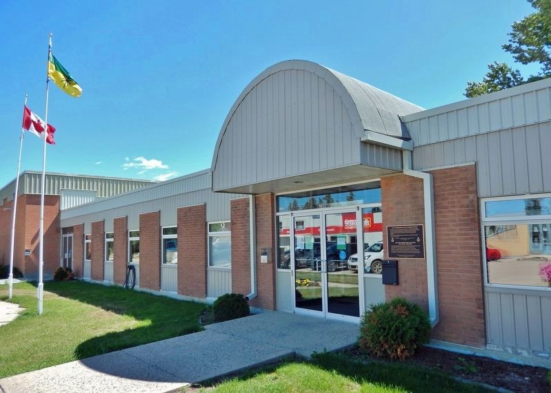
On Washington Avenue just east of First Street, on the right when traveling east.
[English] No. 23 E.F.T.S. was based here during 1942 to 1945 under the British Commonwealth Air Training Plan. Aircrew trained here were part of the 131,553 aircrew trained in Canada for the fight against tyranny. . . . — — Map (db m211676) HM
On Ontario Street just north of 1 Avenue East, on the right when traveling north.
1981 Sask. Provincial High School Champion Third on BCHS Anita Barber Team 1987 Sask. Provincial Scott Tournament of Hearts Champion Third on Kathy Fahlman Team 1991 Sask. Provincial Scott Tournament of Hearts Champion 1992 Sask. . . . — — Map (db m211858) HM
On King Street just south of 8 Avenue East, on the right when traveling north.
The dream of a playground and park as a setting for Biggar’s new school began in 1998. A committee representing the Board of Trustees, the P.T.A., the teaching staff and senior students began to plan the park while others investigated sources of . . . — — Map (db m211799) HM
On 6 Avenue East just west of Dominion Street, on the right when traveling west.
Sandra was born on June 11, 1963, in Biggar, Saskatchewan. She was the daughter of Art and Shirley Schmirler, and sister to Carol and Beverley. Sandra received all of her elementary and high school education in Biggar. She excelled in a variety of . . . — — Map (db m211800) HM
On King Street just south of 8 Avenue East, on the right when traveling north.
1981 Saskatchewan High School Girl’s Curling Gold Medal winner as Third on the BCHS Anita Silvernagle team 1987 Provincial Scott Tournament of Hearts champion as Third on the Kathy Fahlman team 1991 Provincial Scott Tournament of . . . — — Map (db m211797) HM
On Idylwyld Drive North (Highway 1) just south of 25 Street West, on the right when traveling south.
[English] Saskatoon was initially bypassed by two transcontinental railways but its growing significance as the major distribution centre for north-central Saskatchewan resulted in the convergence of three separate lines in the city by 1908. . . . — — Map (db m196883) HM
On 11th Street East east of Broadway Avenue, on the right when traveling east.
Firehall No. 3 was built in 1911, along with an adjacent watertower, to serve an ever expanding city and was officially opened on January 6th, 1912. The first run occurred on February 17th, 1912 to put out a fire caused by boiling tar in a local . . . — — Map (db m196884) HM
Near 20th Street West at Avenue D South, on the right when traveling west.
Built by the Texaco Oil Company in 1929, this building was an early Saskatoon landmark. Originally known as West Side Service Station, the name was changed to Little Chief Service Station in 1943. Frank Carr, who operated the station between 1947 . . . — — Map (db m203733) HM
On 21st Street East just east of 3rd Avenue South, on the right when traveling east.
This is the oldest provincial government office building in Saskatoon. It was erected in 1909 from designs by Storey and van Egmond, the prominent Regina architects. By 1911 the structure was doubled in size, reflecting the rapid expansion in urban . . . — — Map (db m196885) HM
On Wanuskewin Heritage Park Access Road 0.8 kilometers south of Penner Road (Township Road 380).
[English] People have occupied the Plains of North America for thousands of years. Here at Wanuskewin many archaeological features have been identified, representing most of the known elements which characterize Northern Plains . . . — — Map (db m203726) HM
As one of the first buildings constructed on campus, the College Building reflects the prominent role Agriculture Education was to play at the newly created University of Saskatchewan. Originally designed to house the College of Agriculture, this . . . — — Map (db m220898) HM
[English] This handsome structure stands as the centrepiece of the finest grouping of university buildings in Canada designed in the Collegiate Gothic, a style widely used for institutions of higher learning throughout North . . . — — Map (db m220952) HM
On Third Street at 1st Avenue, on the right when traveling east on Third Street.
• Established in Craik in 1911 under management of R.H. Frazee of Toronto • Lot purchased in 1917 for construction of bank building • Royal Bank officials stated in July 1918 that "It will be a two story brick building and modern in every . . . — — Map (db m206990) HM
On Louis Riel Trail (Provincial Highway 11) at East Street (Route 739), on the right when traveling east on Louis Riel Trail.
This east-west trail, roughly followed the Qu'Appelle Valley, beginning near the elbow of the South Saskatchewan River and extending eastward near the Saskatchewan-Manitoba border. Other important trail routes connected at various points on this . . . — — Map (db m211796) HM
On 2nd Avenue just south of 3rd Street, on the right when traveling south.
World War I R. Brown • J. Geal • P.A. Heath • T.M. Hordern • J. Hordern M.N. McCrimmon • R.P. McCordick • H. McMillan T.C. Waters • A.J. Williams World War II L. Bedard • B. Koop . . . — — Map (db m211795) WM
On Main Street (Saskatchewan Route 20) at 6th Avenue, on the right when traveling north on Main Street.
A city reveals its unique past through its historic buildings. This building is one of several in the downtown core that were constructed before 1920. We invite you to explore its history.
1912-1975 Postal Service
1912-1932 . . . — — Map (db m196887) HM
On 3rd Avenue just east of 5th Street, on the right when traveling east.
A city reveals its unique past through its historic buildings. This building is one of several in the downtown core that were constructed before 1920. We invite you to explore its history.
The water tower was constructed from 1914 . . . — — Map (db m196886) HM
On Main Street (Saskatchewan Route 20) at 6th Avenue, on the right when traveling north on Main Street.
This historic building, erected in 1912, expanded in 1955, housed the post office until 1975. Through the years it has been the site for many other government offices:
1912-32 Customs office on second floor which included the Records and . . . — — Map (db m196889) HM
On Main Street (Saskatchewan Route 20) at 6th Avenue, on the right when traveling north on Main Street.
[English] Constructed in 1911, this building is typical of the post offices that were erected by the Department of Public Works in smaller urban centres throughout Canada at the beginning of the 20th century. The quality of the design, with . . . — — Map (db m196890) HM
On Broadway Street at Saskatchewan Avenue, on the right when traveling west on Broadway Street.
[Front]
Memoriam
To the
memory
of the gallant
men of Strongfield
who laid down their
lives on the field
of battle while
upholding the cause
of
freedom and justice
[Side]
World War I
1914 – 1918
F.W. . . . — — Map (db m196902) WM
Near Front Avenue just north of 4th Street, on the left when traveling north.
Although the railway from Regina to Prince Albert was completed by 1890, the area between Saskatoon and the Qu’Appelle failed to attract large numbers of settlers. In 1902, a syndicate was formed in Minneapolis. Incorporated as the Saskatchewan . . . — — Map (db m211789) HM
On Lincoln Street at Railway Street, on the left when traveling south on Lincoln Street.
In December of 1909 the Town Council gave its Public Works Committee the authority to order a fire bell, using the proceeds of a concert as part payment for the bell. This bell was mounted on the Town Hall in 1910 and was to be rung daily at the . . . — — Map (db m211794) HM
On Louis Riel Trail (Provincial Highway 11) at Norfolk Avenue, on the right when traveling north on Louis Riel Trail.
In 1872 the Canadian Federal Parliament passed the Dominion Lands Act as a precursor to land settlement in the West. Eastern interests viewed settlement of the vast North West as a great economic opportunity. Essentially, the American system of the . . . — — Map (db m211670) HM
On Main Street just north of 1 Avenue, on the right when traveling north.
The call of the West lured settlers to this virgin plains before the turn of the century. This district provided many opportunities, so pioneers with spirits of adventure came from Eastern Canada, U. S. A. and Europe. On June 9, 1906 the Village . . . — — Map (db m203873) HM
On CanAm Highway (Provincial Highway 39) just south of Souris Street, on the right when traveling south.
The most vital factor in the settlement of our area was the railroad. This line was opened to rail traffic in September 1893. The station building here was constructed in 1904. — — Map (db m207165) HM
On Bosworth Street at Atlantic Avenue, on the right when traveling west on Bosworth Street.
This Municipal Heritage Building was a prefabricated wood-frame structure assembled for the Bank of Commerce in 1910. It exhibits the Georgian Classical style typical of smaller banks of the period and was one of the first businesses established in . . . — — Map (db m196901) HM
On Manitoba Avenue at Lanigan Street, on the right when traveling south on Manitoba Avenue.
This Municipal Heritage Building of brick and Manitoba Tyndall Stone, designed by provincial architect, Maurice Sharon, was completed in 1920.
Kerrobert was the seat of the judicial circuit from 1913 to 1996. The courthouse held offices of . . . — — Map (db m196900) HM