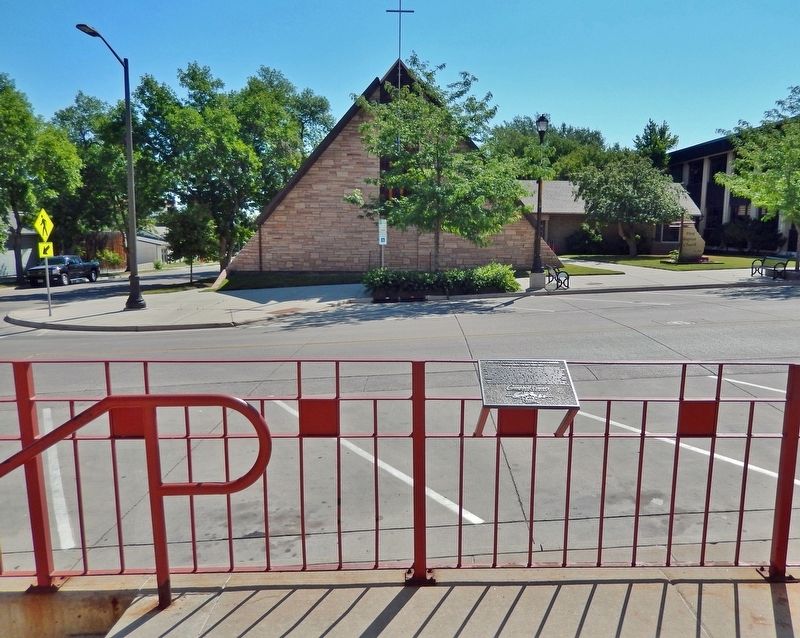
On South Gillette Avenue at East 5th Street, on the right when traveling south on South Gillette Avenue.
Commemorating 100 years having been created from portions of Crook and Weston County by authority granted from the Eleventh Legislature of the State of Wyoming on February 13, 1911 and named after John Allen Campbell, the first Governor of the . . . — — Map (db m242840) HM
Near South Douglas Highway (State Highway 59) at East 8th Street, on the right when traveling south.
When the Burlington & Missouri Railroad laid tracks to this area in August of 1891, the town of Gillette came into existence. The railroad provided local ranchers with the means to transport large herds of livestock to markets in the East. After . . . — — Map (db m306293) HM
Near State Highway 387 at Ranch Drive, on the right when traveling west.
"The lack of rail service in large areas of Wyoming did not prevent small coal mines from being opened. Throughout much of rural Wyoming wood was not readily available, and it was too valuable to be used as fuel on the plains and basins. Coal . . . — — Map (db m242967) HM
Near South Douglas Highway (State Highway 59) at East 8th Street, on the right when traveling south.
Wyoming's eastern Powder River Basin is a region of limited rainfall and high rolling grasslands, an area ideally suited for livestock grazing, but not large-scale crop production. Settlers emigrating to the region could obtain lands under several . . . — — Map (db m306295) HM
Near East Warlow Drive at North Osborne Avenue, on the left when traveling east.
The ditch was prone to flooding during heavy rains. One of the worst floods was in August 1912 when two inches of rain fell in two hours. Gillette Avenue flooded as well as the many businesses and homes in the area. The sidewalks which were made of . . . — — Map (db m306495) HM
Near East Warlow Drive at North Osborne Avenue, on the left when traveling east.
The Chicago, Burlington and Quincy Railroad proposed a canal system that diverted water from Donkey Creek to Stone Pile Creek and from Stone Pile Creek into Burlington Lake. Construction began in 1907 and was completed in 1908. During construction, . . . — — Map (db m306405) HM
Near East Warlow Drive at North Osborne Avenue, on the left when traveling east.
At the center of McManamen Park is a 10-acre lake, dredged in 1987 deep enough to hold water all year long. An additional 40-acres is dedicated to overflow that fills with water in wet years. Turning Burlington Lake into the McManamen Park “prairie . . . — — Map (db m306440) HM
Near East Warlow Drive at North Osborne Avenue, on the left when traveling east.
By October 1943, negotiations were completed where the City of Gillette took over the CB&Q water ditch, according to Mayor Roy Montgomery. Under the terms of the agreement, the city received title to all the land through which the ditch ran, . . . — — Map (db m306292) HM
Near East Warlow Drive at North Osborne Avenue, on the left when traveling east.
In September 1943, officials of the Chicago, Burlington and Quincy Railroad were negotiating with the City of Gillette for disposal of the Burlington Ditch. There was an original offer to the city that was turned down; details of the original offer . . . — — Map (db m306497) HM
Near East Warlow Drive at North Osborne Avenue, on the left when traveling east.
In 2000, the Gillette City Council considered banning dogs from McManamen Park from March 1 to October 1 during the nesting season. The shallow water, which provides a source of food and the nesting habitat consisting of areas of relatively . . . — — Map (db m306468) HM
Near East Warlow Drive at North Osborne Avenue, on the left when traveling east.
Flood waters from the overflowing Burlington Ditch caused thousands of dollars in damage after rapidly melting snow overflowed between Kendrick and Carey Streets in January 1943. The ditch at this point was eight feet deep. Some of the heaviest . . . — — Map (db m306496) HM
Near East Warlow Drive at North Osborne Avenue, on the left when traveling east.
Fred Grant Hicks, born in Ohio, emigrated to Wyoming in 1908 to work for the Burlington Railroad. The Hicks homestead was north of Burlington Lake. He was the roundhouse foreman for twelve years. In 1932 he and his wife Florence purchased the . . . — — Map (db m306470) HM
Near East Warlow Drive at North Osborne Avenue, on the left when traveling east.
Bede McCann was hired quite often in the summer time to use a team and scraper to clear the weeds and grass out of the Burlington Ditch. He also mowed the right-of-way along Highway 14-16 and planted the evergreen trees along the highway and train . . . — — Map (db m306494) HM
Near East Warlow Drive at North Osborne Avenue, on the left when traveling east.
In September 1945, with the conclusion of the war and the impending return of hundreds of men and women, the City administration made plans to improve Gillette and provide employment for all who wished to return and live here. The city was prepared . . . — — Map (db m306279) HM
Near East Warlow Drive at North Osborne Avenue, on the left when traveling east.
A concrete walkway was finished in 2013 around Burlington Lake at McManamen Park. The walkway was made of concrete to allow easier access for wheelchairs and to make the path easier to walk in poor weather. The walkway is10 feet wide and 7,400 . . . — — Map (db m306498) HM
Near East Warlow Drive at North Osborne Avenue, on the left when traveling east.
In 1891 when Gillette was founded, day-to-day living revolved around the railroad and surrounding ranches. The northern boundary of the City at that time was Burlington Lake where cattle were led to drink when livestock was moved by railroads. From . . . — — Map (db m306371) HM
Near State Highway 387 at Ranch Drive, on the right when traveling west.
Trivia Question! Where did cattle originate that were trailed to Wyoming? Long-horned cattle were driven up from Texas on the Chisholm, Western and Goodnight Loving Trails. Herefords were shipped from the British Isles and cattle . . . — — Map (db m242990) HM
Near South Douglas Highway (State Highway 59) at East 8th Street, on the right when traveling south.
who served in the Persian Gulf during Desert Storm Sculptured by Patrick Love base donated by Gillette Energy Rotary Club constructed by Barton Construction — — Map (db m306298) HM WM
Near South Douglas Highway (State Highway 59) near East 8th Street, on the right when traveling south.
Behind every name on these bricks is the story of a man or woman who believed in duty and sacrifice to this great nation. Their stories crisscross the globe and speak of glory, honor and sacrifice of individuals who became part of a greater whole, . . . — — Map (db m306297) HM
Near State Highway 387 at Ranch Drive, on the right when traveling west.
"In the beginning when Wright was first taking shape and becoming its own place it was the spring of 1949 when the Wyoming Highway Department began constructing the Reno Junction Maintenance Camp. It was located about two and a half miles south of . . . — — Map (db m242956) HM
On South Gillette Avenue just south of West 4th Street, on the right when traveling south.
George Amos moved to Wyoming in the late 1800s to work as the foreman on the 4-J Ranch. A bachelor, he was a cowpuncher by day, and a voracious reader at night. In addition to a love for books, Amos subscribed to as many as 20 magazines and many . . . — — Map (db m203256) HM
Near South Douglas Highway (State Highway 59) at East 8th Street, on the right when traveling south.
Located in a corner of the Schneider Ranch and adjacent to the Highlight Road in central Campbell County, sat the Cowboy Bar which served as a watering hole for thirsty roughnecks and miners for 26 years. The bar began as an old outbuilding moved . . . — — Map (db m306300) HM
Thin black lines indicate changes in relevance. Between each pair of lines entries are ordered geographically but all have the same relevance.
* Inflectional forms of words are their plurals, singulars, and possessives as well as gramatical tenses and similar variations.