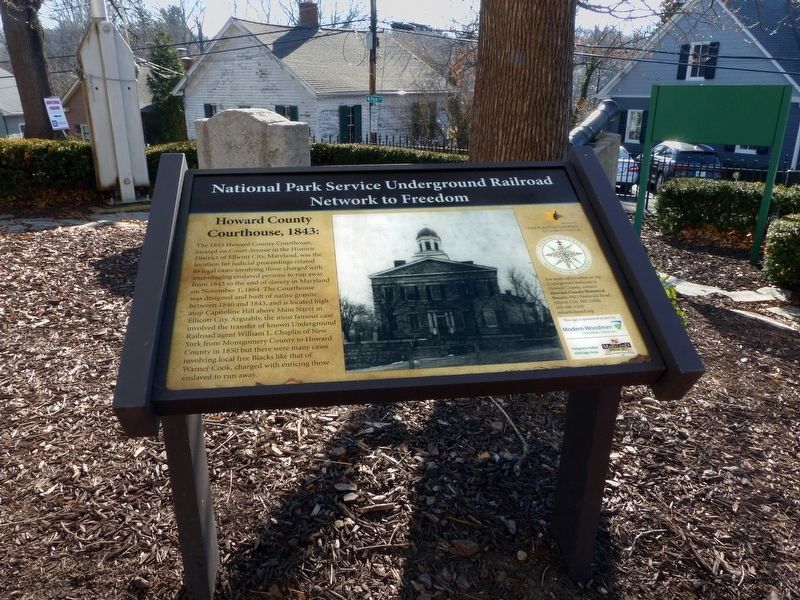
The 1843 Howard County Courthouse, Located on Court Avenue in the Historic District of Ellicott City, Maryland, was the location for judicial proceedings related to legal cases involving those charged with encouraging enslaved persons to run away. . . . — — Map (db m111703) HM
On Tulip Poplar Trail, on the right when traveling south.
Hodge Podge Lodge was the first nature show for children, airing in the 1970s on Maryland Public Television and syndicated on the east coast. The show's host, Miss Jean Worthley, inspired a generation of children about the natural . . . — — Map (db m168874) HM
Near Court Place, on the left when traveling south.
The Howard County Jail, located at 1 Emory Street, in the Historic District of Ellicott City, Maryland, was the location where freedom seekers and those charged with encouraging enslaved persons to run away or rise up against their masters or . . . — — Map (db m111721) HM
On Oella Avenue just north of Frederick Road (Maryland Route 144), on the left when traveling north.
A world apart, Oella is a time capsule of vanishing Americana. Here rose the first manufacturing company ever chartered by the State of Maryland. The year was 1808. For a brief period the Union Manufacturing Company was the largest cotton . . . — — Map (db m144718) HM
Near Maryland Avenue just south of Main Street (Maryland Route 144), on the left when traveling south.
Designed by noted architect E. Francis Baldwin and constructed in 1885, the Freight House served as a loading platform and storage room for freight. Materials were transferred in and out of the building on Maryland Avenue using a wooden platform. . . . — — Map (db m144728) HM
On Maryland Avenue just south of Main Street (Maryland Route 144), on the left when traveling south.
The single set of tracks outside the museum's fence was the original right-of-way for the Baltimore & Ohio (B&O) Railroad. Now owned by CSX Transportation, this right-of-way has been in continuous use since 1830. A second set of tracks was added in . . . — — Map (db m144726) HM
On Waterloo Road (Maryland Route 108) at Richard Valley Road, on the right when traveling north on Waterloo Road.
The first large land grant in what is now Howard County. Patented October 1, 1687 to Adam Shipley who came to Maryland from England in 1668. This marks a section of the western boundary of the 500 acre grant. A Shipley family cemetery is located . . . — — Map (db m226102) HM
On Maryland Avenue at Main Street (Frederick Road) ( Route 144), on the left when traveling south on Maryland Avenue.
Dedicated to the men from
Howard County who fought
To preserve the Union during
the American Civil War
from 1861 to 1865
Union Units with companies raised in
Howard County during the war:
The Patapsco Guards, Independent . . . — — Map (db m111813) WM
On Baltimore National Pike (U.S. 40) 0.1 miles east of Plumtree Drive, on the right when traveling east.
A hanok (Korean: 한옥, 韓屋)
is a traditional Korean house. Hanok were first designed and built in the 14th century during the Joseon Dynasty.
History
A hanok is a Korean house which was . . . — — Map (db m205780) HM
A Forgotten Cemetery William Whipps purchased this small country graveyard in 1855 as his family cemetery. Without
perpetual care, it fell into neglect, eventually overrun with poison ivy,
weeds, and invasive vines. Over time, it was . . . — — Map (db m279673) HM
South Inscription:
The Congress of the United States has caused this Monument to be erected on the site of the Battle of Cowpens as a testimonial to the valor and in appreciation of the services of the American Troops on this field in . . . — — Map (db m11186) HM WM
On Farm Museum Road 0.2 miles south of South Center Street, on the left when traveling south.
Wormseed oil was a major cash crop for farmers in the Piedmont region of Maryland for more than 75 years. Before 1820 wormseed was considered a weed until the oil extracted from the plant was recognized as a treatment for roundworm, hookworm and . . . — — Map (db m188467) HM
Near Main Street (Maryland Route 144) at Ellicott Mills Drive. Reported missing.
The first Howard County Courthouse, located in the historic district of Ellicott City Maryland, was a pre-existing structure rented by the Howard District Commissioners from George Ellicott in 1840 to house judicial proceedings of the new Howard . . . — — Map (db m111783) HM
[picture of steam locomotive] Steam locomotive. A small saddle-tanker locomotive pushed and pulled freight cars around in the quarry, and hauled heavy loads of granite to the main line of the railroad. The saddle-tanker had a water tank that . . . — — Map (db m20499) HM
On Furnace Avenue 0.1 miles west of Railroad Avenue, on the left when traveling south. Reported permanently removed.
On May 5, 1861, U.S. Gen. Benjamin F. Butler occupied Relay, Maryland, with the 8th New York and 6th Massachusetts Infantry Regiments and Cook's Boston Battery of light artillery. Their mission was to prevent Confederate sympathizers from . . . — — Map (db m5876) HM
On Main Street (Maryland Route 144) at Ellicott Mills Drive, on the right on Main Street.
By the 1850s, a prosperous community was located here around the Ellicott family gristmills and ironworks established in the 1770s. When the Civil War began in 1861, the town's population exceeded 2,000. Although the mill workers and merchants of . . . — — Map (db m37545) HM
On Frederick Road (Maryland Route 144) just west of Roxbury Mills Road ( Route 97), on the right when traveling west.
Robert Inn is one of several 19th-century taverns still standing along Frederick Turnpike, also known as MD 144. Reaching here by 1808, the roadway connected Baltimore with Frederick and western Maryland. The new turnpike quickly became popular . . . — — Map (db m147265) HM
Near Duke of Gloucester Street, on the right when traveling south.
Birthplace of Charles Carroll of Carrollton (September 19, 1737 – November 14, 1832), the only Roman Catholic to sign the Declaration of Independence and the last of the signers to die.
Charles Carroll of Annapolis (1702 – 1782), father of . . . — — Map (db m55298) HM
Near Vantage Point Road 0.2 miles Little Patuxent Parkway, on the right when traveling south. Reported permanently removed.
Oakland was the family home of George R. Gaither, a successful Baltimore merchant who purchased the property in 1838. His son, George R. Gaither, Jr., served as captain of a local militia unit, the Howard Dragoons (mounted infrantrymen). Most of . . . — — Map (db m254655) HM
On Furnace Avenue at Riverwatch Avenue, on the right when traveling north on Furnace Avenue.
Origins of Elkridge
The first mention of the Elkridge Hundred can be found in the 1702 Baltimore County Tax List. In 1733, the Maryland Assembly passed an act authorizing the establishment of a town, called "Jansen-Town," located "at and about . . . — — Map (db m150573) HM
On Main Street at Rogers Avenue, on the left when traveling west on Main Street.
Howard County native Decatur Dorsey was one of only sixteen African American soldiers to received the Medal of Honor for courage under fire during the Civil War. Sgt. Dorsey, of Company B, 39th United States Colored Troops, earned his medal at . . . — — Map (db m5756) HM
On Baltimore National Pike (Route 40) at Frederick Road, on the right when traveling east on Baltimore National Pike.
You are standing at Mile Marker 14, a historic stone marker located at the intersection of US Route 40 and MD 144, formerly known as the Pine Orchard hamlet. Although it has worn away over time, hand-chiseled letters read 14 M To B, meaning 14 . . . — — Map (db m179225) HM
Near Old Guilford Road 0 miles south of Guilford Road when traveling south.
Granite was quarried in the Guilford area beginning in the 1830s and continuing until 1925 - a span of almost a century. As the nearby cities of Baltimore and Washington expanded, there was a need for quality building stone for structures and . . . — — Map (db m20501) HM
Health conditions in the 1800's were appalling. Germs and antibiotics had not yet been discovered. Deaths among mothers during childbirth, and infants and children were commonplace. Families relied on a strong faith in God to help see them through . . . — — Map (db m279670) HM
Several family plots at the Whipps Cemetery were enclosed by iron posts and decorative fencing with the insignia of the International Order of Odd Fellows (I.O.O.F.).
This original ironwork, circa 1833, bears the insignia of the . . . — — Map (db m279723) HM
The White Oak is the Maryland state tree. The oldest White oak in the US. stood for over 450 years in the village of Wye, MD. It was over 31 feet around and 96 feet tall. In 2002, it toppled during a thunderstorm. This remarkable tree showed . . . — — Map (db m279664) HM
Near Washington Boulevard (U.S. 1) at South Street.
"Along this section of the valley, where once the vibrant hum of a thriving industry could be heard... now the silence of the tomb prevails. The gods of progress direct its movements in mysterious ways." - L.S. LeRendu, W.J. Dickey & Sons . . . — — Map (db m8838) HM
The Patapsco Female Institute (PFI), located on Church Road with a commanding view of Ellicott City, was one of the most famous and prestigious schools for girls in 19th century America. The school officially opened its doors in 1837 under . . . — — Map (db m74239) HM
On Solomons Island Road South north of Charles Street, on the right when traveling south.
The name "Patuxent" is the diminutive for "Pautuckese," translated means "at the little falls" or "at the falls or rapids." In 1612, Captain John Smith named the river after one of the Werowances villages located along Battle Creek in Calvert . . . — — Map (db m287633) HM
On Main Street west of Court Avenue, on the right when traveling west.
In 1939 this new brick, two-story fire house was built. Fire Department historian B H Shipley, Jr and bride resided on the 2nd floor for seven years. It was also a trolley terminal. The HoCo Volunteer Fire Dept. operated here until 1997, when the . . . — — Map (db m98462) HM
On 9th Street near Riverfront Park Trail, on the right when traveling north.
This point marking the site of the 9th Street Bridge that connected Laurel and Howard County over the Patuxent River is dedicated to the memory of Frank P. Casula (1920-2001).
Frank P. Casula served the Citizens of Laurel and Prince George's . . . — — Map (db m72071) HM
Near Old Guilford Road 0 miles south of Guilford Road when traveling south.
River Facts
• The Little Patuxent River begins in Howard County near Alpha Ridge.
• It is joined by the Middle Patuxent River near Savage.
• It continues south to join the Patuxent River near Crofton in Anne Arundel County.
• The total . . . — — Map (db m20504) HM
Near Old Guilford Road 0 miles south of Guilford Road.
History
Once, a thriving community prospered here along the banks of the Little Patuxent River. Guilford was a center for milling, quarrying, and cotton=cloth production in the late 18th through the early 20th centuries. It featured . . . — — Map (db m19884) HM
On West 18th Street at Baynard Boulevard on West 18th Street.
African American Medal of Honor Recipients Memorial
The Medal of Honor takes its place in our country as the highest award for military valor. The honor, awarded by the President in the name of Congress, may only be accorded an . . . — — Map (db m173924) HM WM
On Randolph Place Northwest at 2nd Street Northwest, on the right when traveling west on Randolph Place Northwest.
Bloomingdale of the 1940s and '50s was a village of high expectations. Within a block of this sign lived four young women who grew up to be judges.
Anna Diggs Taylor rose to chief judge of the U.S. District Court in Michigan. The . . . — — Map (db m302216) HM
Built for Henry Edgar Wootton, Esquire (1837-1894), this is the oldest of the professional buildings which now comprise Ellicott City’s Lawyers’ Row.
Constructed on a 28’ 4” square native granite foundation, it is located on the solid . . . — — Map (db m111839) HM
On Randolph Place Northwest at 2nd Street Northwest, on the right when traveling west on Randolph Place Northwest. Reported permanently removed.
Bloomingdale of the 1940s and '50s was a village of high expectations. Within a block of this sign lived four young women who grew up to be judges.
Anna Diggs Taylor rose to chief judge of the U.S. District Court in Michigan. The . . . — — Map (db m130843) HM
On Hamilton Street just south of Main Street, on the right when traveling south.
During the Civil War, Howard County and the Baltimore region exemplified the divided loyaltiesof Maryland's residents. The people here had commerical ties to both North and South, and its secessionist sympathies erupted in violence on April 19, . . . — — Map (db m306029) HM
Near West Street (Maryland Route 450) at Brewer Avenue.
The record of lynchings in Maryland from 1891-1906
May 13, 1891 - Asbury Green, Centerville
May 17, 1892 - James Taylor, Chestertown
June 8, 1893 - Isaac Kemp, Princess Anne
October 20, 1894 - Stephen Williams, Prince George's County . . . — — Map (db m53171) HM
Near Washington Boulevard (U.S. 1) at South Street.
"There is much to be discovered [indistinguishable] way of beautiful scenery inaccessible on account of lack of trails and [indistinquishable] time this park will be one of the nicest in this part of the county." - Tell W. . . . — — Map (db m8845) HM
Commons originated in England as open areas within settlements where people could graze their livestock. In colonial American, these areas became known as "village greens" where people assembled, troops drilled and games were played. Later, . . . — — Map (db m128068) HM
Near Constitution Avenue Northwest (U.S. 50) east of 19th Street Northwest, on the right when traveling east.
In Congress, July 4, 1776.Unanimous Declaration of the thirteen united States of America.And for the support of this Declaration,
with a firm reliance on the protection of Divine Providence,
we . . . — — Map (db m137039) HM
Thin black lines indicate changes in relevance. Between each pair of lines entries are ordered geographically but all have the same relevance.
* Inflectional forms of words are their plurals, singulars, and possessives as well as gramatical tenses and similar variations.